
Crisfield, Maryland facts for kids
Quick facts for kids
Crisfield, Maryland
|
|||
|---|---|---|---|

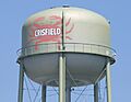
Crisfield water tower
|
|||
|
|||
| Nickname(s):
The Seafood Capital of the World
|
|||

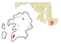
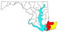
Location in Somerset County and the state of Maryland
|
|||

Crisfield, Maryland
Location in Maryland

Crisfield, Maryland
Location in the United States
|
|||
| Country | |||
| State | |||
| County | |||
| Founded | 1663 | ||
| Incorporation | 1872 | ||
| Founded by | Benjamin Summers | ||
| Named for | John Woodland Crisfield | ||
| Government | |||
| • Type | Mayor–council–manager | ||
| Area | |||
| • Total | 3.17 sq mi (8.22 km2) | ||
| • Land | 1.74 sq mi (4.49 km2) | ||
| • Water | 1.44 sq mi (3.72 km2) | ||
| Elevation | 3 ft (1 m) | ||
| Lowest elevation | 0 ft (0 m) | ||
| Population
(2020)
|
|||
| • Total | 2,475 | ||
| • Density | 1,425.69/sq mi (550.61/km2) | ||
| • Demonym | Crisfielder | ||
| Time zone | UTC−5 (Eastern (EST)) | ||
| • Summer (DST) | UTC−4 (EDT) | ||
| ZIP code |
21817
|
||
| Area code(s) | 410, 443 | ||
| FIPS code | 24-20775 | ||
| GNIS feature ID | 0583972 | ||


Crisfield is a city in Somerset County, Maryland, United States. It is located on the Tangier Sound, which is part of the Chesapeake Bay. In 2020, about 2,475 people lived there. Crisfield is the city farthest south in Maryland.
This area was once a small fishing village called Annemessex Neck. Later, it was named Somers Cove. When people realized how much seafood was available, John W. Crisfield helped bring the Pennsylvania Railroad to the town. This made the quiet fishing village grow quickly.
Crisfield became known as the "Seafood Capital of the World." The city's success was so big that train soot and oyster shells were used to extend the land into the marshes. People in Crisfield often say that the downtown area is literally built on top of oyster shells!
Over time, the health of the Chesapeake Bay declined, and Crisfield faced challenges. Now, Crisfield is mostly a place for tourists to visit. It has many yearly events and festivals, like the National Hard Crab Derby. Crisfield is also a main way to get to Smith Island and Tangier Island.
Contents
Crisfield's Story: A Look Back
The first people to live in this area were the Annemessex, a group of the Pocomoke Indian tribe. Their small fishing village was called Annemessex Neck. The nearby Annemessex River is named after them.
On February 10, 1663, Benjamin Summers arrived from England. He claimed a piece of land about 300 acres big, which he named "Emmessex." He later claimed more land. These areas eventually became known as Somers Cove.
Somers Cove quickly became a major center for distributing seafood on the East Coast. The town grew faster than other settlements nearby. By 1804, it had over 100 buildings.
In 1854, a study of the Chesapeake Bay showed that Somers Cove was a great place for fishing. It had many oyster beds.

In 1866, John W. Crisfield, a lawyer from Princess Anne, helped bring the Eastern Shore Railroad to Somers Cove. The railroad opened on November 6 of that year. In 1872, the town officially became a city and was renamed Crisfield to honor him. The railroad helped the city's economy grow a lot.
Seafood was shipped all over the United States. Crisfield became known as the "Seafood Capital of the World." By 1904, Crisfield was the second-largest city in Maryland, after Baltimore. Its population reached about 25,000 people. The city's seafood industry brought new residents from far away. Crisfield even had a baseball team, the Crisfield Crabbers.
The city's busy seafood industry created a lot of train soot and oyster shells. Around the early 1900s, people used these shells and soot to fill in the salt marshes. This created new land, about half a mile long. Downtown Crisfield was built on this new land. This is why people say Crisfield is "literally built on top of oyster shells."
Crisfield faced challenges as the Chesapeake Bay's health declined. Oyster numbers dropped, making it harder for watermen to earn a living. Some businesses left or closed. In 1976, the railroad that brought Crisfield so much success was closed. However, a new highway, Maryland Route 413, was built along the old railroad path.
Crisfield is still famous for its seafood, especially the Maryland Crab. It has many restaurants and seafood businesses. Several seafood restaurants across the country are named after the city.
Many historic places in Crisfield are listed on the National Register of Historic Places. These include the Crisfield Armory and the Ward Brothers' House and Shop.
Where Crisfield Is Located

Crisfield is a very compact city with little empty land. It has a total area of about 3.06 square miles. About half of this area is land, and the other half is water. Crisfield is very flat, with its highest point only about 3 feet above sea level.
The city is surrounded by salt marshes and is built on a floodplain. The downtown area often floods during big storms and hurricanes. For example, in 2012, Hurricane Sandy caused most of the city to go underwater. People in Crisfield are concerned about flooding and rising sea levels.
Crisfield is the southernmost city in Maryland.
Crisfield's Weather
Crisfield has a humid subtropical climate. This means it has hot, humid summers and cool to mild winters. Because it is close to the water, the city does not get much snow in the winter.
| Climate data for Crisfield, Maryland | |||||||||||||
|---|---|---|---|---|---|---|---|---|---|---|---|---|---|
| Month | Jan | Feb | Mar | Apr | May | Jun | Jul | Aug | Sep | Oct | Nov | Dec | Year |
| Record high °F (°C) | 64 (18) |
69 (21) |
77 (25) |
87 (31) |
91 (33) |
92 (33) |
99 (37) |
98 (37) |
92 (33) |
90 (32) |
78 (26) |
71 (22) |
99 (37) |
| Mean daily maximum °F (°C) | 44 (7) |
47 (8) |
55 (13) |
65 (18) |
74 (23) |
82 (28) |
87 (31) |
85 (29) |
79 (26) |
69 (21) |
58 (14) |
49 (9) |
66 (19) |
| Mean daily minimum °F (°C) | 30 (−1) |
31 (−1) |
38 (3) |
48 (9) |
57 (14) |
66 (19) |
71 (22) |
71 (22) |
64 (18) |
53 (12) |
43 (6) |
34 (1) |
51 (10) |
| Record low °F (°C) | −1 (−18) |
3 (−16) |
10 (−12) |
27 (−3) |
38 (3) |
46 (8) |
51 (11) |
50 (10) |
45 (7) |
30 (−1) |
22 (−6) |
7 (−14) |
−1 (−18) |
| Average precipitation inches (mm) | 3.25 (83) |
3.00 (76) |
4.29 (109) |
2.81 (71) |
3.12 (79) |
2.83 (72) |
4.14 (105) |
4.15 (105) |
2.76 (70) |
2.78 (71) |
2.80 (71) |
2.51 (64) |
38.44 (976) |
| Source: Weather.com | |||||||||||||
People in Crisfield
| Historical population | |||
|---|---|---|---|
| Census | Pop. | %± | |
| 1880 | 986 | — | |
| 1890 | 1,565 | 58.7% | |
| 1900 | 3,165 | 102.2% | |
| 1910 | 3,468 | 9.6% | |
| 1920 | 4,116 | 18.7% | |
| 1930 | 3,850 | −6.5% | |
| 1940 | 3,908 | 1.5% | |
| 1950 | 3,688 | −5.6% | |
| 1960 | 3,540 | −4.0% | |
| 1970 | 3,078 | −13.1% | |
| 1980 | 2,924 | −5.0% | |
| 1990 | 2,880 | −1.5% | |
| 2000 | 2,723 | −5.5% | |
| 2010 | 2,726 | 0.1% | |
| 2020 | 2,475 | −9.2% | |
| U.S. Decennial Census | |||

Crisfield is part of a larger area called the Salisbury-Ocean Pines Combined Statistical Area. This area includes Somerset and Wicomico counties.
In 2010, there were 2,726 people living in Crisfield. The city had 1,113 households. About 33.6% of households had children under 18. The average age in Crisfield was 38.4 years old.
Crisfield's Economy
Crisfield's economy mainly focuses on retail, healthcare, and car services. Seafood is still a very important part of Crisfield's economy. There are several seafood packing plants in the city. In 1997, a company called CrabPlace.com started selling seafood online. This seafood is caught by local watermen.
The biggest employer in Crisfield is McCready Memorial Hospital. The second largest employer is the Sherwin-Williams plant. This plant makes paintbrushes and roller covers.
In the past, Crisfield's economy was all about watermen and seafood. There were once about 150 seafood processing plants in the city. As the Chesapeake Bay became less healthy, the number of blue crabs caught went down a lot. Rules have been put in place to help protect the crab population.
Many people who live in Crisfield work outside the city. A new industrial park is planned just north of Crisfield. This will help expand Crisfield's business area.
Crisfield's Culture and Fun


Crisfield is the main way to get to Smith Island. Because of this, many people in the area speak a special Smith Island accent. Many restaurants in Crisfield also serve Smith Island cake, which is Maryland's state dessert.
Yearly Events
- Scorchy Tawes Pro-Am Fishing Tournament: Since 1986, Crisfield has hosted this 3-day fishing tournament. It offers cash prizes and fun parties.
- J. Millard Tawes Crab and Clam Bake: This event happens every September. It started in 1976 and is named after a former governor born in Crisfield. Many politicians attend each year.
- National Hard Crab Derby & Fair: This is Crisfield's biggest event. It happens every Labor Day weekend and started in 1947. Highlights include a parade, beauty pageants, a Boat Docking Contest, and crab picking contests. The Crab Bowl turns the Somers Cove Marina into fairgrounds with rides, concerts, and fireworks.
Museums
Crisfield has several museums:
- The J. Millard Tawes Historical Museum
- The Ward Brothers Workshop
- The J. Millard Tawes Library
Sports and Recreation
Crisfield once had a minor league baseball team called the Crisfield Crabbers. Today, the city still has several little league baseball and high school sports teams.
Wellington Beach and Park, now called Brick Kiln Beach, reopened in 2013. It has a play area, a gazebo, and bathrooms in the summer. It's also a popular spot for crabbing.
Nearby Janes Island State Park is a large marshy island. It's mostly undeveloped and home to many birds and marine life. You can go fishing, swimming, picnicking, and camping there. The park has about thirty miles of water trails for canoes.
Learning in Crisfield

Crisfield has two public schools. They are part of the Somerset County Public Schools district.
- Carter G. Woodson Elementary School: This school serves students in grades K-5. It was once a middle school and, even earlier, the Crisfield Colored High School.
- Crisfield Academy and High School: This school serves students in grades 8-12. It has been in four different buildings over time, all located near Somerset Avenue.
Getting Around Crisfield
Travel by Water
Crisfield has a strong connection to the water. It has many ways to access the Tangier Sound and Chesapeake Bay.
- City Dock: Located at the end of Main Street, this dock is used by mail ships, large commercial ships, and passenger ferries to Smith Island and Tangier Island.
- County Dock: One block west of the City Dock, this dock is mainly used for freight.
- Little Boat Harbor: This harbor is mostly used by smaller workboats.
Somers Cove Marina is a large marina built in the 1960s. It is owned by the State of Maryland. The marina hosts many of Crisfield's big events, like the National Hard Crab Derby.
Major Roads

Crisfield can be reached by two main state highways:
- Maryland Route 413: This is the main road through the city, known as "The Strip."
- Maryland Route 667: This route also connects to U.S. Route 13, which is the main north-south road on the Delmarva Peninsula.
Other important roads include Maryland Route 358 (Jacksonville Road), which leads to Janes Island State Park, and Maryland Route 460 (Hall Highway), which provides access to the hospital.
Bicycles and Walking
In 2017, bicycle lanes were added to most of MD 413 within the city. There are also plans to turn the old Crisfield Secondary Branch railroad line into a bike trail.
Public Transportation
Shore Transit operates two bus routes in Crisfield: Route 706 North and Route 706 South. These buses stop at McCready Memorial Hospital and connect to other towns on the Eastern Shore.
Airports
The Crisfield Municipal Airport is located near Hopewell. It can be reached from Crisfield via Jacksonville Road. There are plans to expand this airport.
City Services
Crisfield has three water towers and a public sewer system. These services reach as far north as Hopewell. The city also has a sewage treatment plant.
Delmarva Power provides electricity to most of the city. Choptank Electric Cooperative serves the areas just outside the city. Verizon Communications is the main telephone provider. In the mid-2000s, a fiber-optic cable was installed along MD 413, which improved internet service.
Famous People from Crisfield
- Ward Brothers: Famous makers of wooden wildfowl decoys.
- J. Millard Tawes: The 54th Governor of Maryland.
- Harry Clifton Byrd: An American university leader, educator, athlete, and politician.
Images for kids
-
Crisfield water tower
-
Flag of Crisfield, Maryland
-
Seal of Crisfield, Maryland
-
Location in Somerset County and the state of Maryland
-
Location of the Salisbury-Ocean Pines CSA
See also
 In Spanish: Crisfield (Maryland) para niños
