
Salt marsh facts for kids


A salt marsh is a special type of wetland found along coasts. It sits between the land and the sea, where it gets regularly flooded by tides. These tides bring in either salty seawater or slightly salty (brackish water) from the ocean.
Salt marshes are unique ecosystems. They are full of plants that can handle salt, like tough grasses and small shrubs. These plants are important because they help hold the sediment (mud and sand) in place. This keeps the marsh stable.
Salt marshes are vital for many reasons. They are a big part of the ocean's food web, providing food and nutrients. They also protect coastlines from storms and erosion. Sadly, many salt marshes have been damaged by human activities, like building on them or pollution. Rising sea levels due to climate change also threaten them. But people are now working hard to restore and protect these amazing places. They understand how important salt marshes are for biodiversity and for keeping our planet healthy.
Contents
What are Salt Marshes?


Salt marshes grow on quiet shorelines in cooler parts of the world. These areas often have soft mud or sand flats. Rivers and streams bring fresh sediment to these flats. You can find salt marshes in sheltered spots like estuaries (where rivers meet the sea) or behind barrier islands. In warmer, tropical places, you'll find mangrove forests instead of salt marshes. Mangroves have salt-tolerant trees, while salt marshes have grasses and small plants.
Most salt marshes are flat and wide, but not very high. This makes them attractive places for people to live near. Salt marshes can form in different coastal areas. Some are found in river deltas, like the Rhône delta in France or the Mississippi River Delta in the United States. Others are in estuaries or behind natural barriers. For example, many salt marshes in New Zealand are at the end of estuaries where waves are calm.
Salt marshes are like giant nurseries for many animals. The calm waters and tall grasses offer a safe place for young fish to grow before they swim out to the open ocean. Birds also build their nests here. They find plenty of food like fish, insects, and worms. This makes salt marshes very important for biodiversity.
Where are Salt Marshes Found?
Salt marshes are found all over the world, in about 99 countries! In 2017, scientists mapped over 5.4 million hectares of salt marshes. That's a huge area! Later studies estimated the total global area to be even larger, around 9 million hectares.
The biggest salt marshes are usually found outside of tropical regions. You can see many of them along the coasts, bays, and estuaries of the North Atlantic Ocean.
How Salt Marshes Grow
Salt marshes start as flat, muddy areas called tidal flats. Over time, these flats slowly get higher as sediment (like mud and sand) builds up. This process is called accretion. As the land gets higher, it's flooded by the tide less often and for shorter times.
This allows special "pioneer" plants, like Salicornia (glasswort), to start growing. These plants are tough and can handle salty water. Their seeds or root pieces arrive and begin to sprout. Rivers and streams bring in a lot of sediment. When the water slows down over the tidal flats, this sediment settles. Tiny blue-green algae also help by sticking sediment particles together.
The pioneer plants trap more sediment around their stems and leaves. This forms small muddy hills. Over time, these hills grow together, and the plants' roots hold the mud firmly. As more sediment builds up, the marsh surface rises even faster. This means less tidal flooding. Then, other types of plants that prefer higher, less salty ground can move in, creating different plant communities.
Tidal Flooding and Plant Zones

What makes salt marshes special is the daily tidal flow. This constant flooding brings in sediment, nutrients, and water for the plants. In the higher parts of the marsh, called the upper marsh, there is less tidal flooding. This means the salinity (saltiness) of the soil is lower. In the lower marsh, where flooding happens every day, the soil salinity stays pretty constant.
However, in the upper marsh, the saltiness can change a lot. Rain can make it less salty, while dry weather can make it saltier. Because of these differences, different kinds of plants and animals live in different zones of the marsh. Plants closer to the water must be able to survive high salt levels and being underwater often. Plants further inland can handle drier, less nutrient-rich conditions.

For example, in New England salt marshes, you'll see clear zones. In the low marsh, where flooding is frequent, you'll find mostly cordgrass. As you move inland, you'll see zones of salt hay, black rush, and then shrubs. Each plant species has its own tolerance for salt and water, which is why they grow in specific areas.
There aren't many different types of plants in a salt marsh. This is because plants need to be very tough to handle the salt, being underwater, and muddy soil with little oxygen. The most common plants are glassworts and cordgrass. These are often the first plants to grow in a muddy area, starting the marsh's growth. Their roots help stabilize the mud and bring oxygen into it, allowing other plants to grow.
Salt marshes are very active and productive places. They create a lot of organic matter, which breaks down and feeds a huge food chain. This chain includes everything from tiny bacteria to fish and mammals. Many salt marsh plants are not eaten by larger animals directly. Instead, they die and decompose, becoming food for microorganisms. These microorganisms then become food for fish and birds.
Sediment Trapping and Tidal Creeks

Many things affect how much sediment builds up in a salt marsh. Marsh plants help by providing a surface for sediment to stick to. When the tide goes out, the sediment falls off onto the marsh surface. The amount of sediment that sticks depends on the type of plant, how close it is to the sediment source, how much plant material there is, and the plant's height. For instance, plants closer to tidal creeks or mudflats, where there's more suspended sediment, will trap more.
Salt marsh plants also slow down water currents. This helps sediment settle out of the water instead of being carried away. The stems of tall marsh plants create drag, which reduces the water's speed. This encourages deposition and prevents sediment from being stirred up again.
Tidal creeks are common features in salt marshes. These winding channels allow the tide to flow in and flood the marsh surface, and then drain the water away. They can bring in more sediment than areas bordering the open ocean. Larger sediments tend to settle closer to the creeks, while finer sediments are carried further into the marsh.
Human Impacts on Salt Marshes

Coastlines are beautiful and useful, so many people live near them. This means coastal areas are very sensitive to human activities. In the past, people often saw salt marshes as "wastelands." They would fill them in for farms, cities, or to make salt. This caused a lot of damage and loss to these important ecosystems.
A study in 2022 found that about 22% of salt marsh loss between 1999 and 2019 was due to direct human actions. These actions included turning marshes into farms, building cities, or creating other structures. However, the study also showed that 30% of new salt marsh areas during the same period were due to human efforts like restoration projects.
Land Reclamation
For a long time, people turned marshland into farmland. They built dikes to protect the new land from floods. Livestock like sheep and cattle grazed on the rich marsh soil. This "land reclamation" changed the marsh plants, how sediment settled, the saltiness, and water flow. It also led to a loss of biodiversity. For example, in New Zealand, a cordgrass called Spartina anglica was brought from England in 1913 to create more farmland. This plant spread and harmed native plants and animals. Now, people are working to remove it.
Pollution from Upstream Farms
Farming upstream from a salt marsh can also cause problems. It can increase the amount of silt (fine sediment) flowing into the marsh. This can make pioneer plants grow too quickly and spread further, changing the marsh's natural edge. For example, in the Plum Island estuary in the U.S., marshes grew larger in the 18th and 19th centuries after European settlers cut down forests upstream, which increased sediment flow.
City Growth and Pollution

In the last century, cities have grown into former salt marshes. In the U.S., marshes were even used as waste disposal sites. Pollution from cities and industries, including harmful substances, can get trapped in marsh sediments. This can be toxic to plants and animals.
However, since the 1970s, people have become more aware of how valuable salt marshes are. Environmental groups have highlighted their importance. Salt marshes are incredibly productive ecosystems, as productive as tropical rainforests! They also help protect coastlines by reducing wave erosion.
When cities are built right up to the edge of salt marshes, it can harm them. In New Zealand, marshes with natural edges had more plant and animal species. Marshes next to artificial walls or buildings had very little plant life. Pollution from human activities, like sewage and farm runoff, also brings too many nutrients, especially nitrogen, into the marshes. This can change which plants grow there and allow invasive species to take over. For example, the common reed (Phragmites australis) is an aggressive plant that can outcompete native marsh plants. This loss of plant diversity also affects insects and birds that rely on these habitats for food and shelter.
Sea Level Rise
Due to global warming, sea levels are rising as ice melts and oceans expand. This rise in water levels can flood and erode salt marshes. More open water areas can appear within the marsh, causing erosion along their edges until the marsh breaks apart.
However, salt marshes are also very adaptable. They can sometimes keep up with rising sea levels. This happens through a process where marsh plants trap sediment, which helps the plants grow better. Stronger plants then trap even more sediment and create more organic matter. This cycle can allow the marsh surface to rise at a similar rate to the sea level. But this depends on many things, like how well the plants grow, how much sediment is available, and how often storms occur.
Plants that can tolerate salt, called halophytes, are key to a marsh's ability to adapt. With higher sea levels, these plants would be flooded more often. They need to be able to handle increased saltiness and low oxygen in the soil. There's a perfect height for these plants to thrive. If it's too low, the soil has too little oxygen. If it's too high, the soil becomes too salty from evaporation.
Another important factor is "accommodation space." This is the land available for new sediment to build up and for marsh plants to spread sideways. Often, human structures like roads and sea walls limit this space. Studies show that even productive marshes need this space to survive continued sea level rise.
Mosquito Control
Earlier in the 1900s, people thought that draining salt marshes would reduce mosquito populations. In many places, especially in the northeastern United States, people dug straight ditches deep into the marsh. But this actually harmed the habitat of killifish, which eat mosquitoes. So, losing the killifish habitat led to more mosquitoes, not fewer! It also affected birds that ate the killifish. You can still see these old ditches today, even though some efforts have been made to fill them in.
Crabs and Their Role

Crabs play an interesting role in salt marshes. When marsh plants take in more nitrogen, their leaves grow faster. This can make them more appealing to crabs, which then eat more of the leaves. For example, in Argentina, a type of burrowing crab called Neohelice granulata ate more Spartina densiflora plants when they were fertilized.
Crabs can also affect plant growth. Their grazing can reduce how much leaves grow and increase how quickly they die off. Sometimes, fungi can even infect the wounds left by the crabs.
In places like Cape Cod, USA, another crab called Sesarma reticulatum has caused large areas of cordgrass to die off along creek banks. These crabs are increasing in number, possibly because the coastal food web has changed. The bare areas left by these crabs can then be taken over by other burrowing crabs, like Uca pugnax. While Uca pugnax doesn't eat live plants, its intense burrowing activity can harm the growth of new marsh plant seeds and seedlings.
However, crabs can also have positive effects! In New Zealand, the tunnelling mud crab Helice crassa is called an "ecosystem engineer." This is because it helps create new habitats and changes how nutrients are available to other species. Their burrows allow oxygen to reach the muddy soil, which creates a perfect home for special bacteria. These bacteria help remove nitrogen from the marsh, turning it into harmless nitrogen gas that goes into the air.
Tiny Life in Salt Marshes
Salt marshes have changing levels of salt, weather, and nutrients. They also have areas with little to no oxygen. These conditions create strong challenges for the tiny organisms, called microbes, that live there. Microbes play a huge role in how nutrients cycle through the marsh and how the ecosystem works.
Salt marshes are home to many types of microbes. These include organisms that make their own food from chemicals, those that eat other organisms, and those that make food using sunlight. These tiny creatures help with important processes like breaking down dead plants and recycling nutrients.
Restoration and Protection

The old idea that salt marshes were "wastelands" has completely changed. We now know they are some of the most productive habitats on Earth, even as productive as tropical rainforests! Salt marshes are incredibly important for the environment. They provide homes for native fish and migratory birds, and act as safe places for young animals to grow.
Because of their importance, many countries now have laws to protect salt marshes. In the United States, the Clean Water Act helps protect them. In Europe, the Habitats Directive does the same. With this new understanding, there's a growing interest in restoring damaged salt marshes. This can involve letting nature take its course or actively replanting and managing the area. However, some countries, especially those with fast-growing populations and coastal development, still need to recognize the value of these wetlands.
Scientists suggest two main ways to restore salt marshes. One way is to simply leave the marsh alone and let nature heal it. But this often doesn't work well, as plants struggle to return to their original state, and natural tidal patterns might have changed. The second, more common, and often more successful way is to actively restore the habitat. This can mean bringing it back to its original state in the same location or creating a new marsh somewhere else.

Restoration can take a long time, from 2 to 10 years or even longer, depending on how much damage was done. Younger marshes tend to recover faster than older, more established ones. Replanting native plants can speed up the process.
For example, in Connecticut, USA, many salt marshes were lost to filling and dredging. In 1969, a law was passed to stop this. But even with the law, the marshes were still degrading because tidal flow had been changed. At Barn Island, marshes were turned into freshwater areas and taken over by invasive plants like the common reed.
In 1980, a restoration program began at Barn Island. For over 20 years, this program has worked to bring back the natural tidal flow and the original plants and animals. They have reduced invasive species and helped native marsh plants, fish, and insects return. This shows that restoring salt marshes takes a lot of time and effort.
Even with all these efforts, human activities will always pose a threat to salt marshes. Things like dredging, building pipelines, highway construction, accidental spills, or just carelessness can cause damage.

Besides scientific restoration, it's important to teach people about salt marshes. We need to show them how vital these places are for nature and how they protect us from floods. Since many marshes are near cities, they get a lot of visitors. When people see a marsh, they are more likely to care about it. For example, at the Famosa Slough State Marine Conservation Area in San Diego, a group of "friends" worked for over ten years to save the area from development. The city eventually bought the land, and the group helped restore it by removing invasive plants, replanting native ones, and holding public talks and clean-up events.
See also
 In Spanish: Marisma salina para niños
- Bayou
- Beach meadow
- Biodiversity action plan
- Blue carbon
- Body of water
- Bog
- Brackish marsh
- California coastal salt marsh
- Fen
- Great Marsh
- Halligen (salt meadow islands)
- Halophyte
- High marsh
- Lagoon
- Low marsh
- Mangrove swamp
- Marine coastal ecosystem
- Marsh
- Mesopotamian Marshes
- Mudflat
- Ocean Data Viewer: contains worldwide salt marshes dataset
- Outwelling
- Plant community
- Salt lake
- Salt pan (geology)
- Salt marsh die-off
- Seagrass
- Saltwater swamp
- Tidal marsh
- Freshwater marsh
- Wetland
Images for kids
-
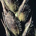
Phaeosphaeria sp. on wheat. This fungus is of the same genus common to salt marsh cordgrass.

