Ōpāwaho / Heathcote River facts for kids
Quick facts for kids Heathcote River |
|
|---|---|

Heathcote River downstream of Barrington Street
|
|
| Country | New Zealand |
| Physical characteristics | |
| River mouth | Pegasus Bay via the Avon Heathcote Estuary 0 m (0 ft) |
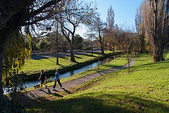
The Heathcote River (which Māori people call Ōpāwaho) flows right through the city of Christchurch, New Zealand. It gets its water from springs near Templetons Road. It also collects rainwater from areas as far west as Pound Road. The river gently winds around the bottom of the Port Hills, moving from the west towards the south-east.
Contents
Where Does the Heathcote River Flow?
The Heathcote River collects water from a large area, about 100 square kilometers. This area is called its catchment. It stretches all the way to the suburb of Yaldhurst. The biggest stream that feeds into the Heathcote is called Cashmere Stream.
The river flows through many different suburbs in Christchurch. These include Wigram, Hillmorton (where the main springs are), Hoon Hay, Spreydon, Cracroft, Cashmere, Beckenham, St Martins, Opawa, Woolston, and Ferrymead.
Finally, the Heathcote River flows into the Avon Heathcote Estuary. An estuary is where a river meets the sea. From there, its waters join Pegasus Bay in the Pacific Ocean.
The River's History and Its Names

The original Māori name for this river is Ōpāwaho. This name means 'The Place of the Outward Pā'. A pā was a fortified village or settlement. This particular pā was an outpost of a larger settlement called Kaiapoi.
The pā was built on higher ground, a bit downstream from where the Opawa Road Bridge is now. It was a very important resting spot for the Ngāi Tahu people. They used it when travelling between Kaiapoi and Horomaka (Banks Peninsula).
A Source of Food and Life
The area around the river was a special place called a mahinga kai. This means it was a place where people gathered lots of food. They found plenty of tuere (blind eels) and kanakana (lamprey) here.
Before cities grew, the river flowed through huge wetlands. Old maps from the 1800s show that the riverbanks were full of plants. You would see flax (harakeke), toetoe, raupo, tutu, and ferns. There were also many ti kouka (cabbage trees).
The land near the river was often wet and low-lying. When the Waimakariri River flooded, even higher ground could get wet. For many centuries, the Māori tribes of Waitaha, Kāti Māmoe, and Ngāi Tahu used the river for food and travel. They had a very close connection with it. The swampy forests around the river were great for catching water birds and forest birds. People also set traps for inanga (whitebait), pātiki (flounder), and tuna (eels).
How the River Got Its European Name
The Heathcote River was named after Sir William Heathcote, 5th Baronet. He was a secretary for the Canterbury Association, which helped set up the Canterbury region.
How the Heathcote River is Managed
The Heathcote River was very important for industries in Woolston. It provided lots of water for things like cleaning wool. However, by 1966, the river had become very polluted. This was because of waste from these industries. That year, the Woolston industrial sewer was built to help with the pollution.
Dealing with Flooding
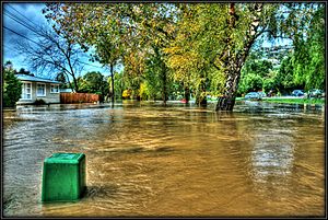
Flooding was also a big problem along the river. To help with this, a project called the Woolston Cut began in 1986. This cut is a shortcut for the river. It allows floodwaters to bypass a long bend in the river, which is known as the Woolston Loop.
The cut is about 510 meters long and cost NZ$2 million. After it was built, some problems appeared. Trees along the riverbank, as far upstream as the Opawa bridge, started to die. The riverbanks also began to collapse.
Scientists found out why this was happening. Salt water from the sea was travelling further upstream with each tide because of the cut. This salt was killing the trees. Also, the soil changed, becoming weaker. Even tiny Tunnelling mud crabs started to move further up the river, which also weakened the banks.
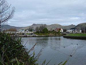
To fix these issues, the Woolston Tidal Barrage was built. This is a special gate at the upstream end of the cut. It is only opened when there are floods. During normal times, the Heathcote River still flows through the old Woolston Loop. Even with the Woolston Cut, parts of the Heathcote River still flood about once a year.
In 2008, the Christchurch City Council asked people for their ideas on how to manage a part of the river. This section was between Colombo Street and Opawa Road. A plan for managing this part of the river was officially approved in April 2009.
 | James Van Der Zee |
 | Alma Thomas |
 | Ellis Wilson |
 | Margaret Taylor-Burroughs |


