
Waimakariri River facts for kids
Quick facts for kids Waimakariri River |
|
|---|---|

View of the Waimakariri River looking towards the Southern Alps
|
|

Map of the course of the Waimakariri River
|
|
| Country | New Zealand |
| Region | Canterbury |
| Physical characteristics | |
| Main source | Southern Alps, near Mount Rolleston Southern Alps, Canterbury 1,535 m (5,036 ft) 42°54′13″S 171°29′48″E / 42.90361°S 171.49667°E |
| River mouth | Brooklands Lagoon, Pacific Ocean near Kaiapoi 0 m (0 ft) 43°23′26″S 172°42′29″E / 43.39056°S 172.70806°E |
| Length | 151 km (94 mi) |
| Basin features | |
| Tributaries |
|
The Waimakariri River is one of the biggest rivers in Canterbury, New Zealand. It is located on the eastern coast of New Zealand's South Island. The river flows for about 151 kilometers (94 miles) from the Southern Alps. It travels southeast across the Canterbury Plains before reaching the Pacific Ocean.
Contents
River Features and Flow
The Waimakariri River is a great example of a braided river. This means it splits into many smaller channels that weave in and out. These channels flow over wide beds of small stones and gravel.
From Mountains to Plains
In its upper parts, the river looks like many braids. As it gets closer to the Canterbury Plains, it goes through a mountain area. Here, the river is squeezed into a narrow canyon called the Waimakariri Gorge. After leaving the gorge, it spreads out again into its braided form across the plains.
Where the River Ends
The Waimakariri River finally flows into the Pacific Ocean. This happens north of Christchurch, close to the town of Kaiapoi.
Who Looks After the River?
Most riverbeds in New Zealand are unoccupied crown land. This means they are owned by the government. However, the bed of the Waimakariri River is special. It is managed by the Canterbury Regional Council. This group is also known as Environment Canterbury. They help take care of the river and its surroundings.
Images for kids
-
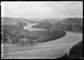
View of river at Kowai Bush near Springfield, 1927
-
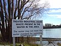
A water pollution sign on the lower reaches of the river
-
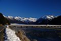
Bridge over the Bealey River
-
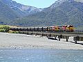
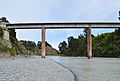
Trains crossing the Waimakariri River bridge
-
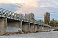
A view of the Waimakariri River bridge
-
The Waimakariri Gorge Bridge
-
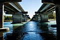
The river flowing between two bridges
-
Another view of a bridge over the Waimakariri River
-
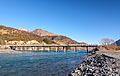
A bridge crossing the Waimakariri River


See also
 In Spanish: Río Waimakariri para niños
