Hagerstown, Maryland facts for kids
Quick facts for kids
Hagerstown, Maryland
|
||
|---|---|---|
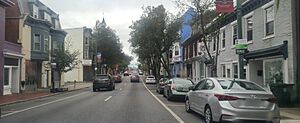
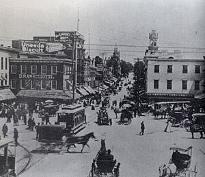
Downtown Hagerstown, looking west on
Franklin Street in 2023 |
||
|
||
| Nicknames:
Hub City, Maryland's Gateway to the West, H-Town, (formerly) Home of the Flying Boxcar
|
||
| Motto(s):
A Great Place to Live, Work, and Visit
|
||
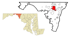
Location in Maryland and in Washington County
|
||
| Country | United States | |
| State | Maryland | |
| County | Washington | |
| Founded | 1762 | |
| Incorporated | 1813 | |
| Founded by | Jonathan Hager | |
| Named for | Jonathan Hager | |
| Government | ||
| • Type | Mayor–council | |
| Area | ||
| • City | 12.56 sq mi (32.54 km2) | |
| • Land | 12.55 sq mi (32.51 km2) | |
| • Water | 0.01 sq mi (0.03 km2) | |
| • Urban | 120.77 sq mi (312.8 km2) | |
| • Metro | 1,019 sq mi (2,637 km2) | |
| Elevation | 551 ft (168 m) | |
| Population
(2020)
|
||
| • City | 43,527 | |
| • Estimate
(2021)
|
43,487 | |
| • Density | 3,467.18/sq mi (1,338.71/km2) | |
| • Urban | 197,557 (US: 194th) | |
| • Urban density | 1,635.8/sq mi (631.6/km2) | |
| • Metro | 293,844 (US: 167th) | |
| Demonym(s) | Hagerstonian | |
| Time zone | UTC−5 (Eastern (EST)) | |
| • Summer (DST) | UTC−4 (EDT) | |
| ZIP Codes |
21740, 21741, 21742, 21746, 21747 and 21749
|
|
| Area code(s) | 301, 240 | |
| FIPS code | 24-36075 | |
| GNIS feature ID | 2390597 | |
| Website | www.hagerstownmd.org | |
Hagerstown is a city in Maryland, United States. It's the main city of Washington County. In 2020, about 43,527 people lived there. Hagerstown is the sixth-largest city in Maryland. It is also the biggest city in the western part of Maryland.
Hagerstown is a central point for a larger area that includes parts of West Virginia. This area is growing fast. The city is located in the Great Appalachian Valley.
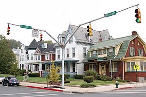
The city has unique hills made of stone. Many old buildings in Hagerstown were built using this local stone. This gives the city a special look.
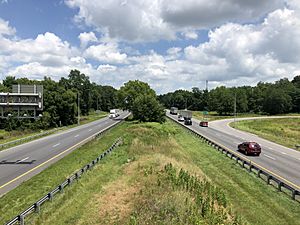
Hagerstown is a busy place for travel and business. Major highways like I-81 and I-70 meet here. Several railroads also pass through. The Hagerstown Regional Airport helps connect the city to other places. Because of all these connections, Hagerstown is often called the Hub City.
Contents
History of Hagerstown
How Hagerstown Began
In 1739, a German immigrant named Jonathan Hager bought land in Maryland. He called his land "Hager's Fancy." In 1762, he officially started a town there. He named it Elizabethtown after his wife, Elizabeth Kershner.
Jonathan Hager worked hard to make Hagerstown the main city for the new Washington County. He is known as the "Father of Washington County." In 1813, the town's name was changed to Hager's-Town. This was because most people already called it that. The state officially approved the name change the next year.
Hagerstown During the Civil War
Hagerstown was very important during the American Civil War. It was a key place for armies from both the North and the South. Four major campaigns happened near the city.
In 1862, during the Maryland Campaign, soldiers passed through Hagerstown. They were on their way to big battles like Battle of South Mountain and Antietam. In 1863, the city saw more military action. This was when General Robert E. Lee's army moved through during the Gettysburg Campaign.
In 1864, the Confederate army entered Hagerstown. They asked the city for money and clothes. This was a payment for damages caused by Union troops elsewhere.
After the war, many soldiers who died were buried in cemeteries in Hagerstown. About 2,800 Confederate soldiers from the battles of Antietam and South Mountain were reburied in Washington Confederate Cemetery. This cemetery is part of Rose Hill Cemetery in Hagerstown.
Railroads and the "Hub City"
Hagerstown got its nickname "Hub City" because many railroads and roads met there. It was a major center for the Western Maryland Railway. Other important railroads like the Pennsylvania and Baltimore and Ohio also served the city.
Today, Hagerstown is still a key spot for major railroads. These include CSX and Norfolk Southern.
Little Heiskell Weathervane
"Little Heiskell" is a famous symbol of Hagerstown. It's a weathervane shaped like a German soldier. A German tinsmith named Benjamin Heiskell made it in 1769. For 166 years, it stood on top of the Market House and then City Hall.
During the Civil War, a Confederate soldier shot a bullet hole through it. He won a bet by hitting it from far away. In 1935, the original Little Heiskell was moved to a museum. You can now see it at the Jonathan Hager House. A copy of it is on top of City Hall today.
Hagerstown's Aviation History
Hagerstown has a rich history in making airplanes. From 1931 to 1984, Fairchild Aircraft was a huge employer in the area. The company was so important that Hagerstown was once called "Home of the Flying Boxcar." This was after the Fairchild C-119 Flying Boxcar cargo plane.
Fairchild made many planes during World War II. At its busiest, Fairchild employed about 10,000 people. This was about 80% of Hagerstown's workers.
After the war, Fairchild continued to build aircraft. These included the C-123 Provider and the Fairchild Republic A-10 Thunderbolt II. In 1984, Fairchild stopped making planes in Hagerstown.
The Hagerstown Aviation Museum shows many of these old aircraft. You can see planes like the 1945 C-82A and the 1953 C-119. The museum is located near the Hagerstown Regional Airport.
The airport is named after Richard A. Henson. He founded Piedmont Airlines, which started in Hagerstown in 1931.
Geography and Climate
Location of Hagerstown
Hagerstown is located in western Maryland. It sits between the Blue Ridge and Allegheny Mountains. This area is part of the Great Appalachian Valley. The city is close to the borders of Pennsylvania, West Virginia, and Virginia.
Hagerstown is about 70 miles (113 km) northwest of Washington, D.C.. It is also about 72 miles (116 km) west of Baltimore.
The city covers about 11.80 square miles (30.56 km²). Most of this is land. Major streams like Hamilton Run and Antietam Creek flow through Hagerstown. The land around the city has low, rolling hills. It's very fertile, which is great for farming. Farmers in the area grow corn and have fruit orchards.
Hagerstown's Climate
Hagerstown has a climate that mixes two types: humid subtropical and humid continental. This means it has hot, humid summers. Winters are cool to moderately cold.
- The average temperature in January is about 32.9°F (0.5°C).
- The average temperature in July is about 77.6°F (25.3°C).
- The highest temperature ever recorded was 107°F (42°C) in July 1999.
- The lowest temperature ever recorded was -27°F (-33°C) in January 1912.
The city gets a moderate amount of rain, about 39.29 inches (998 mm) each year. Rain is spread out through the year. May and June usually get the most rain.
| Climate data for Hagerstown, Maryland (Washington County Airport), 1991–2020 normals, extremes 1899–present | |||||||||||||
|---|---|---|---|---|---|---|---|---|---|---|---|---|---|
| Month | Jan | Feb | Mar | Apr | May | Jun | Jul | Aug | Sep | Oct | Nov | Dec | Year |
| Record high °F (°C) | 78 (26) |
82 (28) |
88 (31) |
94 (34) |
96 (36) |
102 (39) |
107 (42) |
104 (40) |
101 (38) |
95 (35) |
83 (28) |
75 (24) |
107 (42) |
| Mean daily maximum °F (°C) | 40.5 (4.7) |
43.6 (6.4) |
52.8 (11.6) |
64.9 (18.3) |
74.4 (23.6) |
82.6 (28.1) |
87.3 (30.7) |
84.9 (29.4) |
77.8 (25.4) |
66.0 (18.9) |
54.4 (12.4) |
44.0 (6.7) |
64.4 (18.0) |
| Daily mean °F (°C) | 32.9 (0.5) |
35.5 (1.9) |
43.4 (6.3) |
54.6 (12.6) |
64.4 (18.0) |
73.1 (22.8) |
77.6 (25.3) |
75.3 (24.1) |
68.4 (20.2) |
56.7 (13.7) |
45.9 (7.7) |
36.9 (2.7) |
55.4 (13.0) |
| Mean daily minimum °F (°C) | 25.3 (−3.7) |
27.3 (−2.6) |
34.0 (1.1) |
44.3 (6.8) |
54.5 (12.5) |
63.7 (17.6) |
67.9 (19.9) |
65.7 (18.7) |
58.9 (14.9) |
47.4 (8.6) |
37.4 (3.0) |
29.8 (−1.2) |
46.3 (7.9) |
| Record low °F (°C) | −27 (−33) |
−20 (−29) |
−7 (−22) |
9 (−13) |
23 (−5) |
30 (−1) |
42 (6) |
39 (4) |
25 (−4) |
18 (−8) |
−4 (−20) |
−13 (−25) |
−27 (−33) |
| Average precipitation inches (mm) | 2.46 (62) |
1.97 (50) |
3.04 (77) |
3.33 (85) |
3.55 (90) |
3.36 (85) |
2.94 (75) |
2.90 (74) |
3.83 (97) |
2.76 (70) |
2.63 (67) |
2.83 (72) |
35.60 (904) |
| Average snowfall inches (cm) | 5.9 (15) |
5.5 (14) |
6.7 (17) |
trace | 0.0 (0.0) |
0.0 (0.0) |
0.0 (0.0) |
0.0 (0.0) |
0.0 (0.0) |
0.0 (0.0) |
1.4 (3.6) |
2.4 (6.1) |
21.9 (56) |
| Average precipitation days (≥ 0.01 in) | 10.0 | 8.9 | 10.3 | 11.7 | 14.0 | 11.8 | 11.4 | 10.0 | 9.5 | 9.2 | 8.4 | 9.2 | 124.4 |
| Average snowy days (≥ 0.01 in) | 5.6 | 5.1 | 4.6 | trace | 0.0 | 0.0 | 0.0 | 0.0 | 0.0 | 0.0 | 3.9 | 12.9 | 32.1 |
| Source: NOAA | |||||||||||||
People of Hagerstown
| Historical population | |||
|---|---|---|---|
| Census | Pop. | %± | |
| 1820 | 2,670 | — | |
| 1830 | 3,371 | 26.3% | |
| 1840 | 3,625 | 7.5% | |
| 1850 | 3,879 | 7.0% | |
| 1860 | 4,132 | 6.5% | |
| 1870 | 5,779 | 39.9% | |
| 1880 | 6,627 | 14.7% | |
| 1890 | 10,118 | 52.7% | |
| 1900 | 13,591 | 34.3% | |
| 1910 | 16,507 | 21.5% | |
| 1920 | 28,064 | 70.0% | |
| 1930 | 30,851 | 9.9% | |
| 1940 | 32,491 | 5.3% | |
| 1950 | 36,260 | 11.6% | |
| 1960 | 36,660 | 1.1% | |
| 1970 | 35,862 | −2.2% | |
| 1980 | 34,132 | −4.8% | |
| 1990 | 35,445 | 3.8% | |
| 2000 | 36,687 | 3.5% | |
| 2010 | 39,662 | 8.1% | |
| 2020 | 43,527 | 9.7% | |
| 2022 (est.) | 43,701 | 10.2% | |
| U.S. Decennial Census 2018 Estimate |
|||
In 2010, there were 39,662 people living in Hagerstown. The city had 16,449 households. About 32.9% of these households had children under 18.
Most people in Hagerstown are White (75.8%). About 15.5% are African American. Other groups include Asian, Native American, and people of two or more races. About 5.6% of the population is Hispanic or Latino.
The average age in the city was 34.5 years old. About 25.8% of residents were under 18.
Hagerstown's Metro Area
The larger Hagerstown area includes three counties:
In 2020, the population of this larger area was 293,844. This makes it one of the fastest-growing areas in Maryland. Many people are moving here from Washington, D.C., and Baltimore.
Hagerstown's Economy
Hagerstown used to be known for its factories and railroads. It made things like airplanes, trucks, and textiles. Today, the city has many different types of businesses. It has modern service companies and still has strong manufacturing and transportation industries.
The area around Hagerstown is also important for farming. Tourism, especially shopping, helps the local economy too.
Recently, many large warehouses have been built in Hagerstown. This is because the city is located where two major highways, I-81 and I-70, meet. This makes it a great place for e-commerce companies.
Manufacturing is also returning to Hagerstown. For example, Hitachi Rail is building a large factory here.
Healthcare in Hagerstown
Hagerstown has several healthcare facilities:
- Meritus Medical Center: A hospital for patients needing care.
- Western Maryland Hospital Center: A state-run center for long-term care.
- Brook Lane Psychiatric Center: A private center for mental health.
Shopping in Hagerstown
Hagerstown has two main shopping malls:
- Hagerstown Premium Outlets: This mall has over 100 stores. Many visitors from Washington and Baltimore come here to shop.
- Valley Mall: This mall has stores like JCPenney and Belk. It also has a large movie theater.
Culture and Fun
Historical Sites to Explore
Hagerstown is a great place to start if you want to learn about the American Civil War.
- Antietam National Battlefield: This is where one of the bloodiest battles in American history took place. It's in nearby Sharpsburg.
- South Mountain State Battlefield: Another important Civil War site in Washington County.
- Other battlefields like Gettysburg and Harpers Ferry are also close by.
You can also visit Fort Frederick State Park. It has a restored fort from the French and Indian War. Near Boonsboro, you'll find Washington Monument State Park. This park has the oldest monument honoring George Washington.
Hagerstown is also home to the main office for the Chesapeake and Ohio Canal National Historical Park.
Many buildings and areas in Hagerstown are listed on the National Register of Historic Places. This means they are important historical sites. Some examples include the Hager House, Maryland Theatre, and the Western Maryland Railway Station.
Parks and Museums
Hagerstown has many parks. Hagerstown City Park is a popular one. In this park, you can find:
- Washington County Museum of Fine Arts
- Mansion House Art Gallery
- Western Maryland 202 Locomotive Display and Museum
- The Hager House and Museum, which was the home of the city's founder.
Outside the park, the Hagerstown Roundhouse Museum shows exhibits about the city's early railroad history. Discovery Station is a hands-on science and technology museum downtown. It also has exhibits from the Hagerstown Aviation Museum.
Fairgrounds Park is the city's largest park for activities. It has fields for baseball and soccer, a BMX track, and a skatepark.
Theater and Arts
Hagerstown is home to the Maryland Theatre. This theater hosts the Maryland Symphony Orchestra. It also holds the annual Miss Maryland USA Beauty Pageants. The Washington County Playhouse offers dinner theater shows.
The Barbara Ingram School for the Arts is a special school for talented art students. It is located in downtown Hagerstown.
Festivals and Events
Downtown Hagerstown has become a lively place with many annual events:
- Quad State Beer Fest: A festival with craft beer and music.
- Interstate BBQ Festival: A barbecue cooking competition.
- Western Maryland Blues Fest: Features blues music artists from all over the country.
- Augustoberfest: Celebrates Hagerstown's German heritage.
- Alsatia Mummers Parade: An annual parade during Halloween season.
Fairgrounds Park also hosts events. These include the Hagerstown Hispanic Festival and the city's annual July 4th fireworks show.
Professional Sports in Hagerstown
Baseball Teams in Hagerstown
Hagerstown has a long history with baseball.
- Early Teams (1915–1955): From 1915 to 1929, Hagerstown had a minor league team called the Hubs. They played in the Blue Ridge League. Later, from 1941 to 1955, teams like the Hagerstown Owls and Braves played here.
- Hagerstown Suns (1981–2020): The Hagerstown Suns played in Hagerstown for many years. They were a minor league team for different major league teams like the Baltimore Orioles and Washington Nationals. The Suns stopped playing in 2021.
- Hagerstown Flying Boxcars (2024–present): A new baseball team, the Hagerstown Flying Boxcars, started playing in 2024. They play in a new stadium called Meritus Park. The team name honors Hagerstown's history with the Fairchild C-119 Flying Boxcar plane.
Other Sports Venues
West of the city is Hagerstown Speedway. This is a famous dirt-track racing place. Another racing track, Mason-Dixon Dragway, is just southeast of Hagerstown.
Education in Hagerstown
Hagerstown has several schools for students.
Public High Schools
These schools are managed by Washington County Public Schools:
- Antietam Academy
- Barbara Ingram School for the Arts
- Evening High School
- North Hagerstown High School
- South Hagerstown High School
- Washington County Technical High School
Many students from Hagerstown also attend high schools in nearby towns:
- Boonsboro High School, Boonsboro
- Clear Spring High School, Clear Spring
- Smithsburg High School, Smithsburg
- Williamsport High School, Williamsport
Private High Schools
- Broadfording Christian Academy
- Emmanuel Christian School
- Gateway Academy
- Grace Academy
- Heritage Academy
- St. Mary's Catholic School
- Highland View Academy
- St. James School
- Truth Christian Academy
Colleges and Universities
- Hagerstown Community College: A two-year public college.
- University System of Maryland at Hagerstown: This center offers bachelor's, master's, and doctoral degrees. It works with other state colleges in Maryland.
Media in Hagerstown
Radio Stations
Hagerstown shares its radio market with Chambersburg and Waynesboro, Pennsylvania. Here are some local radio stations:
Television Stations
Hagerstown is home to three television stations. It shares a larger TV market with Washington, D.C.
Transportation in Hagerstown
Major Highways
Hagerstown is a crossroads for important highways:
 Interstate 70: Goes east to Baltimore and west across the country.
 Interstate 81: Goes north to New York and south to Tennessee.
 U.S. Route 11: Runs next to I-81.
 U.S. Route 40: Runs next to I-70.
 U.S. Route 40 Alternate
 Maryland Route 58
 Maryland Route 60
 Maryland Route 64
 Maryland Route 65
 Maryland Route 144
 Maryland Route 632
Public Transportation
- Washington County Transit buses help people get around the city. They also offer some service to nearby communities.
- The Maryland Transit Administration has a commuter bus (Route 505). It goes to the Shady Grove Metro Station. From there, people can take the subway to Washington, D.C..
- Taxi services are available in Hagerstown.
- Greyhound Lines and Atlantic Charter Buses offer long-distance bus trips. You can travel to cities like Baltimore, Harrisburg, and Washington.
Hagerstown Regional Airport
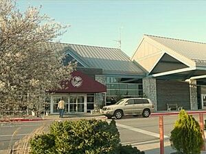
Hagerstown Regional Airport (HGR) is about 5 miles (8 km) north of the city. It's also known as Richard A. Henson Field. This airport is often used by the U.S. President when traveling to Camp David.
The airport has commercial flights from Allegiant Air. You can fly to places like Orlando, Myrtle Beach, and St. Petersburg-Clearwater. Larger airports like Washington Dulles and Baltimore-Washington International (BWI) are about 60-75 miles (97-121 km) away.
Even though many railroads pass through Hagerstown, there is no passenger train service directly in the city. However, you can find train service in nearby Martinsburg, West Virginia, and Frederick, Maryland.
Notable People
- See People from Hagerstown.
Sister Cities
Hagerstown has partnerships with cities around the world:

 Wesel, North Rhine-Westphalia, Germany (since 1952)
 Hagerstown, Indiana, United States (since 2013)
 Xinjin, China (since 2016)
See also
 In Spanish: Hagerstown (Maryland) para niños
 | Ernest Everett Just |
 | Mary Jackson |
 | Emmett Chappelle |
 | Marie Maynard Daly |


