
40th parallel north facts for kids
The 40th parallel north is an imaginary line that goes all the way around the Earth. It's located 40 degrees north of the equator, which is the Earth's middle line.
This special line crosses many parts of the world! It goes through Europe, the Mediterranean Sea, Asia, the Pacific Ocean, North America, and the Atlantic Ocean.
If you were on the 40th parallel north, you would see the sun for about 15 hours during the longest day of summer (the summer solstice). In winter, during the shortest day (the winter solstice), the sun would be visible for about 9 hours and 20 minutes.
Contents
Traveling the 40th Parallel North
Let's take a trip along the 40th parallel north, starting from the Prime Meridian in Spain and heading east!
The line begins in Spain, crossing parts of the Valencian Community. It then goes over the Mediterranean Sea, passing just north of the Spanish islands of Mallorca and Menorca.
Next, it crosses the Italian island of Sardinia before entering the Tyrrhenian Sea. It touches mainland Italy in areas like Campania and Calabria, then crosses the Gulf of Taranto and Apulia.
After Italy, the 40th parallel north crosses the Strait of Otranto and enters Albania, passing near cities like Sarandë and Gjirokastër. It then moves into Greece, going over the Aegean Sea and touching Greek islands like Lemnos.
The line continues into Turkey, passing just north of the capital city, Ankara. From Turkey, it crosses Armenia and Azerbaijan, including the Nagorno-Karabakh region.
It then goes over the Caspian Sea before entering Central Asia, crossing countries like Turkmenistan, Uzbekistan, Tajikistan, and Kyrgyzstan. It even passes through some small areas of Uzbekistan that are surrounded by Kyrgyzstan.
After Central Asia, the 40th parallel north enters China. It crosses many different regions, including Xinjiang, Gansu, Inner Mongolia, Shanxi, Hebei, and even passes just north of Beijing, China's capital city. It also crosses Tianjin and a small part of Liaoning.
The line then goes over the Pacific Ocean, crossing the Liaodong Bay and the Yellow Sea. It briefly touches the Liaodong Peninsula in China again before entering North Korea. In North Korea, it passes through cities like Sinuiju and just north of Hamhung.
After North Korea, it crosses the Sea of Japan and then reaches Japan, specifically the large island of Honshū. Here, it crosses Akita Prefecture and Iwate Prefecture.
The 40th parallel north then travels a long way across the vast Pacific Ocean before reaching North America.
In the United States, this line crosses many states! It goes through California, Nevada, Utah, Colorado, and forms the border between Nebraska and Kansas. It then continues through Missouri, Illinois, Indiana, and Ohio (passing just north of Columbus, Ohio). Finally, it crosses West Virginia, Pennsylvania (passing through Philadelphia), and New Jersey.
After crossing the United States, the 40th parallel north goes over the Atlantic Ocean. It passes just north of Corvo Island in the Azores, which belong to Portugal.
Finally, the line reaches mainland Portugal, passing near cities like Pombal and Covilhã. It then returns to Spain, crossing regions like Extremadura, Castile-La Mancha, and even a small part of the Community of Madrid, before completing its journey back to the Prime Meridian.
The 40th Parallel in the United States


In the United States, the 40th parallel north is very important because it forms the border between the states of Kansas and Nebraska.
This border was decided a long time ago. On May 30, 1854, a law called the Kansas–Nebraska Act was passed. This law created the Kansas Territory and the Nebraska Territory, and it used the 40th parallel north as the dividing line between them.
Images for kids
-
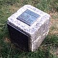
40th parallel marker at Ohio State University in Columbus, Ohio
-

Monument of North latitude 40 degrees at Nyudouzaki in Oga, Akita, Japan
-
Nyudozaki Monument
-

40°N and 140°E Crossing Point in Ogata, Akita, Japan
-

Globe Monument in Fudai, Iwate, Japan
.jpg)


See also
 In Spanish: Paralelo 40 norte para niños
