
Azores facts for kids
Quick facts for kids
Azores
Açores (Portuguese)
|
|||
|---|---|---|---|
|
Autonomous Region of Portugal and outermost region of the European Union
|
|||
| Autonomous Region of the Azores Região Autónoma dos Açores (Portuguese) |
|||
|
|||
| Motto(s):
Antes morrer livres que em paz sujeitos
(English: "Rather die free than subjected in peace") |
|||
| Anthem: Hino dos Açores (English: "Anthem of the Azores") |
|||

Location of the Azores within the European Union
|
|||
| Country | |||
| Settlement | 1432 | ||
| Autonomous status | 30 April 1976 | ||
| Named for | Açor (English: Northern goshawk) | ||
| Capitals | Ponta Delgada (executive) Angra do Heroísmo (judicial) Horta (legislative) 38°40′N 28°04′W / 38.66°N 28.07°W |
||
| Largest city | Ponta Delgada | ||
| Official languages | Portuguese | ||
| Demonym(s) | Açoriano(a) (English: Azorean) | ||
| Government | Autonomous Region | ||
|
• Representative of the Republic
|
Pedro Manuel dos Reis Alves Catarino | ||
|
• President of the Legislative Assembly
|
Luís Garcia | ||
|
• President of the Regional Government
|
José Manuel Bolieiro | ||
|
• Vice-President of the Regional Government
|
Artur Lima | ||
| Legislature | Legislative Assembly | ||
| Area | |||
|
• Total
|
2,351 km2 (908 sq mi) | ||
| Highest elevation | 2,351 m (7,713 ft) | ||
| Lowest elevation | 0 m (0 ft) | ||
| Population | |||
|
• Census
|
236,440 | ||
|
• Density
|
110/km2 (284.9/sq mi) | ||
| GDP (PPP) | 2017 estimate | ||
|
• Total
|
|||
|
• Per capita
|
|||
| Currency | Euro (€) (EUR) | ||
| Time zone | UTC−01:00 | ||
|
• Summer (DST)
|
UTC±00:00 | ||
| Date format | dd/mm/yyyy (CE) | ||
| Driving side | right | ||
| Calling code | +351 (292) | ||
| Postal code |
95nn-99nn
|
||
| ISO 3166 code | PT-20 | ||
| Internet TLD | .pt | ||
| Usual abbreviation | RAA | ||


The Azores (Ə-zorz AY-zorz; Portuguese: Açores), officially called the Autonomous Region of the Azores, is a special region of Portugal. It is a group of nine volcanic islands located in the Atlantic Ocean. These islands are about 1,400 km (870 mi) west of Lisbon, Portugal. They are also about 1,930 km (1,200 mi) southeast of Newfoundland, Canada.
The main ways people make a living here are through farming, dairy farming, raising animals, fishing, and tourism. Tourism has become a very important activity. In the past, the Azores were a key stop for planes flying between Europe and North America to refuel. The government also employs many people in service jobs. The biggest city in the Azores is Ponta Delgada. Each island has its own unique culture, way of speaking, food, and traditions. This is because the islands were settled slowly over 200 years.
The nine main Azorean islands and a small group of islets are divided into three groups. The western group includes Flores and Corvo. The central group has Graciosa, Terceira, São Jorge, Pico, and Faial. The eastern group consists of São Miguel, Santa Maria, and the Formigas islets. These islands stretch for more than 600 km (370 mi) from northwest to southeast. All the islands were formed by volcanoes. However, some, like Santa Maria, have not had any volcanic activity since people settled there centuries ago. Mount Pico, on Pico Island, is the highest point in Portugal, standing at 2,351 m (7,713 ft). If measured from the ocean floor, the Azores are among the tallest mountains on Earth.
The Azores are located where three major tectonic plates meet: the North American plate, Eurasian plate, and Nubian plate. This area is very active with earthquakes and volcanoes. The climate in the Azores is quite mild for its northern location. This is because it is far from continents and influenced by the Gulf Stream. Temperatures stay mild all year, usually between 16 °C (61 °F) and 25 °C (77 °F). It is also generally wet and cloudy.
Contents
- Exploring the History of the Azores
- Geography and Unique Landscapes
- Geology: Volcanoes and Earthquakes
- Biome and Wildlife
- Climate and Weather Patterns
- Economy and Industries
- Population and Communities
- Politics and Government
- Foreign Relations and Defense
- Transportation: Getting Around the Islands
- Culture and Traditions
- Sustainability Efforts
- Images for kids
- See also
Exploring the History of the Azores
Early Discoveries and Settlements
_(cropped).jpg)
Some ancient underground structures have been found on Corvo, Santa Maria, and Terceira islands. An archaeologist suggested they might be 2,000 years old. This could mean people lived there before the Portuguese arrived. However, it is not confirmed if these structures are natural or man-made, or if they are truly that old.
Recent studies on mouse DNA suggest a Scandinavian link to the local mouse population. Also, lake sediment samples indicate that land was cleared and animals were raised between 700 and 850 A.D. These findings hint at a short period of Norse (Viking) settlement. Climate models suggest weaker westerly winds during that time, which would have made it easier for Viking ships to sail to the Azores from Scandinavia.

In 1427, a captain working for Prince Henry the Navigator might have discovered the Azores. However, this is not certain. Some stories say a Flemish sailor named Joshua Vander Berg landed there by accident. The Portuguese later explored the islands and claimed them. The islands were named "Azores" after the Portuguese word for "goshawk" (açor). But it is unlikely that these birds ever lived there.
The islands were mostly settled by people from mainland Portugal. Gonçalo Velho Cabral led the first settlers to Santa Maria and then São Miguel in the 1430s. Settlers built homes, started villages, and cleared land for crops like grain, grapes, and sugar cane. They also brought farm animals such as chickens, cattle, and pigs. Settlement began in 1439, with people mainly from the Algarve and Alentejo regions of Portugal.
Flemish Settlers and Their Influence
By 1490, about 2,000 Flemish people lived on Terceira, Pico, Faial, São Jorge, and Flores islands. Because of this large Flemish settlement, the Azores were sometimes called the Flemish Islands. Prince Henry the Navigator encouraged this settlement. His sister, Isabel, was married to the Duke of Burgundy, who ruled Flanders. When there was trouble in Flanders, Isabel asked Henry to let some Flemings settle in the Azores. He agreed and helped them travel there.
Major Events and Changes
In 1522, Vila Franca do Campo, the capital of São Miguel, was destroyed by an earthquake and landslide. About 5,000 people died, and the capital moved to Ponta Delgada. Vila Franca do Campo was rebuilt and is now a busy fishing port. Ponta Delgada became a city in 1546. From the start, settlers focused on farming. By the 15th century, Graciosa island was exporting wheat, barley, wine, and brandy.

Portugal faced a crisis in 1580 when its king died without an heir. Philip II of Spain claimed the Portuguese throne. The Azores resisted Spanish rule for a while. However, in 1583, Philip II sent his fleet and took control of the islands. The Azores were the last part of the Portuguese Empire to resist. Spain controlled the Azores from 1580 to 1642. Portuguese control returned in 1640, not by the army, but by local people fighting the Spanish soldiers.

English raids occurred in 1589 and 1598. In 1589, an English raid successfully took goods from some islands. Eight years later, a second raid failed.
Overpopulation and Emigration from the Azores

By the late 16th century, the Azores had too many people. To deal with economic problems, many Azoreans began to move to the United States, Canada, and Brazil. Between 1921 and 1977, about 250,000 Azoreans moved to Rhode Island and Massachusetts in the U.S. Some later moved to California. Many also moved to Hawaii in the late 19th century. Cities like Florianópolis and Porto Alegre in Brazil were founded by Azoreans.
The Portuguese Civil War (1828–1834) greatly affected the Azores. In 1829, liberals won a battle on Terceira Island. This made Terceira the main base for the new Portuguese government.
Modern Times and Autonomy

From 1836 to 1976, the Azores were divided into three districts. These divisions were not based on the natural island groups. Instead, they reflected the location of the three main cities: Angra do Heroísmo, Horta, and Ponta Delgada.
During World War II, Portugal allowed Great Britain to use air and naval bases in the Azores in 1943. This was important for protecting convoys and hunting German submarines in the Atlantic. In 1945, the U.S. built Lajes Field air base on Terceira Island. This base is a joint project between the U.S. and Portugal. It continues to support both countries' armed forces.

After the Carnation Revolution in 1974, which ended the dictatorship in Portugal, the Azores became an autonomous region in 1976. This means they have their own government. In 2003, the Azores gained international attention when leaders from the United States, Britain, Spain, and Portugal met there before the Iraq War.
Geography and Unique Landscapes

| Island | Area | |
|---|---|---|
| km2 | sq mi | |
| São Miguel | 759 km2 | 293 sq mi |
| Pico | 446 km2 | 172 sq mi |
| Terceira | 403 km2 | 156 sq mi |
| São Jorge | 246 km2 | 95 sq mi |
| Faial | 173 km2 | 67 sq mi |
| Flores | 143 km2 | 55 sq mi |
| Santa Maria | 97 km2 | 37 sq mi |
| Graciosa | 62 km2 | 24 sq mi |
| Corvo | 17 km2 | 7 sq mi |
The Azores archipelago is in the middle of the North Atlantic Ocean. It stretches for about 600 km (370 mi). The islands rise from a large underwater area called the Azores Plateau. This plateau is about 5.8 million square kilometers.

The nine islands cover a total area of 2,346 km2 (906 sq mi). São Miguel is the largest at 759 km2 (293 sq mi). Corvo is the smallest, at about 17 km2 (6.6 sq mi).
Each island has its own special features:
- Corvo: A large volcanic crater.
- Flores: A rugged island with many valleys.
- Faial: Known for its shield volcano and caldera.
- Pico: Home to Mount Pico, the highest point in Portugal.
- Graciosa: Has active hot springs and a mix of volcanic cones and flat areas.
- São Jorge: A long, thin island formed by volcanic cracks.
- Terceira: Almost circular, with one of the region's largest craters.
- São Miguel: The largest island, with many craters and small volcanic cones.
- Santa Maria: The oldest island, with brown sandy beaches.
.JPG)
The islands are grouped into three main parts:
- The Eastern Group: São Miguel, Santa Maria, and Formigas Islets.
- The Central Group: Terceira, Graciosa, São Jorge, Pico, and Faial.
- The Western Group: Flores and Corvo.
São Jorge, Pico, and Faial are also known as the "Islands of the Triangle."
Geology: Volcanoes and Earthquakes
.jpg)
The Azores are located where three major tectonic plates meet: the North American plate, the Eurasian plate, and the African plate. This causes many faults and fractures in the region. The westernmost islands (Corvo and Flores) are on the North American plate. The other islands are on the boundary between the Eurasian and African plates.
The main geological features are the Mid-Atlantic Ridge, the Terceira Rift, the Azores Fracture Zone, and the Glória Fault. The Mid-Atlantic Ridge is a major boundary between the North American and African-Eurasian plates. It runs through the Azores Plateau and is very active with earthquakes and volcanoes.
Mountains of the Azores
The Azores have several tall mountains. Montanha do Pico (Mount Pico) is the highest at 2,351 meters (7,713 feet) on Pico Island. Other important peaks include Pico da Vara on São Miguel Island and Pico da Esperança on São Jorge Island.
| Mountain | Height (meters) | Height (feet) | Island |
|---|---|---|---|
| Montanha do Pico | 2,351 | 7,713 | Pico Island |
| Pico da Vara | 1,103 | 3,619 | São Miguel |
| Pico da Esperança | 1,053 | 3,455 | São Jorge |
| Cabeço Gordo | 1,043 | 3,422 | Faial |
| Calderia de Santa Bárbara | 1,023 | 3,356 | Terceira |
Volcanic Activity and Formations
The islands' volcanoes are linked to the movement of these tectonic plates. This movement causes many active volcanic eruptions and earthquakes. Most volcanic activity happens along the Terceira Rift.
Since the islands were settled in the 15th century, there have been 28 recorded volcanic eruptions. The last major eruption was the Capelinhos volcano off Faial Island in 1957. The islands have many volcanic features. These include caves and lava tubes like Algar do Carvão. They also have coastal lava fields and inactive volcanic cones.
.jpg)
The islands were formed by volcanic and seismic activity millions of years ago. Santa Maria was the first island to appear, about 8 million years ago. Pico is the youngest, formed about 270,000 years ago. Some islands like Santa Maria, Graciosa, Flores, and Corvo have not had volcanic eruptions in recorded history. However, the other islands have had eruptions since the 14th century.
Earthquakes in the Azores
The Azores experience frequent earthquakes due to their location on active plate boundaries. These earthquakes are usually mild to medium in strength. Occasionally, stronger earthquakes occur. The most powerful earthquake recorded was in 1757 near Calheta on São Jorge Island. It was stronger than 7 on the Richter scale.
In 1522, an earthquake measuring 6.8 destroyed Vila Franca do Campo. This event caused landslides and killed over 5,000 people.

Biome and Wildlife
The Azores are part of the Palearctic realm and have unique plants and animals. They have a special type of forest called laurissilva, which is subtropical. There are over 6,112 land species, and about 411 of them are found only in the Azores. Most of these unique species are animals, especially insects and snails.
.jpg)
Even though the Azores look very green, human activity has changed the vegetation a lot. Much of the native forest was cut down over the past 600 years for wood and to clear land for farming. This has caused many insect species to disappear or become endangered. Many farms have been abandoned, especially due to people moving away. This has allowed invasive plants to spread. Hydrangeas, though beautiful, are an invasive plant. Cryptomeria, a Japanese cedar, is widely grown for timber. Efforts are being made to replant native laurissilva forests.
The Azores have at least two bird species found nowhere else. The Azores bullfinch lives only in the remaining laurissilva forests on São Miguel and is endangered. Monteiro's storm petrel breeds in only two known spots on the islands. An extinct owl species, the São Miguel scops owl, likely disappeared after humans arrived due to habitat loss. Five species of flightless rail birds also once lived here but are now extinct.
_(cropped).jpg)
The Formigas islets and the Dollabarat Reef have a rich marine environment. They are home to black coral, manta rays, different types of sharks, whales, and sea turtles. Seventeen new marine reserves have been added to the Azorean Marine Park, which covers about 900,000 km2 (350,000 sq mi). On São Miguel, hot springs create unique environments for tiny organisms called extremophiles.
Climate and Weather Patterns

The Azores are at a similar latitude to southern Portugal. However, their location in the middle of the Atlantic Ocean gives them a mild, oceanic, and warm subtropical climate. Temperatures do not change much throughout the year.
The Azores High and Its Influence
The climate of the Azores is mainly shaped by changes in air pressure over the North Atlantic. A semi-permanent high-pressure system, known as the Azores High, greatly influences the weather. In winter, the Azores High moves south, allowing cooler air masses to reach the islands. In summer, it moves north, pushing storms away.
.jpg)
Daily high temperatures near sea level usually range between 16 °C (61 °F) and 25 °C (77 °F). Temperatures above 30 °C (86 °F) or below 3 °C (37 °F) are very rare in populated areas. There has never been frost, snow, or temperatures below 5 °C (41 °F) recorded at sea level. The islands are also generally wet and cloudy. Average annual rainfall increases from east to west, from 700 mm (28 in) in Santa Maria to 1,600 mm (63 in) in Flores. On the highlands of Pico, it can be over 5,000 mm (200 in).
Hurricane Season in the Azores
Despite their northern location, the Azores can be affected by tropical cyclones or tropical storms. This happens rarely, mostly in late summer and autumn. These storms can bring some of the worst weather to the archipelago.
Historically, 14 tropical or subtropical cyclones have affected the region. Most were tropical storms or had become extratropical (lost their tropical characteristics) by the time they reached the Azores. However, some Category 1 hurricanes have reached the islands.
Category 1 hurricanes that have impacted the Azores include:
- Hurricane Fran (1973)
- Hurricane Emmy (1976)
- Hurricane Gordon (2006)
- Hurricane Gordon (2012)
- Hurricane Alex (2016)
Economy and Industries
The most important parts of the Azorean economy are services, farming, fishing, industry, and tourism. A famous product from the islands is São Jorge cheese.
Population and Communities
| Historical population | ||
|---|---|---|
| Year | Pop. | ±% |
| 1864 | 249,135 | — |
| 1878 | 263,305 | +5.7% |
| 1890 | 255,487 | −3.0% |
| 1900 | 256,673 | +0.5% |
| 1911 | 242,941 | −5.3% |
| 1920 | 231,543 | −4.7% |
| 1930 | 255,464 | +10.3% |
| 1940 | 287,080 | +12.4% |
| 1950 | 318,459 | +10.9% |
| 1960 | 327,476 | +2.8% |
| 1970 | 289,096 | −11.7% |
| 1981 | 243,410 | −15.8% |
| 1991 | 237,795 | −2.3% |
| 2001 | 241,763 | +1.7% |
| 2011 | 246,772 | +2.1% |
| 2021 | 236,413 | −4.2% |

The Azores are divided into 19 municipalities. Each municipality is further divided into freguesias (civil administrative parishes). There are 156 parishes in total across the Azores.
There are six cities in the Azores: Ponta Delgada, Lagoa, and Ribeira Grande on São Miguel Island. Angra do Heroísmo and Praia da Vitória are on Terceira Island. Horta is on Faial Island. Three of these cities are considered administrative capitals for the regional government. Ponta Delgada is home to the President, Angra to the judicial branch, and Horta to the Regional Assembly.
| Island | Group | Population | Municipalities of the Azores | Main Settlement | ||
|---|---|---|---|---|---|---|
| 2021 | % Total | No | Municipalities (Concelho) | |||
| São Miguel | Eastern | 133,295 | 56.38 | 6 | Lagoa, Nordeste, Ponta Delgada, Povoação, Ribeira Grande, Vila Franca do Campo | Ponta Delgada |
| Terceira | Central | 53,244 | 22.52 | 2 | Angra do Heroísmo, Praia da Vitória | Angra do Heroísmo |
| Faial | Central | 14,334 | 6.06 | 1 | Horta | Horta |
| Pico | Central | 13,883 | 5.87 | 3 | Lajes do Pico, Madalena, São Roque do Pico | Madalena |
| São Jorge | Central | 8,373 | 3.54 | 2 | Calheta, Velas | Velas |
| Santa Maria | Eastern | 5,408 | 2.29 | 1 | Vila do Porto | Vila do Porto |
| Graciosa | Central | 4,091 | 1.73 | 1 | Santa Cruz da Graciosa | Santa Cruz da Graciosa |
| Flores | Western | 3,428 | 1.45 | 2 | Lajes das Flores, Santa Cruz das Flores | Santa Cruz das Flores |
| Corvo | Western | 384 | 0.16 | 1 | Vila do Corvo | Vila do Corvo |
| Total | 236,440 | 19 | ||||
Population and Emigration
_(cropped)_(cropped).jpg)
.jpg)
In 2019, the population of the Azores was 242,796. The islands were empty when Portuguese sailors arrived in the early 15th century. Settlers came from mainland Portugal, Spain, and other parts of Europe and Africa.
Since the 17th century, many Azoreans have moved away, mainly to Brazil, Uruguay, the United States, and Canada. Rhode Island and Massachusetts are popular destinations for Azorean immigrants in the U.S. From 1921 to 1977, about 250,000 Azoreans moved to these states. Many also moved to California and Hawaii. In the early 21st century, during a time of economic difficulty in Portugal, more people emigrated from the Azores.
Politics and Government
_(cropped).jpg)

Since 1976, the Azores have been an autonomous region of Portugal. This means they have their own government and laws. The government includes a legislative assembly with 52 elected members. They also have a regional government led by a president, vice-president, and seven secretaries. These officials manage the daily operations.
The main government offices are spread across three cities:
- The executive branch (President's office) is in Ponta Delgada.
- The legislative branch (Regional Assembly) is in Horta.
- The judicial branch is in Angra do Heroísmo.

_(cropped).jpg)
The islands themselves do not have independent legal status. They are governed by 19 municipalities, which divide the islands. These municipalities are further divided into civil parishes. The island of Corvo is the only municipality without a civil parish due to its small size.
Azorean politics is mainly controlled by two large Portuguese political parties: the Socialist Party and the Social Democratic Party. The Socialist Party usually has a majority in the Legislative Assembly. As of 2020, the President of the Azores is José Manuel Bolieiro from the Social Democratic Party.
Foreign Relations and Defense
As an autonomous part of Portugal, the national government handles the Azores' foreign affairs and defense. The Azores are part of the European Union and the Schengen Area. They are also part of the European Union Customs Union. The Azores Military Zone is the Portuguese Army's command for forces stationed on the islands. The Air Force has a base at Lajes Field. The Navy patrols the large economic zone around the islands.
Transportation: Getting Around the Islands
.jpg)
Aviation: Airports on Each Island
.jpg)
Each of the nine islands has an airport or airfield. The main and busiest airport is João Paulo II Airport on São Miguel. Other important airports are in Horta, Santa Maria, and Flores. These are managed by ANA – Aeroportos de Portugal, a public company. The other airfields are run by the Regional Government. Lajes Airport is a military airbase used by both Portuguese and United States forces.
Marine Transportation: Ferries and Ports
.jpg)
The Azores have a long history of sea travel to connect the islands and allow trade. This led to a shipbuilding industry on many islands. Passenger travel between the main islands began in the 17th century.
For about 20 years, commercial ferry service between most islands stopped. Then, Transmaçor was founded in 1987. This company runs daily connections between Horta and Madalena. They also offer inter-island connections between Faial, Pico, São Jorge, and Terceira during the summer.
_julesvernex2.jpg)
In 2005, Atlânticoline was created to provide transport services. The port of Horta is famous worldwide as a stop for yachts and sailors crossing the Atlantic.
.jpg)
Culture and Traditions
.jpg)
Religious Festivals and Celebrations
Religious festivals and traditional holidays fill the Azorean calendar. The most important religious events are the festivals of the cult of the Holy Spirit, held from May to September on all islands. These festivals are very important to the Azorean people, who are mostly Roman Catholic. They combine religious rituals with celebrations of kindness and sharing among neighbors. These events happen around treatros or impérios, which are small buildings used for meals and storing religious items. On Terceira, these impérios are beautiful, decorated buildings cared for by local groups. Everyone is welcome, as sharing is a key part of these festivals.
.jpg)
.jpg)


The Festival of the Lord Holy Christ of the Miracles in Ponta Delgada is the biggest religious event in the Azores. It takes place on Rogation Sunday. People from all over the world travel to Ponta Delgada to join a procession behind a statue of Christ. The streets are decorated with flowers. The festival lasts a week, with the statue moved between the church and convent nightly. The main procession is even shown on TV.
The Sanjoaninas Festivities in Angra do Heroísmo on Terceira are held in June. They honor Saint Anthony, Saint Peter, and Saint John the Baptist. The festival of Our Lady of Lourdes, the patron saint of whalers, starts in Lajes on Pico Island on the last Sunday of August. This "Whalers Week" includes social and cultural events related to the history of whale hunting. The Wine Harvest Festival on Pico Island takes place in early September.
On Corvo, people celebrate their patron saint, Our Lady of Miracles, every year on August 15. The August Sea Festival happens every year starting on August 15 in Praia Formosa on Santa Maria. Also, "Sea Week," focused on water sports, takes place in August in Horta, Faial.
Carnival is also celebrated in the Azores with lively music, colorful costumes, masks, and floats. Traditional bullfights and running of bulls in the streets are also part of the festivities.
Sustainability Efforts
The Azores are dedicated to sustainable tourism. They have put in place policies to protect their natural, historical, and cultural treasures. About 25% of their land is now Protected Areas for conservation. They have also created large marine reserves.
A key part of their sustainability plan is involving everyone in society. This ensures equal opportunities in health, education, culture, and jobs. The balance between people and nature is seen as vital for the region's sustainable development. This improves the quality of life for both residents and visitors.
The Azores Destination Management Organisation (Açores DMO) was set up in 2018. It helps coordinate sustainability efforts with public and private groups, NGOs, and local communities. The goal is to make the Azores a top sustainable tourist destination. They aim to meet the Sustainable Development Goals and get certified by the EarthCheck Sustainable Destinations program. They focus on constant improvement and involving local communities in decisions.
Images for kids
-
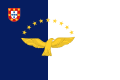
Flag of the Azores
-
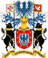
Coat of arms of the Azores
-
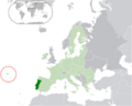
Location of the Azores within the European Union
See also
 In Spanish: Azores para niños
- Macaronesia
- Postage stamps and postal history of the Azores
- List of islands of Portugal
