
Equator facts for kids


The equator is an imaginary line that goes all the way around the middle of a planet, like our Earth. It's one of the important lines of latitude, which are lines that run east to west around the globe. The word "equator" comes from Latin and means "even-maker." This is because at the equator, the day and night are almost exactly the same length all year round!
This special line is exactly halfway between the North Pole and the South Pole. It divides the Earth into two halves: the northern hemisphere (north of the equator) and the southern hemisphere (south of the equator).
Contents
What is the Equator?


The Earth's equator is officially at 0° (zero degrees) of latitude. It's one of five very important circles of latitude on Earth. The others are the Arctic Circle, the Antarctic Circle, the Tropic of Cancer, and the Tropic of Capricorn.
The equator is the only line of latitude that is also a great circle. This means its flat surface (or "plane") goes right through the center of the Earth. If you imagine this plane stretching out into space, it creates something called the celestial equator.
Sunlight and Seasons at the Equator


The Earth travels around the Sun every year. Twice a year, during the March and September equinoxes, the Sun's rays shine directly on the equator. This means the Sun appears to be right over the equator at these times.
If you are standing on the equator, the Sun rises and sets very quickly. This is because the Sun moves almost straight up and down in the sky. The amount of daylight stays nearly the same all year long. It's usually about 14 minutes longer than nighttime. This small difference is due to how light bends in our atmosphere and because we measure sunrise and sunset when the top edge of the Sun appears, not its center.
Earth's Shape and Space Launches
The Earth isn't a perfect sphere; it actually bulges out a little bit at the equator. The Earth's diameter (distance across) at the equator is about 43 kilometres (27 mi) wider than its diameter from pole to pole.
Places near the equator are excellent spots for spaceports, like the Guiana Space Centre in Kourou, French Guiana. This is because the Earth spins fastest at the equator. Launching rockets from here gives them an extra boost of speed. This means they need less fuel to reach space! Rockets usually launch to the east (or southeast or northeast) to take advantage of this extra speed from Earth's spin.
Equatorial Climate and Weather

Diagram of the seasons, showing the December solstice. The North Pole is dark, and the South Pole is lit.
Our seasons happen because the Earth orbits the Sun and because its axis is tilted. As the Earth moves, different parts of it tilt towards or away from the Sun. The part tilted towards the Sun gets more sunlight and has summer. The part tilted away has winter.
During the equinoxes, the Earth's axis isn't tilted towards or away from the Sun. It's straight up and down compared to the Sun's rays. This is why day and night are about 12 hours long everywhere on Earth during an equinox.
Near the equator, the temperature doesn't change much throughout the year. However, there can be big differences in how much rain falls and how humid it is. People in many tropical areas often talk about two seasons: the wet season and the dry season. Some places stay wet or dry all year. Temperatures at sea level are usually hot all year. But in higher places, like the Andes mountains or Mount Kilimanjaro, you can still find glaciers and snow!
The equator crosses mostly over three huge oceans: the Atlantic Ocean, the Indian Ocean, and the Pacific Ocean. The highest point on the equator is at an elevation of 4,690 metres (15,387 ft). This spot is on the southern slopes of Volcán Cayambe in Ecuador. It's just above the snow line, making it the only place on the equator where you can find snow on the ground!
Countries on the Equator
The equator passes through the land of 11 different countries. Starting from the Prime Meridian (0° longitude) and heading east, here are the places the equator crosses:
| Location | Country, territory or sea | Notes |
|---|---|---|
| 0°N 0°E / 0°N 0°E | Atlantic Ocean | Gulf of Guinea |
| 0°0′N 6°31′E / 0.000°N 6.517°E | Crosses the small island of Ilhéu das Rolas | |
| 0°0′N 9°21′E / 0.000°N 9.350°E | Passes near towns like Ayem and Mayene | |
| 0°0′N 13°56′E / 0.000°N 13.933°E | Goes through the town of Makoua | |
| 0°0′N 17°46′E / 0.000°N 17.767°E | Passes south of Butembo | |
| 0°0′N 29°43′E / 0.000°N 29.717°E | Passes south of Kampala | |
| 0°0′N 32°22′E / 0.000°N 32.367°E | Lake Victoria | Crosses some islands belonging to |
| 0°0′N 34°0′E / 0.000°N 34.000°E | Passes north of Kisumu | |
| 0°0′N 41°0′E / 0.000°N 41.000°E | ||
| 0°0′N 42°53′E / 0.000°N 42.883°E | Indian Ocean | Passes between islands of |
| 0°0′N 98°12′E / 0.000°N 98.200°E | Crosses the Batu Islands, Sumatra, and the Lingga Islands | |
| 0°0′N 104°34′E / 0.000°N 104.567°E | Karimata Strait | |
| 0°0′N 109°9′E / 0.000°N 109.150°E | Crosses Borneo | |
| 0°0′N 117°30′E / 0.000°N 117.500°E | Makassar Strait | |
| 0°0′N 119°40′E / 0.000°N 119.667°E | Crosses Sulawesi (Celebes) | |
| 0°0′N 120°5′E / 0.000°N 120.083°E | Gulf of Tomini | |
| 0°0′N 124°0′E / 0.000°N 124.000°E | Molucca Sea | |
| 0°0′N 127°24′E / 0.000°N 127.400°E | Crosses Kayoa and Halmahera islands | |
| 0°0′N 127°53′E / 0.000°N 127.883°E | Halmahera Sea | |
| 0°0′N 129°20′E / 0.000°N 129.333°E | Crosses Gebe and Kawe islands | |
| 0°0′N 129°21′E / 0.000°N 129.350°E | Pacific Ocean | Passes between islands of |
| 0°0′N 80°6′W / 0.000°N 80.100°W | Passes north of Quito, near Mitad del Mundo. Also crosses Isabela Island in the Galápagos Islands | |
| 0°0′N 75°32′W / 0.000°N 75.533°W | Passes north of the border with Peru | |
| 0°0′N 70°3′W / 0.000°N 70.050°W | Crosses the states of Amazonas, Roraima, Pará, and Amapá | |
| 0°0′N 49°21′W / 0.000°N 49.350°W | Atlantic Ocean | At the mouth of the Amazon River |
Even though it's called Equatorial Guinea, no part of this country's mainland is actually on the equator. However, its island of Annobón is about 155 km (96 mi) south of the equator.
Images for kids
-
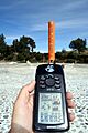
GPS reading taken on the Equator close to the Quitsato Sundial, at Mitad del Mundo, Ecuador.

See also
 In Spanish: Ecuador terrestre para niños
