
Roraima facts for kids
Quick facts for kids
State of Roraima
|
|||
|---|---|---|---|
|
|||

Location of State of Roraima in Brazil
|
|||
| Country | |||
| Capital and Largest City | Boa Vista | ||
| Area | |||
| • Total | 224,298.98 km2 (86,602.32 sq mi) | ||
| Area rank | 14th | ||
| Population
(2012)
|
|||
| • Total | 469,524 | ||
| • Rank | 27th | ||
| • Density | 2.0932953/km2 (5.421610/sq mi) | ||
| • Density rank | 27th | ||
| Demonym(s) | Roraimense | ||
| GDP | |||
| • Year | 2006 estimate | ||
| • Total | R$ 3,660,000,000 (27th) | ||
| • Per capita | R$ 9,075 (13th) | ||
| HDI | |||
| • Year | 2005 | ||
| • Category | 0.750 – medium (18th) | ||
| Time zone | UTC-4 (BRT-1) | ||
| • Summer (DST) | UTC-3 (BRST-1) | ||
| Postal Code |
69300-000 to 69399-000
|
||
| ISO 3166 code | BR-RR | ||
| Website | rr.gov.br | ||


Roraima is a state in the northern part of Brazil. It is the most northern state in the country. Roraima shares borders with other Brazilian states like Pará and Amazonas. It also borders the countries of Venezuela and Guyana. Roraima has the smallest population of all Brazilian states.
Contents
Roraima's Climate and Nature
Roraima has a tropical climate. The average temperature is about 26 °C (79 °F). Most of the state is covered by the Amazon rainforest. There is also a small area of savanna in the east.
Natural Resources and Minerals
The state has many important mineral deposits. These include gold, diamonds, cassiterite, bauxite, and copper. These resources are very valuable.
Native Peoples of Roraima
Roraima is home to several native groups. The Yanomami people are well-known. However, the Macuxi people are much larger in number.
Mount Roraima National Park
The Monte Roraima National Park is a special place. It is near one of Brazil's highest mountains. This mountain is called Mount Roraima. It is a flat-topped mountain, reaching 2,727 meters (9,220 feet) high.
History of Roraima
In 1943, the federal government of Brazil made this area a separate territory. It was first named Rio Branco. This name came from the main river in the region.
In 1962, the territory was renamed "Roraima." The name "Roraima" comes from Monte Roraima. The word "Roraima" comes from the Pemon language. Roroi means "cyan" (a color like blue-green) and ma means "large." So, it means "large blue-green mountain."
Finally, in 1988, Roraima officially became a state of Brazil.
| States of Brazil | |
|---|---|
| Acre | Alagoas | Amapá | Amazonas | Bahia | Ceará | Espírito Santo | Goiás | Maranhão | Mato Grosso | Mato Grosso do Sul | Minas Gerais | Pará | Paraíba | Paraná | Pernambuco | Piauí | Rio de Janeiro | Rio Grande do Norte | Rio Grande do Sul | Rondônia | Roraima | Santa Catarina | São Paulo | Sergipe | Tocantins | |
| Federal District: Brazilian Federal District | |
Images for kids
-
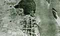
Aerial view of the Boa Vista region at the beginning of the 20th century.
-
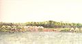
Village of Nossa Senhora da Conceição according to Alexandre Rodrigues Ferreira, late 18th century.
-
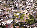
Centre of Boa Vista
-
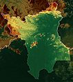
Topographic map of Roraima.
-
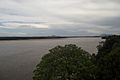
Branco River, near Boa Vista.
-
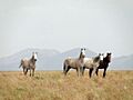
Lavradeiros (wild horses) near Amajari, Roraima. Northern Roraima wild horses are among the last wild horse populations in the world.
-
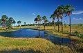
Buritizeiros in Roraima.
-
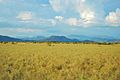
Lavrado region.
-
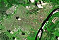
Satellite image of Boa Vista, capital of Roraima, in 2017.
-
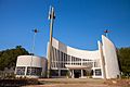
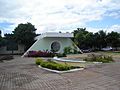
Christ the Redeemer Cathedral
-
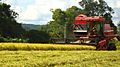
Rice planting
-
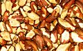
Brazil nuts after shell removal
-
Block I of the Federal University of Roraima (UFRR), on the Paricarana campus.
-
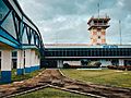
Boarding gate of Boa Vista International Airport.
-
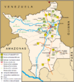
Road map of Roraima.
-
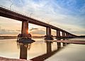
The Macuxis' Bridge crossing the Branco River.
-
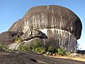
Pedra Pintada is a rock formation considered an archaeological site.

.jpg)


.jpg)


See also

In Spanish: Roraima para niños
