
Espírito Santo facts for kids
Quick facts for kids
State of Espírito Santo (English: Holy Spirit)
|
|||
|---|---|---|---|
|
|||
| Motto(s):
Trabalha e Confia (Portuguese)
"Works and Trusts" |
|||

Location of State of Espírito Santo in Brazil
|
|||
| Country | |||
| Capital | Vitória | ||
| Area | |||
| • Total | 46,077.519 km2 (17,790.630 sq mi) | ||
| Area rank | 23rd | ||
| Population
(2012)
|
|||
| • Total | 3,578,067 | ||
| • Rank | 15th | ||
| • Density | 77.653204/km2 (201.120876/sq mi) | ||
| • Density rank | 7th | ||
| Demonym(s) | capixaba or espiritossantense | ||
| GDP | |||
| • Year | 2006 estimate | ||
| • Total | R$ 52,782,000,000 (11th) | ||
| • Per capita | R$ 15,236 (5th) | ||
| HDI | |||
| • Year | 2005 | ||
| • Category | 0.802 – high (6th) | ||
| Time zone | UTC-03:00 (BRT) | ||
| • Summer (DST) | UTC-02:00 (BRST) | ||
| Postal Code |
29000-000 to 29990-000
|
||
| ISO 3166 code | BR-ES | ||
| Website | es.gov.br | ||


Espírito Santo is a state in southeastern Brazil. People often call it "ES" for short. Its capital city is Vitória. The biggest city is Vila Velha. People born here are called "Capixabas" or "Espiritossantenses". The name "Espírito Santo" means "Holy Spirit" in Portuguese.
Where is Espírito Santo?
Espírito Santo is located in the southeastern part of Brazil. This area also includes the states of São Paulo, Minas Gerais, and Rio de Janeiro.
It shares borders with the Atlantic Ocean to the east. To the north, it borders the state of Bahia. The state of Minas Gerais is to its north and west. To the south, it borders the state of Rio de Janeiro.
Other important cities in Espírito Santo are Cachoeiro de Itapemirim, Colatina, Linhares, São Mateus, and Aracruz.
Exploring Espírito Santo's Geography
Espírito Santo covers about 46,180 square kilometers (17,830 sq mi). This is roughly the same size as the country of Estonia.
The state has many different natural areas. You can find coastal plains, calm lakes, and mountain forests. There are also mangroves, which are special forests that grow in salty water.
The islands of Trindade and Martim Vaz are also part of Espírito Santo. These islands are about 715 kilometers (444 mi) east of Vitória in the southern Atlantic Ocean.
| States of Brazil | |
|---|---|
| Acre | Alagoas | Amapá | Amazonas | Bahia | Ceará | Espírito Santo | Goiás | Maranhão | Mato Grosso | Mato Grosso do Sul | Minas Gerais | Pará | Paraíba | Paraná | Pernambuco | Piauí | Rio de Janeiro | Rio Grande do Norte | Rio Grande do Sul | Rondônia | Roraima | Santa Catarina | São Paulo | Sergipe | Tocantins | |
| Federal District: Brazilian Federal District | |
Images for kids
-

Penha Convent founded in 1558
-
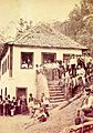
Germans and Luxembourgers immigrants in Espírito Santo in 1875.
-
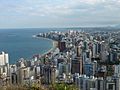
Vila Velha is the most populous municipality in the state.
-
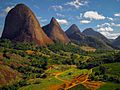
Pontões Capixabas Natural Monument
-
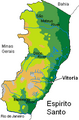
Geography of Espírito Santo.
-
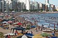
Guarapari during summer
-
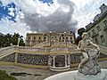
Anchieta Palace
-
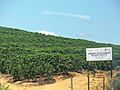
Coffea canephora in Timbuí
-
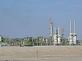
Oil production in Espírito Santo
-
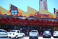
Factory of Garoto Chocolates in Vila Velha
-
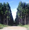
Eucalyptus from Aracruz Celulose in the city of Aracruz
-
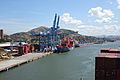
Port of Vitória
-
Caparaó National Park
-
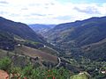
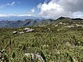
Canaã Valley, in Espírito Santo
-
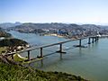
Vitória's port entrance under the Third Bridge (the second-tallest bridge in Brazil), with Ilha do Boi and Camburi Beach in the background.
-

Vitória International Airport
.jpg)


.jpg)

See also
 In Spanish: Espírito Santo para niños
