
Federal District (Brazil) facts for kids
Quick facts for kids
Distrito Federal
|
|||
|---|---|---|---|
|
|||
| Motto(s): | |||
 |
|||
| Country | |||
| Seat of government | Brasília | ||
| Area | |||
| • Total | 5,802 km2 (2,240 sq mi) | ||
| Area rank | 27th | ||
| Population
(2022)
|
|||
| • Total | 2,817,381 | ||
| • Rank | 20th | ||
| • Density | 485.59/km2 (1,257.67/sq mi) | ||
| • Density rank | 1st | ||
| Demonym(s) | Candango | ||
| GDP | |||
| • Total | R$ 286.944 billion (US$ 53.228 billion) |
||
| HDI | |||
| • Year | 2021 | ||
| • Category | 0.814 – very high (1st) | ||
| Time zone | UTC−03:00 (BRT) | ||
| Postal code |
70000-000 to 73690-000
|
||
| ISO 3166 code | BR-DF | ||
| Website | df.gov.br | ||
.svg)
.svg)
The Federal District (which in Portuguese is called Distrito Federal) is one of Brazil's 27 main areas, like a state. It is located in the central-west part of the country. It is the smallest of Brazil's federal units.
Unlike other states, it doesn't have separate cities or towns. Instead, it's divided into 35 special areas called administrative regions. The capital city of Brazil, Brasília, is located here. Brasília is also where the government of the Federal District is based. The Federal District is mostly surrounded by the state of Goiás, but it also shares a small border with Minas Gerais.
Contents
History of the Federal District

From Brazil's first republican constitution, there was a plan to move the country's capital. The capital used to be in Rio de Janeiro. The idea was to move it to the middle of the country.
In 1891, a group of experts was formed. This group, led by astronomer Luiz Cruls, included doctors, geologists, and plant experts. They studied the land, weather, and natural resources of the central highlands. This area was called the Quadrilateral Cruls. They presented their findings to the government in 1894.
In 1922, another group chose a spot in Goiás for the new capital. However, this plan was stopped. It wasn't until 1955 that the idea came up again. During his election campaign, Juscelino Kubitschek, who later became president, promised to move the capital.
Building Brasília
After becoming president, Juscelino Kubitschek, also known as JK, proposed creating a company. This company, called Novacap, would plan and build the new capital. Congress approved the idea, and the company was created in September 1956.
Novacap was in charge of building the new federal capital. They held a competition to design the city. Architect Lúcio Costa's design was chosen. This design also made the name Brasília official. Oscar Niemeyer was chosen as the main architect, and Joaquim Cardozo as the structural engineer.
Construction started in 1956. Oscar Niemeyer and Israel Pinheiro oversaw the work. Many workers, called candangos, came from other states like Goiás, Minas Gerais, and the Northeast. They started digging and moving earth in November 1956.
Thirty thousand workers built Brasília in just 41 months. Israel Pinheiro became the first mayor of the Federal District on April 17, 1960. The city officially opened on April 21, 1960. This date was chosen by Juscelino Kubitschek to honor a Brazilian hero named Tiradentes.
Changes to the Capital
On April 21, 1960, Brazil's capital moved from Rio de Janeiro to Brasília. The new Federal District was created from parts of Goiás and Minas Gerais. The old Federal District, which included Rio de Janeiro, became a new state called Guanabara.
Guanabara existed from 1960 until 1975. Then, it joined with the state of Rio de Janeiro. After this, the capital of Rio de Janeiro state moved back to Rio de Janeiro city.
People and Population
| Historical population | ||
|---|---|---|
| Year | Pop. | ±% |
| 1960 | 141,742 | — |
| 1970 | 546,015 | +285.2% |
| 1980 | 1,203,333 | +120.4% |
| 1991 | 1,598,415 | +32.8% |
| 2000 | 2,051,146 | +28.3% |
| 2010 | 2,570,160 | +25.3% |
| 2022 | 2,817,381 | +9.6% |
| Source: | ||
In 2007, about 2.39 million people lived in the Federal District. The population density was about 410 people per square kilometer.
- Most people live in cities: 94% (2006).
- The population grew by 2.8% between 1991 and 2000.
- There were about 697,000 homes in 2006.
Administrative Regions
The Federal District is divided into 35 administrative regions. These are like neighborhoods or smaller districts within the main area.
| Number | Administrative region |
|---|---|
| I | Plano Piloto |
| II | Gama |
| III | Taguatinga |
| IV | Brazlândia |
| V | Sobradinho |
| VI | Planaltina |
| VII | Paranoá |
| VIII | Núcleo Bandeirante |
| IX | Ceilândia |
| X | Guará |
| XI | Cruzeiro |
| XII | Samambaia |
| XIII | Santa Maria |
| XIV | São Sebastião |
| XV | Recanto das Emas |
| XVI | Lago Sul |
| XVII | Riacho Fundo |
| XVIII | Lago Norte |
| XIX | Candangolândia |
| XX | Águas Claras |
| XXI | Riacho Fundo II |
| XXII | Sudoeste/Octogonal |
| XXIII | Varjão |
| XXIV | Park Way |
| XXV | SCIA |
| XXVI | Sobradinho II |
| XXVII | Jardim Botânico |
| XXVIII | Itapoã |
| XXIX | SIA |
| XXX | Vicente Pires |
| XXXI | Fercal |
| XXXII | Sol Nascente/Pôr do Sol |
| XXXIII | Arniqueira |
| XXXIV | Arapoanga |
| XXXV | Água Quente |
Education in the Federal District
.jpg)
The Federal District has many important schools and universities. Some of the main ones include:
- Universidade de Brasília (UnB) (University of Brasília)
- Universidade Católica de Brasília (UCB) (Catholic University of Brasília)
- Centro Universitário de Brasília (UniCEUB)
- Centro Universitário do Distrito Federal (UniDF)
- Centro Universitário Euroamericano (UNIEURO)
- Instituto de Educação Superior de Brasília (IESB)
- Escola Superior de Ciências da Saúde (ESCS)
- União Pioneira da Integração Social (UPIS)
- Universidade Paulista (UniP) (Paulista University)
- Federal Institute of Brasília (IFB)
Geography and Climate
The Federal District is located in the Brazilian Highlands. It sits at an altitude between 600 and 1,100 meters (about 1,900 to 3,600 feet) above sea level. Its highest point is the Pico do Roncador, in Serra do Sobradinho.
The Federal District is quite large. It is more than twice the size of Tokyo in Japan. It is also bigger than the island of Maui in Hawaii, USA. It's slightly larger than French Polynesia or the US state of Rhode Island. It's a bit smaller than Bali in Indonesia.
The District is mostly surrounded by the state of Goiás. Only a small part borders Minas Gerais along the Preto River. The Preto River marks the eastern border. The Descoberto River marks the western border. The northern and southern borders are mostly straight lines.
Climate of the Federal District
The Federal District has a tropical savanna climate. This means it has a rainy season from October to April. It also has a dry season from May to September. Because of its high altitude, the temperatures are moderate. They are usually warm, not uncomfortably hot. High temperatures range from 25 to 28 degrees Celsius (77 to 82 degrees Fahrenheit) all year.
During the dry season (winter), the air can become very dry. This creates a high risk of fires, especially during the hottest parts of the day. The large artificial Paranoá Lake helps with this. It covers almost 40 square kilometers (15 square miles) and holds a lot of water. This lake helps reduce the severe dryness and fire risk in the cerrado region.
Fun Things to See and Do
.jpg)
There are many interesting places to visit in the Federal District.
City Park (Parque da Cidade)
The "Parque da Cidade" is a huge park in Brasília. Its official name is "Parque da Cidade Sarah Kubitschek," named after the wife of President Juscelino Kubitschek. The park is over four million square meters (about 1.5 square miles) in size.
It has beautiful gardens designed by Burle Marx. The restrooms have special wall tiles designed by Athos Bulcão. The park offers many activities. It has sports courts, a horse track, a racing kart track, and skate tracks. There are also playgrounds, bike paths, and trails for walking and jogging. Thousands of people visit the park every day, especially on weekends.
Brasília Metropolitan Cathedral
Designed by Oscar Niemeyer, this unique church opened in 1970. It has a circular base and 16 curved pillars. These pillars look like praying hands pointing upwards. They form a crown shape with colorful, modern stained-glass windows.
.jpg)
The stained-glass windows were designed by Marianne Peretti. They let natural light into the church, which is built below street level. Outside, you can see sculptures of the four evangelists by Alfredo Ceschiatti. Inside, there are hanging angels and paintings by Emiliano Di Cavalcanti and Athos Bulcão.
Three Powers Square (Praça dos Três Poderes)
The Praça dos Três Poderes is a very important square. It holds some of Oscar Niemeyer's most famous buildings. These include:
- The Planalto Palace: Where the President of Brazil works.
- The National Congress: Where the Chamber of Deputies and Federal Senate meet.
- The Higher Courts of Justice: Where important legal decisions are made.
The square also has the Panteão da Pátria (Pantheon of the Fatherland). There's also the Lúcio Costa Space and three important sculptures. These are "Pombal" by Niemeyer, "Justice" by Alfredo Ceschiatti, and "Os Candangos" by Bruno Giorgi. In the center, a huge Brazilian flag flies on a 100-meter (328-foot) tall pole.
Economy and Transport
Economy
The Federal District is not just a political center; it's also a strong economic hub. It has the seventh-highest total economic output (GDP) among Brazil's federal units. In 2012, its GDP was R$ 171.2 billion (about US$ 53.2 billion). It also has the highest GDP per person in the country, at R$ 64,653 in 2012.
Most of the economy comes from the service sector, like government jobs and businesses, making up 92.5% of the GDP. The industrial sector contributes 7.1%. Agriculture is a small part, at 0.4% of the GDP (2004). The Federal District mainly exports soybean (77.1%) and gold (16.4%) (2002). In 2005, the Federal District made up 3.7% of Brazil's total economy.
Transportation

The Federal District has modern transportation systems.
Brasília International Airport
Brasília International Airport is the third busiest airport in Brazil. It's a key airport for flights across the country because of its central location. Many planes take off and land here, sometimes needing to wait their turn.
In 2005, a second runway was built. In 2003, the passenger terminal was expanded. It can now handle 7.4 million passengers each year. The top floor of the main building has a panoramic view, a food court, shops, and four movie theaters. There are 136 shops at the airport.
Federal District Metro

The Federal District Metro is a train system that serves some cities. It started in 2001. The system has 29 stations, with 24 currently in use, on two lines. It runs from 6:00 AM to 11:30 PM on weekdays and from 7:00 AM to 7:00 PM on weekends.
The metro serves the southern part of Brasília and major cities to the west. One challenge is the long distances between some stations. This is because housing isn't very dense in some areas. So, the metro is a smaller part of the transport system. Buses are still the main way people get around. However, Águas Claras is well-served by the metro. This has made it one of the fastest-growing and most crowded areas in the Federal District.
| Trains | 32 |
| Total extension | 42.38 km (26.33 miles) |
| Operational stations | 24 |
| Total stations | 29 |
Some stations are still being built or are waiting for more people to move into the area before they open.
Sports and Recreation
.jpg)
The Federal District is home to two well-known football clubs: Brasiliense Futebol Clube and Sociedade Esportiva do Gama (Gama). Both have played in Brazil's top football league. Brasiliense was a runner-up in the 2002 Copa do Brasil.
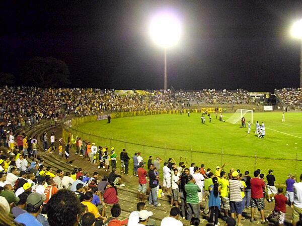
The main soccer stadiums are the Estádio Nacional de Brasília Mané Garrincha, the Estádio Elmo Serejo Farias (Serejão), and the Estádio Walmir Campelo Bezerra (Bezerrão).
The Federal District is also a great place for free flying sports, like hang gliding or paragliding. The dry weather creates strong thermal winds, which are perfect for these sports. The district hosted the 14th Hang Gliding World Championship in 2003. In 2005, it hosted a stage of the Brazilian Hang Gliding Championship.
Brasília was one of the host cities for the 2013 Confederations Cup and the 2014 World Cup. Matches were played at the Mané Garrincha National Stadium. This stadium is part of the Ayrton Senna Multisport Complex. The complex also includes the Nilson Nelson Sports Gymnasium. This gym has hosted volleyball matches and the 2008 Futsal World Cup.
The city of Brasília also has the Autódromo Internacional Nelson Piquet. This racetrack hosted a Formula One race in 1974. An IndyCar race was planned for 2015 but was canceled. The track has been closed since 2015 but is being renovated.
Local Sports Teams
Football Teams
- Campeonato Brasileiro Série D (2)
- Brasiliense FC
- Ceilândia Esporte Clube
Basketball Teams
- Novo Basquete Brasil
- Brasília Basquete
- Cerrado Basquete
Sports Stadiums
Football Stadiums
- Bezerrão
- Estádio Nacional Mané Garrincha
- Serejão
Other Sports Venues
- Nilson Nelson Gymnasium
The Flag of the Federal District
The flag of the Federal District has a white background. This white color stands for peace and the huge size of Brazil. The green and yellow colors in the middle are like the main colors of Brazil's national flag.
The four yellow arrows on the flag represent the native people of Brazil. They point in the four main directions (north, south, east, west). This shows that Brasília, as the capital, sends its political power out to all parts of the country.
The yellow arrows also form a cross. This cross represents the Southern Cross constellation, which can only be seen in the Southern Hemisphere. It also symbolizes the Christian faith brought by Pedro Álvares Cabral. The arrows, with their feathers, create a diamond shape in the middle. This shape refers to the yellow diamond on the national flag, which stands for Brazil's rich minerals.
The flag was designed by the poet and herald Guilherme de Almeida. It was officially adopted on August 25, 1969.
Voting Rights
The Federal District has eight representatives in the Chamber of Deputies. It also has three representatives in the Federal Senate. People living in the Federal District vote for their governor and district deputies. These deputies act like both state representatives and city council members. However, the regional leaders are chosen by the governor, not by public vote.
Gallery
-
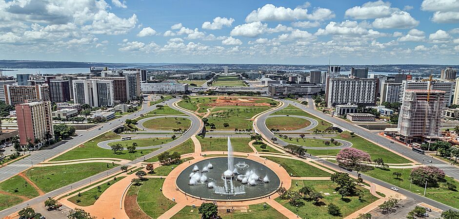
Monumental Axis as seen from the Brasilia TV Tower
-
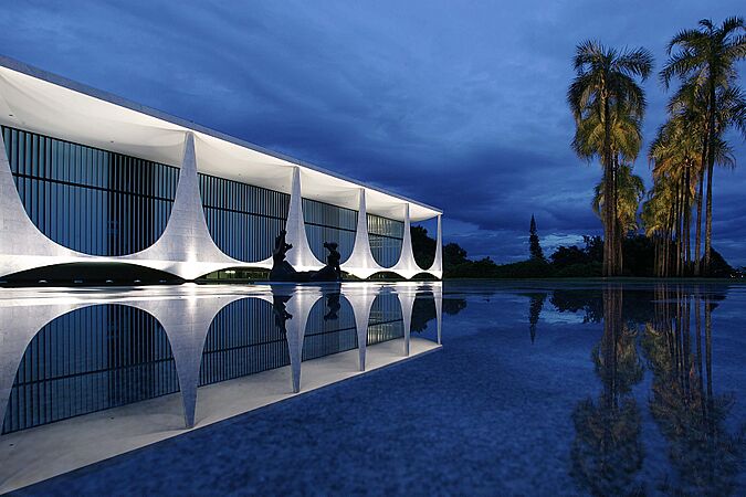
Palácio da Alvorada
-
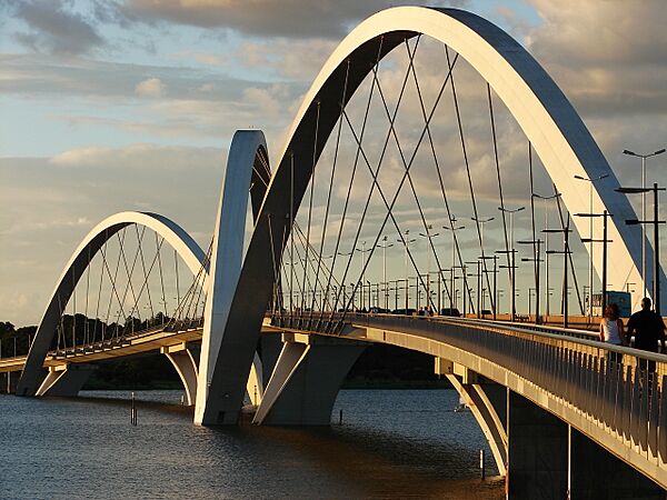
Juscelino Kubitschek bridge
-
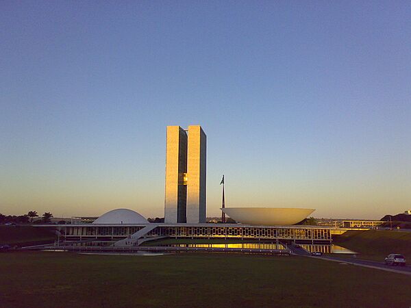
National Congress of Brazil building
-
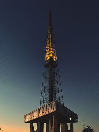
Brasilia TV Tower
-
Cláudio Santoro National Theater
-
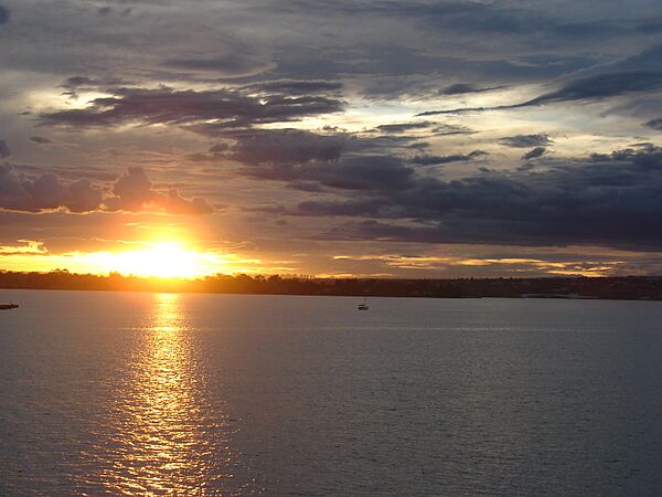
Paranoá Lake
-
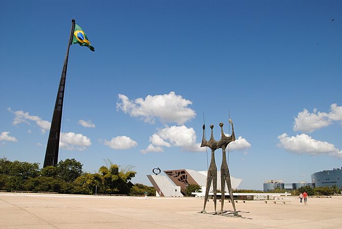
Praça dos Três Poderes with the Brazilian flag and Os Candangos sculpture
-
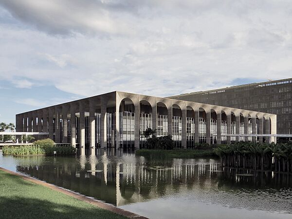
Itamaraty Palace, headquarters of the Ministry of Foreign Affairs of Brazil.
-
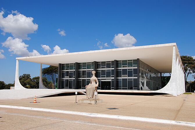
Supreme Federal Court building
-
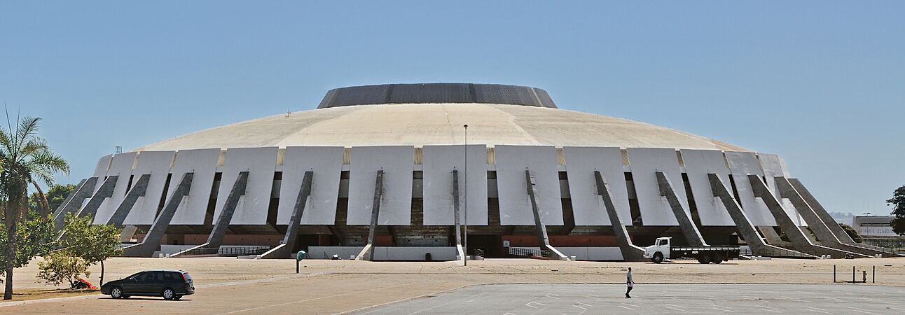
Nilson Nelson Gymnasium
-
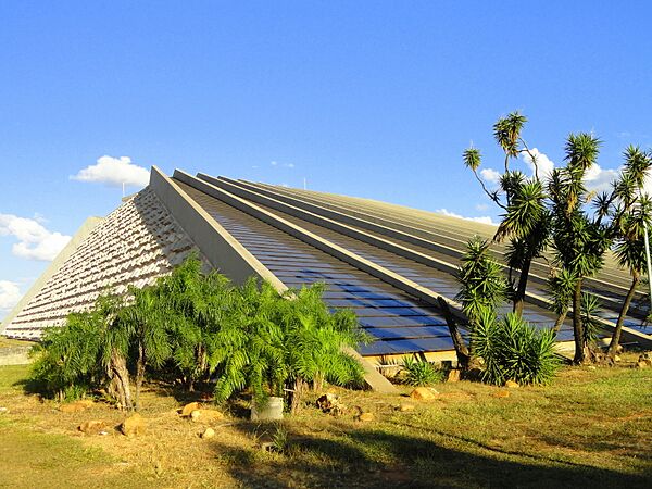
Brasília Planetarium
-
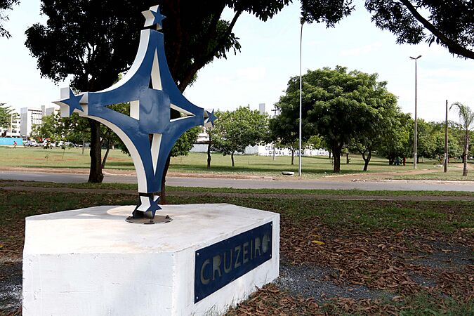
Statue in Cruzeiro
-
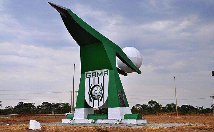
Balão do Periquito, Gama
-
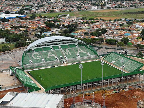
Bezerrão, Gama
-

Praça do Relógio, Taguatinga
-
Serejão, Taguatinga
-
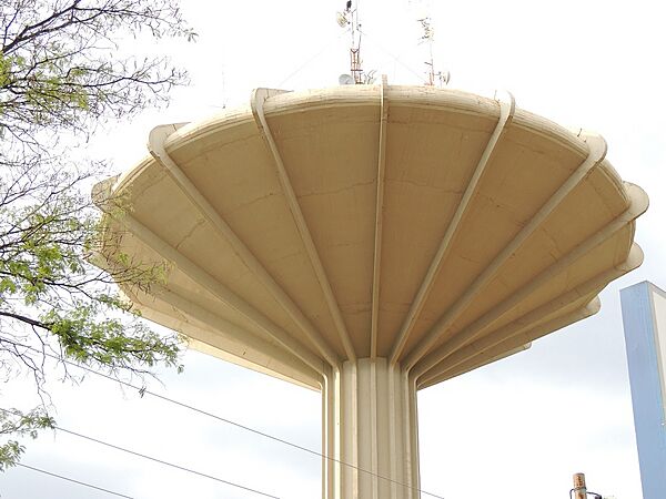
Water reserve in Ceilândia
-
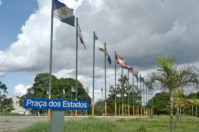
States' Square, Candangolândia
-
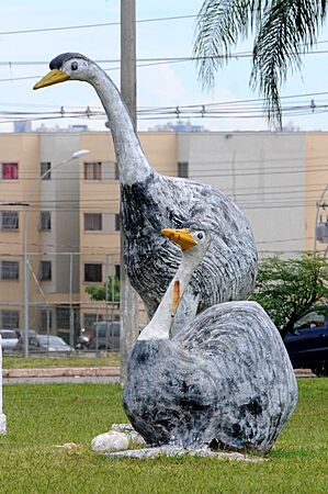
Greater rhea sculpture, Recanto das Emas
-
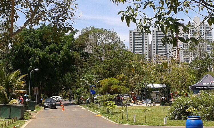
Águas Claras Park
.jpg)


.jpg)


_(3).jpg)
.jpg)
.jpg)
.jpg)


.jpg)


.jpg)
See also
 In Spanish: Distrito Federal (Brasil) para niños
