Macapá facts for kids
Quick facts for kids
Macapá
|
|||
|---|---|---|---|
|
Municipality
|
|||
| Municipality of Macapá | |||
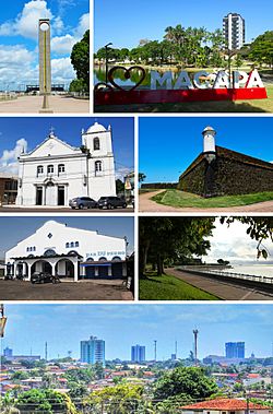
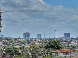
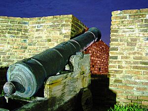
From the top, clockwise: Marco Zero of Ecuador; Floriano Peixoto Square; Main Church of São José de Macapá; Fortress of São José de Macapá; Trapiche Eliezer Levy and Central Market; Rim of Macapá; city center view.
|
|||
|
|||
| Nickname(s):
"A Capital do Meio do Mundo" ("The Capital of the Middle of the World")
|
|||
| Motto(s):
"Macapá, cidade forte" ("Macapá, fortress city")
|
|||
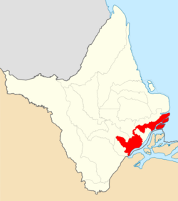
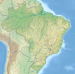
Location of Macapá in the State of Amapá
|
|||
| Country | |||
| Region | North | ||
| State | |||
| Founded | February 4, 1758 | ||
| Area | |||
| • Total | 6,407.12 km2 (2,473.80 sq mi) | ||
| Elevation | 12 m (39 ft) | ||
| Population
(2020 est.)
|
|||
| • Total | 512,902 | ||
| • Density | 80.05188/km2 (207.3334/sq mi) | ||
| Time zone | UTC−3 (BRT) | ||
| Postal code |
68900-001 a 68914-999
|
||
| Area code | +55 96 | ||
| HDI (2010) | 0.733 – high | ||
Macapá is a city in Brazil and the capital of the Amapá state. It's located in the northern part of Brazil, right on the northern channel of the Amazon Delta, close to where it meets the Atlantic Ocean.
The city sits on a small plateau in the southeastern part of Amapá state. You can reach Macapá by road from French Guiana, which is a French territory. There are also regular ferries that connect Macapá to Belém, another Brazilian city.
Macapá is special because the equator line runs right through the middle of it! This is why people often call Macapá "The capital of the middle of the world." The city covers an area of about 6,407 square kilometers (2,474 square miles). It is located northwest of the large island of Marajó and south of the border with French Guiana.
Contents
History of Macapá
The name Macapá comes from the Tupi word macapaba. This means "place of many bacabas," which are fruits from a local palm tree.
The modern city started as a Portuguese military base in 1738. On February 4, 1758, the town of São José de Macapá was officially founded. A strong fort, the Fortress of São Joselito de Macapá, began to be built in 1764. It took 18 years to finish because workers faced illnesses and many enslaved people escaped.
In 1811, a big hurricane hit Macapá, damaging the fort but leaving most of the city safe. Around 1834, a strange month-long storm caused a lot of flooding. Macapá officially became a city in 1854.
People of Macapá
Macapá has a population of about 512,902 people (as of 2020). Its larger metropolitan area has around 499,163 residents, making it the third-largest in Brazil's North Region.
The city of Macapá is home to about 60% of all the people living in the state of Amapá. Most of the population, about 97.92%, lives in the city itself, while a smaller part, 2.08%, lives in rural areas. The city covers about 6,563 square kilometers (2,534 square miles). This means there are about 60.62 people living in each square kilometer.
Getting Around Macapá
Macapá has some roads connecting it to other cities in Brazil. However, it is mostly linked to the rest of the country by air and sea.
For example, Macapá is about 345 kilometers (214 miles) from Belém. But a large island called Marajó separates the two cities, so there are no direct highways. You can only travel between them by boat or airplane.
Macapá is connected to French Guiana by a Brazilian highway called BR-156. This road goes north of the city through the Amazon jungle. Other highways connect Macapá to nearby towns in Amapá, like Santana and Mazagão. The Oyapoque River Bridge, which opened in 2017, now links Brazil and French Guiana by road for the first time.
Macapá International Airport
Macapá International Airport is located just 3 kilometers (1.9 miles) from the city center. It's a very important airport that connects Macapá to many other cities in Brazil.
You can take commercial flights from Macapá to places like Belém, Brasília, Fortaleza, Rio de Janeiro, Salvador, and São Paulo. The airport actually started as a small air base built by the United States during World War II.
Economy of Macapá
Macapá is a major economic hub in northern Brazil. It serves as a busy center for trade in the state of Amapá. Many valuable resources from the state's interior, such as gold, iron, lumber, manganese, oil, timber, and tin ore, pass through Macapá. These goods are then shipped out from the Port of Santana in the nearby municipality of Santana.
Macapá is the fifth wealthiest city in northern Brazil. It has a high rate of economic growth, meaning its economy is growing quickly.
Education in Macapá
Portuguese is the official language of Brazil and the main language taught in schools in Macapá. Students also learn English and French as part of their high school studies.
Schools and Universities
Macapá has several important educational institutions, including:
- Universidade Federal do Amapá (UNIFAP)
- Universidade Estadual do Amapá (UEAP)
- Instituto Federal do Amapá (IFAP)
- Faculdade de Macapá (Fama)
- Faculdade de Tecnologia do Amapá (META)
- Instituto Macapaense do Melhor Ensino Superior (IMMES)
- Faculdade Seama
Famous Places in Macapá
Fortress of St. Joseph
The Fortress of St. Joseph is a historic fort built between 1764 and 1782. It was designed in a special "star fort" style, like those made by the famous engineer Vauban. Its purpose was to protect the northern edge of Brazil and control the Amazon Delta. Today, it is one of the main attractions in Macapá.
Marco Zero Monument
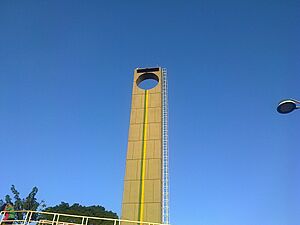
The Marco Zero monument was built to show exactly where the equator line crosses the city. It also helps to show the path of the sun. During the spring and autumn equinox, the sun rises and sets directly on the equator line. At these times, the sun shines perfectly on the monument along Equatorial Avenue.
St. Joseph's Church
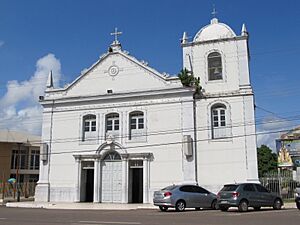
St. Joseph's Church is an important religious building in Macapá.
Milton Corrêa Stadium
The Estádio Milton Corrêa is a sports stadium in central Macapá. It's often called the Zerão, which means "Big Zero," because of its location right on the equator line. The stadium can hold up to 10,000 people and was built in 1990. It is mainly used for football (soccer) matches and is home to several local teams.
Geography of Macapá
The municipality of Macapá includes several important natural areas:
- The Parazinho Biological Reserve: This 111-hectare (274-acre) reserve was created in 1985 to protect an island in the Amazon River.
- The Rio Curiaú Environmental Protection Area: This 21,676-hectare (53,563-acre) area was created in 1992. It helps protect the land near the city from too much building and also helps preserve the culture of the people who have traditionally lived there.
- The Fazendinha Environmental Protection Area: This 137-hectare (339-acre) area was created in 2004.
Climate
The Macapá region has large areas of tropical rainforest. It experiences a tropical monsoon climate, which means it has a long wet season from December to July. The dry season is shorter, lasting about four months. Even during the dry season, you can still expect some rain.
Temperatures in Macapá stay pretty consistent throughout the year. Mornings are usually around 23°C (73°F), and afternoons are around 31°C (88°F).
| Climate data for Macapá (1991–2020 normals, extremes 1967–present) | |||||||||||||
|---|---|---|---|---|---|---|---|---|---|---|---|---|---|
| Month | Jan | Feb | Mar | Apr | May | Jun | Jul | Aug | Sep | Oct | Nov | Dec | Year |
| Record high °C (°F) | 36.0 (96.8) |
35.0 (95.0) |
39.3 (102.7) |
38.3 (100.9) |
36.0 (96.8) |
36.0 (96.8) |
37.0 (98.6) |
37.0 (98.6) |
37.0 (98.6) |
36.6 (97.9) |
39.6 (103.3) |
38.0 (100.4) |
39.6 (103.3) |
| Mean daily maximum °C (°F) | 30.9 (87.6) |
30.2 (86.4) |
30.4 (86.7) |
30.7 (87.3) |
31.3 (88.3) |
31.8 (89.2) |
32.1 (89.8) |
32.8 (91.0) |
33.4 (92.1) |
33.8 (92.8) |
33.4 (92.1) |
32.4 (90.3) |
31.9 (89.5) |
| Daily mean °C (°F) | 26.6 (79.9) |
26.2 (79.2) |
26.4 (79.5) |
26.6 (79.9) |
27.0 (80.6) |
27.1 (80.8) |
27.2 (81.0) |
27.9 (82.2) |
28.5 (83.3) |
28.8 (83.8) |
28.7 (83.7) |
27.8 (82.0) |
27.4 (81.3) |
| Mean daily minimum °C (°F) | 23.6 (74.5) |
23.5 (74.3) |
23.7 (74.7) |
24.0 (75.2) |
24.2 (75.6) |
24.0 (75.2) |
23.9 (75.0) |
24.3 (75.7) |
24.3 (75.7) |
24.4 (75.9) |
24.3 (75.7) |
24.0 (75.2) |
24.0 (75.2) |
| Record low °C (°F) | 19.6 (67.3) |
20.4 (68.7) |
21.1 (70.0) |
20.2 (68.4) |
21.4 (70.5) |
21.0 (69.8) |
20.2 (68.4) |
21.0 (69.8) |
21.0 (69.8) |
21.0 (69.8) |
21.0 (69.8) |
20.4 (68.7) |
19.6 (67.3) |
| Average precipitation mm (inches) | 268.1 (10.56) |
369.3 (14.54) |
400.1 (15.75) |
376.4 (14.82) |
308.4 (12.14) |
252.4 (9.94) |
203.9 (8.03) |
96.3 (3.79) |
25.4 (1.00) |
22.7 (0.89) |
58.1 (2.29) |
144.6 (5.69) |
2,525.7 (99.44) |
| Average precipitation days (≥ 1 mm) | 16.6 | 19.5 | 22.3 | 21.3 | 20.5 | 18.2 | 16.3 | 9.1 | 3.2 | 2.0 | 3.9 | 9.4 | 162.3 |
| Average relative humidity (%) | 84.5 | 87.1 | 87.2 | 87.2 | 86.2 | 84.1 | 82.1 | 78.0 | 73.1 | 71.0 | 72.5 | 78.1 | 80.9 |
| Average dew point °C (°F) | 24.2 (75.6) |
24.2 (75.6) |
24.3 (75.7) |
24.6 (76.3) |
24.8 (76.6) |
24.7 (76.5) |
24.4 (75.9) |
24.5 (76.1) |
24.1 (75.4) |
23.9 (75.0) |
24.0 (75.2) |
24.2 (75.6) |
24.3 (75.8) |
| Mean monthly sunshine hours | 158.1 | 117.1 | 120.9 | 125.8 | 164.5 | 198.9 | 234.3 | 267.6 | 273.6 | 285.3 | 254.9 | 215.0 | 2,416 |
| Mean daily daylight hours | 12.1 | 12.1 | 12.1 | 12.1 | 12.1 | 12.1 | 12.1 | 12.1 | 12.1 | 12.1 | 12.1 | 12.1 | 12.1 |
| Average ultraviolet index | 6 | 6 | 6 | 6 | 7 | 7 | 7 | 7 | 7 | 7 | 7 | 6 | 7 |
| Source 1: Instituto Nacional de Meteorologia (sun 1981–2010) | |||||||||||||
| Source 2: Meteo Climat (record highs and lows) and Weather Atlas (UV index) | |||||||||||||
City Areas
The municipality of Macapá is divided into five main areas, called districts:
- Macapá (the main city area)
- Bailique
- Carapanantuba
- Fazendinha
- São Joaquim do Pacuí
In 1992, some villages in Macapá, like Curiaú de Dentro and Mocambo, were recognized as quilombos. These were settlements created by enslaved people who had escaped. This led to the creation of the Rio Curiaú Environmental Protection Area, which helps protect these communities and their culture.
See also
 In Spanish: Macapá para niños
 | Delilah Pierce |
 | Gordon Parks |
 | Augusta Savage |
 | Charles Ethan Porter |


