
Kiribati facts for kids
Quick facts for kids
Republic of Kiribati
Ribaberiki Kiribati (Gilbertese)
|
|
|---|---|
 Coat of arms
|
|
|
Motto: Te Mauri, te Raoi ao te Tabomoa
("Health, Peace and Prosperity") |
|
|
Anthem: Kunan Kiribati
("Song of Kiribati") |
|
.svg) |
|
| Capital | Tarawa 1°28′N 173°2′E / 1.467°N 173.033°E |
| Largest city | South Tarawa |
| Official languages | |
| Ethnic groups
(2020 census)
|
|
| Religion
(2020 census)
|
|
| Demonym(s) | I-Kiribati |
| Government | Unitary parliamentary republic with an executive presidency |
| Taneti Maamau | |
| Teuea Toatu | |
| Legislature | House of Assembly |
| Independence from the United Kingdom | |
|
• Granted
|
12 July 1979 |
|
• Treaty of Tarawa
|
20 September 1979 |
| Area | |
|
• Total
|
811.19 km2 (313.20 sq mi) (172nd) |
| Population | |
|
• 2021 estimate
|
121,388 (192nd) |
|
• 2020 census
|
119,438 |
|
• Density
|
147.2/km2 (381.2/sq mi) |
| GDP (PPP) | 2023 estimate |
|
• Total
|
|
|
• Per capita
|
|
| GDP (nominal) | 2023 estimate |
|
• Total
|
|
|
• Per capita
|
|
| Gini (2019) | 27.8 low |
| HDI (2022) | medium · 137th |
| Currency | Australian dollar ($) (AUD) |
| Time zone | UTC+12, +13, +14 |
| Driving side | left |
| Calling code | +686 |
| ISO 3166 code | KI |
| Internet TLD | .ki |

Kiribati (pronounced KIRR-i-bass), officially the Republic of Kiribati, is an island country in the central Pacific Ocean. It is part of the Micronesia region in Oceania. Over 119,000 people live here, with more than half on the Tarawa atoll.
Kiribati is made up of 32 atolls and one raised coral island called Banaba. Its total land area is 811 square kilometers (313 sq mi). But these islands are spread out over a huge ocean area of 3.4 million square kilometers (1.3 million sq mi).
The islands of Kiribati cross both the equator and the 180th meridian. This makes Kiribati the only country in the world that is in all four hemispheres: Northern, Southern, Western, and Eastern. The International Date Line goes around Kiribati. This means its eastern islands are in the earliest time zone on Earth, UTC+14.
Kiribati became an independent country in 1979, after being ruled by the United Kingdom. The capital, South Tarawa, is now the most populated area. It has many small islands connected by causeways. Before independence, Kiribati exported phosphate, a mineral used in fertilizers. Now, fisheries (fishing) and exporting copra (dried coconut meat) are important for the economy. Kiribati is one of the world's least developed countries and relies on help from other nations.
Kiribati is a member of many international groups, like the United Nations. As an island nation, it is very sensitive to climate change and tsunamis. Dealing with climate change is a big part of its international efforts.
Contents
About Kiribati: An Island Nation
How Kiribati Got Its Name
The name Kiribati is pronounced KIRR-i-bass. This is how the word "Gilberts" sounds in the Gilbertese language. The country was named after the Gilbert Islands, which were named by French and Russian explorers around 1820. They named them after British Captain Thomas Gilbert. He and Captain John Marshall saw some of these islands in 1788.

The name Kiribati was chosen when the country became independent in 1979. It included all the islands, not just the original Gilbert Islands.
A Look at Kiribati's Past
Early Settlers and Island Life
The islands of Kiribati have been home to people for a very long time. Austronesian peoples speaking an Oceanic language settled here between 3000 BCE and 1300 CE. Later, travelers from Samoa, Tonga, and Fiji brought new cultural ideas. Over time, people from different islands married, and their cultures blended.
Oral stories say the first people were dark-skinned and short. Then, taller, fair-skinned seafarers from the west arrived. Eventually, these groups mixed and became one people.
Around 1300 CE, more people came from Samoa. They brought Polynesian traditions and created clans. By the 15th century, islands in the north were ruled by chiefs (uea). Islands in the center and south were ruled by councils of elders (unimwaane). Tabiteuea island was different; it was known for having an equal society where chiefs were "forbidden."
Islands often fought over land and resources. This continued even when Europeans arrived. Some island leaders got guns and cannons from Europeans, which helped them win battles. Traditional weapons were made from wood with shark teeth. People often preferred these old weapons because they were passed down through their families.


The Colonial Period
European ships started visiting Kiribati in the 17th and 18th centuries. Some ships took islanders away for forced labor, which had a big impact on the communities. From the 1830s, Europeans, Indians, Chinese, and Samoans began to live on the islands. These included traders and missionaries. Christian missionaries arrived in the mid-1800s, bringing new religions to the islands.

In 1892, the Gilbert Islands became a British protectorate, along with the nearby Ellice Islands. This meant they were protected and governed by Britain. Banaba (also called Ocean Island) was added in 1900 because it had rich phosphate deposits. Mining these phosphates brought a lot of money to the British government.
The islands officially became the Gilbert and Ellice Islands colony in 1916. Other islands, like Christmas Island (Kiritimati) and the Phoenix Islands, were added later.
During World War II, some northern Gilbert Islands, including Butaritari and Tarawa, were taken over by Japan from 1941 to 1943. Betio became an airfield. In November 1943, American Marines fought a very tough battle to take back Tarawa. Banaba was also bombed and occupied by Japan. Most of its people were moved to Rabi Island in Fiji after the war.

In the late 1950s and early 1960s, Christmas Island was used by the United States and United Kingdom for nuclear weapons testing.
The Ellice Islands separated from the Gilbert Islands in 1974 and became the independent country of Tuvalu in 1978.
Becoming an Independent Nation

The Gilbert Islands gained independence as the Republic of Kiribati on July 12, 1979. The United States also gave up its claims to the Phoenix and Line Islands in a treaty with Kiribati. The new country chose the name "Kiribati" to include all its islands, not just the original Gilbert Islands.
In 1995, Kiribati moved the International Date Line far to the east. This meant the whole country would be on the same day. It also made Kiribati the first country to see the dawn of the third millennium, which was good for tourism.
In 1999, Kiribati became a full member of the United Nations.
Because of climate change, Kiribati faces big challenges. Rising sea levels threaten its low-lying islands. In 2008, Kiribati's president said the country might lose all its land. In 2012, the government bought land in Fiji, possibly for its citizens to move there in the future.
In 2016, Taneti Maamau became the new President. He was re-elected in 2020. In 2021, Kiribati announced it would allow commercial fishing in its large marine protected area.
In 2020, Kiribati closed its borders to stop COVID-19. It stayed mostly free of the virus until January 2022, when some travelers tested positive. In 2023, Kiribati decided to rejoin the Pacific Islands Forum, a regional group.
How Kiribati is Governed

Kiribati is a parliamentary democratic republic. This means citizens elect people to represent them in a parliament. The country has a constitution that sets out how it is governed.
The leader of Kiribati is the President (called te Beretitenti). The President is also the head of the cabinet. Citizens directly elect the President from a list of candidates chosen by the parliament. A President can serve up to three four-year terms.
The main law-making body is the Maneaba ni Maungatabu (House of Assembly). Its members are elected by the people. There is also a special representative for the Banaban people from Rabi Island in Fiji.
The courts in Kiribati are independent, meaning they are free from government influence. The highest courts are the High Court and the Court of Appeal.
Each of Kiribati's 21 inhabited islands has its own local council. These councils manage local affairs, like town meetings. They can make their own plans for money and spending.
Kiribati has political parties, but they are not very formal. Groups often form around specific issues. Anyone aged 18 or older can vote.
Island Groups of Kiribati


Kiribati has 21 inhabited islands. Geographically, it is divided into three main groups of islands:
- Gilbert Islands: These 16 atolls are where most people live.
- Phoenix Islands: Eight atolls and coral islands, home to one of the world's largest marine protected areas.
- Line Islands: Eight atolls and one reef.
Most of the Phoenix Islands and some of the Line Islands are not inhabited. Banaba is also very sparsely populated now.
Each inhabited island has its own local council. For example, Tarawa Atoll has three councils because it is a larger area with more people.
Geography and Climate


Kiribati is made up of 32 atolls and one island, Banaba. These islands stretch across both the eastern and western, and northern and southern parts of the Earth.
Banaba is a raised-coral island. It used to have a lot of phosphates, but these were all mined before Kiribati became independent. The other islands are made of sand and reef rock. They are very low, rising only one or two meters above sea level.
The soil on the islands is thin and not very fertile. It doesn't hold much water or nutrients. This makes it hard to grow many crops.
Kiritimati (Christmas Island) in the Line Islands is the largest atoll in the world by land area. Because of a change to the International Date Line in 1995, the Line Islands are the first place to enter a new year. For this reason, Caroline Island was renamed Millennium Island in 1997.
Weather in Kiribati

Kiribati has a tropical rainforest climate. This means it is warm and humid all year round. From April to October, winds blow from the northeast, and temperatures are around 30°C (86°F). From November to April, western winds bring rain.
The rainy season, called te Auu-Meang, is from November to April. During this time, Kiribati can experience strong weather events like tropical storms. While full tropical cyclones rarely form right on the equator where Kiribati is, the islands can still be affected by storms passing nearby.
The fair season, with gentler winds and less rain, is from May to November.
Rainfall varies a lot between the islands. For example, the northern Gilbert Islands get about 3,000 mm (120 inches) of rain each year, while the southern islands get only 500 mm (20 inches). Many islands in the dry belt often have long periods of drought.
Nature and Wildlife

Kiribati has three main types of ecosystems: tropical moist forests in Central Polynesia, Eastern Micronesia, and Western Polynesia.
Because the islands are geologically young and the soil is salty, there aren't many types of plants. The Gilbert Islands have about 83 native plants and 306 introduced ones. The Line and Phoenix Islands have fewer. None of these plant species are found only in Kiribati. Some native plants are endangered due to human activities like mining.
The most common wild plants are coconut, pandanus palms, and breadfruit trees. The main crops grown are Babai (a type of taro), Chinese cabbage, pumpkin, tomato, watermelon, and cucumber. Most people in Kiribati are involved in farming or fishing.
Seaweed farming is also important for the economy. Two types of seaweed were brought from the Philippines in 1977. People also collect black-lipped pearl oysters and shellfish.
Kiribati has few land mammals, and none are native to the islands. These include the Polynesian rat, dogs, cats, and pigs. Among the 75 bird species, the Bokikokiko bird is found only on Kiritimati.
The waters around Kiribati are home to 600–800 types of fish, about 200 types of corals, and 1000 types of shellfish. Fishing mainly targets skipjack tuna and yellowfin tuna, as well as flying fish.
Economy and Work

Kiribati has few natural resources. The valuable phosphate deposits on Banaba were used up by the time the country became independent. Now, copra (dried coconut meat) and fish are the main products and exports. Kiribati has the lowest GDP (Gross Domestic Product) in Oceania. It is considered one of the least developed countries in the world.
Kiribati gets a lot of its money from other countries. This includes money from fishing licenses, help for development, and money sent home by Kiribati citizens working abroad, especially seafarers. Since Kiribati produces few goods, it has to import almost all its food and manufactured items. It relies on outside money to pay for these imports.
Many countries and international groups provide financial help to Kiribati. Major donors include Australia, Japan, New Zealand, Taiwan, the European Union, and the United Nations.
Kiribati also has a special fund called the Revenue Equalization Reserve Fund. This fund was set up in 1956 to save money from phosphate mining. In 2008, it was worth US$400 million.
A big Australian bank, ANZ, has branches and ATMs in Kiribati.
Ornamental Fish Trade
Kiribati is a big exporter of hand-caught ornamental fish for aquariums. There are eight licensed companies on Kiritimati (Christmas Island) that do this. In 2005, about 110,000 pet fish were exported. The flame angelfish is the most exported species.
Getting Around Kiribati

Kiribati has two domestic airlines: Air Kiribati and Coral Sun Airways. Both are based at Bonriki International Airport in Tarawa. They fly to islands in the Gilbert and Line Islands. Banaba and the Phoenix Islands do not have domestic flights.
Cassidy International Airport on Kiritimati has international flights. Fiji Airways flies from Nadi (Fiji) to Cassidy Airport and then to Honolulu (USA).
People and Culture
Population and Lifestyle

In November 2020, Kiribati had a population of 119,940 people. About 90% of them live in the Gilbert Islands. More than half of these people live in South Tarawa, which includes the biggest town, Betio.
Traditionally, people lived in villages on the outer islands. Their homes were often made from coconut and pandanus trees. Because of droughts and poor soil, it's hard to farm on a large scale. So, islanders mostly rely on the sea for food and income. Many are sailors and fishermen. Coconut plantations also provide jobs.
In recent years, many people have moved to the capital, Tarawa. South Tarawa's population is now estimated at 69,710. In 1978, it was only 17,921.
.jpg)
Who Are the I-Kiribati?
The native people of Kiribati are called I-Kiribati. They are part of the Oceanic group, which is a sub-group of Austronesians. Archeological evidence shows that Austronesians first settled the islands thousands of years ago. Around the 14th century, people from Fiji, Samoa, and Tonga also came to the islands. This added to the mix of people and brought new language features. However, over time, people from all these groups married each other, leading to a population that looks and shares similar traditions.
Languages Spoken
The people of Kiribati speak Gilbertese, an Oceanic language. English is the other official language, but it is not used much outside of the capital, Tarawa. Often, English words are mixed into Gilbertese. Older generations tend to use more complex forms of the language. Some Gilbertese words come from European settlers. For example, kamea is one word for dog, because islanders heard settlers say "come here" to their dogs.
Many other words have been borrowed, like buun (spoon) or beeki (pig). But some Gilbertese words for European objects are unique, like wanikiba (plane, meaning "flying canoe") or rebwerebwe (motorbike, for the motor noise).
Religious Beliefs
.JPG)
Christianity is the main religion in Kiribati. It was brought by missionaries later than in some other places, because Kiribati was remote. Most people are Roman Catholic (58.9%). Other Christian groups, like the Kiribati Uniting Church (21.2%) and the Kiribati Protestant Church (8.4%), also have many followers. Other faiths like Baháʼí Faith and The Church of Jesus Christ of Latter-day Saints are also present.
Learning and Education

Primary education in Kiribati is free and required for the first nine years, starting at age six. Mission schools are gradually becoming part of the government school system. Higher education is growing. Students can get training in technical skills, teaching, or marine work. Many students go to Fiji to attend the University of the South Pacific. Some go to Australia, New Zealand, or Cuba for medical training.
The education system is set up like this:
- Preschool for children aged 1 to 5.
- Primary school (Class 1 to 6) for ages 6 to 11.
- Junior secondary school (Form 1 to 3) for ages 12 to 14.
- Senior secondary school (Form 4 to 7) for ages 15 to 18.
The Kiribati Ministry of Education manages education. There are government high schools and 13 high schools run by Christian churches. The University of the South Pacific has a campus in Teaoraereke for distance learning and preparatory studies.
Other important schools include the Marine Training Centre in Betio, the Kiribati Institute of Technology, and the Kiribati School of Nursing.
Culture and Traditions
Songs (te anene) and dances (te mwaie) are very important in Kiribati culture.
Music and Dance

Kiribati folk music often involves chanting or singing, with people using their bodies to make rhythms. In modern performances, a group of singers sits and plays a guitar. For formal dances, a wooden box is used as a drum. This box makes a deep, echoing sound when men sitting around it hit it at the same time. Traditional songs are often about love, but there are also songs for competitions, religion, children, patriotism, war, and weddings.
Kiribati dancing is unique because dancers stretch out their arms and make sudden, bird-like head movements. The Great frigatebird on the Kiribati flag represents this bird-like dance style. Most dances are done standing or sitting, with small, controlled movements.
Traditional Food
Traditionally, the main foods for the I-Kiribati were seafood and coconuts. Starchy foods were not common because the climate made it hard to grow many crops. The national crop, bwabwai (a type of taro), was only eaten during special celebrations with pork.

To get enough carbohydrates, the I-Kiribati used the sap and fruit from pandanus and coconut trees. They made drinks like te karewe (fresh coconut sap) and foods like te tuae (dried pandanus cake) and te kabubu (dried pandanus flour). Te kamaimai is a syrup made from coconut sap.
After World War II, rice became a daily food for most families, and it still is today. Most seafood, especially fish, is eaten raw (sashimi-style) with coconut sap, soy sauce, or vinegar dressings, often with chilies and onions.
Coconut crabs and mud crabs are traditionally given to mothers who are breastfeeding. People believe the meat helps produce good quality breast milk.
Sports in Kiribati

Kiribati has competed in the Commonwealth Games since 1998 and the Summer Olympics since 2004. At its first Olympics, Kiribati sent two sprinters and a weightlifter. Kiribati won its first Commonwealth Games medal in 2014 when weightlifter David Katoatau won Gold.
Football is the most popular sport. The Kiribati Islands Football Federation is part of the Oceania Football Confederation. The Kiribati national football team has played ten matches, all at the Pacific Games. The main football stadium is Bairiki National Stadium, which can hold 2,500 people.
Images for kids
-
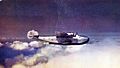
Boeing 314 Clipper in cruise, 1940
-
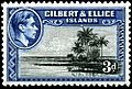
Stamp with portrait of King George VI, 1939


See also
 In Spanish: Kiribati para niños
