South Tarawa facts for kids
|
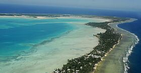
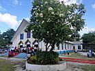
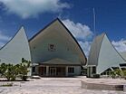
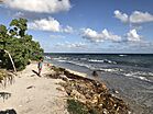
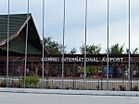
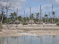
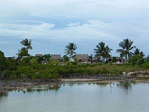
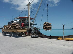
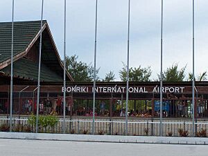
Top: Aerial view of South Tarawa; Middle: Sacred Heart Cathedral, Kiribati Parliament House; Tarawa coastline, Bonriki International Airport
|
|
 |
|
| Geography | |
|---|---|
| Location | Pacific Ocean |
| Coordinates | 1°26′N 173°0′E / 1.433°N 173.000°E |
| Archipelago | Gilbert Islands |
| Area | 15.76 km2 (6.08 sq mi) |
| Highest elevation | 3 m (10 ft) |
| Administration | |
|
Kiribati
|
|
| Demographics | |
| Population | 63,439 (2020 census) |
| Pop. density | 3,578 /km2 (9,267 /sq mi) |
| Ethnic groups | I-Kiribati 95.9% |
South Tarawa (Gilbertese: Tarawa Teinainano) is the capital city of Kiribati. It is also the main center for business and education. More than half of Kiribati's people live here.
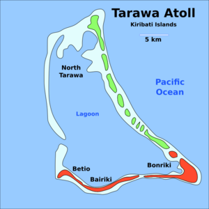
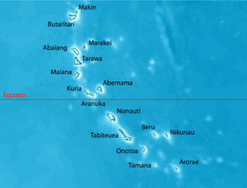
South Tarawa is made up of many small islands. These islands stretch from Betio in the west to Bonriki and Tanaea in the northeast. They are all connected by a main road. In 2020, about 63,439 people lived in South Tarawa.
Many important places are in South Tarawa. These include the main port and the High Court in Betio. The government offices and foreign embassies are in Bairiki. You can find the University of the South Pacific campus in Teaoraereke. The House of Assembly (where laws are made) is in Ambo. The Kiribati Teacher College and King George V and Elaine Bernacchi School are in Bikenibeu. The main hospital is in Nawerewere. Many different churches also have their main offices here.
Contents
How South Tarawa Is Governed
South Tarawa has two main local government areas. These were set up in 1972:
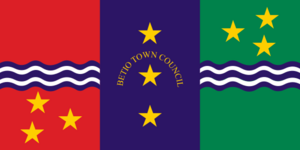
- Betio Town Council (BTC) covers the island of Betio.
- Teinainano Urban Council (TUC) covers the area from Bairiki to Tanaea. The name Teinainano means "down of the mast." This refers to the sail-like shape of the atoll.
Buota is an island that is part of North Tarawa. It is connected to South Tarawa by road. Buota is also growing fast. It faces similar issues like more people moving in and environmental problems.
Geography of South Tarawa
South Tarawa is a chain of small islands. These islands are part of the Tarawa atoll. To the north is the Tarawa Lagoon, which is up to 25 meters deep. To the south is the Pacific Ocean, which can be as deep as 4,000 meters. The islands were formed from sand and other materials from the lagoon.
The islands grow because of strong easterly winds. These winds push sand and sediment. However, during El Niño–Southern Oscillation events, westerly winds can cause the islands to shrink.
Today, these small islands are linked by causeways. This makes them one long island along the southern side of the Tarawa Lagoon. Most of South Tarawa is very low, less than 3 meters above sea level. It is also very narrow, only about 450 meters wide on average.
Population Growth
In 1978, South Tarawa had 17,921 people. Most lived in Betio, Bairiki, and Bikenibeu. Since Kiribati became independent in 1979, the population has more than tripled. In 2020, it reached 63,439 people. All of South Tarawa is now like one big town. It stretches from Tanaea in the northeast to Betio in the southwest.
The village of Buota in North Tarawa is also growing quickly. It is connected to South Tarawa by the main road.
| South Tarawa: Places and population | ||||
| Census area | 1978 | 2005 | 2010 | 2015 |
|---|---|---|---|---|
| Tanaea | 27 | 91 | 279 | 198 |
| Bonriki | 635 | 2,119 | 2,355 | 2,829 |
| Temwaiku | – | 2,011 | 3,135 | 4,072 |
| Causeway (Nawerewere) | – | 1,780 | 2,054 | 1,843 |
| Bikenibeu | 3,971 | 6,170 | 6,568 | 7,575 |
| Abarao | 322 | 908 | 1,665 | 1,761 |
| Eita | 612 | 2,299 | 3,061 | 3,395 |
| Tangintebu | 128 | 94 | 89 | 150 |
| Taborio | 187 | 955 | 1,282 | 1,293 |
| Ambo | – | 1,688 | 2,200 | 2,780 |
| Banraeaba | 501 | 1,789 | 1,969 | 2,072 |
| Antebuka | 504 | 390 | 1,087 | 1,615 |
| Teaoraereke | 848 | 3,939 | 4,171 | 5,105 |
| Nanikai | 604 | 803 | 988 | 1,152 |
| Bairiki | 1,956 | 2,766 | 3,524 | 3,278 |
| Betio | 7,626 | 12,509 | 15,755 | 17,330 |
| South Tarawa total | 17,921 | 40,311 | 50,182 | 56,388 |
History of Tarawa
Tarawa island is important in Kiribati stories and culture. Life on South Tarawa was similar to other islands for a long time. Then, in 1895, it was chosen as the main government spot. This was for the Gilbert and Ellice Islands Protectorate. From 1906 to 1942, the main office was on Ocean Island. It moved to Funafuti during the Japanese occupation of the Gilbert Islands. After 1946, it came back to Tarawa.
Betio was the site of a famous battle, the Battle of Tarawa, during World War II.
Environment and Challenges
The highest point in South Tarawa is only a few meters above sea level. For example, Eita is only 3 meters high. This makes the island very open to natural disasters. Floods and salty soil are starting to harm the limited fresh water.
Climate in South Tarawa
South Tarawa has a Tropical rainforest climate. This means it is warm and humid all year. It usually gets a lot of rain. But the rainfall can change a lot. It depends on the El Niño–Southern Oscillation. During La Niña times, South Tarawa can have very little rain for many months. The hottest temperature ever recorded was 35°C. The coldest was 21°C. This is one of the smallest temperature changes in the world.
| Climate data for Tarawa Airport (South Tarawa) | |||||||||||||
|---|---|---|---|---|---|---|---|---|---|---|---|---|---|
| Month | Jan | Feb | Mar | Apr | May | Jun | Jul | Aug | Sep | Oct | Nov | Dec | Year |
| Record high °C (°F) | 35.0 (95.0) |
33.0 (91.4) |
35.0 (95.0) |
34.5 (94.1) |
34.5 (94.1) |
33.5 (92.3) |
34.5 (94.1) |
34.5 (94.1) |
34.5 (94.1) |
35.0 (95.0) |
35.0 (95.0) |
35.0 (95.0) |
35.0 (95.0) |
| Mean daily maximum °C (°F) | 30.7 (87.3) |
30.6 (87.1) |
30.7 (87.3) |
30.7 (87.3) |
30.8 (87.4) |
30.8 (87.4) |
30.9 (87.6) |
31.0 (87.8) |
31.1 (88.0) |
31.2 (88.2) |
31.3 (88.3) |
30.9 (87.6) |
30.9 (87.6) |
| Daily mean °C (°F) | 28.2 (82.8) |
28.1 (82.6) |
28.1 (82.6) |
28.2 (82.8) |
28.4 (83.1) |
28.3 (82.9) |
28.2 (82.8) |
28.3 (82.9) |
28.4 (83.1) |
28.6 (83.5) |
28.5 (83.3) |
28.2 (82.8) |
28.3 (82.9) |
| Mean daily minimum °C (°F) | 25.3 (77.5) |
25.3 (77.5) |
25.2 (77.4) |
25.3 (77.5) |
25.5 (77.9) |
25.3 (77.5) |
25.1 (77.2) |
25.2 (77.4) |
25.3 (77.5) |
25.4 (77.7) |
25.4 (77.7) |
25.3 (77.5) |
25.3 (77.5) |
| Record low °C (°F) | 21.5 (70.7) |
22.5 (72.5) |
22.5 (72.5) |
22.5 (72.5) |
21.0 (69.8) |
21.0 (69.8) |
21.0 (69.8) |
21.5 (70.7) |
22.5 (72.5) |
22.0 (71.6) |
22.5 (72.5) |
22.0 (71.6) |
21.0 (69.8) |
| Average precipitation mm (inches) | 271 (10.7) |
218 (8.6) |
204 (8.0) |
184 (7.2) |
158 (6.2) |
155 (6.1) |
168 (6.6) |
138 (5.4) |
120 (4.7) |
110 (4.3) |
115 (4.5) |
212 (8.3) |
2,052 (80.8) |
| Average precipitation days (≥ 0.3 mm) | 15 | 12 | 14 | 15 | 15 | 14 | 16 | 18 | 15 | 11 | 10 | 17 | 172 |
| Average relative humidity (%) | 81 | 80 | 81 | 82 | 81 | 81 | 80 | 79 | 77 | 77 | 79 | 81 | 80 |
| Mean monthly sunshine hours | 220.1 | 192.1 | 207.7 | 201.0 | 229.4 | 219.0 | 229.4 | 257.3 | 243.0 | 260.4 | 240.0 | 189.1 | 2,688.5 |
| Mean daily sunshine hours | 7.1 | 6.8 | 6.7 | 6.7 | 7.4 | 7.3 | 7.4 | 8.3 | 8.1 | 8.4 | 8.0 | 6.1 | 7.4 |
| Source: Deutscher Wetterdienst | |||||||||||||
Water Supply
South Tarawa has very little fresh water for its growing population. During dry periods, the only water comes from shallow underground water. This water is stored in the coral rock of the atoll. The water areas at Bonriki and Buota are protected. They can provide about 1,300 cubic meters of water each day.
Other water areas were given up for building or became polluted. Water from Bonriki and Buota is sent to homes in South Tarawa. But the water pipes are old. Also, there isn't enough water. So, each village only gets water for about 2 hours every two days. Many schools and public buildings have no water at all. Many homes use dirty groundwater because of the water shortage.
Because fresh water is scarce, toilets use saltwater for flushing. The sewage system in South Tarawa is not working well. A big project is underway to fix the system. This will help improve cleanliness and public health.
Coastal Erosion
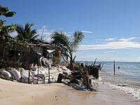
The Ministry of Environment, Lands and Agricultural Development (MELAD) is planting mangroves. This helps protect against coastal erosion. But more work is needed to protect many areas in South Tarawa. Some islands used to be protected by mangroves and ironwood trees. It's not clear how much erosion is from rising sea levels. It's also unclear how much is from human actions. These actions include building sea walls in the wrong places. Also, people dig up sand and gravel from beaches. Coastal erosion will get worse in the future. This is due to climate change and rising sea levels.
Land and Crowding
South Tarawa has a land area of about 15.76 square kilometers. But much of this land cannot be used. This includes water reserves and the airport runway. It also includes causeways and a large reclaimed area at Temwaiku. This area is too swampy and low. If these areas are not counted, the usable land is only about 10 square kilometers.
This means South Tarawa is very crowded. It has about 49 people per hectare. This is almost as dense as London. It is twice as dense as Sydney or Auckland. There are not many tall buildings in South Tarawa. Many people live together in large families. The average household has 7.3 people. They live on small pieces of land. Most land is owned by the original families. But in Betio, Bairiki, and Bikenibeu, the government leases large areas.
Many people in South Tarawa do not have family land or government housing. They have to live as squatters. Fights over land are common. South Tarawa, especially Betio, has high rates of sickness. These include breathing problems, diarrhea, and dysentery. These are linked to overcrowding. The government and its partners are worried about South Tarawa's growth. The government wants people to stay or move to outer islands. They have built new facilities like the South Kiribati Hospital. This helps spread services around the islands. It also helps reduce crowding in South Tarawa.
| South Tarawa: Population and Land Area | ||||
| Census Area | Population 2010 | Land area available | Land area, not available for residential, commercial or government use | Density, people per hectare |
|---|---|---|---|---|
| Tanaea | 279 | 9 hectares (22 acres) | – | 31 |
| Bonriki | 2355 | 70 hectares (173 acres) | 139 hectares (343 acres)1 | 34 |
| Temwaiku | 3135 | 161 hectares (398 acres) | 383 hectares (946 acres)2 | 19 |
| Causeway/Nawerewere | 2054 | |||
| Bikenibeu | 6568 | 181 hectares (447 acres) | – | 36 |
| Abarao | 1665 | 58 hectares (143 acres) | – | 29 |
| Eita | 3061 | 104 hectares (257 acres) | 9 hectares (22 acres)3 | 29 |
| Tangintebu | 89 | |||
| Taborio | 1282 | |||
| Ambo | 2200 | 141 hectares (348 acres) | – | 16 |
| Banraeaba | 1969 | |||
| Antebuka | 1087 | |||
| Teaoraereke | 4171 | 87 hectares (215 acres) | 4.2 hectares (10 acres)4 | 48 |
| Nanikai | 988 | 12 hectares (30 acres) | – | 82 |
| Bairiki | 3524 | 46 hectares (114 acres) | 5.0 hectares (12 acres)5 | 77 |
| Betio-Bairiki causeway | not included | |||
| Betio | 15755 | 154 hectares (381 acres) | 13.7 hectares (34 acres)6 | 102 |
| South Tarawa total | 50182 | 1,023 hectares (2,528 acres) | 553 hectares (1,366 acres) | 49 |
- Bonriki; Water reserve, airport
- Temwaiku; Reclamation and fish ponds
- Eita/Taborio; Abairarang (scout) Is. Abaokoro (Guide) Is. and Taborio Causeway
- Teaoraereke; Causeway
- Naanekai-Bairiki causeway, Bairiki wharf and jetty
- Betio; Sandspit, wharves, jetties
Economy
South Tarawa is the main economic center of Kiribati. It has the main port and the airport. Most government-owned businesses and private companies are here.
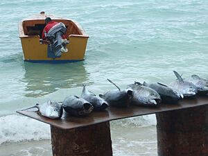
Copra (dried coconut meat) from other islands is processed in Betio. This makes copra oil for selling around the world. Other products are sold locally. There is also a factory that processes tuna for export.
Kiribati imports (buys from other countries) much more than it exports (sells to other countries). Most families in South Tarawa depend on government jobs. They also rely on money sent by relatives working overseas. Not enough jobs is a big problem. In 2010, only 34% of adults in the city had paying jobs. The rest were either not working or doing work for their own family's needs. Young people especially find it hard to get jobs.
Education
South Tarawa has one government high school, King George V and Elaine Bernacchi School in Bikenibeu. There are also several private high schools run by Christian groups:
- Church of God High School
- Moroni High School (which also has a junior high school)
- Sacred Heart High School
- St. Louis High School
- William Goward Memorial School
Visiting South Tarawa
Transport
Fiji Airways flies to Bonriki International Airport in South Tarawa. These flights come from Nadi on Mondays and Thursdays. Solomon Airlines flies to Honiara and Brisbane at least once a week.
Accommodation
There are different places to stay for visitors. This includes people working for a short time in South Tarawa.
See also
 In Spanish: Tarawa Sur para niños
 | Roy Wilkins |
 | John Lewis |
 | Linda Carol Brown |


