Makin (atoll) facts for kids
 |
|
 |
|
| Geography | |
|---|---|
| Location | Pacific Ocean |
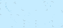
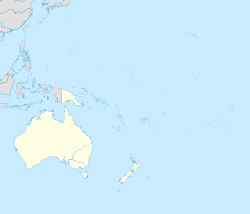
| Coordinates | 3°23′N 173°00′E / 3.383°N 173.000°E |
| Archipelago | Gilbert Islands |
| Area | 7.89 km2 (3.05 sq mi) |
| Highest elevation | 3 m (10 ft) |
| Administration | |
| Demographics | |
| Population | 1,990 (2015 Census) |
| Pop. density | 228 /km2 (591 /sq mi) |
| Ethnic groups | I-Kiribati 98.5% |
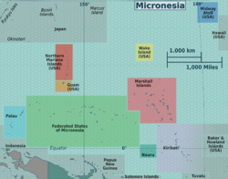
Makin is a group of islands, also called an atoll, found in the Pacific Ocean. It is part of the island nation of Kiribati. Makin is the most northern island in the Gilbert Islands chain. In 2015, about 1,990 people lived there.
Contents
Makin's Geography
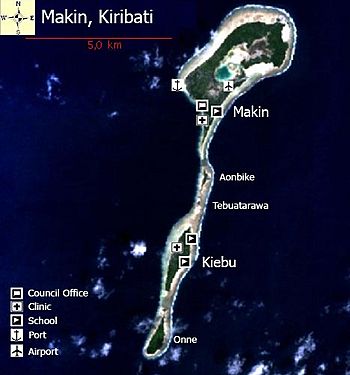
Makin is located about 6 kilometers (3.7 miles) northeast of the Butaritari atoll. It is a long reef feature, stretching 12.3 kilometers (7.6 miles) from north to south. Makin has five small islands, called islets. Two of these islets, Makin and Kiebu, are where people live. The third largest islet, Onne, is also suitable for living.
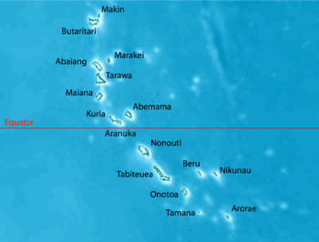
These islands are the northernmost part of the Gilbert Islands. They are also the third most northern islands in the country of Kiribati. Only Teraina and Tabuaeran in the Line Islands are further north.
Makin is not a "true" atoll. However, its largest islet, also named Makin, has a lagoon that is almost completely closed off. This lagoon is 0.3 square kilometers (0.12 square miles) in size. It connects to the open sea on the east through a narrow channel, which has a road bridge over it.
The second largest islet, Kiebu, has an even smaller lagoon. This lagoon is completely closed off and is about 80 meters (260 feet) across.
In the past, nearby Butaritari was sometimes called "Makin Atoll" by the U.S. military. To avoid confusion, Makin was then called "Makin Meang" (meaning Northern Makin) or "Little Makin." Now, "Butaritari" is the common name for the larger atoll, so people usually just say "Makin" for this group of islands.
The Gilbert Islands are sometimes seen as a southern extension of the Ratak Chain in the Marshall Islands. The closest Marshall Islands atoll, Nadikdik Atoll, is about 290 kilometers (180 miles) northwest of Makin.
Islets and Villages of Makin
Makin is made up of five small islands, or islets. Only Makin and Kiebu islets have people living on them all the time. The total population of Makin was 1,798 in the 2010 census.
| Makin: Population and Land Area | ||||
| Islet/Village | Population 2010 | Land area (usable) | People per acre | Area not for use |
|---|---|---|---|---|
| Little Makin | 1,364 | 1,541.5 acres (623.8 ha) | 0.9 | Enclosed lagoon 84.7 acres |
| Bikin Eitei | 8 acres (3.2 ha) | |||
| Aonibike | 30.9 acres (12.5 ha) | |||
| Tebua Tarawa | 5 acres (2.0 ha) | |||
| Kiebu | 434 | 242.2 acres (98.0 ha) | 1.8 | |
| Onne | 122.6 acres (49.6 ha) | |||
| Makin Total | 1,798 | 1,950.2 acres (789.2 ha) | 0.9 | Enclosed lagoon 84.7 acres |
Makin's Climate
Makin's weather is very similar to the nearby Butaritari atoll. It has lots of green plants and a lot of rain. The average rainfall each year is about 4 meters (13 feet). This is much more than in the south of Kiribati, where it might only rain 1 meter (3.3 feet) a year. Makin gets even more rain during an El Niño event.
Environmental Challenges
Rising sea levels are causing problems on Makin. Saltwater is getting into the pits where bwabwai or babai (a type of giant swamp taro) is grown. This saltwater harms the plants. The coastline is also eroding, meaning the land is being washed away by the sea.
For example, on Kiebu islet, a shared bwabwai pit is very close to a saltwater pond. When it rains, the pond overflows and damages the bwabwai plants. Recently, very high tides have also caused saltwater to enter the pits, harming the food crops.
Building causeways (raised roads over water) has also reduced how well the lagoon water mixes. This has led to low oxygen levels in the lagoon, which hurts fish and other sea creatures. Erosion along the shoreline is also linked to digging up sand and gravel, reclaiming land, and building causeways. These activities are thought to change the ocean currents near the shore.
Makin's Economy
Like other islands in Kiribati, Makin has a mostly subsistence economy. This means people grow or catch most of their own food. Most homes are built using materials found on the island. Families mainly eat fish, coconuts, and fruits like bananas and papaya. However, imported foods like rice, sugar, and tobacco are also considered important.
Makin produces a lot of copra, which is dried coconut meat used to make coconut oil. Besides this, there are not many other ways to earn money. Some people work for the government or the Island Council. Many families also get money from relatives who work in South Tarawa or overseas.
Myths and Legends of Makin
There are many different stories about how Makin and the other Gilbert Islands were created. One important legend in Makin's culture tells of spirits who lived in a tree in Samoa. These spirits traveled north, carrying branches from this tree, called Te Kaintikuaba, which means "the tree of life." These spirits, along with a wise being named Nareau, are said to have created the islands of Tungaru (the Gilbert Islands).
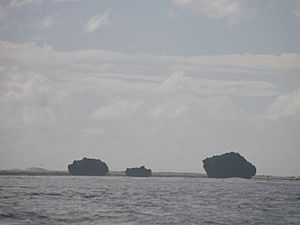
Nakaa Beach is at the northern tip of Makin Atoll. This beach is a very important place in the traditional stories of the islands. It is believed to be the place where the spirits of the dead leave to go to the underworld. Nakaa is the legendary guardian who watches over the entrance to the land of the dead.
Makin's History
In 1606, a Spanish explorer named Pedro Fernandes de Queirós saw both Butaritari and Makin. He called them the Buen Viaje Islands, which means "good trip" in Spanish.
Historically, Butaritari and Makin were ruled by a chief called an Uea. This chief lived on Butaritari Island and had all the power to make decisions for both Butaritari and Makin. This system was very different from the southern Gilbert Islands, where decisions were made by a group of elders called unimwane. The last Uea was Nauraura Nakoriri. He was in power before and after the Gilberts became a British Protectorate in 1892.
In 1841, the US Exploring Expedition surveyed the island. The Little Makin Post Office opened around 1925.
Makin in World War II
Japanese forces took control of Makin in December 1941, just days after the attack on Pearl Harbor. They did this to protect their southern flank from Allied attacks and to isolate Australia. This was part of a plan called Operation FS.
On August 17–18, 1942, the United States launched a surprise attack on Makin. This event is known as the raid on Makin. The goal was to draw Japanese attention away from the Solomon Islands and New Guinea areas.
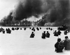
Later, the United States invaded and captured Makin during the Battle of Makin. This battle took place from November 20 to November 24, 1943. The U.S. also captured nearby Tarawa island during this Gilbert Islands campaign.
Travel and Tourism
Makin Airport is located just northeast of Makin Village, between the lagoon and the sea. Its airport code is MTK. Two flights per week are offered by Air Kiribati. These flights connect Makin to Butaritari and to Bonriki International Airport in Tarawa.
There are no special hotels or resorts for tourists on Makin. However, both the Kiribati Protestant Church and the Island Council have guest houses where visitors can stay.
See also
 In Spanish: Makin para niños
- Makin Airport
- Battle of Makin
 | Kyle Baker |
 | Joseph Yoakum |
 | Laura Wheeler Waring |
 | Henry Ossawa Tanner |


