Mount Kilimanjaro facts for kids
Quick facts for kids Mount Kilimanjaro |
|
|---|---|
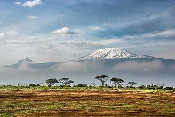
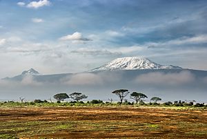
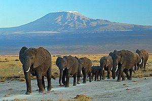
Kilimanjaro from Amboseli National Park, Kenya
|
|
| Highest point | |
| Prominence | Ranked 4th |
| Listing | Ultra |
| Geography | |
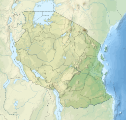
| Location | Kilimanjaro Region, Tanzania |
| Parent range | The Eastern Rift mountains |
| Topo map | Kilimanjaro map and guide by Wielochowski |
| Geology | |
| Formed by | Volcanism along the Gregory Rift |
| Age of rock | 4 million years |
| Mountain type | Stratovolcano |
| Last eruption | Between 150,000 and 200,000 years ago |
| Climbing | |
| First ascent | 6 October 1889 by Hans Meyer and Ludwig Purtscheller |
Mount Kilimanjaro is a huge, dormant volcano in Tanzania, Africa. It is the highest mountain in Africa and the tallest free-standing mountain in the world. This means it stands alone and is not part of a mountain range. Kilimanjaro rises 5,895 m (19,341 ft) above sea level. It is also the highest volcano in the Eastern Hemisphere.
The southern and eastern parts of Kilimanjaro were once home to the Chagga Kingdoms. These kingdoms existed until 1963. The name Kilimanjaro has a mysterious origin. It might mean "mountain of greatness" or "unclimbable mountain." A German missionary, Johannes Rebmann, was the first European to report seeing the mountain in 1848. After several tries, Hans Meyer reached Kilimanjaro's highest point in 1889.
In 1973, the mountain became part of Kilimanjaro National Park. Kilimanjaro is one of the Seven Summits, which are the highest mountains on each continent. This makes it a very popular place for hiking and climbing. There are seven main paths to Uhuru Peak, the highest point. Even though climbing Kilimanjaro is not as hard as some other mountains, its great height can cause altitude sickness.
Kilimanjaro formed from volcanic activity over 2 million years ago. It is part of the East African Rift. Its slopes are covered with montane forests and cloud forests. Many unique plants and animals live only on Mount Kilimanjaro. This includes the giant groundsel Dendrosenecio kilimanjari. The mountain also has a large ice cap and Africa's biggest glaciers. These include Credner Glacier, Furtwängler Glacier, and the Rebmann Glacier. Sadly, this ice cap is shrinking very fast. Over 80% of it disappeared in the 1900s. Experts believe the ice cap could be completely gone by the mid-2000s.
Contents
What's in a Name?
The exact meaning of the name Kilimanjaro is still debated. The Chagga people live near the mountain. They do not have one name for the whole mountain. Instead, they call its two main peaks Kipoo and Kimawenze. These names are usually known as Kibo and Mawenzi. Kibo means "spotted" because of its snow. Mawenzi means "broken top" because of its jagged shape.
Some people think "Kilimanjaro" comes from the Chagga words kilemanjaare or kilemajyaro. These words mean "unclimbable." Early explorers might have misunderstood this as the mountain's name. The word kileme means "that which defeats." Kilelema means "that which has become difficult or impossible." The -jaro part might come from njaare, meaning a bird, or jyaro, meaning a caravan.
Early Western ideas suggested the name came from the Swahili words kilima (mountain) and njaro (greatness) or jaro (caravans). So, it could mean "mountain of greatness" or "mountain of caravans." Another idea was "white mountain," with njaro meaning whiteness. However, kilima actually means "hill" in Swahili. It is a smaller version of mlima (mountain). This makes the Swahili origin less likely.
In the 1880s, Kilimanjaro became part of German East Africa. It was called Kilima-Ndscharo in German. In 1889, Hans Meyer reached Kibo's highest point. He named it Kaiser-Wilhelm-Spitze after the German Emperor. After Tanzania became independent in 1964, the summit was renamed Uhuru Peak. "Uhuru" means "Freedom" in Swahili.
Mountain Makeup
Kilimanjaro is a large stratovolcano. It has three main volcanic cones. Kibo is the highest. Mawenzi is 5,149 m (16,893 ft) tall. Shira is the lowest at 4,005 m (13,140 ft). Mawenzi and Shira are extinct volcanoes, meaning they will not erupt again. Kibo is dormant, which means it could erupt in the future.
Uhuru Peak is the highest point on Kibo's crater rim. The Tanzania National Parks Authority says Uhuru Peak is 5,895 m (19,341 ft) high. This measurement comes from a British survey in 1952. Other measurements have been taken since then.
How the Volcanoes Formed
Scientists do not know much about the inside of Kilimanjaro. This is because there has not been much erosion. Erosion would expose the rock layers that make up the volcano.
The Shira volcano started erupting about 2.5 million years ago. Its last major eruption was about 1.9 million years ago. Shira has a wide flat top at 3,800 m (12,500 ft). This might be a filled-in caldera, which is a large bowl-shaped hollow formed after a volcano erupts and collapses.
Both Mawenzi and Kibo began erupting about 1 million years ago. They are separated by a flat area called the Saddle Plateau. This plateau is at 4,400 m (14,400 ft) elevation.
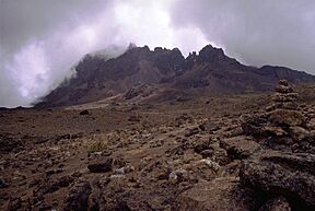
The youngest rocks found at Mawenzi are about 448,000 years old. Mawenzi has a horseshoe shape with sharp peaks. This shape is due to deep erosion. Most of the eastern side of Mawenzi has been worn away by erosion.
Kibo is the largest cone. It is more than 24 km (15 mi) wide at the Saddle Plateau. The last activity here was between 150,000 and 200,000 years ago. This activity created the Kibo summit crater we see today. Kibo still has fumaroles in its crater. These are vents that release gas. Kibo has a nearly perfect cone shape. Its southern side has steep cliffs 180 to 200 m (590 to 660 ft) high. These cliffs form a 2.5 km-wide (1.6 mi) caldera. This caldera was caused by the summit collapsing.
Inside this caldera is the Inner Cone. Inside the Inner Cone's crater is the Reusch Crater. The Ash Pit, 350 m (1,150 ft) deep, is inside the Reusch Crater. About 100,000 years ago, part of Kibo's crater rim collapsed. This created the area known as the Western Breach.
Kibo also has over 250 smaller volcanoes, called parasitic cones. These are on its northwest and southeast sides. They formed between 150,000 and 200,000 years ago.
Kilimanjaro's Glaciers
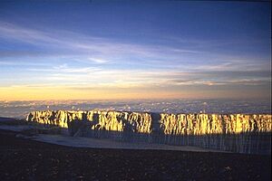
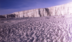
Kibo has an ice cap because Kilimanjaro is a huge mountain that rises above the snow line. The ice cap spreads out and forms individual glaciers at its edges. The middle of the ice cap is broken up by the Kibo crater. The glaciers at the summit do not move much. This is because they are not very thick.
Evidence from geology shows that Kilimanjaro had five periods of glaciers in the past. The most recent major one was about 20,000 to 17,000 years ago. After a very dry period, the ice fields on Kilimanjaro might have disappeared around 11,500 years ago. However, more rain at the start of the Holocene epoch (11,500 years ago) allowed the ice cap to form again.
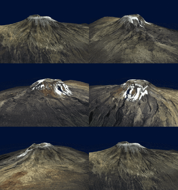
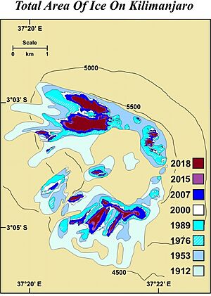
In the late 1880s, Kibo's summit was completely covered by an ice cap. It was about 20 km2 (7.7 sq mi) wide. Glaciers flowed down the western and southern slopes. The entire caldera was buried in ice. The slope glaciers melted quickly between 1912 and 1953. This was due to a sudden climate change in the late 1800s. They have continued to melt more slowly since then.
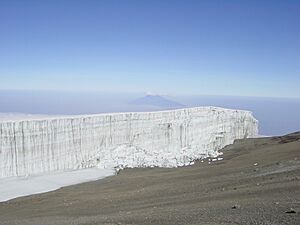
The glaciers on Kilimanjaro's crater plateau have appeared and disappeared many times over thousands of years. Each cycle lasted a few hundred years. The shrinking of the slope glaciers since the late 1800s seems to be caused by less humidity, not just warmer temperatures. Even though air temperatures at that height are always below freezing, sunlight melts the ice on vertical walls. These vertical ice walls are unique to the summit glaciers. They are a major reason why the glaciers are shrinking.
Almost 85 percent of Kilimanjaro's ice cover disappeared between October 1912 and June 2011. The ice cover shrank from 11.40 km2 (4.40 sq mi) to less than 1 km2 (0.39 sq mi). Between 1912 and 1953, about 1.1 percent of the ice cover was lost each year. From 1989 to 2007, the loss rate was 2.5 percent per year. By 2011, almost 40 percent of the ice present in 2000 had vanished. The glaciers are getting thinner and smaller. They are not getting new snow and ice. The loss of glacier ice is due to both melting and sublimation (when ice turns directly into gas).
The shrinking of Kilimanjaro's ice fields is unique in its 12,000-year history. It is happening at the same time as glaciers are shrinking around the world. In 2013, experts thought that most of Kilimanjaro's ice would be gone by 2040. It is very unlikely that any ice will remain after 2060.
The Furtwangler Glacier is a small part of the ice cap that once covered the mountain. This glacier has shrunk a lot in the last century. Over 80 percent of it has melted. The glacier is named after Walter Furtwangler. He was one of the first people to climb Kilimanjaro in 1912.
If the ice disappears completely, it will not greatly affect the water supply around the mountain. The forests on Kilimanjaro, far below the ice, are the main water sources for local people.
Rivers and Streams
Kilimanjaro has many rivers and streams. They are especially found on the wetter southern side of the mountain. Below 1,200 m (3,900 ft), there is less water flow. This is because of more evaporation and people using the water. The Lumi and Pangani rivers drain Kilimanjaro on its eastern and southern sides.
A Special Geological Site
In October 2022, the International Union of Geological Sciences (IUGS) named Kilimanjaro a "geological heritage site." It was chosen because it is the highest stratovolcano of the East African Rift that still has a glacier on its summit. These sites are important places with geological features that are scientifically important.
People and History
Chagga Stories
The Chagga people have many stories about Kilimanjaro. They traditionally lived on the southern and eastern slopes. One legend tells of a man named Tone. He made the god Ruwa angry, causing a famine. People were mad at Tone, so he ran away. A lonely person with magical stones that turned into cattle helped him. This person told Tone not to open the cattle stable. Tone did not listen, and the cattle escaped. As they ran, they created hills, including Mawenzi and Kibo. Tone finally collapsed on Kibo, ending his chase.
Another Chagga story talks about elephant graves filled with ivory on the mountain. It also mentions a cow named Rayli. This cow produced amazing fat from her tail. If someone tried to steal the fat too slowly, Rayli would snort loudly. This would blow the thief down onto the plains.
Early Mentions
People outside Africa might have known about Kilimanjaro a long time ago. Sailors' reports from Ptolemy mention a "moon mountain" and a spring lake of the Nile. This could be Kilimanjaro. However, it is hard to know for sure. It could also refer to other mountains in East Africa. Before Ptolemy, ancient writers like Aeschylus and Herodotus mentioned "Egypt nurtured by the snows." They also spoke of a spring between two mountains.
European Explorers
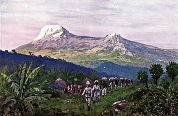
German missionaries Johannes Rebmann and Johann Krapf were the first Europeans to try to reach the mountain. In 1848, Rebmann was the first European to report seeing Kilimanjaro. He wrote in his diary about a "beautiful white cloud" on the mountain. He realized it must be snow. This helped explain old stories of a "vast mountain of gold and silver" guarded by spirits.
In 1861, Baron Karl Klaus von der Decken and Richard Thornton tried to climb Kibo. They only reached 2,500 m (8,200 ft) because of bad weather. In 1862, von der Decken tried again with Otto Kersten. They reached 4,300 m (14,000 ft).
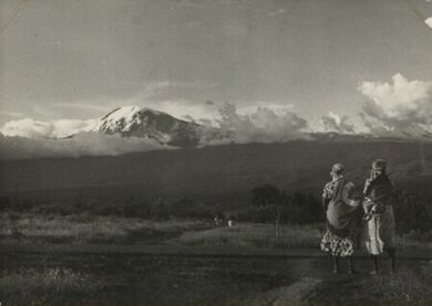
In 1871, missionary Charles New became the first European to reach the snows on Kilimanjaro. He reached an elevation of just over 4,000 m (13,000 ft). In 1887, Hans Meyer, a German geology professor, reached the lower edge of Kibo's ice cap. He had to turn back because he did not have the right equipment for the ice.
In 1889, Meyer returned to Kilimanjaro with Austrian mountaineer Ludwig Purtscheller. They set up several camps with food supplies. This allowed them to try for the summit multiple times without going all the way down. On October 6, 1889, they reached the highest summit. They were the first to confirm that Kibo has a crater. Meyer and Purtscheller spent 16 days above 4,600 m (15,000 ft) during their trip. Mwini Amani, a local guide, helped them by cooking and bringing water and firewood to their high camps.
First Women Climbers
In 1909, Gertrude Benham from London tried to reach the summit. Her porters left after finding skeletons of past climbers. Benham continued alone and reached the edge of Kibo Crater, now called Gilman’s Point. Bad weather, like heavy snow and fog, made it hard to find her way. She had to turn back. The first woman to successfully reach the summit was Sheila MacDonald. She completed the climb on September 30, 1927, when she was 22 years old.
Modern Times
The first time someone climbed Mawenzi's highest summit was on July 29, 1912. German climbers Eduard Hans Oehler and Fritz Klute did it. They named it Hans Meyer Peak.
In 1989, a group celebrating the 100-year anniversary of the first ascent gave special awards. These awards were for the African porter-guides who helped Meyer and Purtscheller. One person, Yohani Kinyala Lauwo, was thought to be in old pictures from the 1889 trip. He lived in Marangu. Lauwo did not know his age. He did not remember Meyer or Purtscheller. But he did remember a climb with a Dutch doctor. He also said he climbed the mountain three times before World War I. The committee believed he was part of Meyer's team. They thought he was born around 1871. Lauwo passed away on May 10, 1996. Some people say he was a co-first-climber of Kilimanjaro.
Animals and Plants
Animals
Large animals are not common on Kilimanjaro. They are seen more often in the forests and lower parts of the mountain. Elephants and Cape buffaloes can be dangerous to hikers. Other animals reported include bushbucks, chameleons, dik-diks, duikers, mongooses, sunbirds, and warthogs. Zebras, leopards, and hyenas have sometimes been seen on the Shira plateau. Some animals found only on Kilimanjaro include the Kilimanjaro shrew and the chameleon Kinyongia tavetana.
Vegetation
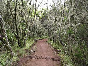
Natural forests cover about 1,000 km2 (250,000 acres) on Kilimanjaro. In the lower areas, people grow maize, beans, and sunflowers. On the western side, wheat is grown. There are also remains of old savanna plants like Acacia and Combretum. Between 1,000 m (3,300 ft) and 1,800 m (5,900 ft), coffee plants grow in "Chagga home gardens." The native plants at this height are mostly in hard-to-reach valleys. Higher up, in cloud forests, you can find Podocarpus latifolius and Hagenia abyssinica. Fog-loving mosses also grow there.
On the drier northern slopes, forests are made of olive trees and Juniperus. Between 3,100 m (10,200 ft) and 3,900 m (12,800 ft), there are Erica bushes and heathlands. Above that, up to 4,500 m (14,800 ft), you find Helichrysum. Some new plants, like Poa annua, have also been seen.
The lower northern and western slopes have mostly Acacia savanna. Most of the wooded grasslands on the lower southern and eastern slopes have been cleared for farming.
Records from the Maundi crater show that Kilimanjaro's plants have changed over time. During the last Ice Age, forests moved to lower areas. The plant belt with Erica bushes moved down by 1,500 m (4,900 ft). This happened between 42,000 and 30,000 years ago because it was drier and colder.
The Tussock Grassland on Kilimanjaro's slopes has many unique plants. One example is the water holding cabbage.
Protecting the Mountain
Since 1973, Mount Kilimanjaro has been a national park. This means human activities inside its borders are limited to protect its natural environment. The government has also stopped tree cutting to prevent harm to the environment and save the park's many different plants and animals.
Kilimanjaro's Climate
Kilimanjaro's climate is special because of its height. It is affected by both the warm winds near the equator and the cold winds high up. The mountain also stands alone, which influences its weather. Kilimanjaro has winds that blow up the mountain during the day and down at night. These winds are stronger on the southern side.
Kilimanjaro has two rainy seasons. One is from March to May, and the other is around November. The northern slopes get much less rain than the southern ones. The lower southern slope gets 800 to 900 mm (31 to 35 in) of rain each year. This increases to 1,500 to 2,000 mm (59 to 79 in) at 1,500 m (4,900 ft) height. It can even reach over 3,000 mm (120 in) in the forest belt. In the highest alpine zone, rainfall drops to 200 mm (7.9 in).
The average temperature at the summit is about −7 °C (19 °F). At night, temperatures on the Northern Ice Field can drop to −9 °C (16 °F). During the day, they average −4 °C (25 °F). On very cold nights, temperatures can fall to −15 to −27 °C (5 to −17 °F).
Snow can fall any time of year. But it mostly happens during Tanzania's two rainy seasons. Snowfall at the summit is about 250 to 500 mm (9.8 to 19.7 in) per year. This snow melts within days or years.
| Climate data for Machame 10, Kilimanjaro, Tanzania (5,803 m) (2012–2015) | |||||||||||||
|---|---|---|---|---|---|---|---|---|---|---|---|---|---|
| Month | Jan | Feb | Mar | Apr | May | Jun | Jul | Aug | Sep | Oct | Nov | Dec | Year |
| Record high °C (°F) | 5.6 (42.1) |
6.2 (43.2) |
4.0 (39.2) |
3.7 (38.7) |
5.3 (41.5) |
6.5 (43.7) |
4.5 (40.1) |
2.9 (37.2) |
4.7 (40.5) |
4.8 (40.6) |
4.6 (40.3) |
5.8 (42.4) |
6.5 (43.7) |
| Mean daily maximum °C (°F) | −0.6 (30.9) |
−1.2 (29.8) |
−1.2 (29.8) |
−0.4 (31.3) |
−0.2 (31.6) |
−1.8 (28.8) |
−2.3 (27.9) |
−2.2 (28.0) |
−2.2 (28.0) |
−1.5 (29.3) |
−0.9 (30.4) |
−0.5 (31.1) |
−1.3 (29.7) |
| Daily mean °C (°F) | −5.7 (21.7) |
−6.0 (21.2) |
−5.7 (21.7) |
−5.4 (22.3) |
−5.4 (22.3) |
−6.4 (20.5) |
−6.4 (20.5) |
−6.4 (20.5) |
−6.5 (20.3) |
−6.1 (21.0) |
−5.6 (21.9) |
−5.5 (22.1) |
−5.9 (21.3) |
| Mean daily minimum °C (°F) | −9.4 (15.1) |
−9.4 (15.1) |
−8.9 (16.0) |
−8.5 (16.7) |
−8.8 (16.2) |
−9.8 (14.4) |
−9.8 (14.4) |
−9.7 (14.5) |
−9.8 (14.4) |
−9.4 (15.1) |
−8.9 (16.0) |
−8.9 (16.0) |
−9.3 (15.3) |
| Record low °C (°F) | −12.4 (9.7) |
−11.9 (10.6) |
−12.3 (9.9) |
−11.2 (11.8) |
−11.2 (11.8) |
−13.4 (7.9) |
−13.1 (8.4) |
−12.3 (9.9) |
−12.5 (9.5) |
−11.8 (10.8) |
−11.2 (11.8) |
−11.0 (12.2) |
−13.4 (7.9) |
| Source: CEDA Archive | |||||||||||||
Climate Zones
Kilimanjaro has five main climate zones as you go up the mountain:
- Bushland / Lower Slope: 800 to 1,800 m (2,600 to 5,900 ft)
- Rainforest: 1,800 to 2,800 m (5,900 to 9,200 ft)
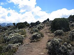
- Heather / Moorland: 2,800 to 4,000 m (9,200 to 13,100 ft)
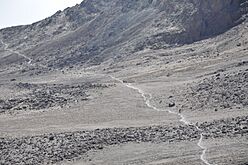
- Alpine Desert: 4,000 to 5,000 m (13,000 to 16,000 ft)
- Arctic: 5,000 to 5,895 m (16,404 to 19,341 ft)
Tourism and Climbing
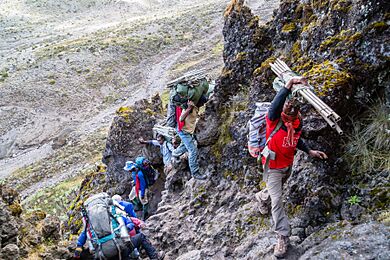
Kilimanjaro National Park earned US$51 million in 2013. This made it the second-highest earning national park in Tanzania. In 2011–12, the park had 57,456 tourists. Of these, 16,425 hiked the mountain. The park's plan allows for 28,470 hikers each year. Hiking the mountain creates jobs for about 11,000 guides, porters, and cooks. However, there have been concerns about their working conditions and low pay.
Because Kilimanjaro National Park is so popular, the Tanzanian government has improved roads to make it easier to reach. Kilimanjaro International Airport also helps travelers get to the area.
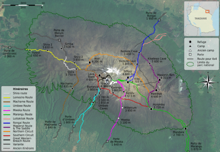
There are seven official paths to climb and descend Kilimanjaro: Lemosho, Lemosho Western-Breach, Machame, Marangu, Mweka, Rongai, Shira, and Umbwe. The Machame route takes six or seven days. Lemosho takes six to eight days. The Northern Circuit routes take seven or more days. The Lemosho Western-Breach Route is more private. It avoids the long midnight climb to the summit that other routes have. The Rongai is the easiest camping route. The Marangu route is also fairly easy and has shared huts for sleeping.
Mawenzi Technical Climbing
You can find challenging climbing routes on the Mawenzi cone. Unlike the regular paths to Uhuru Peak on Kibo, climbing Mawenzi needs a special permit. This permit is only given to experienced climbers with the right gear. Climbing on Mawenzi is limited to two climbers at a time and only during the day.
Climbing Records
The oldest person to climb Mount Kilimanjaro is Anne Lorimor. She was 89 years and 37 days old when she reached Uhuru Peak on July 18, 2019. The oldest man to reach the summit is American Fred Dishelhorst. He was 88 years old when he made it to the top on July 19, 2017. The second oldest man is American Charlie Winger. He reached the top on July 5, 2025, at 88 years, 1 month, and 26 days old. He did not use extra oxygen. The third oldest man is American Robert Wheeler. He was 85 years old when he summited on October 2, 2014.
Maxwell J. Ojerholm from Massachusetts, USA, reached Uhuru Peak without help on July 4, 2009. He was ten years old and took the difficult Machame Route. Colin M. Barker from Missouri, USA, also completed the same route at age ten on December 22, 2020. Theodore Margaroli from London, age 10, reached the summit without help by the Western Breach in 2019. On July 11, 2025, Lydia Zhong Chew from Boulder, Colorado, USA, reached Uhuru Peak. She was 10 years old and took the Machame route. She and her 12-year-old sister Julia Zhong Chew are thought to be the youngest climbers of Chinese descent. Even though the age limit for a climbing permit is 10 years, Keats Boyd from Los Angeles reached the summit at age 7 on January 21, 2008. Montannah Kenney from Texas equaled this record in March 2018. Coaltan Tanner from New Mexico also equaled it in July 2018.
The fastest climb and fastest round trip were set by Swiss-Ecuadorian mountain guide Karl Egloff. On August 13, 2014, he ran from Umbwe Gate to the top in 4 hours and 56 minutes. He returned to Mweka Gate in a total of 6 hours, 42 minutes, and 24 seconds.
The female round trip record is held by Fernanda Maciel from Brazil. Her time was 10 hours and 6 minutes. Her ascent time of 7:08 was beaten on February 23, 2018, by Danish ultramarathon runner Kristina Schou Madsen. Her time was 6:52:54 from Mweka Gate.
Several climbs by people with disabilities have also gained attention. Bernard Goosen from South Africa, who uses a wheelchair, climbed Kilimanjaro in six days in 2007. In 2012, Kyle Maynard, who has no forearms or lower legs, crawled to the summit without help.
On February 9, 2015, Valerii Rozov performed the first wing-suit BASE jump from Kilimanjaro's summit. He flew about 3 kilometers before landing.
In 2020, a team with two people who had lost both legs above the knee, Hari Budha Magar and Justin Oliver Davis, reached Kilimanjaro's summit. It took them six days to cover the 56 km (35 mi) distance.
Safety on the Mountain
Climbing Kilimanjaro is not as technically hard as climbing in the Himalayas or Andes. However, the high elevation, cold temperatures, and strong winds can make it a tough trek. Your body needs time to get used to the high altitude. Even experienced climbers can get altitude sickness. A study in 2005 found that 61.3 percent of climbers reached the summit. But 77 percent experienced acute mountain sickness (AMS).
Kilimanjaro's summit is high enough for dangerous conditions like high altitude pulmonary edema (HAPE) or high altitude cerebral edema (HACE). These are severe forms of AMS. These health risks increase if you climb too fast. This can happen because of high park fees, busy travel schedules, and a lack of permanent shelters on most routes.
Falls on steep parts of the mountain and rock slides have caused deaths. Because of this, the route through the Arrow Glacier was closed for several years. It reopened in December 2007. However, it officially closed again on January 20, 2024. Due to strong El Niño weather, the Western Breach has been washed down the mountain. This huge water flow has created new ravines. It seems to be loosening the rock, making it unstable. At the base of the route, rainwater has opened new paths. There is now an active river flowing through the Arrow Glacier Camp. This area had no water for decades.
Not properly disposing of human waste on the mountain has created a health risk. This means all water must be boiled.
From January 1996 to October 2003, 25 people died while climbing Kilimanjaro. Most of these deaths were due to severe altitude sickness. Other deaths were from injuries, heart attacks, or pneumonia. The overall death rate was about 13.6 deaths for every 100,000 climbers.
Kilimanjaro in Books and Movies
Kilimanjaro is a very famous mountain in stories and films. Journalist Tom Bissell called it "perhaps the world's most literary mountain."
The mountain is a key part of Ernest Hemingway's 1936 short story The Snows of Kilimanjaro. This story was made into a movie in 1952. Dave Eggers wrote about his climb in the short story Up the Mountain Coming Down Slowly. The climb is also shown in Andrei Gusev's 2020 novel Once in Malindi. Writer Douglas Adams climbed the mountain in a rubber rhinoceros suit. He did this to raise money to help save African rhinos.
Kilimanjaro was also featured in Toto's 1982 song "Africa". An IMAX film called Kilimanjaro: To The Roof Of Africa came out in 2002. Kilimanjaro is also shown a lot in the Lion King movies and shows.
Images for kids
See also
 In Spanish: Kilimanjaro para niños
 | DeHart Hubbard |
 | Wilma Rudolph |
 | Jesse Owens |
 | Jackie Joyner-Kersee |
 | Major Taylor |


