Western Maryland facts for kids


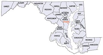
Western Maryland is a special part of the U.S. state of Maryland. People sometimes call it the Maryland panhandle because it's a narrow strip of land, like the handle of a pan. This area mostly includes three counties: Washington, Allegany, and Garrett.
Western Maryland is bordered by Preston County, West Virginia to the west, the Mason–Dixon line (which is the border with Pennsylvania) to the north, and the Potomac River and West Virginia to the south. At one spot, near the town of Hancock, the state is super narrow, only about 1.8 miles wide!
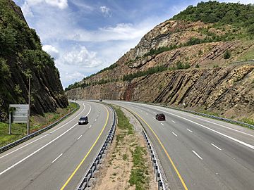
This region is much more rural than the busy Washington-Baltimore area, where most of Maryland's people live. Western Maryland is famous for its mountainous terrain. It's part of the central Appalachians, and its counties are even part of the Appalachian Regional Commission, which helps the region grow.
The biggest city in Western Maryland is Hagerstown, which is in Washington County. Important highways that go through Western Maryland include I-70, I-81, and I-68.
Contents
Climate in Western Maryland
The weather in Western Maryland is more like the mountains of northern West Virginia than other parts of Maryland. Summers here are usually much cooler than in the rest of the state, and winters are colder and snowier.
In winter, temperatures can drop below 0 degrees Fahrenheit (about -18 degrees Celsius) on about eight nights each year. The amount of snow can vary a lot, from about 20 inches (0.5 meters) in the eastern parts to over 120 inches (3 meters) in the higher mountains!
Here's a look at the climate data for Hagerstown, the largest city in Western Maryland. It's in Washington County, which is the easternmost and lowest county in the region.
| Climate data for Hagerstown, Maryland (Washington County Airport), 1981−2010 normals | |||||||||||||
|---|---|---|---|---|---|---|---|---|---|---|---|---|---|
| Month | Jan | Feb | Mar | Apr | May | Jun | Jul | Aug | Sep | Oct | Nov | Dec | Year |
| Record high °F (°C) | 78 (26) |
81 (27) |
88 (31) |
95 (35) |
96 (36) |
102 (39) |
107 (42) |
105 (41) |
99 (37) |
93 (34) |
84 (29) |
78 (26) |
107 (42) |
| Mean daily maximum °F (°C) | 38.3 (3.5) |
41.4 (5.2) |
50.7 (10.4) |
62.9 (17.2) |
72.2 (22.3) |
81.3 (27.4) |
85.2 (29.6) |
83.0 (28.3) |
75.3 (24.1) |
65.1 (18.4) |
53.5 (11.9) |
41.3 (5.2) |
62.6 (17.0) |
| Mean daily minimum °F (°C) | 23.3 (−4.8) |
25.8 (−3.4) |
32.3 (0.2) |
42.6 (5.9) |
51.8 (11.0) |
61.4 (16.3) |
65.5 (18.6) |
63.6 (17.6) |
56.2 (13.4) |
44.4 (6.9) |
36.3 (2.4) |
26.8 (−2.9) |
44.3 (6.8) |
| Record low °F (°C) | −17 (−27) |
−9 (−23) |
0 (−18) |
18 (−8) |
30 (−1) |
37 (3) |
42 (6) |
40 (4) |
29 (−2) |
18 (−8) |
6 (−14) |
−6 (−21) |
−17 (−27) |
| Average precipitation inches (mm) | 2.68 (68) |
2.55 (65) |
3.38 (86) |
3.56 (90) |
4.03 (102) |
3.88 (99) |
3.41 (87) |
3.14 (80) |
3.67 (93) |
2.88 (73) |
3.22 (82) |
2.89 (73) |
39.29 (998) |
| Source: NOAA | |||||||||||||
And here is the climate data for Oakland, which is in Garrett County. This is the westernmost county and has the highest elevation in Western Maryland.
| Climate data for Oakland, Maryland (1981−2010 normals, extremes 1893−present) | |||||||||||||
|---|---|---|---|---|---|---|---|---|---|---|---|---|---|
| Month | Jan | Feb | Mar | Apr | May | Jun | Jul | Aug | Sep | Oct | Nov | Dec | Year |
| Record high °F (°C) | 75 (24) |
76 (24) |
83 (28) |
88 (31) |
89 (32) |
95 (35) |
98 (37) |
101 (38) |
95 (35) |
88 (31) |
78 (26) |
74 (23) |
101 (38) |
| Mean daily maximum °F (°C) | 34.5 (1.4) |
38.2 (3.4) |
47.6 (8.7) |
59.0 (15.0) |
67.6 (19.8) |
75.3 (24.1) |
78.8 (26.0) |
77.8 (25.4) |
71.4 (21.9) |
61.8 (16.6) |
50.3 (10.2) |
38.9 (3.8) |
58.4 (14.7) |
| Mean daily minimum °F (°C) | 15.8 (−9.0) |
17.3 (−8.2) |
24.9 (−3.9) |
34.3 (1.3) |
44.5 (6.9) |
53.4 (11.9) |
58.0 (14.4) |
56.1 (13.4) |
48.6 (9.2) |
37.0 (2.8) |
28.3 (−2.1) |
20.7 (−6.3) |
36.6 (2.6) |
| Record low °F (°C) | −40 (−40) |
−29 (−34) |
−20 (−29) |
−2 (−19) |
17 (−8) |
26 (−3) |
33 (1) |
30 (−1) |
19 (−7) |
7 (−14) |
−16 (−27) |
−32 (−36) |
−40 (−40) |
| Average precipitation inches (mm) | 3.54 (90) |
3.20 (81) |
4.13 (105) |
3.87 (98) |
5.14 (131) |
4.42 (112) |
5.46 (139) |
3.78 (96) |
3.45 (88) |
3.15 (80) |
3.83 (97) |
3.85 (98) |
47.82 (1,215) |
| Average snowfall inches (cm) | 30.9 (78) |
22.2 (56) |
17.6 (45) |
5.2 (13) |
0 (0) |
0 (0) |
0 (0) |
0 (0) |
0 (0) |
0.5 (1.3) |
6.8 (17) |
22.9 (58) |
106.1 (268.3) |
| Average precipitation days (≥ 0.01 in) | 15.5 | 11.9 | 13.6 | 13.7 | 15.0 | 13.5 | 13.0 | 11.3 | 10.9 | 10.7 | 12.4 | 15.1 | 156.6 |
| Average snowy days (≥ 0.1 in) | 10.2 | 7.9 | 5.6 | 2.0 | 0 | 0 | 0 | 0 | 0 | 0.4 | 2.6 | 7.9 | 36.5 |
| Source: NOAA | |||||||||||||
History of Western Maryland
In 1748, enough people lived in Western Maryland that a new county was created. It was called Frederick County, and it used to stretch much farther west than it does today. Early on, many German immigrants came from Pennsylvania and helped develop the flat lands and valleys of Western Maryland.
Washington County
Washington County was formed in 1776. It was named after George Washington. This county was created by dividing Frederick County. The biggest city here is Hagerstown, which was named after Jonathan Hager, a German settler.
Allegany County
In 1785, the city of Cumberland was founded in Allegany County. This county was a very important place for pioneers traveling west. They would pass through the Cumberland Narrows, a 1,000-foot-high gap that forms the main path through the Allegheny Mountains. In the mid-1700s, English settlers came to Allegany County. They started mining and building towns and farms. This county was a key transportation hub for travelers using canals, trains, and horse-drawn buggies.
Garrett County
Garrett County is the westernmost county in Maryland. It was the last part of Maryland to be settled, starting in 1764. The county itself was officially created in 1872 by John Work Garrett, who was the president of the B&O Railroad.
Appalachian Development Efforts
The Appalachian Regional Development Act was passed in 1965. This act aimed to help with poverty and economic problems in the Appalachian region, which includes 13 states. The main goal was to improve the economy and bring this region up to the same level as the rest of the country. For Maryland, this act helped bring attention to the poverty levels in the Western Maryland counties. The program created for this was called the Appalachian Regional Commission (ARC).
Population of Western Maryland Counties
According to the 2010 U.S. Census, the three westernmost counties of Maryland had a total population of 252,614 people. This was about 4.4% of all the people living in Maryland at that time.
- Washington County is the most populated, with about 147,430 people in 2010.
- Allegany County is next, with 75,087 people in 2010.
- Garrett County is the least populated, with 30,097 people in 2010.
Major Communities
Here are some of the biggest cities and towns in Western Maryland, listed by county, with their populations from the 2020 census:
- Washington County:
* Hagerstown (43,527) * Boonsboro (3,336) * Smithsburg (2,975) * Williamsport (2,137) * Hancock (1,546)
- Allegany County:
* Cumberland (20,859) * Frostburg (9,002) * Westernport (1,888)
- Garrett County:
* Mountain Lake Park (2,092) * Oakland (1,925)
Economy
Western Maryland has a strong agricultural economy. This means farming is a big deal here! The most famous crops are the delicious apples grown in the Cumberland Valley. Farmers also grow corn, potatoes, beans, and different kinds of green-leaf vegetables. Many farms raise both crops and livestock, and there are many dairy cattle farms in the region.
Tourism and Fun Things to Do
Tourism is very important to Western Maryland. Many visitors come to explore the area, and the tourism industry is growing!
Historical Sites
Western Maryland has many places important to military history, especially the Civil War. In 1862, Washington County was the site of one of the Civil War's bloodiest single-day battles at Antietam National Battlefield.
The city of Cumberland is also known for its transportation history. The Downtown Cumberland Historic District is a special area recognized for its history. The Western Maryland Railway Station in Cumberland is a popular spot for visitors interested in trains.
Outdoor Adventures in Garrett County
Garrett County is famous for its many state parks and outdoor activities. Places like Deep Creek Lake attract many visitors every year.
- Deep Creek Lake: This is the largest lake in Western Maryland. It's a man-made lake, about 4,000 acres big, and owned by the State of Maryland. Construction started in 1920, and the lake was filled by 1929. It was first made to power a small hydroelectric plant (which makes electricity from water). Later, it became a popular tourist spot. Today, people enjoy boating and fishing on the lake. Deep Creek Lake State Park offers fishing piers, a beach for swimming, covered picnic areas, and places for camping.
- Wisp Ski Resort: Maryland's only ski resort, Wisp Ski Resort, is right next to Deep Creek Lake. It covers 172 acres. In winter, you can go cross-country skiing and snowmobiling. All year round, it has a fun mountain coaster. Wisp is a major attraction in the region.
Sports
Western Maryland also has some cool sports teams and events!
- The Frostburg State Bobcats compete in many sports in NCAA Division II as part of the Mountain East Conference.
Garrett County, along the Savage River, has hosted two big ICF Canoe Slalom World Championships in 1989 and 2014. This is where athletes race canoes through challenging river courses.
Education
Western Maryland has several colleges where students can continue their education:
- Allegany College of Maryland – a community college
- Frostburg State University – a four-year university
- Garrett College – a community college
- Hagerstown Community College – a community college
Idea for a New State
In 2014, some people in Western Maryland talked about wanting to form a new state. This new state would include Garrett, Allegany, Washington, Frederick, and Carroll counties. Supporters of this idea felt that the more populated eastern part of Maryland had too much political power. They wanted more say in issues like gun laws and taxes.
 | Dorothy Vaughan |
 | Charles Henry Turner |
 | Hildrus Poindexter |
 | Henry Cecil McBay |

