Emmitsburg, Maryland facts for kids
Quick facts for kids
Emmitsburg
|
|||
|---|---|---|---|
| Town of Emmitsburg | |||

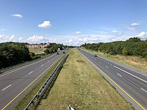
Panoramic view of Emmitsburg from US-15 Rest Area
|
|||
|
|||

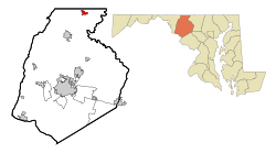
Location of Emmitsburg, Maryland
|
|||
| Country | |||
| State | |||
| County | |||
| Founded | 1785 | ||
| Incorporated | 1825 | ||
| Area | |||
| • Total | 1.64 sq mi (4.24 km2) | ||
| • Land | 1.62 sq mi (4.19 km2) | ||
| • Water | 0.02 sq mi (0.05 km2) | ||
| Elevation | 400 ft (100 m) | ||
| Population
(2020)
|
|||
| • Total | 2,770 | ||
| • Density | 1,713.05/sq mi (661.46/km2) | ||
| Time zone | UTC−5 (Eastern (EST)) | ||
| • Summer (DST) | UTC−4 (EDT) | ||
| ZIP Code |
21727
|
||
| Area code(s) | 301, 240 | ||
| FIPS code | 24-26200 | ||
| GNIS feature ID | 2390171 | ||
Emmitsburg is a small town in Frederick County, Maryland, United States. It is located very close to the border with Pennsylvania.
The town was founded in 1785. It is home to Mount St. Mary's University, a well-known college. Emmitsburg also has two important Catholic pilgrimage sites. These are the National Shrine Grotto of Our Lady of Lourdes and the Basilica and National Shrine of St. Elizabeth Ann Seton. Saint Elizabeth Ann Seton was the first person born in the U.S. to become a saint. Her shrine is one of the top eight Catholic pilgrimage spots in the country.
Emmitsburg is also where the National Emergency Training Center (NETC) is located. This campus trains people for emergencies. It includes the Emergency Management Institute, the National Fire Academy, and the National Fallen Firefighters Memorial.
In 2020, about 2,776 people lived in Emmitsburg. The town is famous for its youth baseball teams. They won three Cal Ripken Baseball championships in a row from 2013 to 2015. The current mayor of Emmitsburg is Frank Davis.
Contents
History of Emmitsburg
Emmitsburg got its name from its founder, William Emmit, in 1785. But people lived in this area even before the town was officially named. It was first called "Silver Fancy" and then "Poplar Fields." This was especially true because British rules limited where colonists could settle.
Early Settlements and Churches
In 1757, a group of Lutherans built a church. They shared it with another German church group until 1798. After the American Revolutionary War, a Catholic missionary named Rev. Jean Dubois started a church and then a school for religious studies in Emmitsburg. Later, Elizabeth Ann Seton opened a convent, which is a home for nuns, along with a school and a hospital. Soon, many Methodists moved to Emmitsburg. They formed their own church group instead of sharing a minister with a town in Pennsylvania.
Emmitsburg During the Civil War
In June 1863, during the American Civil War, the Union soldiers made Emmitsburg stronger. They wanted to stop the Confederate army from invading their territory. On the night of June 23, half of the town mysteriously burned down. People say that this "Great Fire" was started by someone who supported the Union. This was to stop the Confederate soldiers from taking supplies from the town.
Luckily, Emmitsburg was spared a big battle. The main fight, known as the Battle of Gettysburg, happened about 12 miles north in Gettysburg. Confederate soldiers briefly held Emmitsburg on July 4 as they retreated.
Geography and Climate
Emmitsburg covers about 1.52 square miles (3.94 square kilometers) of land. It is located near the base of Catoctin Mountain.
Emmitsburg's Climate
Emmitsburg has a climate with hot, humid summers and moderately cold winters. This type of climate is called a humid continental climate.
Getting Around Emmitsburg
Most people travel to and from Emmitsburg by car. U.S. Route 15 is the main highway. It connects Emmitsburg to Gettysburg in the north and Frederick in the south. There is also a special road, U.S. Route 15 Business, which goes through the center of town. The main US 15 highway now goes around the east side of Emmitsburg.
Another important road is Maryland Route 140. This road goes east towards Westminster and then to Baltimore. If you go west on MD 140, it crosses into Pennsylvania and becomes Pennsylvania Route 16.
People of Emmitsburg
In 2010, there were 2,814 people living in Emmitsburg. There were 997 households, which are groups of people living together. About 670 of these were families.
Most of the people living in Emmitsburg were White (95.0%). There were also African American (2.0%), Native American (0.2%), and Asian (0.9%) residents. About 2.5% of the population was Hispanic or Latino.
About 38.8% of households had children under 18 living with them. The average household had 2.64 people, and the average family had 3.22 people. The average age in town was 39.5 years old. About 26% of residents were under 18.
Local News
Emmitsburg has two local newspapers. They are called the Emmitsburg News-Journal and The Catoctin Banner. Both newspapers are published once a month.
See also
 In Spanish: Emmitsburg (Maryland) para niños
 | Selma Burke |
 | Pauline Powell Burns |
 | Frederick J. Brown |
 | Robert Blackburn |


