Kent County, Delaware facts for kids
Quick facts for kids
Kent County
|
|||
|---|---|---|---|
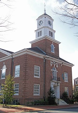
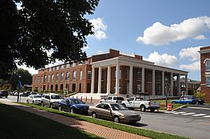
The Kent County Courthouse in Dover in 2006
|
|||
|
|||

Location within the U.S. state of Delaware
|
|||
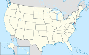 Delaware's location within the U.S. |
|||
| Country | |||
| State | |||
| Founded | August 8, 1683 | ||
| Named for | Kent, England | ||
| Seat | Dover | ||
| Largest city | Dover | ||
| Area | |||
| • Total | 798 sq mi (2,070 km2) | ||
| • Land | 586 sq mi (1,520 km2) | ||
| • Water | 212 sq mi (550 km2) 26.6%% | ||
| Population
(2020)
|
|||
| • Total | 181,851 | ||
| • Density | 310.33/sq mi (119.82/km2) | ||
| Time zone | UTC−5 (Eastern) | ||
| • Summer (DST) | UTC−4 (EDT) | ||
| Congressional district | At-large | ||
Kent County is a special area called a county in the middle of Delaware, a state in the United States. In 2020, about 181,851 people lived here. This makes it the county with the fewest people in Delaware.
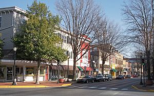
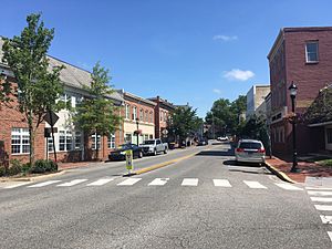
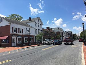
The main town, or county seat, is Dover. Dover is also the capital city of Delaware. Kent County got its name from Kent, a county in England. The Dover area is part of a larger region that includes cities like Philadelphia and Camden.
Contents
History of Kent County
Around 1670, people from England started settling near the St. Jones River. On June 21, 1680, a new area called St. Jones County was created. This county was later given to William Penn in 1682. It became part of Penn's new Delaware Colony.
William Penn wanted a main town for the court. A courthouse was built in 1697. The town of Dover was officially planned in 1717. It was named after Dover in England. In 1777, Dover became the capital of Delaware. In 1787, Delaware was the very first state to approve the U.S. Constitution. This is why Delaware is known as "the First State."
During the late 1700s, Kent County's economy was mostly based on small farms growing grain. These farms did not need as many enslaved people as tobacco farms did. Because of this, by the early 1800s, many African Americans in Delaware were free.
In the 1960s, Dover was important for making spacesuits. These suits were worn by NASA astronauts during the Apollo missions to the Moon. A company called ILC Dover made these suits. The "A7L" suit was first used in 1967. It was the same suit worn by Neil Armstrong and Buzz Aldrin when they walked on the Moon during the Apollo 11 mission. The company still makes parts for spacesuits today.
Geography of Kent County
Kent County covers about 798 square miles. About 586 square miles of this is land, and 212 square miles (or 26.6%) is water.
Like all counties in Delaware, Kent County is divided into smaller areas called Hundreds. There are different ideas about why they are called "Hundreds." It might have been an area with 100 families, 100 people, or enough people to form 100 soldiers. Kent County first had six Hundreds. Later, two more were added. Today, there are eight Hundreds in the county.
Neighboring Counties
- New Castle County - to the north
- Salem County, New Jersey - to the northeast
- Cumberland County, New Jersey - to the east
- Cape May County, New Jersey - to the east
- Sussex County - to the south
- Caroline County, Maryland - to the southwest
- Queen Anne's County, Maryland - to the west
- Kent County, Maryland - to the northwest
Protected Natural Areas
Climate in Kent County
Kent County has a humid subtropical climate. This means it has hot, humid summers and mild winters. The average temperature in July is about 77.9°F (25.5°C). In January, the average temperature is about 36.0°F (2.2°C). The county gets about 47.6 inches of rain each year. It also gets about 13.2 inches of snow.
| Climate data for Dover, Delaware (1991−2020 normals, extremes 1893–present) | |||||||||||||
|---|---|---|---|---|---|---|---|---|---|---|---|---|---|
| Month | Jan | Feb | Mar | Apr | May | Jun | Jul | Aug | Sep | Oct | Nov | Dec | Year |
| Record high °F (°C) | 77 (25) |
80 (27) |
88 (31) |
97 (36) |
98 (37) |
101 (38) |
104 (40) |
102 (39) |
99 (37) |
95 (35) |
85 (29) |
75 (24) |
104 (40) |
| Mean maximum °F (°C) | 65.7 (18.7) |
65.4 (18.6) |
73.5 (23.1) |
83.0 (28.3) |
88.1 (31.2) |
93.1 (33.9) |
95.4 (35.2) |
93.1 (33.9) |
89.0 (31.7) |
82.8 (28.2) |
73.9 (23.3) |
66.1 (18.9) |
96.1 (35.6) |
| Mean daily maximum °F (°C) | 44.4 (6.9) |
47.4 (8.6) |
54.5 (12.5) |
66.0 (18.9) |
74.4 (23.6) |
82.7 (28.2) |
86.9 (30.5) |
85.1 (29.5) |
79.2 (26.2) |
68.9 (20.5) |
58.0 (14.4) |
48.6 (9.2) |
66.3 (19.1) |
| Daily mean °F (°C) | 36.0 (2.2) |
38.2 (3.4) |
45.0 (7.2) |
55.5 (13.1) |
64.4 (18.0) |
73.2 (22.9) |
77.9 (25.5) |
76.2 (24.6) |
70.1 (21.2) |
59.2 (15.1) |
48.7 (9.3) |
40.3 (4.6) |
57.1 (13.9) |
| Mean daily minimum °F (°C) | 27.6 (−2.4) |
29.0 (−1.7) |
35.4 (1.9) |
44.9 (7.2) |
54.4 (12.4) |
63.8 (17.7) |
69.0 (20.6) |
67.3 (19.6) |
61.0 (16.1) |
49.5 (9.7) |
39.3 (4.1) |
32.1 (0.1) |
47.8 (8.8) |
| Mean minimum °F (°C) | 10.8 (−11.8) |
13.3 (−10.4) |
20.5 (−6.4) |
31.1 (−0.5) |
40.7 (4.8) |
51.0 (10.6) |
59.5 (15.3) |
58.4 (14.7) |
47.7 (8.7) |
34.4 (1.3) |
24.0 (−4.4) |
17.8 (−7.9) |
8.8 (−12.9) |
| Record low °F (°C) | −7 (−22) |
−11 (−24) |
7 (−14) |
14 (−10) |
28 (−2) |
41 (5) |
45 (7) |
35 (2) |
30 (−1) |
25 (−4) |
11 (−12) |
−3 (−19) |
−11 (−24) |
| Average precipitation inches (mm) | 3.43 (87) |
3.08 (78) |
4.21 (107) |
3.72 (94) |
3.89 (99) |
4.56 (116) |
4.14 (105) |
4.92 (125) |
4.25 (108) |
4.06 (103) |
3.36 (85) |
3.99 (101) |
47.61 (1,209) |
| Average snowfall inches (cm) | 4.1 (10) |
5.9 (15) |
0.6 (1.5) |
0.0 (0.0) |
0.0 (0.0) |
0.0 (0.0) |
0.0 (0.0) |
0.0 (0.0) |
0.0 (0.0) |
0.0 (0.0) |
0.0 (0.0) |
2.6 (6.6) |
13.2 (34) |
| Average precipitation days (≥ 0.01 in) | 9.7 | 9.2 | 9.8 | 10.3 | 10.5 | 9.2 | 9.0 | 8.2 | 8.2 | 8.0 | 7.4 | 10.2 | 109.7 |
| Average snowy days (≥ 0.1 in) | 1.8 | 1.9 | 0.4 | 0.0 | 0.0 | 0.0 | 0.0 | 0.0 | 0.0 | 0.0 | 0.0 | 0.8 | 4.9 |
| Average ultraviolet index | 2 | 3 | 5 | 6 | 8 | 9 | 9 | 8 | 7 | 4 | 2 | 2 | 5 |
| Source 1: NOAA | |||||||||||||
| Source 2: Weather Atlas (UV) | |||||||||||||
Transportation in Kent County
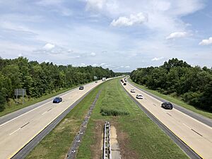
Kent County has many important roads and ways to travel.
Major Roads
Here are some of the main highways in Kent County:
 US 13
US 13 US 113
 DE 1
DE 1 DE 6
DE 6 DE 8
DE 8 DE 9
DE 9 DE 10
DE 10 DE 11
DE 11 DE 12
DE 12 DE 14
DE 14 DE 15
DE 15 DE 16
DE 16 DE 42
DE 42 DE 44
DE 44 DE 300
Train Lines
The Delmarva Central Railroad runs freight (cargo) trains through Kent County. One line goes north to south, passing through towns like Dover and Harrington. Another line branches off and goes east to Houston and Milford. There are no passenger trains for people to ride in the county.
Public Buses
DART First State provides bus services in Kent County. There are local bus routes that serve the Dover area. You can also take buses to other cities like Wilmington and Georgetown. During certain times of the year, there are buses that go to popular beach towns like Lewes and Rehoboth Beach.
Airports
Kent County has several airports, including ones for public use and a military base:
- Chandelle Estates Airport in Dover
- Chorman Airport in Farmington
- Dover Air Force Base in Dover
- Delaware Airpark in Cheswold
- Henderson Aviation Airport in Felton
- Jenkins Airport in Wyoming
- Smyrna Airport in Smyrna
People of Kent County
| Historical population | |||
|---|---|---|---|
| Census | Pop. | %± | |
| 1790 | 18,920 | — | |
| 1800 | 19,554 | 3.4% | |
| 1810 | 20,495 | 4.8% | |
| 1820 | 20,793 | 1.5% | |
| 1830 | 19,913 | −4.2% | |
| 1840 | 19,872 | −0.2% | |
| 1850 | 22,816 | 14.8% | |
| 1860 | 27,804 | 21.9% | |
| 1870 | 29,804 | 7.2% | |
| 1880 | 32,874 | 10.3% | |
| 1890 | 32,664 | −0.6% | |
| 1900 | 32,762 | 0.3% | |
| 1910 | 32,721 | −0.1% | |
| 1920 | 31,023 | −5.2% | |
| 1930 | 31,841 | 2.6% | |
| 1940 | 34,441 | 8.2% | |
| 1950 | 37,870 | 10.0% | |
| 1960 | 65,651 | 73.4% | |
| 1970 | 81,892 | 24.7% | |
| 1980 | 98,219 | 19.9% | |
| 1990 | 110,993 | 13.0% | |
| 2000 | 126,697 | 14.1% | |
| 2010 | 162,310 | 28.1% | |
| 2020 | 181,851 | 12.0% | |
| 2023 (est.) | 189,789 | 16.9% | |
| U.S. Decennial Census 1790-1960 1900-1990 1990-2000 2010-2020 |
|||
Population Facts
In 2020, Kent County had 181,851 people. The population has grown a lot over the years. For example, in 1790, there were about 18,920 people.
In 2021, most people in Kent County were white (58.8% non-Hispanic white). About 28.4% were Black or African American. Other groups included Asian (2.4%), Native American (0.8%), and Pacific Islander (0.1%). About 4.1% of people were of two or more races. People of Hispanic or Latino origin made up 7.8% of the population.
The average household in 2021 had about 2.63 people. The median household income was $63,715. This means half of the households earned more than this amount, and half earned less.
Amish Community
Kent County is home to an Amish community. These are people who live a simple life, often without modern technology. They live west of Dover. There are about 1,650 Amish people in this area. The Amish first settled here in 1915.
You can find several Amish businesses in the area. They sell things like food, furniture, quilts, and handmade crafts. Every September, a big bike ride called the Amish Country Bike Tour happens here. It is one of the largest cycling events in Delaware. However, as more buildings are built, the number of Amish people living in the community has slowly decreased.
Communities in Kent County
Cities
- Dover
- Harrington
- Milford (partly in Sussex County)
Towns
Census-Designated Places
These are areas that are like towns but are not officially incorporated as one.
Unincorporated Areas
These are small communities that are not part of any city or town.
Education in Kent County
Kent County has several school districts for younger students:
- Caesar Rodney School District
- Capital School District
- Lake Forest School District
- Milford School District
- Smyrna School District
- Woodbridge School District
For higher education, there is:
Wesley College joined DSU in 2021.
See also
 In Spanish: Condado de Kent (Delaware) para niños
 | Jackie Robinson |
 | Jack Johnson |
 | Althea Gibson |
 | Arthur Ashe |
 | Muhammad Ali |


