Cape May County, New Jersey facts for kids
Quick facts for kids
Cape May County
|
|||
|---|---|---|---|
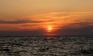
Sunset on Sunset Beach in Lower Township in May 2009
|
|||
|
|||
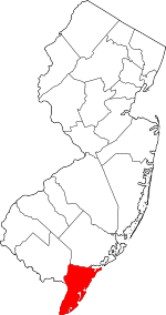
Location within the U.S. state of New Jersey
|
|||
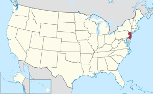 New Jersey's location within the U.S. |
|||
| Country | |||
| State | |||
| Founded | 1685 | ||
| Named for | Cornelius Jacobsen Mey | ||
| Seat | Cape May Court House | ||
| Largest municipality | Lower Township (population) Middle Township (area) |
||
| Area | |||
| • Total | 620.31 sq mi (1,606.6 km2) | ||
| • Land | 251.52 sq mi (651.4 km2) | ||
| • Water | 368.79 sq mi (955.2 km2) 59.5% | ||
| Population
(2020)
|
|||
| • Total | 95,263 | ||
| • Estimate
(2023)
|
94,610 |
||
| • Density | 153.5732/sq mi (59.2949/km2) | ||
| Time zone | UTC−5 (Eastern) | ||
| • Summer (DST) | UTC−4 (EDT) | ||
| Congressional district | 2nd | ||
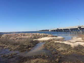
Cape May County is the southernmost county in the U.S. state of New Jersey. It sits on the Cape May peninsula. The Delaware Bay is to its west, and the Atlantic Ocean is to its south and east. Along the Atlantic coast are five barrier islands. These islands have become popular seaside resorts.
Cape May County is a very popular summer spot. It has over 30 miles (48 km) of beaches. Many people from New Jersey and nearby states visit here. In summer, the population can grow to over 750,000 people. Tourism is the county's biggest industry. It brings in billions of dollars each year. The businesses that support tourism, like hotels and restaurants, are the largest employers. The main town for the county government is Cape May Court House. This area is part of both the Jersey Shore and South Jersey regions.
In 2020, the county had 95,263 people. This makes it the second-least populated county in New Jersey. The county is part of the Ocean City, NJ metropolitan area. It is also part of the larger Philadelphia-Reading-Camden combined area.
Before Europeans arrived, the Kechemeche tribe of the Lenape Native Americans lived here. European explorers began buying land in the early 1600s. The county is named after Cornelius Jacobsen Mey. He was a Dutch captain who explored the area in 1620-1621. Cape May County was officially formed in 1685. Cape May (originally Cape Island) was founded in 1690. It is known as America's oldest seaside resort.
The county was divided into three townships in 1798. These were Lower, Middle, and Upper. Other towns were created between 1827 and 1928. The first railroad opened in 1863. It helped transport farm crops and later brought many tourists to the coastal resorts. The Garden State Parkway opened in 1956. This highway made it easier for cars to reach the county.
Lower Township had the most residents in 2020. Middle Township is the largest in terms of land area.
Contents
History of Cape May County
Early Beginnings
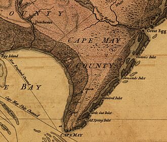
Before Europeans came, the Lenape people lived in South Jersey. The Kechemeche tribe traveled to the barrier islands in summer. They would hunt and fish there. In the 1600s, different European countries claimed this land. These included the Dutch, Swedish, and British.
On August 28, 1609, English explorer Henry Hudson visited the Delaware Bay. He spent one day on land near what is now Cape May Point. The southern tip of New Jersey was called Cape Maey by 1666. It was named after Dutch explorer Cornelius Jacobsen May. He sailed along the New Jersey coast in 1620-1621.
Around 1630, the Dutch West India Company bought land from the native people. They bought more land later. Because there were many whales, the Dutch founded Town Bank around 1640. This was a whaling village along the Delaware Bay. It was the first European settlement in Cape May County.
County Formation and Growth
In 1685, Cape May County was separated from Burlington County. At that time, Burlington County covered most of South Jersey. In 1690, a new settlement began at Cape Island. This place is now known as Cape May. As whaling became less important, Cape May grew. Town Bank became less important and was mostly washed away by 1750.
In 1692, Cape May County became one of the first four counties of West Jersey. Its borders were adjusted over the next two centuries. The first water mill in the county was built in 1699 in Cold Spring. Early churches and homes in Cold Spring served as centers for the county government.
In 1744, the county chose Romney Marsh as its center. This place is now called Cape May Court House. The first jail and courthouse were built there in 1764. By 1750, about 1,000 people lived in the county. It was quite isolated by forests. Cape May became known as America's oldest bathing resort by 1765. Its motto today is "The Nation's Oldest Seashore Resort."
During the American Revolutionary War, a battle happened here. On June 29, 1776, two British ships attacked the American ship Nancy. The Nancy fled to Turtle Gut Inlet (now in Wildwood Crest). The Americans abandoned and blew up their ship. This killed many British sailors. This was the only Revolutionary War battle in the county.
Modern Development
On February 21, 1798, Cape May County was divided into three townships. These were Lower, Middle, and Upper. During the War of 1812, British forces raided farms for food. In response, locals dug canals to the ocean. This made the water salty and undrinkable for the British.
In 1827, Dennis Township was created from parts of Upper Township. The oldest independent town in the county was Cape Island Borough in 1848. It became the city of Cape May in 1869. Over the next 60 years, transportation improved. Most of the county's current towns were created during this time.
Many towns were founded as resorts. Ocean City was founded in 1879 as a religious retreat. Sea Isle City started in 1882. Avalon was established in 1887. Woodbine was founded in 1891. It was an agriculture settlement for Russian Jews escaping religious persecution.
During World War II, the Cape May Canal was built. It connected the Delaware Bay and Cape May Harbor in 1943. The Garden State Parkway opened in 1955. This brought many tourists and new residents. Since the 1970s, the mainland has grown more developed. This is because building on the barrier islands is expensive.
Geography and Climate
Land and Water
Cape May County is about 29 miles (47 km) long. It is 15 miles (24 km) wide at its widest point. The U.S. Census Bureau says the county has a total area of 620.31 square miles (1,606.6 km2). About 40.5% of this is land, and 59.5% is water.
The county is about 150 miles (240 km) south of New York City. It is 80 miles (130 km) southeast of Philadelphia. The Atlantic Ocean is to the south and east. Being near the water gives the county milder temperatures. It also has a constant breeze. These factors help its tourism economy. The lowest point is sea level along the coast. The highest points are about 60 feet (18 m) above sea level. These are in Belleplain State Forest.
The county is mostly flat and coastal. Much of it is on the Cape May Peninsula. This peninsula is part of the Atlantic coastal plain. To the west is the Delaware Bay. To the east are marshes and water channels. These make up the Intracoastal Waterway. The county has over 1,574 miles (2,533 km) of streams and rivers. The Great Egg Harbor River covers the northern part. There are also many ponds, lakes, bays, and reservoirs.
There are five barrier islands. They are about 32 miles (51 km) long in total. These islands are next to the mainland. They have gently-sloped beaches and are mostly developed.
Weather Patterns
| Weather chart for Cape May Court House, New Jersey | |||||||||||||||||||||||||||||||||||||||||||||||
|---|---|---|---|---|---|---|---|---|---|---|---|---|---|---|---|---|---|---|---|---|---|---|---|---|---|---|---|---|---|---|---|---|---|---|---|---|---|---|---|---|---|---|---|---|---|---|---|
| J | F | M | A | M | J | J | A | S | O | N | D | ||||||||||||||||||||||||||||||||||||
|
3.3
42
28
|
2.9
44
29
|
4.3
51
35
|
3.5
61
44
|
3.5
70
53
|
3.4
79
63
|
3.7
85
68
|
3.6
83
67
|
3.3
78
61
|
3.7
67
50
|
3.3
57
41
|
3.5
47
32
|
||||||||||||||||||||||||||||||||||||
| temperatures in °F precipitation totals in inches source: The Weather Channel |
|||||||||||||||||||||||||||||||||||||||||||||||
|
Metric conversion
|
|||||||||||||||||||||||||||||||||||||||||||||||
Cape May County has a moderate climate. This is because it is on the coast and is New Jersey's southernmost county. Summers are often 3–5 degrees cooler than nearby areas. Winters are 5–10 degrees warmer. The average temperatures in Cape May Court House range from 22°F (−6°C) in January to 85°F (29°C) in July. The county gets about 40 inches (1,000 mm) of rain each year. It usually gets 10 to 15 inches (25 to 38 cm) of snow. This is much less than the mountains of New Jersey. The county has windy conditions all year.
Because it is on the coast, Cape May County has been affected by tropical cyclones for centuries. A very strong hurricane hit the area in 1821. It was estimated to be a Category 4 storm. If a similar storm hit today, it could cause over $1 billion in damage here. Hurricane Gloria in 1985 brought winds of 101 mph (163 km/h). Hurricane Sandy hit in 2012. It caused at least $150 million in damage in the county. Sandy brought the highest tide ever recorded at the Cape May–Lewes Ferry terminal.
Other storms have also caused damage. In March 1962, a coastal storm caused very high tides. This damaged boardwalks in Cape May, Avalon, and Sea Isle City. The 1991 Perfect Storm also caused high tides and beach erosion. In January 2016, a blizzard called "Winter Storm Jonas" brought record high tides. Nearly every town in the county reported damage. Beaches were severely eroded. Since 1950, ten tornadoes have also touched down in the county.
Wildlife and Nature
Cape May County is home to many migratory birds. It is one of the largest gathering spots for them in North America. Nearly 900,000 migratory birds were seen in Avalon in 1995. Along the Delaware Bay, up to 1.5 million birds pass through each spring. The Stone Harbor Bird Sanctuary was created in 1947. It is a National Natural Landmark.
Besides 151 bird species, the county's waters have two types of whales. They also have loggerhead sea turtles, northern pine snakes, and two types of treefrogs. The tiger salamander also lives here. Eight types of fish and four types of shellfish are found in the coastal waters.
About 30% of the county is covered by forests. These forests provide homes for birds like the barred owl and red-shouldered hawk. They also support insects and migratory birds. The county's swampy areas have over 20 types of trees and 40 types of shrubs. About 42% of the county is wetlands. The marshes have plants like the common reed and smooth cordgrass. On the beaches, American beachgrass helps form sand dunes.
The county gets its fresh water from five underground aquifers. Strong storms can cause saltwater to get into these freshwater supplies. West Cape May used to call itself the "lima bean capital of the world." This was because of its good growing conditions. The city still has an annual lima bean festival.
Geology
The oldest rocks in the county are very deep, about 5,000 feet (1,500 m) down. They formed during the Precambrian era. These are metamorphic rocks like gneiss and quartzite. During the Paleozoic era, this area was part of a large mountain range. Over time, erosion formed valleys that collected sediment.
Later, during the Paleocene and Eocene periods, and the Miocene period, Cape May County was underwater. The coastline changed again during the Quaternary period. During a warm period between ice ages, melting glaciers formed rivers. These rivers carried sediment to the coast. The Great Egg Harbor River once formed a delta that covered much of the county with sediment.
During the most recent ice age, sea levels were much lower. Around 14,000 years ago, glaciers began melting. This led to the formation of Cape May County's barrier islands. They likely formed from sand spits and lines of dunes.
Population and People
| Historical population | |||
|---|---|---|---|
| Census | Pop. | %± | |
| 1790 | 2,571 | — | |
| 1800 | 3,066 | 19.3% | |
| 1810 | 3,632 | 18.5% | |
| 1820 | 4,265 | 17.4% | |
| 1830 | 4,936 | 15.7% | |
| 1840 | 5,324 | 7.9% | |
| 1850 | 6,433 | 20.8% | |
| 1860 | 7,130 | 10.8% | |
| 1870 | 8,349 | 17.1% | |
| 1880 | 9,765 | 17.0% | |
| 1890 | 11,268 | 15.4% | |
| 1900 | 13,201 | 17.2% | |
| 1910 | 19,745 | 49.6% | |
| 1920 | 19,460 | −1.4% | |
| 1930 | 29,486 | 51.5% | |
| 1940 | 28,919 | −1.9% | |
| 1950 | 37,131 | 28.4% | |
| 1960 | 48,555 | 30.8% | |
| 1970 | 59,554 | 22.7% | |
| 1980 | 82,266 | 38.1% | |
| 1990 | 95,089 | 15.6% | |
| 2000 | 102,326 | 7.6% | |
| 2010 | 97,265 | −4.9% | |
| 2020 | 95,263 | −2.1% | |
| 2023 (est.) | 94,610 | −2.7% | |
| Historical sources: 1790-1990 1970-2010 2000 2010 2020 |
|||
2020 Census Information
In 2020, Cape May County had 95,263 people. There were 40,939 households and 26,792 families. The population density was about 379 people per square mile (146 people/km2). Most residents, 85.6%, were White. About 3.74% were African American, and 0.95% were Asian. People of Hispanic or Latino background made up 7.83% of the population.
About 23.8% of households had children under 18. The average household had 2.19 people. The average family had 2.70 people. The median age in the county was 50.5 years old. This means half the people were older than 50.5, and half were younger.
The median household income was $69,980. The median family income was $83,695. About 8.8% of the population lived below the poverty line. This included 14.2% of those under 18.
Housing and Income
In 2010, there were 98,365 houses in the county. Only about 42% of these were lived in all year. The county has 47 campgrounds with almost 18,000 campsites. This is more than all other counties in New Jersey combined. There are also 18,700 hotel rooms.
In 2013, the median household income was $57,168. This was one of the lowest in New Jersey. About 10% of residents lived below the federal poverty line. Many residents are considered "ALICE." This means they are working but still struggle to afford basic needs.
Economy and Jobs
The main jobs in Cape May County are in hotels, food service, retail, healthcare, arts, entertainment, and construction. In the past, whaling and farming were important. But in the 1800s, seasonal resorts became popular. These older industries are still part of the economy today.
The largest employer is Morey's Piers, which hires 1,500 people. Cape Regional Medical Center employs over 1,000 people. More than 10,000 people work in the hospitality sector. The unemployment rate changes a lot. It is highest in winter and lowest in summer. This shows how much the county depends on seasonal tourism jobs.
In 2021, the county's total economic output was $5.0 billion. This ranked 19th in the state.
Tourism is Key

Tourism is the biggest industry in Cape May County. This is because of its beaches and location between the Delaware Bay and the Atlantic Ocean. In summer, tourists often outnumber local residents by 9 to 1. Many tourists come from the Greater Philadelphia area, North Jersey, New York, and Québec, Canada.
Some towns, like North Wildwood, Wildwood, and Wildwood Crest, have an extra 2% tourism sales tax. This money helps promote tourism.
Since 1968, the county has worked to attract tourists from Canada. They even had a tourism office in Montreal. Many Canadian visitors are French-speaking. They often visit in late July. Most stay in hotels in The Wildwoods or campgrounds on the mainland.
Many popular beaches in Cape May County require beach tags. These are small fees to access the beach. They help pay for safety and maintenance. In 2016, six towns collected $10 million from beach tags. Ocean City made the most money, $4.1 million. Some beaches, like those in Strathmere and The Wildwoods, offer free public access.
Fishing and Farming
Fishing has been important since the 1600s. The first European settlement was a whaling village. By the mid-1700s, too much whaling reduced the whale population. In the early 1800s, shipbuilding was a key industry.
Today, fishing is still a big part of the economy. In 2016, the ports of Cape May and Wildwood were the ninth largest commercial fishing ports in the U.S. They were the second largest on the East Coast. Fishermen brought in 47 million pounds (21 million kg) of seafood. This was worth $85 million. Scallops are the main catch.
Farming became important in the 1800s. About 40% of the county's land was used for farming. The first freight railroad in 1863 helped this industry. Farming was a major part of the economy until the 1960s. West Cape May still has an annual lima bean festival.
Education in Cape May County
There are 16 school districts in Cape May County. Two of them are countywide.
School Districts
- K-12 Schools:
* Cape May County Special Services School District (for special education) * Middle Township Public Schools * Ocean City School District * Wildwood City School District
- High Schools Only:
* Cape May County Technical School District (countywide) * Lower Cape May Regional School District
- Elementary Schools (K-8, some K-6):
* Avalon School District * Cape May City School District (K-6) * Dennis Township Public Schools * Lower Township School District (K-6) * North Wildwood School District * Stone Harbor School District * Upper Township School District * West Cape May School District (K-6) * Woodbine School District * Wildwood Crest School District
There are 25 public elementary and middle schools. There are also five public high schools:
- Cape May County Technical High School
- Lower Cape May Regional High School
- Middle Township High School
- Ocean City High School
- Wildwood High School
Private Schools
There are also nine private schools in the county. These include:
- Bishop McHugh Regional Catholic School (Catholic)
- Cape Christian Academy (Christian)
- Cape Trinity Catholic School (Catholic)
- Wildwood Catholic Academy (Catholic)
Higher Education and Libraries
In 2013, 31% of county residents had at least a bachelor's degree. Almost 90% had a high school diploma. Atlantic Cape Community College started offering classes here in 1973. A full campus opened in Cape May Court House in 2005. The college works with other universities like Rutgers University.
The Cape May County Library has several locations. These include Cape May, Cape May Court House, and Wildwood Crest. Ocean City also has its own library.
Services and Infrastructure
Cape Regional Medical Center is the only hospital in the county. It opened in 1950. It has 242 beds and over 1,000 staff members. It serves both residents and tourists. AtlantiCare has also opened two urgent care centers here.
The Beesley's Point Generating Station was a power plant in Upper Township. It used to generate electricity from coal. There are plans for green energy projects. One is the Delaware Wind Energy Area. It is about 16 miles (26 km) southeast of Cape May. Wind turbines there could generate a lot of electricity.
Towns and Communities
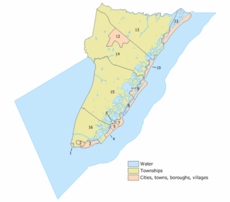
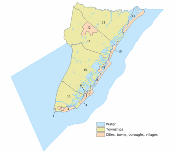
Cape May County has many towns and communities. Here are some of them:
| Municipality (with map key) |
Municipal type |
Population | Housing Units |
Total Area |
Water Area |
Land Area |
Pop. Density |
Housing Density |
Communities |
|---|---|---|---|---|---|---|---|---|---|
| Avalon (9) | borough | 1,334 | 5,434 | 4.93 | 0.77 | 4.15 | 321.3 | 1,308.8 | |
| Cape May (3) | city | 3,607 | 4,155 | 2.74 | 0.34 | 2.40 | 1,500.6 | 1,728.5 | |
| Cape May Point (1) | borough | 291 | 619 | 0.31 | 0.02 | 0.30 | 984.5 | 2,094.2 | |
| Dennis Township (14) | township | 6,467 | 2,672 | 64.33 | 3.53 | 60.80 | 106.4 | 43.9 | Belleplain CDP (597) Clermont Dennisville Ocean View South Dennis South Seaville |
| Lower Township (16) | township | 22,866 | 14,507 | 31.01 | 3.27 | 27.74 | 824.3 | 523.0 | Diamond Beach CDP (136) Erma CDP (2,134) Miami Beach North Cape May CDP (3,226) Villas CDP (1,483) |
| Middle Township (15) | township | 18,911 | 9,296 | 82.96 | 12.62 | 70.33 | 268.9 | 132.2 | Burleigh CDP (725) Cape May Court House CDP (5,338) Dias Creek Goshen Green Creek Mayville Nummytown Rio Grande CDP (2,670) Swainton Whitesboro CDP (2,205) |
| North Wildwood (7) | city | 4,041 | 8,840 | 2.13 | 0.38 | 1.75 | 2,305.8 | 5,044.1 | |
| Ocean City (11) | city | 11,701 | 20,871 | 10.80 | 4.46 | 6.33 | 1,847.7 | 3,295.7 | |
| Sea Isle City (10) | city | 2,114 | 6,900 | 2.53 | 0.36 | 2.17 | 974.5 | 3,180.8 | |
| Stone Harbor (8) | borough | 866 | 3,247 | 1.96 | 0.56 | 1.40 | 619.6 | 2,323.3 | |
| Upper Township (13) | township | 12,373 | 6,341 | 68.69 | 6.54 | 62.15 | 199.1 | 102.0 | Beesley's Point Marmora Palermo Strathmere CDP (158) Tuckahoe |
| West Cape May (2) | borough | 1,024 | 1,043 | 1.18 | 0.01 | 1.17 | 878.8 | 895.1 | |
| West Wildwood (6) | borough | 603 | 893 | 0.35 | 0.07 | 0.28 | 2,188.4 | 3,240.9 | |
| Wildwood (5) | city | 5,325 | 6,843 | 1.39 | 0.09 | 1.30 | 4,082.0 | 5,245.7 | |
| Wildwood Crest (4) | borough | 3,270 | 5,569 | 1.31 | 0.18 | 1.13 | 2,884.0 | 4,911.6 | |
| Woodbine (12) | borough | 2,472 | 1,079 | 8.02 | 0.00 | 8.02 | 308.2 | 134.5 | |
| Cape May | county | 97,265 | 98,309 | 620.42 | 368.99 | 251.42 | 386.9 | 391.0 |
Fun and Recreation
Cape May County Park & Zoo is located in Cape May Court House.
Parks and Open Spaces

As of 2015, almost half of the land in Cape May County is protected open space. In 1989, voters approved a tax to preserve open spaces. This program has spent $65 million to protect land, farms, and historic sites.
Belleplain State Forest was created in 1928. It has over 21,254 acres (8,601 ha) of pine, oak, and cedar trees. Corson's Inlet State Park was established in 1969. It protects one of the last undeveloped areas along the Jersey Shore. Cape May Point State Park opened in 1974. There are also 10 wildlife management areas in the county.
In 1942, land was given to the county for a park. This became Park Central. In 1978, the Cape May County Park & Zoo was created within Park Central. It is now over 200 acres (81 ha) and has 250 animal species. Other parks include Park East, Park North (Richard M. Cameron Wildlife Sanctuary), and Park South (Fishing Creek Wildlife Preserve).
The New Jersey Pinelands National Reserve was created in 1978. It is a large protected area in South Jersey. It spans seven counties, including Cape May. The Pinelands Commission manages growth in the Pine Barrens. In 1989, the Cape May National Wildlife Refuge was established. It protects important wildlife habitats.
Local Drinks
Cape May County has several breweries, distilleries, and wineries.
- Breweries: Cape May Brewing Company opened in 2011. It became the third-largest brewer in New Jersey by 2015. Other breweries include Slack Tide Brew, Cold Spring Brewing, and Mudhen Brewery.
- Distilleries: Lazy Eye Distillery was the first to open since the Prohibition era. Cape May Distillery and Nauti Spirits also operate here.
- Wineries: The area is good for growing grapes. There are six wineries in the county. Cape May Winery & Vineyard opened in 1995. Other wineries include Turdo Vineyards & Winery and Hawk Haven Vineyard & Winery.
Getting Around Cape May County
Native Americans created trails across Cape May County long ago. In 1695, the first ferry service started across the Great Egg Harbor Bay. A road from Cape May to Burlington was built between 1697 and 1707. Early roads were often made of logs in wet areas.
In 1863, the Cape May and Millville Railroad opened. This connected the county to other areas faster. It helped transport farm goods and brought more people to the coastal resorts. By 1892, most of the county was reachable by train.
In 1916, New Jersey created its state highway system. The road between Cape May and Seaville became U.S. Route 9. The Beesley's Point Bridge opened in 1928. It connected Cape May County with Atlantic County. From 1934 to 1946, five toll bridges were built. These connected the barrier islands to the mainland and to each other.
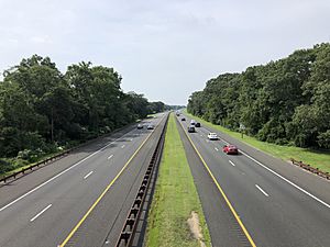
The Great Egg Harbor Bridge opened in 1956. It connected the county to the Garden State Parkway. This highway brings hundreds of thousands of people to the county in summer. The parkway runs through the entire county. Its southern end, called Exit Zero, is in Lower Township. The Cape May–Lewes Ferry started in 1964. It carries cars and people across the Delaware Bay.
The county has over 1,036 miles (1,667 km) of roads. Local towns maintain most of them. The county owns 23 bridges. These include causeways and bridges connecting the barrier islands.
Public transportation is limited. NJ Transit buses operate several lines in and out of the county. The Great American Trolley Company runs private trolleys in Cape May and the Wildwoods. The county also has a free transportation system for some residents.
There are three airports in the county. Ocean City Municipal Airport opened in 1937. Cape May Airport opened in 1941. Woodbine Municipal Airport opened in 1945. In 2009, the Ocean City area had one of the highest percentages of people who walked to work in the United States.
See also
 In Spanish: Condado de Cape May para niños
 | Jackie Robinson |
 | Jack Johnson |
 | Althea Gibson |
 | Arthur Ashe |
 | Muhammad Ali |


