
Cape May Point, New Jersey facts for kids
Quick facts for kids
Cape May Point, New Jersey
|
||
|---|---|---|
|
Borough
|
||

Saint Peter's-By-The-Sea Episcopal Church
|
||
|
||

Location of Cape May Point in Cape May County highlighted in red (left). Inset map: Location of Cape May County in New Jersey highlighted in orange (right).
|
||

Census Bureau map of Cape May Point, New Jersey
|
||

Cape May Point, New Jersey
Location in Cape May County, New Jersey

Cape May Point, New Jersey
Location in New Jersey

Cape May Point, New Jersey
Location in the United States
|
||
| Country | ||
| State | ||
| County | ||
| Incorporated | April 19, 1878 | |
| Named for | Cape May / Cornelius Jacobsen May | |
| Government | ||
| • Type | Walsh Act | |
| • Body | Board of Commissioners | |
| Area | ||
| • Total | 0.31 sq mi (0.81 km2) | |
| • Land | 0.29 sq mi (0.76 km2) | |
| • Water | 0.02 sq mi (0.05 km2) 5.81% | |
| Area rank | 553rd of 565 in state 16th of 16 in county |
|
| Elevation | 7 ft (2 m) | |
| Population
(2020)
|
||
| • Total | 305 | |
| • Estimate
(2023)
|
299 | |
| • Rank | 560th of 565 in state 16th of 16 in county |
|
| • Density | 1,034.0/sq mi (399.2/km2) | |
| • Density rank | 380th of 565 in state 7th of 16 in county |
|
| Time zone | UTC−05:00 (Eastern (EST)) | |
| • Summer (DST) | UTC−04:00 (Eastern (EDT)) | |
| ZIP Code |
08212
|
|
| Area code(s) | 609 exchanges: 884, 898 | |
| FIPS code | 3400910330 | |
| GNIS feature ID | 0885179 | |

Cape May Point is a small borough located at the very tip of the Cape May Peninsula in Cape May County, New Jersey. It's a quiet place, especially known for its natural beauty and history.
Even though it's small, Cape May Point is part of the larger Philadelphia metropolitan area. In 2020, about 305 people lived here. But in the summer, the population can grow to around 4,500 visitors!
The famous Cape May Light lighthouse is very close by. It's so important to Cape May Point that the town uses the lighthouse as its logo on official vehicles.
Cape May Point is also known as a "dry town." This means that selling alcohol is not allowed by law. It's one of only three towns in Cape May County where this rule is still in place.
Contents
- History of Cape May Point
- Geography of Cape May Point
- What Is Cape May Point Like?
- Population and People of Cape May Point
- Education in Cape May Point
- Transportation in Cape May Point
- Climate and Weather in Cape May Point
- Places to Visit in Cape May Point
- Famous People from Cape May Point
- Images for kids
- See also
History of Cape May Point
Cape May Point has an interesting past. It was first called Stites Beach. Then, in 1876, its name changed to Seagrove.
When Was Cape May Point Established?
The town officially became a borough on April 19, 1878. This happened after people voted for it. It was created from parts of Lower Township. The name "Cape May" comes from a Dutch captain named Cornelius Jacobsen May. He explored and mapped this area between 1611 and 1614.
What Historical Sites Can You Find?
Near the coast of Cape May Point, you can see the remains of the SS Atlantus. This was a World War I-era ship made of concrete! It's located next to Sunset Beach.
Geography of Cape May Point

Cape May Point is a very small place. According to the United States Census Bureau, it covers about 0.31 square miles (0.81 square kilometers). Most of this area is land, with a small part being water.
The borough is next to Lower Township, the Atlantic Ocean, and Delaware Bay. This location makes it a great spot for enjoying the coast.
What Is Cape May Point Like?
Cape May Point is mostly made up of houses. In 2004, there were about 600 homes. The prices of houses here have gone up over time. By 2004, a four-bedroom house could cost around $1 million.
Most houses are built on small lots, about 50 by 100 feet. They are also usually smaller than 2,100 square feet. This is because of the town's building rules. The houses look "relatively modest" and don't have the fancy designs you might see in other parts of Cape May.
In 2004, there were only two businesses in Cape May Point. These were the Cape May Bird Observatory bird shop and the Cape May Point General Store.
Population and People of Cape May Point
The number of people living in Cape May Point has changed over the years.
| Historical population | |||
|---|---|---|---|
| Census | Pop. | %± | |
| 1880 | 198 | — | |
| 1890 | 167 | −15.7% | |
| 1900 | 153 | −8.4% | |
| 1910 | 162 | 5.9% | |
| 1920 | 121 | −25.3% | |
| 1930 | 104 | −14.0% | |
| 1940 | 126 | 21.2% | |
| 1950 | 198 | 57.1% | |
| 1960 | 263 | 32.8% | |
| 1970 | 204 | −22.4% | |
| 1980 | 255 | 25.0% | |
| 1990 | 248 | −2.7% | |
| 2000 | 241 | −2.8% | |
| 2010 | 291 | 20.7% | |
| 2020 | 305 | 4.8% | |
| 2023 (est.) | 299 | 2.7% | |
| Population sources:1880–2000 1880–1920 1880–1890 1890-1910 1910–1930 1940–2000 2010> 2020 |
|||
What Was the Population in 2010?
The 2010 United States census counted 291 people living in Cape May Point. There were 164 households, which means groups of people living together. Most people were White (94.50%). A small number were Black or African American (2.75%) or from other backgrounds.
The average age of people in Cape May Point was 66.4 years old. More than half of the population (55.7%) was 65 years or older. This shows it's a popular place for older adults.
Education in Cape May Point
_2.jpg)
Cape May Point has a unique school system. The Cape May Point School District does not operate its own schools anymore. Instead, all students go to schools outside the district.
Where Do Students Go to School?
- For younger students (pre-kindergarten through sixth grade), public school students attend Cape May City Elementary School. This is in Cape May City.
- For older students (seventh through twelfth grades), public school students attend schools in the Lower Cape May Regional School District. This district also serves students from Cape May City, Lower Township, and West Cape May.
- The middle school is Richard M. Teitelman Middle School (grades 7-8).
- The high school is Lower Cape May Regional High School (grades 9-12).
Students can also choose to attend Cape May County Technical High School. This school offers special programs for students from the entire county.
Transportation in Cape May Point
_just_north_of_Cape_May_County_Route_651_(Lincoln_Avenue)_in_Cape_May_Point,_Cape_May_County,_New_Jersey.jpg)
Cape May Point has about 7.39 miles of roads. Most of these roads are maintained by the town itself.
There are no large highways like Interstates or U.S. routes that go through Cape May Point. The main roads are smaller county routes, such as County Route 629.
Climate and Weather in Cape May Point
Cape May Point has a humid subtropical climate. This means it has hot, somewhat humid summers and cool winters. It rains throughout the year.
What Are Summers Like?
In summer, a cool sea breeze often blows in the afternoon. This helps to keep things comfortable. However, sometimes it can get very hot and humid.
What Are Winters Like?
In winter, it can get very cold and windy. The average snowfall from November to April is about 12 inches (30 cm). February is usually the snowiest month.
| Climate data for Cape May Point Beach, NJ (1981–2010 Averages) | |||||||||||||
|---|---|---|---|---|---|---|---|---|---|---|---|---|---|
| Month | Jan | Feb | Mar | Apr | May | Jun | Jul | Aug | Sep | Oct | Nov | Dec | Year |
| Mean daily maximum °F (°C) | 41.9 (5.5) |
43.7 (6.5) |
50.4 (10.2) |
59.4 (15.2) |
68.6 (20.3) |
77.7 (25.4) |
82.0 (27.8) |
81.1 (27.3) |
75.8 (24.3) |
66.1 (18.9) |
56.3 (13.5) |
46.7 (8.2) |
62.6 (17.0) |
| Daily mean °F (°C) | 35.3 (1.8) |
37.0 (2.8) |
43.3 (6.3) |
52.3 (11.3) |
61.4 (16.3) |
70.8 (21.6) |
75.6 (24.2) |
74.9 (23.8) |
69.5 (20.8) |
59.1 (15.1) |
49.7 (9.8) |
40.2 (4.6) |
55.8 (13.2) |
| Mean daily minimum °F (°C) | 28.6 (−1.9) |
30.2 (−1.0) |
36.3 (2.4) |
45.3 (7.4) |
54.2 (12.3) |
63.8 (17.7) |
69.1 (20.6) |
68.6 (20.3) |
63.1 (17.3) |
52.2 (11.2) |
43.0 (6.1) |
33.8 (1.0) |
49.1 (9.5) |
| Average precipitation inches (mm) | 3.36 (85) |
2.80 (71) |
4.16 (106) |
3.64 (92) |
3.63 (92) |
3.19 (81) |
3.79 (96) |
4.07 (103) |
3.24 (82) |
3.62 (92) |
3.23 (82) |
3.61 (92) |
42.34 (1,075) |
| Average relative humidity (%) | 68.9 | 67.7 | 66.0 | 64.5 | 68.9 | 73.0 | 72.9 | 75.4 | 72.1 | 71.0 | 69.7 | 69.4 | 70.0 |
| Average dew point °F (°C) | 26.1 (−3.3) |
27.3 (−2.6) |
32.7 (0.4) |
40.7 (4.8) |
51.1 (10.6) |
61.7 (16.5) |
66.3 (19.1) |
66.6 (19.2) |
60.1 (15.6) |
49.7 (9.8) |
40.2 (4.6) |
31.0 (−0.6) |
46.2 (7.9) |
| Source: PRISM | |||||||||||||
| Climate data for North Cape May, NJ Ocean Water Temperature (2 N Cape May Point) | |||||||||||||
|---|---|---|---|---|---|---|---|---|---|---|---|---|---|
| Month | Jan | Feb | Mar | Apr | May | Jun | Jul | Aug | Sep | Oct | Nov | Dec | Year |
| Daily mean °F (°C) | 37 (3) |
37 (3) |
42 (6) |
50 (10) |
59 (15) |
68 (20) |
73 (23) |
74 (23) |
72 (22) |
61 (16) |
52 (11) |
42 (6) |
56 (13) |
| Source: NOAA | |||||||||||||
Places to Visit in Cape May Point

One important place in Cape May Point was the Saint Mary by-the-Sea Retreat House. This was a retreat facility run by the Sisters of St. Joseph. Many people loved this landmark.
History of Saint Mary by-the-Sea
The building first opened as the Shoreham Hotel in 1889. Later, it became a nursing home. In 1909, the Sisters bought the property and named it Saint Mary. The building is large, with a "U-shape" and 38,000 square feet of space.
The Sisters announced in 2016 that they planned to close Saint Mary. The COVID-19 pandemic in New Jersey made it harder to hold retreats there. So, in 2021, the order officially closed Saint Mary.
What Is Saint Mary by-the-Sea Now?
In June 2023, the Cape May Point Science Center opened in the Saint Mary building. They bought the building in 2022.
Famous People from Cape May Point
Many interesting people have lived in or are connected to Cape May Point:
- Benjamin Harrison (1833–1901), who was the 23rd President of the United States. He was given a cottage in Cape May Point in 1890.
- Mary O'Hara (1885–1980), an author famous for her novel My Friend Flicka.
- Bill Pilczuk (born 1971), a swimmer.
- David Allen Sibley (born 1961), an ornithologist who writes and illustrates bird guides, like The Sibley Guide to Birds.
- John Wanamaker (1838–1922), a well-known retailer.
Images for kids
-
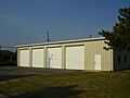
Cape May Point Public Works Complex
-
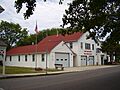
Cape May Point Volunteer Fire Company
-
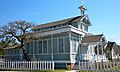
Saint Peter's-By-The-Sea Episcopal Church
-
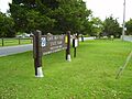
Cape May Point State Park (in Lower Township)


See also
 In Spanish: Cape May Point para niños
