Strathmere, New Jersey facts for kids
Quick facts for kids
Strathmere, New Jersey
|
|
|---|---|

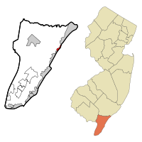
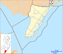
Map of Strathmere highlighted within Cape May County. Right: Location of Cape May County in New Jersey.
|
|
| Country | |
| State | |
| County | Cape May |
| Township | Upper |
| Area | |
| • Total | 0.76 sq mi (1.96 km2) |
| • Land | 0.53 sq mi (1.36 km2) |
| • Water | 0.23 sq mi (0.60 km2) 21.29% |
| Elevation | 3 ft (1 m) |
| Population
(2020)
|
|
| • Total | 137 |
| • Density | 258.5/sq mi (99.8/km2) |
| Time zone | UTC−05:00 (Eastern (EST)) |
| • Summer (DST) | UTC−04:00 (Eastern (EDT)) |
| ZIP Code |
08248
|
| Area code(s) | 609 |
| FIPS code | 34-71250 |
| GNIS feature ID | 02390365 |
Strathmere is a small community in Cape May County, New Jersey. It is part of Upper Township. In 2020, about 137 people lived there.
Strathmere is special because it has free public beaches. These beaches are watched by lifeguards. Only a few places in New Jersey offer free ocean beaches with lifeguards. Other places include Atlantic City and the Wildwood towns.
Contents
History of Strathmere
The first people known to live on Ludlam Island, where Strathmere is located, were the Lenape Native Americans. They visited the island in summer to hunt for fish and crabs.
A part of the island was once called Corson's Inlet. This name came from the waterway that separates the island from Ocean City. In 1905, Corson's Inlet was sold to Upper Township. This happened because the nearby town of Sea Isle City needed money to pay off its debts.
In 1912, the community of Corson's Inlet got a new name: Strathmere.
There's also a part of Strathmere called Whale Beach. It got its name because whales used to wash up on the shore there sometimes.
In 2007, some people in Strathmere wanted to leave Upper Township and join Sea Isle City. They felt their taxes were too high and that local services were not good enough. After many meetings, it was decided that leaving Upper Township would make school taxes go up for everyone else in Upper Township. So, Strathmere stayed part of Upper Township.
Geography of Strathmere
Strathmere is a coastal community. It has both land and water areas. The total area is about 0.76 square miles (1.96 square kilometers). Most of this is land, but a good part is water.
Population Changes
The number of people living in Strathmere has changed over the years:
- In 2000, there were 175 people.
- In 2010, the population was 158.
- In 2020, it was 137 people.
This shows that the population has slowly decreased over time.
Weather in Strathmere
Strathmere has a humid subtropical climate. This means it has hot, somewhat humid summers and cool winters. It rains throughout the year.
In summer, a cool sea breeze often blows in the afternoon. But sometimes it can get very hot and humid. In winter, it can get very cold and windy. Strathmere usually gets between 12 and 18 inches (30 to 46 cm) of snow each winter. February is often the snowiest month.
The ocean water temperature changes with the seasons. It's coldest in February (around 35°F or 2°C) and warmest in August (around 73°F or 23°C).
Schools in Strathmere
Children living in Strathmere go to schools in the Upper Township School District for kindergarten through 8th grade. For high school, students attend Ocean City High School, which is part of the Ocean City School District.
There are also county-wide schools available, like Cape May County Technical High School and Cape May County Special Services School District.
See also
 In Spanish: Strathmere para niños
 | Madam C. J. Walker |
 | Janet Emerson Bashen |
 | Annie Turnbo Malone |
 | Maggie L. Walker |


