
Whitesboro, New Jersey facts for kids
Quick facts for kids
Whitesboro, New Jersey
|
|
|---|---|

Whitesboro School
|
|

Map of the former Whitesboro-Burleigh CDP in Cape May County. Inset: Location of Cape May County in New Jersey.
|
|

Whitesboro, New Jersey
Location in Cape May County, New Jersey

Whitesboro, New Jersey
Location in New Jersey

Whitesboro, New Jersey
Location in the United States
|
|
| Country | |
| State | |
| County | Cape May |
| Township | Middle |
| Named for | George Henry White |
| Area | |
| • Total | 3.56 sq mi (9.22 km2) |
| • Land | 3.54 sq mi (9.17 km2) |
| • Water | 0.02 sq mi (0.05 km2) 0.50% |
| Elevation | 20 ft (6 m) |
| Population
(2020)
|
|
| • Total | 2,300 |
| • Density | 649.72/sq mi (250.83/km2) |
| Time zone | UTC−05:00 (Eastern (EST)) |
| • Summer (DST) | UTC−04:00 (Eastern (EDT)) |
| ZIP Code |
08252 - Cape May
|
| Area code(s) | 609 and 640 |
| FIPS code | 34-80855 |
| GNIS feature ID | 02390509 |
Whitesboro is a community in Middle Township, located in Cape May County, New Jersey. It is also known as a census-designated place (CDP). This means it is a special area defined by the government for counting people.
Before 2010, Whitesboro was part of a larger CDP called Whitesboro-Burleigh. Now, Whitesboro and Burleigh are separate CDPs. In 2020, about 2,300 people lived in Whitesboro. Whitesboro was created as a special place for African Americans. Most of the Black population in Middle Township lives here.
Contents
History of Whitesboro
Whitesboro was started around 1901 by a group called the Equitable Industrial Association. Important Black American leaders were part of this group. These leaders included the writer Paul Laurence Dunbar and the educator Booker T. Washington. The main investor and the person the town is named after was George Henry White. He was a lawyer who had been the last Black Republican congressman from North Carolina.
White and his partners wanted to build a community where Black people could live without facing unfair treatment. This was especially important because of the discrimination Black people faced in the southern states. They sold shares in this new community to African Americans from North Carolina, South Carolina, and Virginia.
Historical Discoveries
In 2006, the Johnson Family Historical Trust found an old document. It was the original deed to Whitesboro property from the George H. White Realty Company. An expert called it one of "America's Untold Treasures." The Johnson Family Historical Trust has many rare items important to Whitesboro's past. For example, they have a 1936 radio that belonged to James L. Johnson. He was a famous ham radio operator. His radios are important for understanding Whitesboro's history and the history of technology.
More than 50 historical items from the town's first investors are known. These items will be shown in Whitesboro in the future. The Johnson Family Historical Trust plans to dig for more artifacts. They will search at different historical spots in Whitesboro.
In 2024, a group called the Whitesboro Historic Preservation Project began working. They want Whitesboro to become its own independent town.
Geography of Whitesboro
Whitesboro covers about 3.6 square miles (9.4 square kilometers). Most of this area is land. Only a very small part, about 0.018 square miles (0.047 square kilometers), is water.
People in Whitesboro
| Historical population | |||
|---|---|---|---|
| Census | Pop. | %± | |
| 2010 | 2,205 | — | |
| 2020 | 2,300 | 4.3% | |
| Population sources: 2010 | |||
2010 Population Details
In 2010, there were 2,205 people living in Whitesboro. There were 870 households and 572 families. The population density was about 610 people per square mile.
The people living in Whitesboro came from different backgrounds:
- 53% were White.
- 37% were Black or African American.
- About 1% were Asian.
- About 0.5% were Native American.
- About 3% were from other races.
- About 5% were from two or more races.
- About 9% of the population was Hispanic or Latino.
In the households, 23% had children under 18. About 42% were married couples living together. About 18% were households led by a woman without a husband. About 30% of households were single people. About 18% of households had someone 65 or older living alone. The average household had 2.53 people. The average family had 3.15 people.
About 24% of the people were under 18 years old. About 21% were 65 years or older. The average age in Whitesboro was 41.5 years.
Education in Whitesboro
Whitesboro is part of the Middle Township School District. This district runs Middle Township High School.

There are also county-wide schools. These include Cape May County Technical High School. Another is the Cape May County Special Services School District. In the past, when schools were separated by race, Whitesboro had a school just for Black children. It taught students from first to eighth grade.
Notable People from Whitesboro
- Stedman Graham (born 1951): He was a great basketball player for Middle Township High School. He is now an educator, author, and businessman. He is also the longtime partner of famous media person Oprah Winfrey.
Images for kids
-
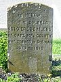
World War I memorial
-
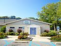
Martin Luther King Community Center
-
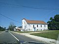
St. Stephen AME Church


See also
 In Spanish: Whitesboro (Nueva Jersey) para niños
