Turtle Gut Inlet facts for kids
Quick facts for kids Turtle Gut Inlet |
|
|---|---|

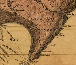
Location of Turtle Gut Inlet on 1777 map
|
|
| Coordinates | 38°57′34″N 74°51′09″W / 38.95944°N 74.85250°W |
| Type | Inlet |
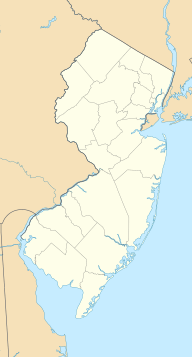
Turtle Gut Inlet was a natural waterway, called an inlet, that once existed in what is now Wildwood Crest, New Jersey. This area is part of Cape May County, New Jersey, in the United States.
Contents
What Was Turtle Gut Inlet?
An inlet is a narrow strip of water that connects a larger body of water, like an ocean, to a bay or lagoon. Turtle Gut Inlet separated two land areas: Five Mile Beach and Two Mile Beach. Today, these two beaches are connected because the inlet is gone.
Where Was It Located?
The inlet was roughly located where Diamond Beach is today. Diamond Beach is partly on what was Two Mile Beach. It also sits on land that was created after Turtle Gut Inlet closed.
A Look Back at Turtle Gut Inlet
Turtle Gut Inlet has been known for a long time. It appeared on maps as early as 1706, where it was called Turtle Inlet. Later, in 1749, another map showed it as Turtle Gutt.
The Battle of Turtle Gut Inlet
A very important event happened here in June 1776. The naval Battle of Turtle Gut Inlet was fought in this waterway and the nearby Atlantic Ocean. This was a battle during the American Revolutionary War. It was the only battle of that war to take place in Cape May County.
How the Inlet Changed
People described Turtle Gut Inlet in different ways over the years:
- In 1834, it was noted as being in Lower Township, Cape May County, between Five Mile and Two Mile Beach.
- In 1878, it was described as a small channel. This channel connected Richardson Sound and Grassy Sound with the ocean. It was said to have about three feet of water over its sandbar.
Turtle Gut Inlet eventually closed in 1922. When it closed, it made Two Mile Beach and Five Mile Beach become one continuous stretch of land. Today, Sunset Lake is a small part of what used to be Turtle Gut Inlet.
 | Laphonza Butler |
 | Daisy Bates |
 | Elizabeth Piper Ensley |


