Hartly, Delaware facts for kids
Quick facts for kids
Hartly, Delaware
|
|
|---|---|

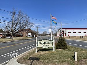
Intersection of DE 11 and DE 44 in Hartly
|
|

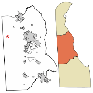
Location of Hartly in Kent County, Delaware.
|
|
| Country | |
| State | |
| County | Kent |
| Area | |
| • Total | 0.06 sq mi (0.15 km2) |
| • Land | 0.06 sq mi (0.15 km2) |
| • Water | 0.00 sq mi (0.00 km2) |
| Elevation | 69 ft (21 m) |
| Population
(2020)
|
|
| • Total | 73 |
| • Density | 1,280.70/sq mi (497.90/km2) |
| Time zone | UTC−5 (Eastern (EST)) |
| • Summer (DST) | UTC−4 (EDT) |
| ZIP code |
19953
|
| Area code(s) | 302 |
| FIPS code | 10-33250 |
| GNIS feature ID | 214061 |
Hartly is a small town in Kent County, Delaware, United States. It is part of the area around Dover. In 2020, only 73 people lived there. This makes Hartly the smallest town in Delaware!
Contents
About Hartly
Hartly is located at 39°10′07″N 75°42′48″W / 39.1687230°N 75.7132641°W. It is a very small town, covering only about 0.1 square miles (0.26 square kilometers) of land.
What You'll Find in Hartly
Hartly is found where two roads meet: Delaware Route 11 and Delaware Route 44. The town has about 31 homes. You can also find the Hartly Volunteer Fire Company, a post office, and Hartly Elementary School. There are also two daycares, a hardware store called Hartly Feed and Hardware, and a Family Dollar store.
A Look at Hartly's History
On July 21, 1983, a strong tornado hit Hartly. This tornado was rated F2 on the Fujita scale. It caused two deaths and injured nine people. This event is known as the deadliest tornado in Delaware's history.
Population Over Time
| Historical population | |||
|---|---|---|---|
| Census | Pop. | %± | |
| 1920 | 905 | — | |
| 1930 | 101 | −88.8% | |
| 1940 | 125 | 23.8% | |
| 1950 | 139 | 11.2% | |
| 1960 | 164 | 18.0% | |
| 1970 | 180 | 9.8% | |
| 1980 | 106 | −41.1% | |
| 1990 | 107 | 0.9% | |
| 2000 | 78 | −27.1% | |
| 2010 | 74 | −5.1% | |
| 2020 | 73 | −1.4% | |
| U.S. Decennial Census | |||
The number of people living in Hartly has changed a lot over the years. In 1920, there were 905 people, but by 2020, the population had dropped to 73.
Who Lives in Hartly?
In 2000, there were 78 people living in 25 households. Most people (91.03%) were White. A smaller number (3.85%) were African American. Some people (1.28%) were from other races, and 3.85% were from two or more races. About 2.56% of the population was Hispanic or Latino.
Many households (60%) had children under 18 living with them. The average household had about 3 people. The average age of people in Hartly was 28 years old.
Education in Hartly
Students in Hartly attend schools within the Capital School District. The main high school for the district is Dover High School.
Transportation and Services
Getting Around Hartly
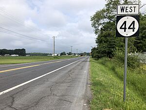
Hartly is located at the meeting point of Delaware Route 11 and Delaware Route 44. Route 11 goes southwest towards Maryland and northeast towards Kenton. Route 44 goes northwest towards Delaware Route 300 and southeast towards Delaware Route 8 in Pearsons Corner, which leads to Dover.
Utilities and Power
Delmarva Power, which is part of a company called Exelon, provides electricity to the town of Hartly. Chesapeake Utilities supplies natural gas to the homes and businesses in Hartly.
See also
 In Spanish: Hartly para niños
 | Stephanie Wilson |
 | Charles Bolden |
 | Ronald McNair |
 | Frederick D. Gregory |


