Houston, Delaware facts for kids
Quick facts for kids
Houston, Delaware
|
|
|---|---|

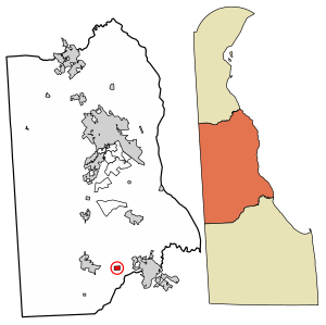
Location of Houston in Kent County, Delaware.
|
|
| Country | |
| State | |
| County | Kent |
| Area | |
| • Total | 0.38 sq mi (0.99 km2) |
| • Land | 0.38 sq mi (0.99 km2) |
| • Water | 0.00 sq mi (0.00 km2) |
| Elevation | 52 ft (16 m) |
| Population
(2020)
|
|
| • Total | 381 |
| • Density | 994.78/sq mi (383.87/km2) |
| Time zone | UTC−5 (Eastern (EST)) |
| • Summer (DST) | UTC−4 (EDT) |
| ZIP code |
19954
|
| Area code(s) | 302 |
| FIPS code | 10-36760 |
| GNIS feature ID | 214127 |
Houston (pronounced HOW-stən) is a small town in Kent County, Delaware, United States. It is part of the Dover metropolitan area, which is a larger group of towns and cities around Dover. In 2020, about 381 people lived in Houston. The town was named after John W. Houston.
Contents
Where is Houston?
According to the United States Census Bureau, Houston is a small town. It covers a total area of about 0.99 square kilometers (or 0.38 square miles). All of this area is land, meaning there are no large lakes or rivers within the town's borders.
Who Lives in Houston?
Let's look at how many people have lived in Houston over the years:
| Historical population | |||
|---|---|---|---|
| Census | Pop. | %± | |
| 1930 | 254 | — | |
| 1940 | 296 | 16.5% | |
| 1950 | 332 | 12.2% | |
| 1960 | 421 | 26.8% | |
| 1970 | 317 | −24.7% | |
| 1980 | 357 | 12.6% | |
| 1990 | 487 | 36.4% | |
| 2000 | 430 | −11.7% | |
| 2010 | 374 | −13.0% | |
| 2020 | 381 | 1.9% | |
| U.S. Decennial Census | |||
In 2000, there were 430 people living in Houston. These people lived in 151 households, and 115 of these were families. The town had about 1,144 people per square mile.
Most of the people in Houston in 2000 were White (89.30%). There were also African American residents (8.37%), Native American residents (0.70%), and people from other backgrounds. About 4.65% of the population was Hispanic or Latino.
Many households (39.7%) had children under 18 living with them. Most households (64.2%) were married couples. The average household had about 2.85 people.
The median age in Houston in 2000 was 33 years old. This means half the people were younger than 33 and half were older. About 30.5% of the population was under 18 years old.
The median income for a household in Houston was $39,545. For families, the median income was $46,563. A small number of families (1.7%) and people (5.8%) lived below the poverty line.
Education
Students in Houston attend schools that are part of the Milford School District.
Town Services and Roads
Transportation
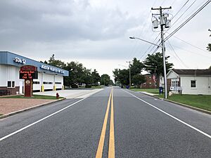
In Houston, the main streets that run from east to west are Front Street and School Street. Broad Street goes north and south through the middle of town. If you go north on Broad Street, you'll reach Delaware Route 14. This route goes west towards Harrington and east towards Milford.
Another road, Deep Grass Lane, passes to the west of Houston. It goes south towards Williamsville and north as Killens Pond Road towards Felton. The Delmarva Central Railroad also has a train line, called the Indian River Subdivision, that runs east to west through Houston.
Utilities
The company that provides electricity to Houston is Delmarva Power. They are part of a larger company called Exelon. For natural gas, the town gets its supply from Chesapeake Utilities.
See also
 In Spanish: Houston (Delaware) para niños
 | Victor J. Glover |
 | Yvonne Cagle |
 | Jeanette Epps |
 | Bernard A. Harris Jr. |


