Vallejo, California facts for kids
Quick facts for kids
Vallejo, California
|
||
|---|---|---|
|
|
||
|
||
| Nickname(s):
V-Town, The Old Capital, Valley Joe
|
||
| Motto(s):
City of Opportunity, The Naval City
|
||
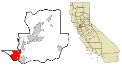
Location in Solano County and the state of California
|
||
| Country | United States | |
| State | California | |
| Region | San Francisco Bay Area | |
| County | Solano | |
| Founded | 1851 | |
| Incorporated | March 30, 1868 | |
| Government | ||
| • Type | Mayor-council | |
| Area | ||
| • Total | 48.78 sq mi (126.34 km2) | |
| • Land | 30.50 sq mi (79.01 km2) | |
| • Water | 18.27 sq mi (47.33 km2) 38.0% | |
| Elevation | 69 ft (21 m) | |
| Population
(2020)
|
||
| • Total | 126,090 | |
| • Rank | 1st in Solano County 50th in California |
|
| • Density | 2,584.9/sq mi (998.02/km2) | |
| Time zone | UTC−8 (Pacific) | |
| • Summer (DST) | UTC−7 (PDT) | |
| ZIP Codes |
94589–94592
|
|
| Area code | 707 | |
| FIPS code | 06-81666 | |
| GNIS feature IDs | 1661612, 2412142 | |
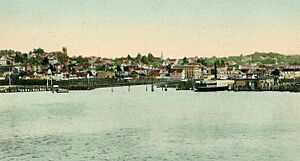
Vallejo is a city in Solano County, California. It is the second largest city in the North Bay part of the Bay Area. The city sits on the shores of San Pablo Bay. In 2020, about 126,090 people lived there.
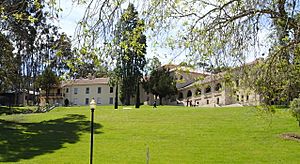
Vallejo is home to the California Maritime Academy. It also has Touro University California and the fun park Six Flags Discovery Kingdom.
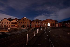
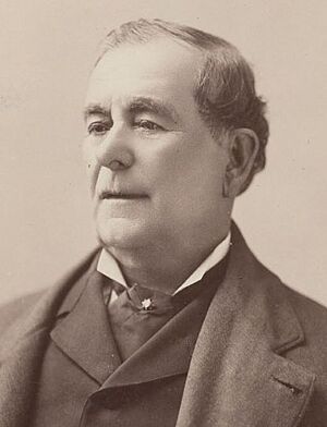
The city is named after Mariano Guadalupe Vallejo, a famous general and leader from California's past. It was started in 1851 and even served as California's capital city from 1852 to 1853. After that, the government moved to Benicia. Benicia was named after General Vallejo's wife, Benicia Carrillo de Vallejo. The Mare Island Naval Shipyard opened in 1854. This shipyard was very important to Vallejo's economy for many years.
Contents
History of Vallejo
Long ago, the area where Vallejo now stands was home to Native American tribes. These included the Coast Miwok, Suisunes, and other Patwin tribes. There are still signs of their ancient sites in the hills above Blue Rock Springs Park.
How Vallejo Began
The city of Vallejo was once part of a huge land grant called Rancho Suscol. This grant was about 84,000 acres (340 square kilometers). It was given to General Mariano Guadalupe Vallejo in 1843. The city is named after him because he was a Mexican military officer. He was in charge of settling and overseeing the North Bay region. General Vallejo helped keep peace in the area and founded the town of Sonoma in 1836.
In 1846, some Anglo immigrants wanted California to be independent from Mexico. This led to the Bear Flag Revolt. General Vallejo was even held prisoner during this time. Later, California became part of the United States. General Vallejo agreed with this change. He believed it would bring good things to California.
Vallejo as California's Capital

In 1851, Vallejo was chosen to be the official capital of California. The government planned to meet there the next year. In 1852, the lawmakers met for the first time in Vallejo. However, a proper Capitol building was not ready for them.
In 1853, they met in Vallejo again. But after only a month, they decided to move the capital. On February 4, 1853, the capital officially moved to Benicia. This city was named after General Vallejo's wife.
After the capital moved, the government started a naval shipyard on Mare Island. This helped Vallejo's economy greatly. Because of the shipyard, many people from the Philippines began to move to Vallejo in the early 1900s. The shipyard operated for over a hundred years, finally closing in 1996.
General Vallejo continued to be active in state politics. He also served on the group that wrote California's first constitution in 1849. However, he faced problems with his land ownership around Sonoma. This made him lose most of his land. He eventually left public life. General Vallejo passed away in 1890.
Even though the town is named after General Vallejo, many people see John B. Frisbie as its true founder. General Vallejo gave Frisbie the power to manage his land. Frisbie then hired E. H. Rowe. Rowe designed the city's layout. He named the east-west streets after states and the north-south streets after California counties.
Vallejo in Modern Times

The Mare Island Naval Shipyard was very important during World War II. It built and repaired many submarines.
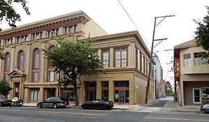
Downtown Vallejo still has many old Victorian and Craftsman style homes.
In 2008, the city council decided to file for Chapter 9 bankruptcy. This meant the city needed help managing its money. It was the largest California city to do so at that time. The city came out of bankruptcy in 2011.
Geography and Climate
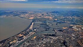
Vallejo covers about 49.5 square miles (128 square kilometers). About 30.7 square miles (79 square kilometers) is land. The rest, about 18.9 square miles (49 square kilometers), is water. The Napa River flows into the Mare Island Strait in Vallejo. This strait then flows into San Pablo Bay, which is part of the San Francisco Bay.
Vallejo is located in the southwestern part of Solano County, California. It is in the North Bay area of Northern California. Vallejo is next to Benicia to the east. American Canyon and the Napa county line are to the north. The Carquinez Strait is to the south, and San Pablo Bay is to the west.
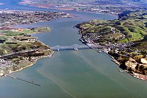
Vallejo has a mild, coastal Mediterranean climate. This means it has warm, dry summers and mild, wet winters. Vallejo is usually about 10°F (5.5°C) cooler than cities further inland. Average temperatures range from about 8°C (46°F) in January to 19.8°C (67.6°F) in July. The summer season is quite long, with June, July, August, and September having similar warm temperatures.
| Climate data for Vallejo | |||||||||||||
|---|---|---|---|---|---|---|---|---|---|---|---|---|---|
| Month | Jan | Feb | Mar | Apr | May | Jun | Jul | Aug | Sep | Oct | Nov | Dec | Year |
| Record high °F (°C) | 84.9 (29.4) |
86.0 (30.0) |
91.9 (33.3) |
95.0 (35.0) |
104.0 (40.0) |
114.8 (46.0) |
111.9 (44.4) |
109.9 (43.3) |
109.9 (43.3) |
106.0 (41.1) |
90.0 (32.2) |
81.0 (27.2) |
114.8 (46.0) |
| Mean daily maximum °F (°C) | 57.0 (13.9) |
61.5 (16.4) |
65.1 (18.4) |
69.6 (20.9) |
74.5 (23.6) |
79.0 (26.1) |
79.9 (26.6) |
81.9 (27.7) |
82.0 (27.8) |
76.5 (24.7) |
65.8 (18.8) |
57.6 (14.2) |
70.9 (21.6) |
| Daily mean °F (°C) | 47.7 (8.7) |
51.1 (10.6) |
53.4 (11.9) |
56.7 (13.7) |
61.2 (16.2) |
65.7 (18.7) |
67.6 (19.8) |
67.5 (19.7) |
66.7 (19.3) |
62.1 (16.7) |
54.3 (12.4) |
48.2 (9.0) |
58.5 (14.7) |
| Mean daily minimum °F (°C) | 38.3 (3.5) |
40.8 (4.9) |
42.1 (5.6) |
43.7 (6.5) |
47.7 (8.7) |
51.3 (10.7) |
53.4 (11.9) |
53.1 (11.7) |
51.4 (10.8) |
47.8 (8.8) |
42.6 (5.9) |
38.8 (3.8) |
45.9 (7.7) |
| Record low °F (°C) | 19.0 (−7.2) |
23.0 (−5.0) |
23.0 (−5.0) |
27.0 (−2.8) |
30.0 (−1.1) |
34.0 (1.1) |
37.9 (3.3) |
32.0 (0.0) |
36.0 (2.2) |
28.0 (−2.2) |
26.6 (−3.0) |
14.0 (−10.0) |
14.0 (−10.0) |
| Average precipitation inches (mm) | 5.2 (131) |
4.4 (112) |
3.3 (84) |
1.7 (42) |
0.7 (18) |
0.2 (5) |
0 (0) |
0.1 (2) |
0.3 (8) |
1.4 (35) |
3.0 (76) |
4.6 (116) |
24.7 (627) |
| Average precipitation days | 11 | 10 | 9 | 6 | 3 | 1 | 0 | 0 | 1 | 4 | 8 | 10 | 63 |
People of Vallejo
| Historical population | |||
|---|---|---|---|
| Census | Pop. | %± | |
| 1870 | 2,188 | — | |
| 1880 | 5,987 | 173.6% | |
| 1890 | 6,343 | 5.9% | |
| 1900 | 7,965 | 25.6% | |
| 1910 | 11,340 | 42.4% | |
| 1920 | 21,107 | 86.1% | |
| 1930 | 16,072 | −23.9% | |
| 1940 | 20,072 | 24.9% | |
| 1950 | 26,038 | 29.7% | |
| 1960 | 60,877 | 133.8% | |
| 1970 | 71,710 | 17.8% | |
| 1980 | 80,303 | 12.0% | |
| 1990 | 109,199 | 36.0% | |
| 2000 | 116,760 | 6.9% | |
| 2010 | 115,942 | −0.7% | |
| 2020 | 126,090 | 8.8% | |
| U.S. Decennial Census 2010 2020 |
|||
Vallejo is known for being a very diverse city. Studies in 2012 and 2022 called it one of the most diverse cities in the United States. This means people from many different backgrounds live there.
In 2020, the population was 126,090. About 28% of the people were Hispanic or Latino. Around 23% were Asian, and 19% were Black or African American. About 21% were White, and 7% were of mixed or other backgrounds.
Diversity in Vallejo
In 2010, Vallejo had 115,942 people. Most people lived in homes, with only a small number in group living situations. There were over 40,000 households. Many of these had children under 18. The average household had about 2.82 people.
The population included people of all ages. About 23% were under 18. About 12% were 65 or older. The median age was 37.9 years.
In 2000, there were 116,760 people in Vallejo. The city had about 39,601 households. Many families lived in the city. The average household size was 2.90 people.
The population was spread out by age. About 27.6% were under 18. About 11.2% were 65 or older. The median age was 35 years.
The average income for a household in 2000 was $47,030. For families, it was $53,805. About 10.1% of the population lived below the poverty line.
Economy and Jobs
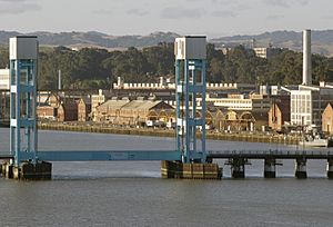
Vallejo is an important center for business in the North Bay region. It is especially important for Solano County.
Top Employers in Vallejo
Many people work in Vallejo. Here are some of the largest employers in the city:
| # | Employer | # of Employees |
|---|---|---|
| 1 | Kaiser Permanente Medical Center | 2,735 |
| 2 | Vallejo City Unified School District | 2,160 |
| 3 | Six Flags Discovery Kingdom | 1,660 |
| 4 | Kaiser Permanente Advice & Call Center | 830 |
| 5 | Sutter Solano Medical Center | 600 |
| 6 | City of Vallejo | 598 |
| 7 | U.S. Forest Service | 400 |
| 8 | California Highway Patrol | 300 |
| 9 | U.S. Postal Service | 215 |
| 10 | California Maritime Academy | 208 |
Arts and Culture
In recent years, many artists have moved to Vallejo. They come looking for more affordable places to live and bigger spaces to work. These artists, who often moved from bigger cities like San Francisco, are working with city leaders. Their goal is to help make the downtown area lively again.
The Vallejo Art Walk is a special event. It happens on the second Friday of every month in downtown Vallejo. It has become a popular place for artists from all over the Bay Area and California.
Education in Vallejo
Vallejo has one main school district, the Vallejo City Unified School District (VCUSD). There are also private schools and colleges in the city.
Vallejo City Unified School District Schools
The VCUSD includes several schools:
High Schools
- Jesse Bethel High School
- Vallejo High School
- St. Patrick-St. Vincent High School
Middle Schools
- Cave Language Academy (TK-8)
- Hogan Middle School
- Loma Vista Environmental Science Academy (K-8)
- Mare Island Health & Fitness Academy (K-8)
- Solano Widenmann Leadership Academy (K-8)
- Vallejo Charter School (K-8)
Elementary Schools
- Cave Language Academy (TK-8)
- Dan Mini Elementary School
- Federal Terrace Elementary School
- Glen Cove Elementary School
- Highland Elementary School
- Johnston Cooper Elementary School
- Lincoln Elementary School
- Loma Vista Environmental Science Academy (K-8)
- Mare Island Health & Fitness Academy (K-8)
- Patterson Elementary School
- Pennycook Elementary School
- Solano Widenmann Leadership Academy (K-8)
- Steffan Manor Elementary School
- Vallejo Charter School (K-8)
- Warlaw Elementary School
Other Programs
- John Finney Education Complex
- Vallejo Regional Education Center (for adults)
Private Schools in Vallejo
Some private schools in Vallejo are:
- Jia Christian Academy
- Mustard Seed Preschool and Kindergarten
- St. Basil Catholic School
- North Hills Christian School
- St. Catherine of Siena School
- St. Patrick-St. Vincent High School
- Starting Gate School
Colleges and Universities
Vallejo is part of the Solano Community College district. This college has two campuses in Vallejo. One is the Vallejo Center, and the other is the Auto Tech Center.
- California Maritime Academy (part of the CSU system)
- Touro University California
Getting Around Vallejo
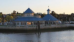
Vallejo has public transportation to help people get around. The San Francisco Bay Ferry runs regularly from downtown Vallejo to the San Francisco Ferry Building. There's also Amtrak Thruway bus service.
SolTrans buses take passengers around Vallejo and Benicia. They also offer faster service to Fairfield, California and Bay Area Rapid Transit (BART) stations. The Vallejo Transit Center is a main spot for many bus lines. It is located at 311 Sacramento Street.
The Amtrak Thruway 7 bus stops in Vallejo twice a day. It stops at Vallejo Station and at Six Flags Discovery Kingdom. From there, you can connect to other places like Martinez and Arcata.
Vallejo is easy to reach by car. Interstate 80 goes through Vallejo, connecting San Francisco and Sacramento. The northern part of the Carquinez Bridge is also in Vallejo. You can also get to Vallejo using Interstate 780 from Benicia and Route 37 from Marin County. Route 29 starts in Vallejo and goes north into Napa County.
Media and News
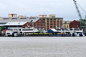
The main local newspaper in Vallejo is the Vallejo Times Herald. The community also has the Vallejo Independent Bulletin. You can also watch local programs on Vallejo Community Access Television (VCAT 27).
Open Vallejo is a news group that focuses on important investigative stories. The Vallejo Sun is another local news source. It covers city news, police, housing, education, and events.
You can also listen to local radio stations. These include KZCT 89.5 FM, which is a community radio station. There are also KDIA/KDYA Christian radio stations.
Sister Cities
Vallejo has six sister cities around the world. Sister cities are towns or cities that form a special bond to promote cultural ties and understanding.
| City | Country | Year of Partnership |
|---|---|---|
| Trondheim | 1960 | |
| Akashi | 1968 | |
| La Spezia | 1987 | |
| Baguio | 1993 | |
| Bagamoyo | 1993 | |
| Jincheon | 2001 |
Famous People from Vallejo
See also
 In Spanish: Vallejo (California) para niños
 | Leon Lynch |
 | Milton P. Webster |
 | Ferdinand Smith |


