Baguio facts for kids
Quick facts for kids
Baguio
|
|||
|---|---|---|---|
|
Highly urbanized city
|
|||
|
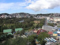
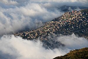
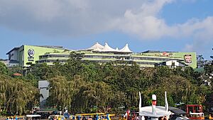
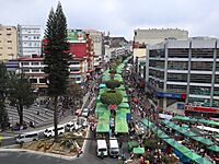
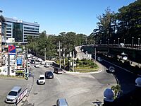
Skyline with overlooking Burnham Park
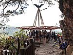
Mines View Park
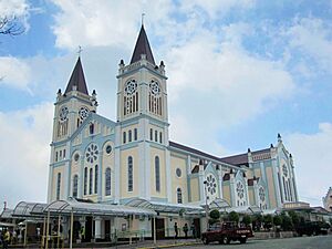
Baguio Cathedral
Camp John Hay Park
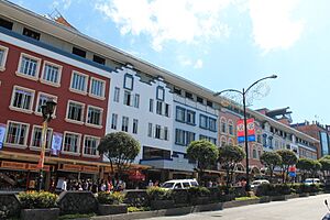
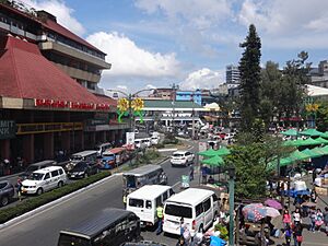
Session Road
|
|||
|
|||
| Nicknames:
Summer Capital of the Philippines
City of Pines |
|||
| Anthem: Baguio Hymn | |||
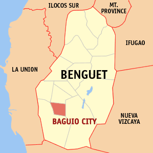
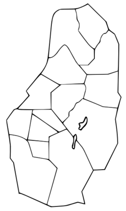
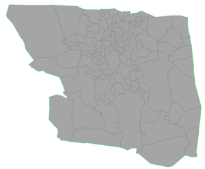
Benguet with Baguio highlighted
|
|||
|
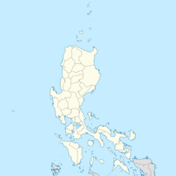
OpenStreetMap
|
|||
| Country | Philippines | ||
| Region | Cordillera Administrative Region | ||
| Province | Benguet (geographically only) | ||
| District | [[{{#property:P7938}} | — Lua error in Module:Wd at line 1804: attempt to index field 'wikibase' (a nil value).]] | ||
| Founded | 1900 | ||
| Incorporated | September 1, 1909 (city) | ||
| Highly urbanized city | December 22, 1979 | ||
| Barangays | 129 (see Barangays) | ||
| Government | |||
| • Type | Sangguniang Panlungsod | ||
| Area | |||
| • Highly urbanized city | 57.51 km2 (22.20 sq mi) | ||
| • Metro
(BLISTT)
|
1,094.79 km2 (422.70 sq mi) | ||
| Elevation | 1,450 m (4,760 ft) | ||
| Highest elevation | 1,667 m (5,469 ft) | ||
| Lowest elevation | 910 m (2,990 ft) | ||
| Population
(2020 census)
|
|||
| • Highly urbanized city | 366,358 | ||
| • Density | 6,370.3/km2 (16,499.1/sq mi) | ||
| • Metro
(BLISTT)
|
644,589 | ||
| • Metro density | 3,100/km2 (8,000/sq mi) | ||
| • Households | 100,220 | ||
| Economy | |||
| • Gross domestic product | ₱139,174 million (2021) $2,762 million (2021) |
||
| • Income class | 1st city income class | ||
| • Poverty incidence |
|
||
| • Revenue | ₱ 2,750 million (2022) | ||
| • Assets | ₱ 10,449 million (2022) | ||
| • Expenditure | ₱ 1,746 million (2022) | ||
| • Liabilities | ₱ 2,072 million (2022) | ||
| Service provider | |||
| • Electricity | Benguet Electric Cooperative (BENECO) | ||
| • Water | Baguio Water District (BWD) | ||
| Time zone | UTC+8 (PST) | ||
| ZIP code |
2600
|
||
| PSGC |
[https://psa.gov.ph/classification/psgc/?q=psgc/barangays/{{#pro000®code={{&provcode=
|
||
| IDD : area code | +63 (0)74 | ||
| Native languages | Kankanay language family Ibaloi Ilocano Tagalog |
||
| Website | www |
||
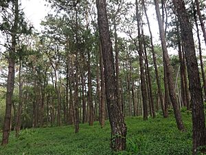
Baguio is a special city in the Cordillera Administrative Region, Philippines. It's often called the "Summer Capital of the Philippines" because it has a cool climate, unlike the warmer lowlands. Baguio is about 1,500 meters (4,900 feet) above sea level. This cool weather helps mossy plants, orchids, and pine trees grow, which is why it's also known as the "City of Pines."
The city was first set up by the United States in 1900. It was built on the site of an Ibaloi village called Kafagway. Baguio was the only mountain resort the United States built in Asia.
Baguio is a "highly urbanized city," meaning it manages itself independently. It used to be the capital of Benguet province but now operates separately. However, for geographical and statistical reasons, it's still considered part of Benguet. Baguio is a major hub for business, trade, and education in northern Luzon. It's also the most populated city and the government center of the Cordillera Administrative Region.
As of 2025, Baguio has an estimated population of about 407,000 people. The city's population has been growing steadily over the last ten years. The larger Baguio Metropolitan Area, which includes nearby towns, has a total population of about 451,844 people.
Contents
- What's in a Name?
- A Look Back: Baguio's History
- Baguio's Location
- Environment and Challenges
- City Design and Buildings
- Who Lives in Baguio?
- Baguio's Economy
- Baguio's Culture
- Fun Things to Do: Tourism
- How Baguio is Governed
- Sports and Recreation
- Getting Around Baguio
- Essential Services
- Healthcare in Baguio
- Learning in Baguio
- Famous People from Baguio
- Partner Cities
- See also
What's in a Name?
Baguio was originally named Kafagway by the local people. The name Baguio comes from the Ibaloi word bagiw, which means "moss." This word was later changed to Baguio by the Spanish. People from Baguio are sometimes called Ibagiw. This name is also used for the city's yearly arts festival.
A Look Back: Baguio's History
Early Days: The Ibaloi Village of Kafagway
Long ago, Baguio was a vast mountain area with thick forests. Many animals like deer, cloud rats, and Philippine eagles lived there. It was a hunting ground for the Ibalois and other Igorot groups. When the Spanish arrived in the Philippines, they couldn't fully take over this area because the Igorots defended their land strongly.
Igorot stories say that the wealthy baknang families of Benguet started between 1565 and the early 1600s. This happened when a gold trader named Amkidit married a Kankanaey woman who was gold panning in Acupan. Their son, Baruy, found a gold deposit and developed it.
Spanish Influence
In 1846, during Spanish rule, the Spanish set up a military post in nearby La Trinidad. They divided Benguet into 31 small villages called rancherías. One of these was Kafagway, a wide grassy area where Burnham Park is now. Kafagway was a small village with only about 20 houses. Most of the land belonged to Mateo Cariño, an important Ibaloi leader. The Spanish government office was moved to Cariño's house, where the city hall stands today. The local name for the area was Bag-iw, meaning "moss," which the Spanish spelled as Baguio.
The First Philippine Republic
In July 1899, during the Philippine Revolution, Filipino forces led by Pedro Paterno freed La Trinidad from the Spanish. They took over the government and declared Benguet a province of the new Philippine Republic. Baguio became a "town," and Mateo Cariño was its first mayor.
American Era: The Summer Capital
When the United States took control of the Philippines, Baguio was chosen to be the summer capital for the American government. In 1900, an American zoologist named Dean Conant Worcester led a trip to find a cool place in the northern mountains. Governor-General William Taft visited in 1901 and loved the cool air. On November 11, 1901, the American government bought land in Baguio from the Ibaloi people.
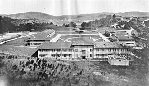
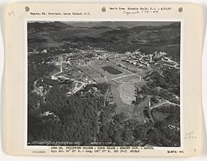
In 1903, workers from the Philippines, Japan, and China built Kennon Road. This was the first direct road connecting Baguio to the lowlands. Before this, the main road was Naguilian Road, which was mostly a horse trail. Camp John Hay was set up in October 1903 as a military base for the United States Army. It was a place for soldiers to rest and recover from the heat.
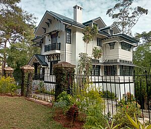
The Mansion, built in 1908, became the official summer home for the American Governor-General. It was designed by architect William E. Parsons.
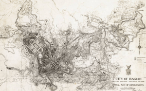
Daniel Burnham, a famous city planner, designed the layout of Baguio. His plan, made in 1904, followed the "City Beautiful movement," with wide streets and avenues. On September 1, 1909, Baguio officially became a city and was named the "Summer Capital of the Philippines."
After this, more places were built, like Wright Park, Burnham Park, Governor Pack Road, and Session Road.
World War II in Baguio
Before World War II, Baguio was important because it was the summer capital and home to the Philippine Military Academy. On December 8, 1941, Japanese bombers attacked Camp John Hay. Baguio was declared an "open city" on December 27, meaning it would not be defended, to protect its people.
During the Japanese invasion, the Imperial Japanese Army used Camp John Hay as a military base. Nearby Camp Holmes became a camp for about 500 foreign civilians, mostly Americans.
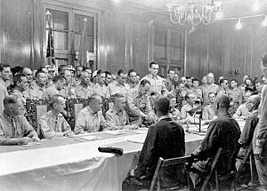
By March 1945, American and Filipino forces began attacking Baguio. Between March 4 and 10, planes dropped many bombs, turning much of the city into ruins. By April 27, 1945, the city was freed. In September 1945, Japanese forces in the Philippines officially surrendered at Camp John Hay's American Residence.
Rebuilding Baguio
After World War II ended, Baguio quickly recovered. It became a popular place for tourism, even though it stopped being the official "Summer Capital" in 1976.
Baguio During the Marcos Era
The 1970s were a time of big changes in the Philippines, including Baguio. President Ferdinand Marcos declared Martial Law in September 1972. This period is remembered for many human rights issues.
During this time, the Baguio City jail was used to hold "political detainees." These were people seen as threats to the government and were often held without formal charges. The Baguio Chapter of the Free Legal Assistance Group helped defend these detainees.
The People Power Revolution
In 1986, after a special election, people gathered at the Baguio Cathedral to protest. This was part of the larger People Power Revolution across the Philippines. These protests led to President Ferdinand Marcos being removed from power on February 25, 1986.
Cordillera Administrative Region
On July 15, 1987, President Corazon Aquino created the Cordillera Administrative Region. Baguio became its government center. There have been attempts to make the Cordillera region an independent area, but these efforts have not yet succeeded.
The 1990 Luzon Earthquake
The 1990 Luzon earthquake (magnitude 7.7) hit Baguio and Benguet on July 16, 1990. Many buildings and roads were damaged. Some buildings collapsed, and there were many injuries. Baguio was rebuilt with help from the Philippine government and other countries like Japan and the United States.
Baguio's Location
Baguio is a city located high up in the Cordillera Central mountain range in northern Luzon. The city center is about 1,400 to 1,500 meters (4,600 to 4,900 feet) above sea level. Some areas within Baguio's borders are as low as 900 meters (2,950 feet) and as high as 1,700 meters (5,570 feet). Mountains outside Baguio can reach over 2,200 meters (7,200 feet).
The city is surrounded by the province of Benguet. It covers a small area of about 57.5 square kilometers (22.2 sq mi). Most of the developed parts of the city are built on hilly land in the northern section. When Daniel Burnham planned the city, he set the City Hall as a central point. From there, the city stretches about 8.2 km (5.1 mi) from east to west and 7.2 km (4.5 mi) from north to south.
Baguio's Barangays
Baguio is divided into 129 small communities called barangays. Each barangay has smaller areas called puroks and some have sitios.
- A. Bonifacio-Caguioa-Rimando (ABCR)
- Abanao-Zandueta-Kayong-Chugum-Otek (AZKCO)
- Alfonso Tabora
- Ambiong
- Andres Bonifacio (Lower Bokawkan)
- Apugan-Loakan
- Asin Road
- Atok Trail
- Aurora Hill Proper (Malvar-Sgt. Floresca)
- Aurora Hill, North Central
- Aurora Hill, South Central
- Bagong Lipunan (Market Area)
- Bakakeng Central
- Bakakeng North
- Bal-Marcoville (Marcoville)
- Balsigan
- Bayan Park East
- Bayan Park Village
- Bayan Park West (Bayan Park, Leonila Hill)
- BGH Compound
- Brookside
- Brookspoint
- Cabinet Hill-Teacher's Camp
- Camdas Subdivision
- Camp 7
- Camp 8
- Camp Allen
- Campo Filipino
- City Camp Central
- City Camp Proper
- Country Club Village
- Cresencia Village
- Dagsian, Lower
- Dagsian, Upper
- Dizon Subdivision
- Dominican Hill-Mirador
- Dontogan
- DPS Compound
- Engineers' Hill
- Fairview Village
- Ferdinand (Happy Homes-Campo Sioco)
- Fort del Pilar
- Gabriela Silang
- General Emilio F. Aguinaldo (Quirino‑Magsaysay, Lower)
- General Luna, Upper
- General Luna, Lower
- Gibraltar
- Greenwater Village
- Guisad Central
- Guisad Sorong
- Happy Hollow
- Happy Homes (Happy Homes-Lucban)
- Harrison-Claudio Carantes
- Hillside
- Holy Ghost Extension
- Holy Ghost Proper
- Honeymoon (Honeymoon-Holy Ghost)
- Imelda R. Marcos (La Salle)
- Imelda Village
- Irisan
- Kabayanihan
- Kagitingan
- Kayang Extension
- Kayang-Hilltop
- Kias
- Legarda-Burnham-Kisad
- Liwanag-Loakan
- Loakan Proper
- Lopez Jaena
- Lourdes Subdivision Extension
- Lourdes Subdivision, Lower
- Lourdes Subdivision, Proper
- Lualhati
- Lucnab
- Magsaysay Private Road
- Magsaysay, Lower
- Magsaysay, Upper
- Malcolm Square-Perfecto (Jose Abad Santos)
- Manuel A. Roxas
- Market Subdivision, Upper
- Middle Quezon Hill Subdivision (Quezon Hill Middle)
- Military Cut-off
- Mines View Park
- Modern Site, East
- Modern Site, West
- MRR-Queen of Peace
- New Lucban
- Outlook Drive
- Pacdal
- Padre Burgos
- Padre Zamora
- Palma-Urbano (Cariño-Palma)
- Phil-Am
- Pinget
- Pinsao Pilot Project
- Pinsao Proper
- Poliwes
- Pucsusan
- Quezon Hill Proper
- Quezon Hill, Upper
- Quirino Hill, East
- Quirino Hill, Lower
- Quirino Hill, Middle
- Quirino Hill, West
- Quirino-Magsaysay, Upper (Upper QM)
- Rizal Monument Area
- Rock Quarry, Lower
- Rock Quarry, Middle
- Rock Quarry, Upper
- Saint Joseph Village
- Salud Mitra
- San Antonio Village
- San Luis Village
- San Roque Village
- San Vicente
- Sanitary Camp, North
- Sanitary Camp, South
- Santa Escolastica
- Santo Rosario
- Santo Tomas Proper
- Santo Tomas School Area
- Scout Barrio
- Session Road Area
- Slaughter House Area (Santo Niño Slaughter)
- SLU-SVP Housing Village
- South Drive
- Teodora Alonzo
- Trancoville
- Victoria Village
Baguio's Climate
| Climate data for Baguio (1991–2020 normals, extremes 1909–2021) | |||||||||||||
|---|---|---|---|---|---|---|---|---|---|---|---|---|---|
| Month | Jan | Feb | Mar | Apr | May | Jun | Jul | Aug | Sep | Oct | Nov | Dec | Year |
| Record high °C (°F) | 28.4 (83.1) |
28.7 (83.7) |
30.4 (86.7) |
30.0 (86.0) |
29.4 (84.9) |
28.7 (83.7) |
27.9 (82.2) |
27.7 (81.9) |
28.0 (82.4) |
27.7 (81.9) |
28.2 (82.8) |
28.2 (82.8) |
30.4 (86.7) |
| Mean daily maximum °C (°F) | 23.1 (73.6) |
23.7 (74.7) |
24.8 (76.6) |
25.5 (77.9) |
24.7 (76.5) |
24.3 (75.7) |
23.1 (73.6) |
22.3 (72.1) |
23.0 (73.4) |
23.6 (74.5) |
23.9 (75.0) |
23.5 (74.3) |
23.8 (74.8) |
| Daily mean °C (°F) | 18.1 (64.6) |
18.5 (65.3) |
19.7 (67.5) |
20.7 (69.3) |
20.6 (69.1) |
20.4 (68.7) |
19.6 (67.3) |
19.3 (66.7) |
19.6 (67.3) |
19.6 (67.3) |
19.5 (67.1) |
18.8 (65.8) |
19.5 (67.1) |
| Mean daily minimum °C (°F) | 13.0 (55.4) |
13.4 (56.1) |
14.5 (58.1) |
15.9 (60.6) |
16.4 (61.5) |
16.5 (61.7) |
16.2 (61.2) |
16.2 (61.2) |
16.1 (61.0) |
15.6 (60.1) |
15.1 (59.2) |
14.1 (57.4) |
15.2 (59.4) |
| Record low °C (°F) | 6.3 (43.3) |
6.7 (44.1) |
7.4 (45.3) |
10.0 (50.0) |
12.0 (53.6) |
13.3 (55.9) |
12.5 (54.5) |
12.8 (55.0) |
12.6 (54.7) |
11.3 (52.3) |
9.2 (48.6) |
7.6 (45.7) |
6.3 (43.3) |
| Average rainfall mm (inches) | 16.4 (0.65) |
23.7 (0.93) |
50.5 (1.99) |
99.5 (3.92) |
340.0 (13.39) |
406.1 (15.99) |
772.7 (30.42) |
963.2 (37.92) |
537.3 (21.15) |
477.3 (18.79) |
96.1 (3.78) |
41.6 (1.64) |
3,824.4 (150.57) |
| Average rainy days (≥ 1 mm) | 3 | 3 | 5 | 8 | 18 | 19 | 24 | 25 | 22 | 13 | 7 | 5 | 152 |
| Average relative humidity (%) | 85 | 85 | 84 | 85 | 88 | 90 | 92 | 93 | 92 | 90 | 86 | 85 | 88 |
| Mean monthly sunshine hours | 226.5 | 228.0 | 242.6 | 254.9 | 224.9 | 206.3 | 168.0 | 145.5 | 178.9 | 232.2 | 223.2 | 210.9 | 2,541.8 |
| Percent possible sunshine | 66 | 71 | 66 | 69 | 57 | 53 | 42 | 37 | 49 | 65 | 66 | 62 | 58 |
| Source 1: PAGASA | |||||||||||||
| Source 2: DWD (sunshine 1978-2022) | |||||||||||||
Baguio has a mild climate because of its high elevation. It's usually about 7 to 10 degrees Celsius (13 to 18 degrees Fahrenheit) cooler than cities near sea level. The average temperature is between 15 and 23 degrees Celsius (59 and 73 degrees Fahrenheit). The coldest months are from November to February. The lowest temperature ever recorded was 6.3 degrees Celsius (43.3 degrees Fahrenheit) on January 18, 1961. The highest was 30.4 degrees Celsius (86.7 degrees Fahrenheit) on March 15, 1988. Temperatures rarely go above 26 degrees Celsius (79 degrees Fahrenheit).
Rain in Baguio
Baguio gets much less rain during its dry season. However, it receives a huge amount of rain during the rainy season, from June to October. The city gets over 3,914 millimeters (154 inches) of rainfall each year, which is one of the highest in the Philippines.
Environment and Challenges
Air and Waste Management

Baguio faces challenges with air quality. In 2018, a report listed it as having some of the most polluted air among several Philippine cities. Efforts are being made to improve this, like testing eco-friendly vehicles.
Another big problem is garbage and waste disposal. The city used to send its trash to a landfill far away, but this became very expensive. The city government has been looking into new ways to manage waste, like using waste-to-energy technology. Baguio's wastewater treatment plant also needs to be expanded to handle the city's needs.
City Design and Buildings
Baguio is a planned city. American architect and urban planner Daniel Burnham designed it. His design used wide streets and avenues spreading out from central areas.
During World War II, much of Baguio was destroyed. After the war, the city was rebuilt. However, some old buildings were not saved. The 1990 Luzon earthquake also damaged many buildings.
Today, Baguio's buildings are mostly modern.
Baguio's Architecture
Baguio's buildings show a lot of American influence because Americans established the city. Examples include buildings at Teacher's Camp and Camp John Hay. Some buildings also have Spanish influences, like Porta Vaga Mall. A more modern building is SM City Baguio, built in 2003.
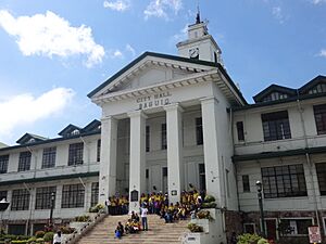
There are groups working to protect Baguio's historic buildings. For example, there was discussion about renovating the Baguio City Hall grounds. The renovations continued, and the City Hall park was finished in May 2019. It is now seen as a symbol of the city's new identity as a creative center.
Who Lives in Baguio?
The first people to live in Baguio were the Ibaloi people. When Americans founded the city in the early 1900s, other groups moved in. These included other Igorot tribes, Ilocanos from the lowlands, Americans, and mestizos (people of mixed Filipino and foreign heritage). Many Chinese and Japanese workers also helped build Kennon Road and later settled in the city.
Baguio is a very populated city, with over 6,000 people per square kilometer. Daniel Burnham originally planned the city for 25,000 to 30,000 people. However, its population grew to 366,358 people by May 2020. The city has a young population, with 65.5% of people under thirty years old. During peak tourist seasons, like Holy Week, the number of people in the city can double.
Safety in Baguio
Baguio is considered one of the safest cities in the ASEAN region. In 2018, it ranked sixth for safety. The Baguio City Police Office is very good at solving crimes, with an 84% success rate. In May 2019, they reported a 27% drop in crimes compared to the previous year. The Baguio City Police Office was named the best city police station in the country in 2018.
Religions in Baguio
Baguio is mostly a Christian city. As of 2015, most residents are Roman Catholics. There are also many Evangelicals and members of other Christian groups.
A smaller number of people in Baguio are Muslims. The largest mosque in the area is Masjid Al-Maarif, which is a center for Islamic studies. The city also has smaller groups of Buddhists and atheists, along with people of other faiths.
Baguio's Economy
Baguio attracts many businesses and investments because it brings together different people and cultures from the Cordillera Administrative Region. The city has a large retail industry, with many shoppers coming for good deals. Popular places for bargaining include Baguio Market and Maharlika Livelihood Center. There are also many shopping centers and malls, like SM City Baguio, Baguio Center Mall, and Abanao Square.
Local food and retail businesses are very common in Baguio. You can find many shops and restaurants along Bonifacio Street, Session Road, Teacher's Camp, Mines View Park, and near the market.
The main business areas are Session Road, Harrison Road, Magsaysay Avenue, and Abanao Street. Here you'll find cinemas, hotels, restaurants, and department stores. The City Market sells many local products, especially from Benguet province. These include colorful woven fabrics, handmade beads, wood carvings, flowers, strawberries, and "Baguio" vegetables. Strawberries and string beans (called Baguio beans in the Philippines) are sent to markets all over the country.
Baguio is also important as the economic center of the Cordillera Administrative Region. The city's economy benefits from the mining industry in nearby Benguet towns. Many farm products from Benguet pass through Baguio for processing, sale, or distribution to other areas.
Industries in Baguio
Baguio is known as one of the best places for investment in the Philippines.
The Baguio City Economic Zone (BCEZ) is a special business park located in the southern part of the city. Companies here mostly make and export knitted clothes, electronics, and computer parts. A well-known company is Texas Instruments Philippines, which is one of the country's largest exporters. Other companies in the BCEZ include Baguio Ayalaland Technohub, Moog Philippines, Inc., and Sitel Philippines, Baguio.
Outsourcing Services
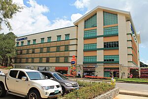
Outsourcing companies also contribute to Baguio's economy and provide many jobs. Sitel is the largest BPO company in the city, with several locations in the BCEZ. Other BPOs are also present, often in special economic zones. For example, the Ayala Technohub in Camp John Hay hosts Concentrix.
In recent years, many ESL (English as a Second Language) schools have opened in Baguio. They teach students from other countries and offer online lessons.
Baguio's Culture
Arts and Museums
Baguio became a popular place for Filipino artists in the 1970s to 1990s. Artists like Ben Cabrera (a National Artist) and filmmaker Butch Perez moved there because of the cool climate and low living costs. Local artists like Santiago Bose and filmmaker Kidlat Tahimik also created art in the city. Even today, artists from all over the country come for the annual Baguio Arts Festival. The city has several museums, including the Baguio Museum and Museo Kordilyera. The Mansion House at Wright Park has also been opened as a presidential museum.
Baguio is part of UNESCO's Creative Cities Network. This is because of the city's strong traditions in crafts and folk art, like wood carving, silver craft, traditional weaving, and tattooing. Baguio is the first city in the Philippines to join this network, which promotes creative industries and culture in city development.
Languages Spoken
The main languages spoken in Baguio are Ilocano, Tagalog, and English. Other languages like Ibaloi, Kankanaey, Pangasinan, Cantonese, Hokkien, and Japanese are also spoken by different communities in the city.
Festivals and Special Days
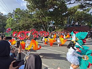
The yearly flower festival, called the Panagbenga Festival, happens every February. It was created to celebrate the city's beautiful flowers and cool weather. It also helped the city recover after the 1990 Luzon earthquake. The festival features floats covered in flowers and street dancing. The dancers wear flower-inspired costumes and perform the Bendian, an Ibaloi celebration dance.
The annual Gong Festival is celebrated on October 29. This day is also the National Indigenous Peoples’ Thanksgiving Day. The festival includes traditional dances and the symbolic beating of seven gongs. This is done to promote peace, unity, and the preservation of cultural heritage.
Baguio celebrates its city charter anniversary every September 1. This day is a special non-working holiday.
Fun Things to Do: Tourism
Tourism is one of Baguio's most important industries because of its cool climate and interesting history. It's a top tourist spot in the Philippines. During holidays, many people from warmer areas visit Baguio to enjoy the cold weather. In the summer, especially during Holy Week, tourists from all over the country flock to the city. At these times, the city's population can double. To welcome visitors, Baguio has over 80 hotels and inns, plus many temporary homes offered by locals. Festivals like the Panagbenga Festival also attract many tourists.
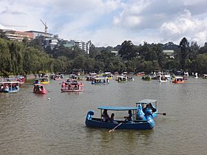
Baguio was named one of the top 25 destinations in Asia in the 2011 TripAdvisor Traveller's Choice Destinations Awards. Popular tourist spots include Burnham Park, Mines View Park, Wright Park, The Mansion, and the Botanical Garden.
How Baguio is Governed
Local Government
Baguio is a highly urbanized city with its own special rules. This means it is not controlled by the Benguet province, even though it used to be part of it.
The City of Baguio is led by its mayor and vice mayor. The vice mayor also leads the city council. The council has 12 elected members and 3 other members who represent different groups in the city. The city government offices are at the Baguio City Hall.
The 129 barangays are led by their own captains, who are helped by a 7-person council. These officials can serve up to 3 terms in a row, with each term lasting 3 years.
Elected Officials
The city government officials as of June 30, 2025:
| Position | Name | Year elected | Term no. |
|---|---|---|---|
| Congressman | Mauricio G. Domogan | 2025 | 1 |
| Mayor | Benjamin B. Magalong | 2019 | 3 |
| Vice Mayor | Faustino A. Olowan | 2019 | 3 |
| Councilor | Edison Bilog | 2025 | 1 |
| Joel Alangsab | 2025 | 1 | |
| Jose M. Molintas | 2022 | 2 | |
| Leandro B. Yañgot Jr. | 2022 | 2 | |
| Vladimir D. Cayabas | 2019 | 3 | |
| Peter C. Fianza | 2022 | 2 | |
| Van Dicang | 2025 | 1 | |
| Fred L. Bagbagen | 2019 | 3 | |
| Paolo Salvosa | 2025 | 1 | |
| Betty Lourdes F. Tabanda | 2019 | 3 | |
| Yuri Weygan | 2025 | 1 | |
| Elmer O. Datuin | 2022 | 2 | |
| Councilor (ex-officio member) ABC President |
Rocky M. Aliping | 2024 | 1 |
| Councilor (ex-officio member) SK President |
John Rhey L. Mananeng | 2023 | 1 |
| Councilor (ex-officio member) Indigenous People's Mandatory Representative (IPMR) |
Maximo H. Edwin Jr. | 2023 | 1 |
National Government Summer Homes
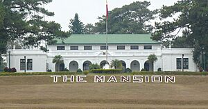
Baguio is home to the summer residences of the President, Vice President, and other important government leaders. The Supreme Court and Court of Appeals also hold special sessions in the city during April.
Sports and Recreation
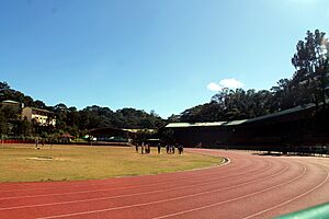
Baguio has hosted many sports events, including international ones. The Baguio Athletic Bowl in Burnham Park is a main sports venue. Baguio hosted the 1978 World Chess Championship and built the Baguio Convention Center for it. The city takes part in the CARAA games (Cordillera Administrative Region Athletic Association) and has often been the overall champion.
In recent years, Baguio has become known for its success in Mixed Martial Arts, especially with Team Lakay.
Getting Around Baguio
Air Travel
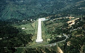
Loakan Airport is the only airport serving Baguio. It's a major domestic airport. However, regular commercial flights to Baguio stopped in 1998. While some airlines tried to restart flights, they couldn't keep them going. Commercial flights resumed in 2022 but were halted in July 2024 due to low passenger numbers.
The airport is south of the city center. Its runway is short (1,802 meters or 5,912 feet), so it can only handle smaller planes. It's mostly used by helicopters and propeller planes.
Land Transportation
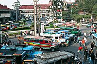
Jeepneys and taxis are the main ways to get around Baguio. The government is working to modernize jeepneys, so more new, eco-friendly ones are being used. Several bus lines connect Baguio to Manila and other provinces.
From Metro Manila, you can reach Baguio using highways like NLEX, SCTEX, and TPLEX. The three main roads leading to Baguio from the lowlands are Kennon Road, Aspiras–Palispis Highway (also known as Marcos Highway), and Naguilian Road. These roads all pass through Tuba, Benguet.
- Kennon Road is often the fastest route but can be dangerous, especially during the rainy season.
- Aspiras-Palispis Highway and Naguilian Road are longer but safer, especially for buses and trucks.
The Benguet-Nueva Vizcaya Road connects Baguio to Aritao in Nueva Vizcaya province. Another road, Halsema Highway, goes north through the mountains.
Since 2021, Baguio has been building a bicycle lane network. As of 2024, the city has over 15 kilometers (9 miles) of shared lanes and segregated lanes for bikes.
Hop On, Hop Off (HoHo) Tourist Bus
To help with traffic and parking, Baguio started a free shuttle service called the Hop On, Hop Off (HoHo) Tourist Bus. Tourists can park their cars at the Baguio Convention Center for a fee and then ride the bus for free to different tourist spots. The HoHo bus runs on a loop, stopping at places like the Baguio Botanical Garden, Mansion House, Mines View Park, and Wright Park. It used to run daily but its operations were suspended at the end of 2024.
All times are in Philippine Standard Time (UTC+08:00).
| Destination | First trip | Last trip | Location | |
|---|---|---|---|---|
| BCC | 8:30 AM | 4:30 PM | Military Cut-off | Baguio |
| Botanical Garden | 9:05 AM | 5:05 PM | Saint Joseph Village | |
| The Mansion | 9:25 AM | 5:25 PM | Lualhati | |
| Mines View Park | 9:50 AM | 5:50 PM | Mines View Park | |
| Wright Park | 10:20 AM | 6:20 PM | Lualhati | |
| Governor Pack Road | — | — | Session Road Area | |
| Stops, stations and transit systems in italics are either under construction or proposed. | ||||
Future Transportation Ideas
- Cable Cars: There are plans to study installing cable cars in Baguio to help with transportation.
- Monorail: A monorail project connecting Baguio to La Trinidad is also being considered. This could help tourism and reduce traffic.
Essential Services
Water and Electricity
The Baguio Water District provides most of the city's water supply. It operates many deep wells to serve over 300,000 customers. However, the water district is concerned about the city's decreasing water supply.
Electricity is provided by Benguet Electric Cooperative (BENECO). There have been discussions about creating a separate electric company just for Baguio, but this would require careful study.
The city also owns and operates its own renewable energy plants, the Asin Mini Hydropower Plants. These plants used to provide power and income for the city but stopped operating in 2015. The city plans to fix them so they can work again.
Healthcare in Baguio
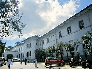
Baguio has several private hospitals, including Baguio Medical Center and Saint Louis University's Hospital of Sacred Heart. One hospital, BCU-Santo Niño de Jesus Medical Center Foundation, closed in 2009 but was reopened temporarily during the COVID-19 pandemic as an isolation center.
The Baguio City Health Services Office manages the city's health programs. It runs 16 health centers and 15 smaller clinics. Baguio is also home to the Baguio General Hospital and Medical Center (BGHMC). This is the only government hospital in the city and the largest government hospital in the Cordillera Administrative Region.
Learning in Baguio
Education is a big part of Baguio's economy. Many students move to the city to attend college. Baguio is known as the "Educational Center of the North" because its universities perform well in exams and have high standards.
Schools for Younger Students
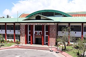
The Baguio Schools Division Office manages all public and private schools, from elementary to high school. The city has 45 public elementary schools and 21 public high schools. Many private high schools are part of the city's private universities. The Philippine Science High School - CAR campus opened in Baguio in 2009. In 2016, the city government also opened Baguio City Science High School.
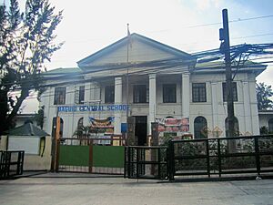
Baguio Central School, the country's first public elementary school, opened on September 2, 1899. It started as a small school with only 25 Igorot boys. The school was badly damaged in World War II but was renovated. It is considered a heritage school.
Colleges and Universities
Baguio has eight major universities and colleges. Easter College, Baguio's first private school, was founded in 1906.
The University of the Philippines, a top state university, moved its campus to Baguio in 1938. It became UP Baguio in 2002.
Saint Louis University is the largest university in Baguio and northern Manila, with over 30,000 students. It was founded in 1911 and became a university in 1963.
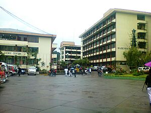
Other universities include Baguio Central University (founded 1945), University of the Cordilleras (founded 1946), and University of Baguio (founded 1948). Pines City Colleges, mainly a nursing and medical school, opened in 1969.
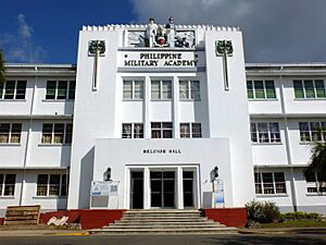
The Philippine Military Academy, the country's military school, moved to Baguio in 1908.
Famous People from Baguio
Partner Cities
In the Philippines
- Angeles City
- Alaminos, Pangasinan
- Bacolod
- Calbayog, Samar
- Candon
- Daet, Camarines Norte
- Davao City
- Dipaculao, Aurora
- Lopez, Quezon
- Lucena
- Makati
- Mandaue
- Marawi, Lanao del Sur
- Muñoz, Nueva Ecija
- Ormoc, Leyte
- Pavia, Iloilo
- San Carlos, Negros Occidental
- Zamboanga City
Around the World
 Cusco, Peru
 Gongju, South Korea
 Hangzhou, China
 Hanyū, Saitama, Japan
 Honolulu, Hawaii, United States
 Karuizawa, Nagano, Japan
 Nazareth, Israel
 Vaughan, Canada
 Seoul, South Korea
 San Antonio, Texas, United States
 Shepparton, Australia
 Taebaek, South Korea
 Tamuning, Guam, United States
 Taxco, Mexico
 Vallejo, California, United States
 Wakkanai, Hokkaido, Japan
See also
 In Spanish: Baguió para niños
- Capital of the Philippines
- Daniel Burnham
- Hill station
- Kennon Road
- La Trinidad
- Sagada
- Banaue
- Session Road
 | Kyle Baker |
 | Joseph Yoakum |
 | Laura Wheeler Waring |
 | Henry Ossawa Tanner |


