Ormoc facts for kids
Quick facts for kids
Ormoc
|
|||
|---|---|---|---|
|
Independent component city
|
|||
| City of Ormoc | |||
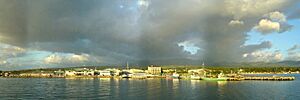
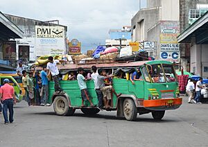
View of Ormoc from Ormoc Bay
|
|||
|
|||
| Motto(s):
Ormoc, Beautiful Land
|
|||
| Anthem: Ormoc, Dutang Matahum (English: Ormoc, Beautiful Land) |
|||
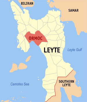
Map of Leyte with Ormoc highlighted
|
|||
|
OpenStreetMap
|
|||
| Country | Philippines | ||
| Region | Eastern Visayas | ||
| Province | Leyte (geographically only) |
||
| District | [[{{#property:P7938}} | — Lua error in Module:Wd at line 1804: attempt to index field 'wikibase' (a nil value).]] | ||
| Founded | February 26, 1834 | ||
| Cityhood | June 21, 1947 | ||
| Barangays | 85 (see Barangays) | ||
| Government
|
|||
| • Type | Sangguniang Panlungsod | ||
| Area | |||
| • Total | 613.60 km2 (236.91 sq mi) | ||
| Elevation | 234 m (768 ft) | ||
| Highest elevation | 1,318 m (4,324 ft) | ||
| Lowest elevation | 0 m (0 ft) | ||
| Population
(2020 census)
|
|||
| • Total | 230,998 | ||
| • Density | 376.463/km2 (975.036/sq mi) | ||
| • Households | 56,048 | ||
| Demonym(s) | Ormocanon | ||
| Economy | |||
| • Income class | 1st city income class | ||
| • Poverty incidence |
|
||
| • Revenue | ₱ 2,353 million (2022) | ||
| • Assets | ₱ 7,479 million (2022) | ||
| • Expenditure | ₱ 1,764 million (2022) | ||
| • Liabilities | ₱ 1,323 million (2022) | ||
| Service provider | |||
| • Electricity | Leyte 5 Electric Cooperative (LEYECO 5) | ||
| Time zone | UTC+8 (PST) | ||
| ZIP code |
6541
|
||
| PSGC |
[https://psa.gov.ph/classification/psgc/?q=psgc/barangays/{{#pro000®code={{&provcode=
|
||
| IDD : area code | +63 (0)53 | ||
| Native languages | Cebuano Tagalog Waray |
||
| Website | www |
||
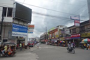
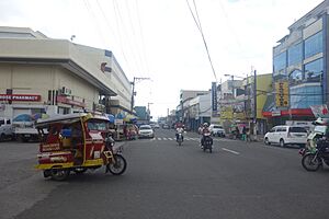
Ormoc is a vibrant city in the Eastern Visayas region of the Philippines. It is officially known as the City of Ormoc. In the 2020 census, it had a population of 230,998 people. This makes it the second-largest city in the province of Leyte by population, after Tacloban. Ormoc City is a major center for business, culture, and transportation in western Leyte.
Ormoc is an independent city, which means it manages its own affairs and is not directly controlled by the Leyte Provincial Government. However, it is still part of the 4th Congressional District of Leyte for elections. It is also grouped with Leyte province for official statistics. The city has faced challenges from strong storms. In 2013, Super Typhoon Yolanda (also known as Haiyan) caused a lot of damage. Before that, in 1991, Tropical Storm Thelma (Uring) caused severe flooding and loss of life.
Contents
What's in a Name?
The name Ormoc comes from an old Visayan word, ogmok. This word means "lowland" or "flat plain." The city celebrates an annual Piña Festival. This festival honors Saints Peter and Paul and gives thanks for the good pineapple harvest.
Ormoc's Story
Early Beginnings
During the Spanish rule, people from nearby towns moved to Ormoc's fertile plains. Many of these early settlers were Malayans. They often traded with Chinese, Javans, and Indonesians. However, they were often attacked by Moro pirates. To protect themselves, the Malayans in Ormoc created a "grapevine" warning system. People in watchtowers would alert others when pirates were coming.
Spanish Era
On July 16, 1595, Pedro Cherino and other Jesuit missionaries arrived in Leyte. They started a mission in Ormoc in May 1597, and many locals became Christians. Peace was broken in 1634 when Raja Bungsu, the sultan of Sulu, attacked the town. He captured 300 people and also raided other towns. The people of Ormoc fought back but were outnumbered.
In 1768, Augustinian missionaries took over from the Jesuits. On February 26, 1834, Ormoc became a separate municipality from Palompon.
Philippine Revolution
Ormoc was a place where many revolutionaries wanted independence from Spanish rule. They joined the Philippine Revolution after it began in August 1896. Leyte soon came under the control of the Revolutionary Government, led by Vicente Lukban.
American Period
After the revolution, the Americans took control. A civil government was set up in Leyte on April 22, 1901. The revolutionary leader Faustino Ablen encouraged locals to join the Pulahan Movement. In 1903, the nearby municipality of Albuera became part of Ormoc.
World War II
During the Japanese Occupation, Ormoc was a base for small groups of the Imperial Japanese Army. As the Allies got closer, Japan sent more troops to the city. This led to the Battle of Ormoc Bay. After the battle, the city was freed.
Becoming a City
Ormoc officially became a city on October 20, 1947, through Republic Act No. 179. It was the fifteenth city in the Philippines and the first in the Eastern Visayas region. In 1950, the town of Kananga was created from several areas that used to be part of Ormoc City.
1991 Flash Flood
On November 5, 1991, Tropical Storm Uring caused massive flooding in the Ormoc region. The city reported 4,922 deaths and 3,000 missing people. About 14,000 homes were destroyed, and property damage was over P600 million. The missing people were never found. Many blamed illegal logging and kaingin (slash-and-burn farming) for making the flood worse. Heavy rain caused rivers to overflow into the lowlands of Ormoc.
On November 5, 2011, a monument was unveiled to remember the 20th anniversary of the flood. It stands over a mass grave where many victims are buried. The sculpture, called "Gift of Life," shows a life going to heaven.
2013 Super Typhoon Haiyan
On November 7, 2013, Typhoon Haiyan, one of the strongest tropical cyclones ever recorded, hit the Philippines. While it caused fewer deaths than Tropical Storm Uring, it destroyed about 90% of the city's buildings.
2022 Barangay Changes
On January 19, 2021, the City Council passed Ordinance 52 Series of 2021. This ordinance aimed to combine the numbered barangays (neighborhoods) in the city center and give them new names:
- Barangays 1–8, 12, 13, 15, 17, 23 & 27 became South.
- Barangays 9–11, 16, 18, 25 & 28 became East.
- Barangays 14, 19–22, 24 & 26 became West.
- Barangay 29 was renamed North.
A special vote, called a plebiscite, was held on October 8, 2022, to approve these changes. Most voters approved the reorganization.
Ormoc's Location and Features
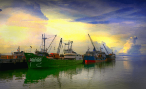
Ormoc City is a port city and the largest city in Leyte by land area. It is the second-largest in Eastern Visayas after Calbayog in Samar. The city is located at the head of Ormoc Bay, and its land is mostly gentle, rolling plains. High mountains separate Ormoc from the eastern part of Leyte. Many rivers and streams flow through Ormoc, including the Bao River, Pagsangahan River, and Anilao and Malbasag Rivers.
Barangays: City Neighborhoods
Ormoc is divided into 85 barangays, which are like local neighborhoods. Each barangay has smaller areas called puroks and some have sitios. The number of barangays was reduced from 110 after the 2022 vote merged 29 of them into four larger ones.
- Airport
- Alegria
- Alta Vista
- Bagongbong
- Bagong Buhay
- Bantigue
- Batuan
- Bayog
- Biliboy
- Cabaon-an
- Cabintan
- Cabulihan
- Cagbuhangin
- Camp Downes
- Can-adieng
- Can-untog
- Catmon
- Cogon Combado
- Concepcion
- Curva
- Danhug (Lili-on)
- Dayhagan
- Dolores
- Domonar
- Don Carlos B. Rivilla Sr. (Boroc)
- Don Felipe Larrazabal
- Don Potenciano Larrazabal
- Doña Feliza Z. Mejia
- Donghol
- East (Poblacion; consisting former Brgys. District 9–11, 16, 18, 25 (Malbasag), 28)
- Esperanza
- Gaas
- Green Valley
- Guintigui-an
- Hibunawon
- Hugpa
- Ipil
- Juaton
- Kadaohan
- Labrador (Balion)
- Lake Danao
- Lao
- Leondoni
- Libertad
- Liberty
- Licuma
- Liloan
- Linao
- Luna
- Mabato
- Mabini
- Macabug
- Magaswi
- Mahayag
- Mahayahay
- Manlilinao
- Margen
- Mas-in
- Matica-a
- Milagro
- Monterico
- Nasunogan
- Naungan
- North (Poblacion; consisting former Brgy. District 29 (Nadongholan))
- Nueva Sociedad
- Nueva Vista
- Patag
- Punta
- Quezon, Jr.
- Rufina M. Tan (Rawis)
- Sabang Bao
- Salvacion
- San Antonio
- San Isidro
- San Jose
- San Juan
- San Pablo (Simangan)
- San Vicente
- Santo Niño
- South (Poblacion; consisting former Brgys. District 1–8, 12, 13, 15, 17, 23, 27)
- Sumangga
- Tambulilid
- Tongonan
- Valencia
- West (Poblacion; consisting former Brgys. District 14, 19–22, 24, 26 (Isla Verde))
Ormoc's Climate
Ormoc City has a tropical climate. This means it is generally warm all year round. It experiences rainfall throughout the year, with heavier rains during certain months.
People of Ormoc
The people who live in Ormoc are called Ormocanons. Most of them speak Cebuano, which is common in western and southern Leyte. Some also speak Waray.
Like most Filipinos, Ormocanons are mostly Roman Catholic. The city celebrates its annual festival, the Feast of Sts. Peter and Paul, on June 28 and 29. This honors their patron saints, Saint Peter and Saint Paul. Other Catholic holidays and local barangay festivals are also celebrated. There is also a small Muslim community in the city, many of whom are Maranaos from Mindanao.
Ormoc's Economy
Ormoc's economy is a mix of different activities. These include farming, fishing, industry, tourism, and services. Important farm products are sugar cane, rice, and pineapple.
The city's economy is growing partly because it helps supply a lot of the country's electricity. This comes from its rich geothermal power resources. The Tongonan Geothermal Power Plant, located in Barangay Tongonan and nearby Kananga, produces this energy. Ormoc is also a gateway to the Leyte Industrial Development Estate. This area has large factories like the Philippine Phosphate Fertilizer Plant, which is Asia's biggest fertilizer factory, and the Philippine Associated Smelter and Refining Company, the country's largest copper processing plant.
Places to Visit in Ormoc
Here are some interesting places tourists can visit in Ormoc City:
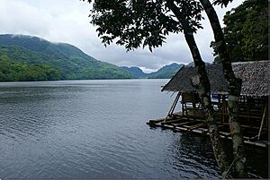
- Lake Danao is a violin-shaped lake about 3 kilometers long. It sits high up, about 640 meters (2,100 feet) above sea level. You can find floating cottages here and rent boats. This lake was renamed and became Lake Danao National Park in 1998. It is now a protected area.
- Tongonan Hotsprings National Park is located about 18 kilometers northeast of Ormoc City. It's a 272-hectare park with a cool climate and lots of green plants. It has a warm pool with medicinal properties and a geyser that spouts boiling water and steam. This area is a source of geothermal power, which provides electricity to the entire region. It was the first geothermal plant to operate in the Philippines.
- Pineapple Plantation is a large farm covering 210 hectares north of the city in Barangay Hibunawon. Ormoc's "Queen Pineapple" is famous for being very sweet. It's a popular gift to bring home and is an unofficial symbol of the city.
- Centennial Park was built in the early 1990s to honor Filipino soldiers who fought to free Leyte and the Philippines. The Centennial Marker was added in 1998 to celebrate 100 years of Philippine independence. This park is a nice place for relaxing and picnics.
- Lake Kasudsuran is one of Ormoc's three beautiful lakes. It's a 5-hectare lake located in Barangay Gaas, about 27 kilometers northeast of Ormoc City. It's in a forest area on a plateau about 1,000 meters above sea level. You can only reach this lake by walking.
- Alto Peak is the highest mountain in Eastern Visayas. It is also known as Mt. Amindueuen. While technically part of Jaro, Leyte, the starting point for climbing it is in Barangay Cabintan, Ormoc City. Farming communities with vegetable plantations live in this area.
- Sayahan Falls is a recently discovered waterfall in Sitio Maglahug, Barangay Gaas, Ormoc City. It became popular after a local tourist shared pictures of it online.
- Puente dela Reina is the oldest bridge in the city. Its old cobblestones are still there. It was built in the early 1800s and finished in 1861. In the Spanish era, it was a docking area for boats used by Chinese, Javans, and Indonesians who came to trade. The bridge is still used today.
- Western Leyte Guerrilla Warfare Forces Monument remembers the Filipino fighters who fought against the Japanese during World War II.
- Ruins of Cong. Dominador Tan Residence The Tan Mansion was built in the 1930s. During World War II, it was used as a Japanese base. It was destroyed during the bombing of Ormoc, known as the “Battle of Ormoc Bay.” The ruins are a historical site for both Japan and the Philippines.
City Services
Transportation
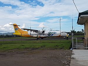
The Port of Ormoc is the city's main seaport. For air travel, Ormoc Airport serves the city, but it does not have regular commercial flights. The closest airport with commercial flights is Daniel Z. Romualdez Airport in Tacloban.
Energy
Ormoc is home to the largest power plant in Southeast Asia, the Tongonan Geothermal Power Plant in Barangay Tongonan. This plant provides electricity to the entire Eastern Visayas Region and also helps supply power to Luzon and Mindanao.
Learning in Ormoc
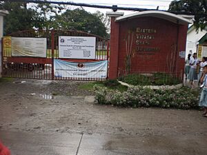
Ormoc is an important educational center for western Leyte. It has many schools for primary and secondary education, both public and private. For higher education, there are colleges like Saint Peter's College of Ormoc, Western Leyte College of Ormoc City, Inc., Santo Niño College of Ormoc, Saint Paul's School of Ormoc Foundation, Inc., and STI College - Ormoc. More recently, ACLC College of Ormoc, San Lorenzo Ruiz College of Ormoc, Ormoc City Institute of Technology (OCIT), and the Ormoc campus of the Eastern Visayas State University have opened. Ormoc also has a Chinese school called Ormoc Se San School.
Famous Ormocanons
- Johnriel Casimero - a professional boxer
- Rey Evangelista - a former professional basketball player
- Richard Gomez - an actor and former mayor of Ormoc City. He is currently a Congressman for Leyte's 4th District.
- Chico Lanete and Garvo Lanete - professional basketball players
- Lucy Torres-Gomez - an actress and former Congresswoman. She is currently the mayor of Ormoc City.
- Robert Bolick - a professional basketball player
See also
 In Spanish: Ormoc para niños
 | John T. Biggers |
 | Thomas Blackshear |
 | Mark Bradford |
 | Beverly Buchanan |


