
Eastern Visayas facts for kids
Quick facts for kids
Eastern Visayas
Sinirangan Kabisay-an
Sidlakang Kabisay-an Silangang Kabisayaan Region VIII |
|
|---|---|

Clockwise from top:
|
|

Location in the Philippines
|
|
| Country | |
| Island group | Visayas |
| Regional center | Tacloban |
| Area | |
| • Total | 23,251.10 km2 (8,977.30 sq mi) |
| Population
(2015)
|
|
| • Total | 4,440,150 |
| • Density | 190.96516/km2 (494.5975/sq mi) |
| Time zone | UTC+8 (PST) |
| ISO 3166 code | PH-08 |
| Provinces |
6
|
| Cities | |
| Municipalities | 136 |
| Barangays | 4,390 |
Eastern Visayas is a special area in the Philippines known as Region VIII. It's like a big neighborhood made up of several provinces and cities. The main city and center of this region is Tacloban.
This region is famous for its three main islands: Samar, Leyte, and Biliran. It has six provinces and two important cities. One of its most famous sights is the San Juanico Bridge, which connects two of its largest islands.
Contents
Discover Eastern Visayas
Eastern Visayas is located in the central part of the Philippines. It's part of the Visayas island group. This region is known for its beautiful natural spots and rich history. Many people visit to see its stunning beaches, waterfalls, and historical landmarks.
Where is Eastern Visayas?
Eastern Visayas is on the eastern side of the Visayas island group. It faces the Pacific Ocean. This location means it experiences different weather patterns. It also has many coastlines. The region is surrounded by water, making fishing an important activity.
Provinces and Cities
Eastern Visayas is made up of six provinces. These are Biliran, Leyte, Northern Samar, Samar, Eastern Samar, and Southern Leyte. Each province has its own unique charm.
There are also two major cities in the region. These are Ormoc and Tacloban. Tacloban is the biggest city and the regional center. It's where many government offices and businesses are located.
Leyte Province
Leyte is one of the largest provinces in Eastern Visayas. It is known for its important role in history. Many historical events happened here. The capital city of Leyte is Tacloban.
Samar Province
Samar is another big island and province. It is famous for its caves and waterfalls. Exploring these natural wonders is a popular activity for visitors. The capital of Samar is Catbalogan.
Biliran Province
Biliran is the smallest province in the region. It is known for its beautiful waterfalls and hot springs. It's a great place for nature lovers. The capital of Biliran is Naval.
Famous Places to See
Eastern Visayas has many interesting places to visit. These places show off the region's beauty and history.
San Juanico Bridge
The San Juanico Bridge is one of the most famous landmarks. It connects the islands of Leyte and Samar. It is the longest bridge in the Philippines that crosses a body of water. The bridge offers amazing views of the sea.
MacArthur Landing Memorial Park
This park in Palo, Leyte is a historical site. It marks where General Douglas MacArthur landed during World War II. There are large statues of MacArthur and his companions. It reminds people of an important moment in history.
Sohoton Caves and Natural Bridge National Park
Located in Basey, Samar, this park is a natural wonder. It features beautiful caves and a natural rock bridge. You can explore the caves and see unique rock formations. It's a perfect spot for adventure.
Culture and Festivals
The people of Eastern Visayas have a rich culture. They celebrate many colorful festivals. These festivals show their traditions and beliefs.
Pintados-Kasadyaan Festival
This is one of the most vibrant festivals. It is celebrated in Tacloban City. People paint their bodies with designs that look like ancient warriors. They dance in the streets to celebrate their heritage.
Sangyaw Festival
Also held in Tacloban, the Sangyaw Festival is a grand parade. It features beautiful costumes and lively music. It's a celebration of thanksgiving and joy.
What People Do There
Many people in Eastern Visayas work in farming and fishing. The region's fertile land is good for growing rice, corn, and coconuts. Its long coastlines mean that fishing is also a major source of income. Tourism is also growing, as more people discover the region's beauty.
Images for kids
-
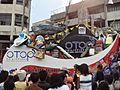
Float exhibiting products of Eastern Visayas
-
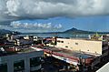
A view of Tacloban as seen in December 2015


See also
 In Spanish: Bisayas Orientales para niños
