
Tacloban facts for kids
Quick facts for kids
Tacloban
|
|||
|---|---|---|---|
|
Highly urbanized city
|
|||
| City of Tacloban | |||
|
From top, left to right: Avenida Rizal, Yolanda Shrine, Santo Niño Church, Justice Romualdez Street, Santo Niño Shrine and Heritage Museum, Prince Mansion, and aerial view of Downtown Tacloban
|
|||
|
|||
Nickname(s):
|
|||
| Motto(s):
City of Love, Beauty and Progresses
|
|||

Map of Eastern Visayas with Tacloban highlighted
|
|||
|
OpenStreetMap
|
|||
.svg)
Tacloban
Location in Visayas
.svg)
Tacloban
Location in Philippines
|
|||
| Country | Philippines | ||
| Region | Eastern Visayas | ||
| Province | Leyte (geographically only) | ||
| District | [[{{#property:P7938}} | — Lua error in Module:Wd at line 1804: attempt to index field 'wikibase' (a nil value).]] | ||
| Founded | 1770 | ||
| Provincial capital | February 26, 1830 | ||
| Cityhood | June 20, 1952 | ||
| Highly urbanized city | December 18, 2008 | ||
| Barangay | 138 (see Barangays) | ||
| Government
|
|||
| • Type | Sangguniang Panlungsod | ||
| Area | |||
| • Total | 201.72 km2 (77.88 sq mi) | ||
| Elevation | 40 m (130 ft) | ||
| Highest elevation | 574 m (1,883 ft) | ||
| Lowest elevation | 0 m (0 ft) | ||
| Population
(2020 census)
|
|||
| • Total | 251,881 | ||
| • Density | 1,248.67/km2 (3,234.03/sq mi) | ||
| • Households | 57,251 | ||
| Demonym(s) | Taclobanon | ||
| Economy | |||
| • Income class | 1st city income class | ||
| • Poverty incidence |
|
||
| • Revenue | ₱ 1,915 million (2022) | ||
| • Assets | ₱ 4,723 million (2022) | ||
| • Expenditure | ₱ 1,441 million (2022) | ||
| • Liabilities | ₱ 4,259 million (2022) | ||
| • Gross domestic product | ₱45,283 million (2021) $899 million (2021) |
||
| Service provider | |||
| • Electricity | Leyte 2 Electric Cooperative (LEYECO 2) | ||
| Time zone | UTC+08:00 (PST) | ||
| ZIP code |
6500
|
||
| PSGC |
[https://psa.gov.ph/classification/psgc/?q=psgc/barangays/{{#pro000®code={{&provcode=
|
||
| IDD : area code | +63 (0)53 | ||
| Native languages | Waray Tagalog |
||
| Website | www |
||
.jpg)

_2023-11-19.jpg)
.jpg)

.jpg)
.jpg)


Tacloban is a big city on Leyte island in the Eastern Visayas region of the Philippines. It is officially called the City of Tacloban. In 2020, about 251,881 people lived there, making it the most populated city in Eastern Visayas. The city is located about 360 miles (580 km) southeast of Manila.
Tacloban is the main center for the Eastern Visayas region. It is also the largest city and capital of Leyte province. Even though it's part of Leyte geographically, it runs its own government.
Tacloban was the capital of the Philippines for a short time from October 1944 to February 1945. In 2010, it was ranked as one of the most competitive cities in the Philippines. On November 8, 2013, a very strong storm called Typhoon Haiyan (also known as Yolanda) caused a lot of damage to the city. Pope Francis visited Tacloban on January 17, 2015, to meet with the people affected by the typhoon.
Contents
What's in a Name?
The name Tacloban comes from the word taklub. This was a special bamboo tray used by early fishermen to catch crabs or shrimp.
A Look Back in Time: Tacloban's History


Tacloban was first known as Kankabatok. This name came from the first people who lived there, the Kabatok tribe. They built their homes near where the Santo Niño Church is today.
Because of pirate attacks, the area didn't grow much at first. In 1770, a small village with a chapel was set up. It was called Tacloban and was part of Palo. The Augustinian priests helped spread the devotion to Santo Niño, who became the village's patron saint.
As the village grew and pirate attacks lessened, it became a busy trading spot. It was then renamed Tacloban and became its own town. Later, it became the capital of Leyte province.
The name change happened because fishermen often went to Kankabatok. They used a bamboo tool called a "taklub" to catch seafood. When asked where they were going, they would say "(to) tarakluban", meaning "the place where they use the taklub." This name eventually became Tacloban.
It's believed Tacloban became an official town around the 1770s. In 1768, Leyte and Samar became separate provinces. Tacloban's location made it a key trading point between them.
On February 26, 1830, Tacloban became the capital of Leyte. This was because it had a great port with good facilities. On June 20, 1952, Tacloban officially became a chartered city.

In 1901, Colonel Arthur Murray became the first military governor of Leyte. He opened Tacloban's port for international trade. Before World War II, Tacloban was the main center for business, education, and culture in Leyte. Products like copra and abaca were exported a lot.
In November 1912, a strong typhoon hit Tacloban, causing huge damage. Many lives were lost.
On May 25, 1942, Japanese forces took over Tacloban. They stayed for two years. During this time, they made the city's airfield better and used San Pedro Bay as a port. Filipino guerrilla groups fought back against the Japanese.
Leyte was the first place in the Philippines to be freed by Filipino and American soldiers. General Douglas MacArthur and his troops landed on the beaches of Tacloban and Palo on October 20, 1944. This event marked the beginning of the end of the war in the Philippines.
Just three days later, on October 23, MacArthur declared Tacloban the temporary capital of the Philippines. This lasted until the whole country was freed.
On January 8, 1960, MacArthur returned to Leyte for a special visit and was welcomed by the people of Tacloban.
Tacloban was declared a highly urbanized city on October 4, 2008. This means it is now directly managed by the national government, not the provincial government.
Typhoon Haiyan in 2013

On November 8, 2013, Typhoon Haiyan (also called Yolanda) hit Tacloban with full force. It caused massive destruction. Buildings were destroyed, trees were uprooted, and a 13-foot (4-meter) storm surge badly damaged the Daniel Z. Romualdez Airport. The airport was later used as a center for help and evacuation. A US Marine general said that almost every building in the city was destroyed or badly damaged. The city faced many challenges, but it has been recovering since. The official death toll was 6,201.
Pope Francis's Visit in 2015

On January 17, 2015, Pope Francis, the head of the Roman Catholic Church, visited Tacloban. He celebrated a special Mass with the people who survived Typhoon Haiyan.
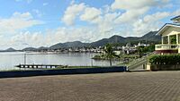
Where is Tacloban?
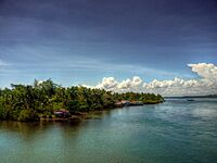
Tacloban is located at the northeastern tip of Leyte Island. Its eastern side faces Cancabato Bay. This bay is at the eastern entrance of San Juanico Strait. The strait separates Leyte and Samar islands.
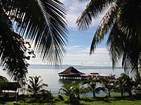
-
The eastern part of the city facing Cancabato Bay.
-
San Pedro Bay shore looking northeast towards Cancabato Bay and the San Juanico Strait, with Samar island in the distance.
-
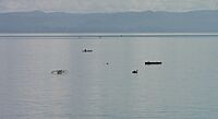
Fishermen on outrigger canoes on Cancabato Bay, with the San Juanico Strait and Samar island in the background.
-
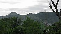
Hills surrounding Tacloban.
-
A village along the coast in Tacloban.


Tacloban's Barangays
Tacloban is divided into 138 smaller areas called barangays. Each barangay has its own smaller sections called puroks and sometimes sitios.
| Number | Name |
|---|---|
| 1 | Libertad |
| 2 | Jones |
| 3 | Upper Nulatula |
| 4 | Libertad |
| 5 | T. Claudio |
| 5-A | T. Claudio |
| 6 | |
| 6-A | Sto. Nino |
| 7 | |
| 8 | T. Claudio |
| 8-A | |
| 12 | GE Palanog |
| 13 | Salazar/J. Romualdez |
| 14 | |
| 15 | |
| 16 | |
| 17 | |
| 18 | |
| 19 | |
| 20 | |
| 21 | P. Burgos |
| 22 | |
| 23 | |
| 23-A | |
| 24 | |
| 25 | |
| 26 | P.Gomez |
| 27 | |
| 28 | |
| 29 | P.Gomez |
| 30 Burgos | |
| 31 | |
| 32 | |
| 33 | |
| 34 | Real |
| 35 | |
| 35-A | |
| 36 | Sabang |
| 36-A | Sabang |
| 37 | Sea Wall |
| 37-A | G.E. Palanog Gawad Kalinga Village |
| 38 | Calvary Hill |
| 39 | Calvary Hill |
| 40 | Calvary Hill |
| 41 | Calvary Hill |
| 42-A | Quarry |
| 42-B | Quarry |
| 43-A | Quarry |
| 43-B | Quarry |
| 44-A | Quarry |
| 44-B | Quarry |
| 45 | |
| 46 | Imelda/Juan Luna |
| 47 | |
| 48-A | |
| 48-B | |
| 49 | Youngfield |
| 50 | Youngfield |
| 50-A | Youngfield |
| 50-B | Youngfield |
| 51 | |
| 51-A | |
| 52 | Lucban Magallanes |
| 53 | Magallanes |
| 54 | Magallanes |
| 54-A | Magallanes |
| 55 | El Reposo |
| 56 | El Reposo |
| 56-A | El Reposo |
| 57 | Whitelane Sampaguita |
| 58 | |
| 59 | Sagkahan Picas |
| 59-A | Sampaguita |
| 59-B | Sampaguita |
| 59-E | Sagkahan Picas |
| 60 | Sagkahan Aslum |
| 60-A | Sagkahan |
| 61 | Sagkahan |
| 62 | Sagkahan Saging |
| 62-A | Sagkahan Ilong |
| 62-B | Sagkahan Picas |
| 63 | Sagkahan Mangga |
| 64 | Sagkahan Bliss |
| 65 | Paseo de Legaspi |
| 66 | Anibong |
| 66-A | Anibong |
| 67 | Anibong |
| 68 | Anibong |
| 69 | Anibong, Happy Land |
| 70 | Anibong, Rawis |
| 71 | Naga-naga |
| 72 | PHHC Seaside |
| 73 | PHHC Mountainside |
| 74 | Lower Nula-Tula |
| 75 | Fatima Village |
| 76 | Fatima Village |
| 77 | Fatima Village |
| 78 | Marasbaras |
| 79 | Marasbaras |
| 80 | Marasbaras |
| 81 | Marasbaras |
| 82 | Marasbaras |
| 83 | Paraiso |
| 83-A | Burayan |
| 83-B | San Jose, Cogon |
| 83-C | San Jose |
| 84 | San Jose |
| 85 | San Jose |
| 86 | San Jose |
| 87 | San Jose |
| 88 | San Jose |
| 89 | San Jose, Baybay |
| 90 | San Jose |
| 91 | Abucay |
| 92 | Apitong |
| 93 | Bagacay |
| 94 | Tigbao |
| 94-A | Basper |
| 95 | Caibaan |
| 95-A | Caibaan |
| 96 | Calanipawan |
| 97 | Cabalawan |
| 98 | Camansihay |
| 99 | Diit |
| 100 | San Roque |
| 101 | New Kawayan |
| 102 | Kawayan |
| 103 | Palanog |
| 103-A | San Paglaum |
| 104 | Salvacion |
| 105 | Suhi |
| 106 | Santo. Niño |
| 107 | Santa Elena |
| 108 | Tagapuro |
| 109 | V&G Subdivision |
| 109-A | V&G Subdivision |
| 110 | Utap |
Tacloban's Climate
Tacloban has a tropical rainforest climate. This means it's usually wet all year round, with heavy and frequent rainfall. There isn't a clear summer or winter season.
The average daytime temperature in Tacloban is about 31.1°C (88°F). May is usually the warmest month, and January and February are the coolest. The highest temperature ever recorded was 38.0°C (100.4°F) in April and August. The lowest was 17.5°C (63.5°F) in December.
Tacloban gets a lot of rain, averaging about 2,659.3 mm (104.7 inches) per year. December is the wettest month, and April is the driest.
| Climate data for Tacloban City (1991–2020, extremes 1903–2023) | |||||||||||||
|---|---|---|---|---|---|---|---|---|---|---|---|---|---|
| Month | Jan | Feb | Mar | Apr | May | Jun | Jul | Aug | Sep | Oct | Nov | Dec | Year |
| Record high °C (°F) | 34.7 (94.5) |
34.8 (94.6) |
35.9 (96.6) |
38.0 (100.4) |
37.9 (100.2) |
36.6 (97.9) |
37.8 (100.0) |
38.0 (100.4) |
37.2 (99.0) |
36.0 (96.8) |
35.2 (95.4) |
35.0 (95.0) |
38.0 (100.4) |
| Mean daily maximum °C (°F) | 29.5 (85.1) |
30.2 (86.4) |
31.0 (87.8) |
32.0 (89.6) |
32.5 (90.5) |
32.1 (89.8) |
31.9 (89.4) |
32.3 (90.1) |
32.1 (89.8) |
31.7 (89.1) |
31.0 (87.8) |
31.1 (88.0) |
31.4 (88.5) |
| Daily mean °C (°F) | 26.7 (80.1) |
26.9 (80.4) |
27.6 (81.7) |
28.5 (83.3) |
29.0 (84.2) |
28.7 (83.7) |
28.5 (83.3) |
28.8 (83.8) |
28.6 (83.5) |
28.4 (83.1) |
27.9 (82.2) |
27.3 (81.1) |
28.1 (82.6) |
| Mean daily minimum °C (°F) | 23.8 (74.8) |
23.7 (74.7) |
24.1 (75.4) |
25.0 (77.0) |
25.6 (78.1) |
25.4 (77.7) |
25.1 (77.2) |
25.3 (77.5) |
25.1 (77.2) |
25.1 (77.2) |
24.8 (76.6) |
24.4 (75.9) |
24.8 (76.6) |
| Record low °C (°F) | 18.8 (65.8) |
17.6 (63.7) |
18.0 (64.4) |
20.2 (68.4) |
20.5 (68.9) |
20.9 (69.6) |
21.0 (69.8) |
20.6 (69.1) |
21.0 (69.8) |
19.8 (67.6) |
19.4 (66.9) |
17.5 (63.5) |
17.5 (63.5) |
| Average rainfall mm (inches) | 367.1 (14.45) |
278.4 (10.96) |
233.3 (9.19) |
124.0 (4.88) |
143.4 (5.65) |
210.8 (8.30) |
188.4 (7.42) |
156.1 (6.15) |
186.1 (7.33) |
214.6 (8.45) |
288.0 (11.34) |
450.4 (17.73) |
2,840.6 (111.83) |
| Average rainy days (≥ 1.0 mm) | 18 | 15 | 14 | 12 | 11 | 15 | 15 | 12 | 13 | 16 | 19 | 22 | 182 |
| Average relative humidity (%) | 86 | 84 | 83 | 82 | 83 | 84 | 84 | 83 | 84 | 85 | 87 | 88 | 84 |
| Source: PAGASA | |||||||||||||
People and Languages
In 2020, Tacloban had 251,881 residents. Most people in Tacloban speak Waray-Waray. This language is also known as Lineyte-Samarnon. Over 90% of the city's population speaks it. Waray-Waray is also the common language used by people from different ethnic groups in the city.
Tacloban has a mix of cultures and languages. Many people have Spanish and Chinese backgrounds. There are also foreign residents and native Leyteños. Other Filipino groups have moved to the city, including those who speak Cebuano, Tagalog, and Ilocano.
Most residents (88.52%) are Roman Catholic. There are also Muslims, members of the Iglesia ni Cristo, Evangelicals, Baptists, and Seventh-Day Adventists.
Tacloban's Economy
.jpg)

.jpg)
.jpg)
.jpg)
| Source: Philippine Statistics Authority |
|
Tacloban is the main economic hub of Eastern Visayas. Its economy relies on farming, trade, and tourism. The city has a large area called the Eastern Visayas Agri-Industrial Growth Center (EVRGC). This center helps with eco-industrial activities.
Tacloban is one of the fastest-growing cities in the Philippines. It also has one of the lowest poverty rates in the country. After the big typhoon in 2013, the city was declared a "start-up city." This meant everything had to be rebuilt. The city is now recovering quickly.
How Tacloban is Governed
.jpg)
The city's government is led by the mayor. The city council, called the Sangguniang Panlungsod, makes laws for the city. It has ten elected members and other representatives. The vice mayor leads the council. The current city mayor is Alfred Romualdez.
Since 2008, Tacloban has been a highly urbanized city. This means it is directly overseen by the national government, not the provincial government.
Tacloban City is part of the 1st District of Leyte. This district also includes seven other towns. The current representative for the district is Congressman Martin Romualdez.
Tacloban's Official Seal

The official seal of Tacloban shows the city's identity. It was created when Tacloban became a city on June 20, 1952.
The symbols on the seal represent different parts of the city:
- Left Side - This part stands for the province of Samar. Samar provides many farm and sea products to Tacloban, helping its trade.
- Center - This represents the beautiful San Juanico Strait.
- The Galleon - This ship symbolizes Ferdinand Magellan. He landed on Homonhon, Eastern Samar, which was the first Philippine island he saw during his trip around the world.
- Right Side - This is the Leyte side, where Tacloban City is located.
Tacloban's Culture and Festivals


The city's main celebration is a week-long fiesta that ends on June 30. This Grand Fiesta of Tacloban includes a traditional handover ceremony. Fireworks and big parades are part of the fun. During this time, every house in the city prepares a feast and welcomes guests.
- Subiran Regatta
- This is a race of traditional one-man sailboats called "subiran." The race happens on the beautiful Leyte Gulf. Sailors use only their skills to steer the boat with the wind, without paddles. The Subiran Regatta is held every year during the Tacloban City Fiesta. It helps keep the art of sailing alive and shows off the skills of local boatmen.

- Balyuan
- This event, organized by the Department of Tourism and the city government, started in 1975. It's a re-enactment of a story about exchanging religious images between a village in Basey and Sitio Kankabatok (now Tacloban City). The story says that in the past, people from Kankabatok would borrow a larger image of Santo Niño from Basey for their fiesta. The image was returned after the celebrations. Later, when Kankabatok grew, the Santo Niño image stayed there. This event celebrates the cultural ties between the people of south Samar and eastern Leyte.
- Sangyaw Festival
- "Sangyaw" is an old Waray word meaning "to announce news." The Sangyaw Festival was started in the 1980s. It was brought back in 2008 by the current city mayor, Alfred Romualdez. The festival invites different performing groups from various festivals across the country to compete. It aims to become a major festival in the Philippines.
Getting Around Tacloban


Tacloban has different ways to get around, including planes, multicabs, taxis, jeepneys, tricycles, and pedicabs. The city has the Daniel Z. Romualdez Airport. The New Transport Terminal in the Abucay district is the main hub for buses and other land transport to and from different parts of the region. The San Juanico Bridge connects Tacloban to the town of Santa Rita in Samar.
Healthcare Services
As the main center of Eastern Visayas, Tacloban offers many healthcare services. There are several hospitals and medical places in the city.
- Public hospitals
- Eastern Visayas Medical Center (EVMC)
- Tacloban City Hospital
- Private hospitals
- ACE Medical Center Tacloban
- Divine Word Hospital
- Our Mother of Mercy Hospital
- Remedios Trinidad Romualdez Hospital
- Tacloban Doctors Medical Center
Learning in Tacloban

Tacloban has many schools and colleges, both public and private.
Some notable schools include:
- UP Tacloban College
- Leyte Normal University
- Eastern Visayas State University
- Holy Infant College
- Holy Spirit Foundation College, Inc.
- Holy Virgin of Salvacion Foundation College, Inc.
- ABE International Business College Tacloban
- ACLC College of Tacloban
- AMA College Tacloban
- Asia Pacific Career College
- Asian Development Foundation College
- CIE British School Tacloban
- Colegio De La Salle Fondation de Tacloban, Inc.
- Dr. Vicente Orestes Romualdez Educational Foundation (College of Law)
- JE Mondejar Foundation College
- Leyte Colleges
- Leyte National High School
- National Maritime Polytechnic
- Remedios Trinidad Romualdez Medical Foundation
- Sacred Heart College of Tacloban
- St. Scholastica's College, Tacloban
- St. Benedict College of Tacloban, Inc.
- Liceo del Verbo Divino
- St. Therese Educational Center of Leyte (STECL)
- St. Therese Christian Development Center Foundation, Inc. (STCDCFI)
- St. Therese Educational Foundation of Tacloban, Inc. (STEFTI)
- Saint Arnold Janssen College of Tacloban, Inc.
Sister Cities
International
 Fukuyama, Hiroshima, Japan
Famous People from Tacloban
- Merlie Alunan - a poet and teacher.
- Gina Apostol - a writer.
- Toni Rose Basas - a former professional volleyball player.
- Louis Bulaong - a writer.
- Norberto Castillo - a former head of the University of Santo Tomas.
- Andres Centino - a former Chief of Staff of the Philippine Armed Forces.
- Kim Chiu - a famous actress and TV star who grew up partly in Tacloban.
- Dennis Daa - a professional basketball player.
- Dino Daa - a professional basketball player.
- Bullet Dumas - an indie folk singer-songwriter.
- Karla Estrada - an actress and singer.
- Ted Failon - a news anchor and TV personality.
- Nieves Fernandez - a brave World War II guerrilla fighter.
- Jose Mari Gonzales - an actor.
- Xyza Gula - a volleyball player.
- Ruby Ibarra - a Filipina-American rapper.
- Iluminado Lucente - a famous Waray poet and former mayor of Tacloban.
- Carlo Francisco Manatad - a filmmaker and film editor.
- AZ Martinez - an actress and beauty queen.
- Joanné Nugas - a Filipina-Swedish music artist.
- Daniel Padilla - a popular actor and singer.
- Dan Palami - a businessman and former manager of the Philippine national football team.
- Joel Porlares – a leader of the Philippine Independent Church.
- Rudy Robles - an actor.
- Benjamin Romualdez - a former governor and ambassador.
- Cristina Romualdez - a former actress and former mayor of Tacloban City.
- Ferdinand Martin Romualdez - a representative and current Speaker of the House of Representatives.
- Imelda Romualdez-Marcos - a former First Lady.
- Lou Salvador - a basketball player.
- Mark Swainston - a footballer.
- Jean-Paul Verona - an award-winning music producer.
- Nimfa C. Vilches - a judge.
- Aira Villegas - an Olympic bronze medalist in boxing.
See also
 In Spanish: Tacloban para niños
