
Solano County, California facts for kids
Quick facts for kids
Solano County
|
|||
|---|---|---|---|
| Solano County | |||
   Images, from top down, left to right: The Solano County Government Center in downtown Fairfield, Benicia Capitol State Historic Park, Vacaville Hills
|
|||
|
|||

Location in the state of California
|
|||
| Country | United States | ||
| State | California | ||
| Region | San Francisco Bay Area | ||
| Incorporated | February 18, 1850 | ||
| Named for | Chief Solano of the Suisun people | ||
| County seat | Fairfield | ||
| Largest city | Vallejo (population) Fairfield (area) |
||
| Government | |||
| • Type | Council–Administrator | ||
| • Body |
Erin Hannigan
Monica Brown Wanda Williams John Vasquez Mitch Mashburn |
||
| Area | |||
| • Total | 906 sq mi (2,350 km2) | ||
| • Land | 822 sq mi (2,130 km2) | ||
| • Water | 84 sq mi (220 km2) | ||
| Highest elevation | 2,822 ft (860 m) | ||
| Population
(2020)
|
|||
| • Total | 453,491 | ||
| • Density | 552/sq mi (213/km2) | ||
| GDP | |||
| • Total | $35.408 billion (2022) | ||
| Time zone | UTC−8 (Pacific Time Zone) | ||
| • Summer (DST) | UTC−7 (Pacific Daylight Time) | ||
| Area code | 707 | ||
| FIPS code | 06-095 | ||
| GNIS feature ID | 277312 | ||
| Congressional districts | 4th, 7th, 8th | ||


Solano County (![]() i/səˈlɑːnoʊ/) is a county in the U.S. state of California. A county is like a large district with its own local government. As of 2020, about 453,491 people live here. The main city, or county seat, is Fairfield.
i/səˈlɑːnoʊ/) is a county in the U.S. state of California. A county is like a large district with its own local government. As of 2020, about 453,491 people live here. The main city, or county seat, is Fairfield.
Solano County is part of the larger San Francisco Bay Area. It is the county in the northeastern part of this nine-county region. A small part of the University of California, Davis, is also located in Solano County.
Contents
History of Solano County
Solano County was one of the very first counties in California. It was created in 1850 when California officially became a state.
The county was named after Chief Solano. He was a leader of the Suisun people, a Native American tribe from this area. Chief Solano was a close friend of General Mariano Guadalupe Vallejo, who asked for the county to be named after him. Chief Solano was also known as Sem-Yeto, which means "brave or fierce hand." He was given the Spanish name Francisco Solano when he was baptized. This name came from a Spanish Franciscan missionary named Father Francisco Solano.
Travis Air Force Base, an important military base, is located just east of Fairfield. In recent years, a company called California Forever bought a lot of land in the county. They plan to build a new city there.
Where is Solano County?
Solano County is the easternmost county in the North Bay part of the San Francisco Bay Area. Sometimes, news reports might say it's in the East Bay. Also, a part of the county stretches into the Sacramento Valley.
Geography and Nature
The U.S. Census Bureau says that Solano County covers about 906 square miles. About 84 square miles of this area is water, which is about 9.3% of the total.
Neighboring Counties
Solano County shares borders with these other counties:
- Contra Costa County, California - to the south
- Sonoma County, California - to the west
- Napa County, California - to the west
- Yolo County, California - to the north
- Sacramento County, California - to the east
Protected Natural Areas
Part of the San Pablo Bay National Wildlife Refuge is located in Solano County. This area helps protect wildlife and their habitats.
Plants and Animals of Solano County
Solano County is home to several rare and endangered species of plants and animals. These include:
- The Delta green ground beetle
- A wildflower called Lasthenia conjugens, also known as Contra Costa goldfields
- An annual plant named Legenere limosa, or false Venus' looking glass
Getting Around Solano County
Main Roads and Highways


 Interstate 80
 Interstate 505
 Interstate 680
 Interstate 780
 State Route 12
 State Route 29
 State Route 37
 State Route 84
 State Route 113
Public Transportation Options
Several public transportation groups serve Solano County:
- SolTrans: This agency was formed by combining Vallejo Transit and Benicia Breeze. Vallejo Transit used to run a ferry to San Francisco.
- San Francisco Bay Ferry: You can catch a ferry from Vallejo to other parts of the Bay Area.
- Fairfield and Suisun Transit
- Vacaville City Coach
- Rio Vista Delta Breeze
These agencies connect with each other, making it easy to travel around the county. You can also connect to BART stations in Contra Costa County. There are also links to Napa, Yolo, and Sacramento counties.
For longer trips, you can use Greyhound buses or Amtrak trains.
Airports for Small Planes
The public airports in Solano County for smaller planes are the Nut Tree Airport and Rio Vista Municipal Airport.
People of Solano County
| Historical population | |||
|---|---|---|---|
| Census | Pop. | %± | |
| 1850 | 580 | — | |
| 1860 | 7,169 | 1,136.0% | |
| 1870 | 16,871 | 135.3% | |
| 1880 | 18,475 | 9.5% | |
| 1890 | 20,946 | 13.4% | |
| 1900 | 24,143 | 15.3% | |
| 1910 | 27,559 | 14.1% | |
| 1920 | 40,602 | 47.3% | |
| 1930 | 40,834 | 0.6% | |
| 1940 | 49,118 | 20.3% | |
| 1950 | 104,833 | 113.4% | |
| 1960 | 134,597 | 28.4% | |
| 1970 | 169,941 | 26.3% | |
| 1980 | 235,203 | 38.4% | |
| 1990 | 340,421 | 44.7% | |
| 2000 | 394,542 | 15.9% | |
| 2010 | 413,344 | 4.8% | |
| 2020 | 453,491 | 9.7% | |
| 2023 (est.) | 449,218 | 8.7% | |
| U.S. Decennial Census 1790–1960 1900–1990 1990–2000 2010 2020 |
|||
Population in 2020
In 2020, Solano County had a population of 453,491 people. The county is known for being very diverse.
| Race / Ethnicity (NH = Non-Hispanic) | Pop 2010 | Pop 2020 | % 2010 | % 2020 |
|---|---|---|---|---|
| White alone (NH) | 168,628 | 155,125 | 40.80% | 34.21% |
| Black or African American alone (NH) | 58,743 | 60,051 | 14.21% | 13.24% |
| Native American or Alaska Native alone (NH) | 1,864 | 1,624 | 0.45% | 0.36% |
| Asian alone (NH) | 59,027 | 70,953 | 14.28% | 15.65% |
| Pacific Islander alone (NH) | 3,243 | 3,775 | 0.78% | 0.83% |
| Other Race alone (NH) | 1,463 | 2,988 | 0.35% | 0.66% |
| Mixed Race or Multi-Racial (NH) | 21,020 | 30,820 | 5.09% | 6.80% |
| Hispanic or Latino (any race) | 99,356 | 128,155 | 24.04% | 28.26% |
| Total | 413,344 | 453,491 | 100.00% | 100.00% |
Diversity in Solano County
A study in 2014 by The Atlantic magazine found that Solano County was the 5th most racially diverse county in the United States. This means many different ethnic and racial groups live there.

Cities and Towns
Cities in Solano County
Other Communities
These are smaller communities that are not officially cities:
- Allendale
- Elmira
- Green Valley
- Hartley
- Bahia
- Batavia
- Birds Landing
- Bucktown
- Collinsville
- Cordelia
- Denverton
- Maine Prairie
- Mankas Corner
- Rockville
- Scandia
Largest Communities by Population (2020)
Here are the largest cities and communities in Solano County, based on the 2020 census:
| Rank | Settlement | Type | Population (2020 census) |
|---|---|---|---|
| 1 | Vallejo | City | 126,090 |
| 2 | † Fairfield | City | 119,881 |
| 3 | Vacaville | City | 102,386 |
| 4 | Suisun City | City | 29,518 |
| 5 | Benicia | City | 27,131 |
| 6 | Dixon | City | 18,988 |
| 7 | Rio Vista | City | 10,005 |
| 8 | Hartley | CDP | 2,430 |
| 9 | Green Valley | CDP | 1,654 |
| 10 | Allendale | CDP | 1,651 |
| 11 | Elmira | CDP | 193 |
Fun Fact about Solano County
In 1985, a humpback whale named Humphrey got lost. He swam far off his usual path and ended up in a narrow waterway called Shag Slough, north of Rio Vista. Rescuers had to take apart a county bridge to help him turn around and get back to the ocean!
Images for kids
-
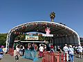
People line up at the gate to the Solano County Fair in Vallejo, California
-
A building on the Solano County Fairgrounds


See also
 In Spanish: Condado de Solano para niños
