
Yolo County, California facts for kids
Quick facts for kids
Yolo County, California
|
|||
|---|---|---|---|
| County of Yolo | |||
     Images, from top down, left to right: The former Yolo County Courthouse in Woodland, The Ziggurat in West Sacramento, Mondavi Center on the UC Davis campus, Downtown Winters, Canada Geese at the Yolo Bypass Wildlife Area
|
|||
|
|||

Location in the state of California
|
|||
| Country | United States | ||
| State | California | ||
| Region | Sacramento Valley | ||
| CSA | Greater Sacramento | ||
| Incorporated | February 18, 1850 | ||
| County seat | Woodland | ||
| Largest city | Davis (population) West Sacramento (area) |
||
| Government | |||
| • Type | Council–CAO | ||
| • Body | Board of Supervisors | ||
| Area | |||
| • Total | 1,024 sq mi (2,650 km2) | ||
| • Land | 1,015 sq mi (2,630 km2) | ||
| • Water | 8.9 sq mi (23 km2) | ||
| Highest elevation | 3,123 ft (952 m) | ||
| Population
(2020)
|
|||
| • Total | 216,403 | ||
| • Density | 211.33/sq mi (81.60/km2) | ||
| Time zone | UTC-8 (Pacific Time Zone) | ||
| • Summer (DST) | UTC-7 (Pacific Daylight Time) | ||
| Area codes | 530, 916, 279 | ||
| FIPS code | 06-113 | ||
| GNIS feature ID | 277321 | ||
| Congressional districts | 4th, 7th | ||


Yolo County is a county in the northern part of California. It's officially called the County of Yolo. Yolo County was one of the very first counties in California. It was created in 1850 when California became a state.
In 2020, about 216,403 people lived here. The main city, or county seat, is Woodland. Yolo County is part of the larger Greater Sacramento area. It is located in the Sacramento Valley.
Contents
What's in a Name?
The name "Yolo" comes from the Patwin Native American people. Some believe it comes from the word Yo-loy, which means "a place with lots of rushes" (a type of plant). Others think it's from the village of Yodoi or the name of its chief, Yodo.
A Look Back: Yolo County History
Yolo County has a long history. It was one of the first counties created in California. This happened in 1850, the same year California joined the United States.
Exploring Yolo County's Geography

Yolo County covers a total area of about 1,024 square miles. Most of this area, about 1,015 square miles, is land. The rest, about 8.9 square miles, is water.
Neighboring Counties
Yolo County shares its borders with several other counties:
- Colusa County to the north
- Sutter County to the northeast
- Sacramento County to the east
- Solano County to the south
- Napa County to the west
- Lake County to the northwest
Getting Around Yolo County
There are many ways to travel in and around Yolo County.
Main Roads
Several major highways pass through Yolo County, making it easy to get to other parts of California.
County Roads
Yolo County has a special system for naming its local roads. They are called "County Roads" and have numbers.
- Roads that go north and south have numbers from 41 to 117. These numbers get higher as you go from west to east.
- Roads that go east and west have numbers from 1 to 38A, and then from 151 to 161. These numbers get higher as you go from north to south.
Usually, each number means the roads are about 1 mile apart. Sometimes, letters are added (like 38A) for roads that are closer together. When these county roads enter a city, their names often change. For example, County Road 101 in Woodland becomes Pioneer Avenue.
Public Transportation
You can get around Yolo County and to nearby cities using public transport.
- Yolobus runs buses throughout Yolo County. They also go to Sacramento and the Sacramento International Airport.
- The University of California, Davis and the city of Davis work together to run Unitrans. This is a bus service for both the city and the university campus.
- Fairfield-Suisun Transit also has a bus line that stops in Davis. It travels between Fairfield and Sacramento.
- Amtrak has a train station in Davis.
Airports
There are several airports in Yolo County:
- Yolo County Airport
- University Airport
- Borges–Clarksburg Airport
- Watts–Woodland Airport
The Port of West Sacramento
The Port of Sacramento is now known as the Port of West Sacramento. It's an inland port located in West Sacramento, California. This port is about 79 miles northeast of San Francisco. It's in the middle of the California Central Valley, which is a very rich farming area.
Who Lives Here? Yolo County's Population
| Historical population | |||
|---|---|---|---|
| Census | Pop. | %± | |
| 1850 | 1,086 | — | |
| 1860 | 4,716 | 334.3% | |
| 1870 | 9,899 | 109.9% | |
| 1880 | 11,772 | 18.9% | |
| 1890 | 12,684 | 7.7% | |
| 1900 | 13,618 | 7.4% | |
| 1910 | 13,926 | 2.3% | |
| 1920 | 17,105 | 22.8% | |
| 1930 | 23,644 | 38.2% | |
| 1940 | 27,243 | 15.2% | |
| 1950 | 40,640 | 49.2% | |
| 1960 | 65,727 | 61.7% | |
| 1970 | 91,788 | 39.7% | |
| 1980 | 113,374 | 23.5% | |
| 1990 | 141,092 | 24.4% | |
| 2000 | 168,660 | 19.5% | |
| 2010 | 200,849 | 19.1% | |
| 2020 | 216,403 | 7.7% | |
| 2023 (est.) | 220,544 | 9.8% | |
| U.S. Decennial Census 1790-1960 1900-1990 1990-2000 2010 2020 |
|||
In 2020, Yolo County had a population of 216,403 people. The county is home to a diverse mix of people. About 43.4% of the population was White (not Hispanic). About 33.1% of the people were Hispanic or Latino. Other groups included Asian (13.8%), Black or African American (2.6%), and people of two or more races (5.5%).
Back in 2000, there were 168,660 people living in the county. The average household had about 2.71 people. The median age was 30 years old. This means half the people were younger than 30, and half were older.
Learning in Yolo County
Yolo County has good schools and colleges.
Public Schools
The public schools in the county are managed by the Yolo County Office of Education.
Colleges and Universities
For higher education, students can attend:
- University of California, Davis
- Woodland Community College
Communities in Yolo County
.jpg)
Yolo County has several cities and smaller communities.
Cities
Census-Designated Places (CDPs)
These are areas that are like towns but are not officially incorporated as cities.
- Brooks
- Clarksburg
- Dunnigan
- El Macero
- Esparto
- Guinda
- Knights Landing
- Madison
- Monument Hills
- Rumsey
- Tancred
- University of California-Davis
- Yolo
Other Communities
These are smaller, unincorporated communities.
- Capay
- Plainfield
- Zamora
- Ronda - This used to be a settlement near Dunnigan. It was still on maps in 1915.
Community Sizes (2010 Census)
Here's a list of communities in Yolo County, ranked by their population in 2010. † county seat
| Rank | City/town/etc. | Type | Population (2010 Census) |
|---|---|---|---|
| 1 | Davis | City | 65,622 |
| 2 | † Woodland | City | 55,468 |
| 3 | West Sacramento | City | 48,744 |
| 4 | Winters | City | 6,624 |
| 5 | University of California Davis | CDP | 5,786 |
| 6 | Esparto | CDP | 3,108 |
| 7 | Monument Hills | CDP | 1,542 |
| 8 | Dunnigan | CDP | 1,416 |
| 9 | Knights Landing | CDP | 995 |
| 10 | Madison | CDP | 721 |
| 11 | Yolo | CDP | 450 |
| 12 | Clarksburg | CDP | 418 |
| 13 | Guinda | CDP | 254 |
| 14 | Rumsey Indian Rancheria | AIAN | 77 |
Images for kids
-
The official flag of Yolo County.
-
The official seal of Yolo County.
-
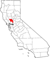
Map showing where Yolo County is located in California.
See also
 In Spanish: Condado de Yolo para niños
