
Knights Landing, California facts for kids
Quick facts for kids
Knights Landing
|
|
|---|---|

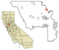
Location of Knights Landing in Yolo County, California
|
|

Knights Landing
Location in California
|
|
| Country | |
| State | |
| County | Yolo County |
| Area | |
| • Total | 1.298 km2 (0.501 sq mi) |
| • Land | 1.298 km2 (0.501 sq mi) |
| • Water | 0 km2 (0 sq mi) 0% |
| Elevation | 11 m (36 ft) |
| Population
(2010)
|
|
| • Total | 995 |
| • Density | 766.6/km2 (1,986.0/sq mi) |
| FIPS code | 06-38800 |
Knights Landing is a small community in Yolo County, California. It is located right on the Sacramento River. The town was founded by William Knight. It used to be known as Baltimore and East Grafton.
Knights Landing is about 25 miles northwest of Sacramento. It sits 36 feet (11 meters) above sea level. In 2010, about 995 people lived there. The area's ZIP Code is 95645. Its phone area code is 530.
Contents
Geography and Climate of Knights Landing
This community covers a small area. It is about 0.5 square miles (1.3 square kilometers) in size. All of this area is land.
Understanding Knights Landing's Climate
Knights Landing has a climate called a warm-summer Mediterranean climate. This means it has hot, dry summers. Winters are mild and wet. This type of climate is common in California.
People and Population in Knights Landing
In 2010, the population of Knights Landing was 995 people. This means there were about 1,985 people for every square mile. All 995 people lived in homes. No one lived in group homes or institutions.
Diversity of Residents
The people living in Knights Landing came from many backgrounds.
- 56.3% were White.
- 0.4% were African American.
- 1.0% were Native American.
- 0.7% were Asian.
- 34.0% were from other races.
- 7.6% were from two or more races.
A large part of the population, 64.7%, was Hispanic or Latino.
Homes and Families
There were 317 homes in Knights Landing.
- About 40% of homes had children under 18.
- Most homes (53.9%) were married couples.
- About 24% of homes had people living alone.
The average home had about 3.14 people. The average family had about 3.74 people.
Age Groups in the Community
The population had different age groups:
- 26.6% were under 18 years old.
- 11.3% were aged 18 to 24.
- 23.9% were aged 25 to 44.
- 26.9% were aged 45 to 64.
- 11.3% were 65 years or older.
The average age in Knights Landing was 34.3 years. For every 100 females, there were about 108 males.
Housing in Knights Landing
There were 343 housing units in the area.
- About 67% of homes were owned by the people living in them.
- About 33% of homes were rented.
Most people (65.8%) lived in homes they owned. The rest (34.2%) lived in rented homes.
History of Knights Landing
Knights Landing was founded in 1843. It was started by Dr. William Knight. He was a doctor from Baltimore, Maryland. Dr. Knight built the first settlement on a mound. This mound was an old meeting place for Native Americans. These groups lived near Cache Creek and the Sacramento River.
Early Importance of the Location
The location quickly became important. It was a good spot for steamboats to land. It also helped people communicate between the east and west sides of the river.
When the town was planned in 1849, it was first named Baltimore. But there was a disagreement about selling the land. So, the name Baltimore was not used.
Ferries and Businesses
Dr. Knight started a ferry service there. Later, J. W. Snowball took over the ferry. Back then, it cost $1 for a person and a horse to cross. A wagon with a team of animals cost $5.
In 1850, S. R. Smith opened a hotel. In 1853, Charles F. Reed officially planned the town. It was then named Knight's Landing. That same year, J. W. Snowball and J. J. Perkins opened a large general store. It was built on the old Native American mound.
On January 1, 1854, Captain J. H. Updegraff opened his own hotel. It was called the "Yolo House." He held a big New Year's party. A steamboat brought guests from Sacramento. In 1860, D. N. Hershey and George Glascock built a new brick hotel. The Yolo House then became a private home.
Railroad and Education
On March 25, 1890, the Southern Pacific Railroad line to Knight's Landing was finished. This helped the town grow. Later, a bridge was built across the river. This also greatly helped the town's success.
The Southern Pacific Railroad once had a line that went from Davis, California, through Woodland, California, and Knights Landing. It continued to Marysville, California. Today, the line stops a few miles northeast of Woodland.
Grafton Elementary was the only public school in Knights Landing. It closed on June 23, 2009. The Woodland Joint Unified School District now serves the area. In 2010, the Science and Technology Academy of Knights Landing opened. It is a charter school located on the old Grafton Elementary campus.
Knights Landing Cemetery
The Knights Landing Cemetery is just south of town. It is said to be one of the possible burial places for the famous stagecoach bandit Charles Bolles. He was also known as Black Bart. If his grave is there, it does not have a marker.
Images for kids
-
Location of Knights Landing in Yolo County, California
| Historical population | |||
|---|---|---|---|
| Census | Pop. | %± | |
| U.S. Decennial Census | |||
See also
 In Spanish: Knights Landing para niños
