Marysville, California facts for kids
Quick facts for kids
Marysville, California
|
|
|---|---|
| City of Marysville | |
|
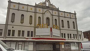
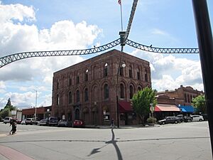
Top: City Hall (left) and State Theatre (right); bottom: Chinatown (left) and Elks Lodge (right).
|
|
| Nickname(s):
Gateway to the Gold Fields
|
|
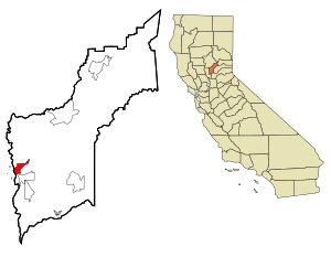
Location in Yuba County and the state of California
|
|
| Country | United States |
| State | California |
| County | Yuba |
| Incorporated | February 5, 1851 |
| Area | |
| • Total | 3.58 sq mi (9.28 km2) |
| • Land | 3.46 sq mi (8.97 km2) |
| • Water | 0.12 sq mi (0.31 km2) 3.36% |
| Elevation | 62 ft (19 m) |
| Population
(2020)
|
|
| • Total | 12,844 |
| • Density | 3,588/sq mi (1,384.1/km2) |
| Time zone | UTC-8 (Pacific) |
| • Summer (DST) | UTC-7 (PDT) |
| ZIP code |
95901
|
| Area code | 530 |
| FIPS code | 06-46170 |
| GNIS feature IDs | 277554, 2411046 |
Marysville is a city in California, and it's the main city of Yuba County. It's located in the Gold Country area of Northern California. In 2020, about 12,844 people lived there. Marysville is part of the larger Sacramento region. It's often called the "Gateway to the Gold Fields" because of its history.
Contents
Discovering Marysville's Past
Marysville was first home to the Maidu people for about 10,000 years. The first non-native explorers, like Jedediah Smith, arrived in 1828. In 1843, Theodore Cordua started a trading post and home called New Mecklenburg here.
The Gold Rush and a New Name
In 1848, the California Gold Rush began. Charles Covillaud, a former worker for Cordua, found gold. He bought part of Cordua's ranch. Later, he bought the rest with his wife's relatives. This ranch became a popular stop for riverboats bringing gold seekers. Even today, a sign calls Marysville the "Gateway to The Gold Fields."
In 1850, Covillaud and others hired a surveyor to plan a town. They first called it Jubaville, then Yubaville. A lawyer named Stephen J. Field bought land and helped set up a new government. On January 18, 1850, the town was named Marysville. It was named after Charles Covillaud's wife, Mary Murphy Covillaud. She was a survivor of the famous Donner Party. Marysville became an official city in 1851.
Growth and Challenges
By 1853, Marysville had grown from a tent city to a town with brick buildings. It had mills, factories, schools, and newspapers. Its population grew to almost 10,000 people by 1853. By 1857, Marysville was one of California's biggest cities. Over $10 million in gold was sent from Marysville banks to San Francisco. People even thought Marysville would become "The New York of the Pacific."
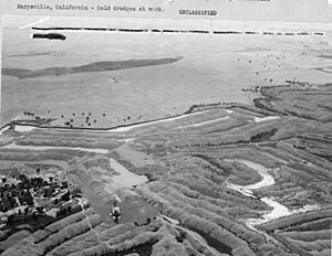
However, a type of mining called hydraulic mining caused problems. It washed a lot of dirt and rocks into the Feather and Yuba Rivers. This made the riverbeds higher, which put Marysville at risk of flooding. The city built a system of walls called levees to protect itself. These levees helped prevent floods but also stopped the city from growing much. That's why Marysville is known as "California's Oldest 'Little' City." The river also became too shallow for boats to reach Marysville.
A Welcoming Place for Chinese Americans
Marysville became home to many Chinese Americans starting in the 1850s. While many Chinese people faced unfair treatment in other parts of California, Marysville offered them a safe place. It was one of the few Chinatowns in California that didn't experience violence. The Chinese Bok Kai Temple in Marysville is believed to be the oldest continuously running Taoist temple in America. A Chinese New Year festival has been celebrated here since 1880. In Cantonese, Marysville is called Sahm Fou (Third City).
Early Businesses and Modern Changes
Marysville also had a busy Jewish business community during the Gold Rush. Stores like Schneider's Clothing and the Old Corner Cigar Store were important. Union Lumber, started in 1852, is still owned by the Cheim family today.
In 2010, the city decided to sell part of Washington Square Park. This was to build a shopping center and bring in more money for the city.
Marysville's Location and Weather
Marysville covers about 3.6 square miles (9.3 square kilometers). Most of this is land, with a small amount of water. Flooding has always been a big concern for the city.
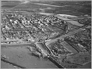
Marysville is located about 40 miles north of Sacramento in the Sacramento Valley. The Yuba River borders the city to the south and east. The Feather River borders it to the west. These two rivers meet just southwest of the city. When there's a lot of snow melting from the nearby Sierra Nevada mountains or heavy rain, these rivers can cause serious flooding.
Marysville's Climate
Marysville has a hot-summer Mediterranean climate. This means it has mild, wet winters and hot, dry summers.
- Winter: January is usually the wettest month. The wet season runs from mid-October to mid-April. During this time, it often rains, and the area can have thick tule fog. Heavy rain or too much mountain snow can lead to big floods in the spring. Snow is rare in the valley.
- Spring: Spring starts wet but becomes drier and warmer. April is the wettest spring month. May has some rain, but usually from thunderstorms.
- Summer: June to September is the dry and hot season. It usually doesn't rain much, except for rare thunderstorms. July and August are the hottest months, with temperatures often reaching the upper 90s Fahrenheit. A cool "delta breeze" from the Bay Area helps cool things down at night.
- Autumn: Autumn starts warm but gets cooler, wetter, and foggier. Rain and fog become more common from mid-October into November.
| Climate data for Marysville, California (Yuba County Airport), 1991–2020 normals, extremes 2000–present | |||||||||||||
|---|---|---|---|---|---|---|---|---|---|---|---|---|---|
| Month | Jan | Feb | Mar | Apr | May | Jun | Jul | Aug | Sep | Oct | Nov | Dec | Year |
| Record high °F (°C) | 76 (24) |
80 (27) |
88 (31) |
96 (36) |
107 (42) |
111 (44) |
113 (45) |
110 (43) |
115 (46) |
104 (40) |
86 (30) |
73 (23) |
115 (46) |
| Mean maximum °F (°C) | 67.7 (19.8) |
72.5 (22.5) |
78.7 (25.9) |
89.1 (31.7) |
96.9 (36.1) |
106.5 (41.4) |
106.9 (41.6) |
105.1 (40.6) |
102.8 (39.3) |
90.8 (32.7) |
78.3 (25.7) |
66.1 (18.9) |
108.4 (42.4) |
| Mean daily maximum °F (°C) | 55.5 (13.1) |
60.4 (15.8) |
66.2 (19.0) |
72.6 (22.6) |
81.9 (27.7) |
90.1 (32.3) |
96.2 (35.7) |
94.6 (34.8) |
89.6 (32.0) |
79.0 (26.1) |
64.2 (17.9) |
55.4 (13.0) |
75.5 (24.2) |
| Daily mean °F (°C) | 46.8 (8.2) |
50.8 (10.4) |
54.8 (12.7) |
59.5 (15.3) |
67.1 (19.5) |
74.0 (23.3) |
78.5 (25.8) |
77.0 (25.0) |
72.7 (22.6) |
64.2 (17.9) |
52.7 (11.5) |
46.6 (8.1) |
62.1 (16.7) |
| Mean daily minimum °F (°C) | 38.2 (3.4) |
41.1 (5.1) |
43.4 (6.3) |
46.4 (8.0) |
52.4 (11.3) |
57.9 (14.4) |
60.7 (15.9) |
59.5 (15.3) |
55.7 (13.2) |
49.4 (9.7) |
41.3 (5.2) |
37.7 (3.2) |
48.6 (9.3) |
| Mean minimum °F (°C) | 27.3 (−2.6) |
30.3 (−0.9) |
34.2 (1.2) |
37.1 (2.8) |
44.3 (6.8) |
50.1 (10.1) |
53.9 (12.2) |
53.0 (11.7) |
47.9 (8.8) |
39.3 (4.1) |
31.4 (−0.3) |
25.8 (−3.4) |
24.1 (−4.4) |
| Record low °F (°C) | 19 (−7) |
24 (−4) |
29 (−2) |
32 (0) |
35 (2) |
43 (6) |
51 (11) |
47 (8) |
41 (5) |
32 (0) |
26 (−3) |
20 (−7) |
19 (−7) |
| Average precipitation inches (mm) | 3.81 (97) |
3.65 (93) |
2.92 (74) |
1.40 (36) |
0.93 (24) |
0.28 (7.1) |
0.00 (0.00) |
0.05 (1.3) |
0.11 (2.8) |
1.03 (26) |
2.21 (56) |
3.68 (93) |
20.07 (510.2) |
| Average precipitation days (≥ 0.01 in) | 10.4 | 9.0 | 9.1 | 6.6 | 3.9 | 1.1 | 0.1 | 0.3 | 0.7 | 3.9 | 7.1 | 11.1 | 63.3 |
| Source 1: NOAA | |||||||||||||
| Source 2: National Weather Service (mean maxima/minima 2006–2020) | |||||||||||||
Marysville's Population Over Time
| Historical population | |||
|---|---|---|---|
| Census | Pop. | %± | |
| 1870 | 4,738 | — | |
| 1880 | 4,321 | −8.8% | |
| 1890 | 3,991 | −7.6% | |
| 1900 | 3,497 | −12.4% | |
| 1910 | 5,430 | 55.3% | |
| 1920 | 5,461 | 0.6% | |
| 1930 | 5,763 | 5.5% | |
| 1940 | 6,646 | 15.3% | |
| 1950 | 7,826 | 17.8% | |
| 1960 | 9,553 | 22.1% | |
| 1970 | 9,353 | −2.1% | |
| 1980 | 9,898 | 5.8% | |
| 1990 | 12,324 | 24.5% | |
| 2000 | 12,268 | −0.5% | |
| 2010 | 12,072 | −1.6% | |
| 2019 (est.) | 12,476 | 3.3% | |
| U.S. Decennial Census 1850–1870 1880-1890 1900 1910 1920 1930 1940 1950 1960 1970 1980 1990 2000 2010 |
|||
Population in 2010
In 2010, Marysville had 12,072 people. Most residents (71%) were White. Other groups included African American (4.3%), Native American (2.5%), and Asian (4.1%). About 24.2% of the population was Hispanic or Latino.
There were 4,668 households in Marysville. About 33.7% of these households had children under 18. The average household had 2.44 people.
Population in 2000
In 2000, Marysville's population was 12,268. The racial makeup was similar to 2010. About 17.5% of the population was Hispanic or Latino.
The average income for a household in 2000 was $28,494. About 18.9% of the population lived below the poverty line.
Education in Marysville
Marysville's public schools are part of the Marysville Joint Unified School District.
- High Schools: The city has five high schools: Marysville High, Lindhurst High School, Yuba County Career Preparatory Charter School, Marysville Charter Academy for the Arts, and Abraham Lincoln Home School.
- Library: Marysville is home to the main library of the Yuba County Library system.
- College: Yuba College, a public community college, is located nearby in Linda.
Media and Culture
Local News
The Appeal-Democrat is the main newspaper for Marysville and the surrounding area. The Territorial Dispatch is a smaller weekly paper. The Sacramento Bee is also sold in the city.
Marysville in Song
Marysville is mentioned in the song "Burma Shave" by Tom Waits. He describes it as a small town near other places like Yuba City and Chico.
Getting Around Marysville
Highways
Marysville is served by two main highways:
- California State Route 20: This highway runs east to Nevada City and west through Yuba City.
- California State Route 70: This highway goes south towards Sacramento and north towards Quincy.
Airports and Buses
The Yuba County Airport is located three miles southeast of Marysville. It's mainly used for small planes. Local bus service is provided by Yuba Sutter Transit.
Train Service
Passenger train service to Marysville ended in 1957. Amtrak's Coast Starlight used to stop here but stopped in 1999. There are plans to possibly extend San Joaquins trains to Marysville in the future. You can also take an Amtrak Thruway bus from Marysville to Sacramento and Stockton.
Parks and Recreation
Marysville has 15 parks, which are split into community, neighborhood, and passive parks.
Community Parks
- Ellis Lake: This is a central feature of Marysville. It's a lake with green areas and sidewalks. It was once a swamp but was turned into a beautiful lake by John McLaren, who also designed Golden Gate Park in San Francisco. The lake is great for walks, picnics, and fishing. It used to host a big 4th of July celebration with boat races and fireworks. The fireworks show was stopped in 2004. The lake's water fountain and lights were updated in 2007.
- East Lake: Located on Yuba Street, this park has picnic areas in a natural setting.
- Bryant Field: This is a city-owned Baseball stadium and home to the Marysville Drakes Baseball team. It can seat 3,000 people.
- Beckwourth Riverfront Park Complex: This large park is next to the Feather River. It has a MotoCross Course, soccer fields, a nature area, picnic spots, and a boat launch. It also hosts the annual Marysville Stampede rodeo.
Neighborhood Parks
- Gavin Park: This park has picnic tables, benches, play equipment, and a large open play area.
- Miner Park: One of the largest neighborhood parks, it has play equipment, basketball hoops, and open play areas.
- Motor Park: This park has play equipment, picnic tables, a basketball court, and an open play area.
- Steven J. Field (circle) Park: A small circular park with play equipment, benches, and picnic tables.
- Triplett Park: This park has picnic tables, benches, and play equipment.
- Veterans Park: This park was renamed in 2000 after a Veterans Memorial was built. It has play equipment, benches, and picnic tables.
- Yuba Park: This park offers play equipment, picnic facilities, and a large open play area.
- Basin Park: This park is used for storm drainage during rainy seasons. When dry, it can be used for sports.
Passive Parks
- 3rd and D Street Mini Park: A small park in downtown Marysville with benches for resting.
- Plaza Park: Located near the Bok Kai Temple, this park has benches and picnic tables.
- Washington Park: This park has picnic tables and large open areas for outdoor activities.
Arts and Culture
Mary Aaron Memorial Museum
The Mary Aaron Memorial Museum is in a beautiful brick house built in 1855. It's one of the oldest brick buildings in the area. The museum shows what life was like for local residents through old photos, clothes, and furniture. It also highlights the Chinese community's history in Marysville. Admission is free, and it's open on Fridays and Saturdays.
Bok Kai Temple
The Bok Kai Temple was built in 1854 by Chinese residents to worship their gods. The most important god here is Bok Eye, the god of water. The temple is still important to the Chinese community in Marysville, and they work to preserve it. You can visit the temple by request.
Bok Kai Festival and Parade
Every year, Marysville celebrates the Chinese New Year and the god Bok Eye with a festival. The Bok Kai parade has been held since 1880, making it one of California's oldest parades. The parade date changes each year because it follows the Chinese lunar calendar. It features marching bands, floats, and a giant dragon that is 175 feet long! Over 15,000 people come to watch it every year.
The festival ends with "Bomb Day," where special "bombs" (fireworks) are set off. Young Chinese people try to catch "good fortune" rings that are shot into the air, hoping for good luck all year.
Historic Sites
Marysville has many historic sites listed on the National Register of Historic Places. These include the Bok Kai Temple, Decker-Jewett Bank, Ellis Building, Forbes House, Hart Building, Mary Aaron Museum, Packard Library, and the Marysville Historic Commercial District. Other interesting historic places are homes designed by Julia Morgan, the Hotel Marysville, the State Theater, the Marysville Cemetery, and the Marysville Hebrew Cemetery.
Notable People from Marysville
- Larry Bagby: An actor.
- Stephen Johnson Field: A former Associate Justice of the U.S. Supreme Court.
- R. H. Macy: He ran a dry goods store here during the Gold Rush.
- Joe Rose: A former NFL player.
See also
 In Spanish: Marysville (California) para niños
 | Emma Amos |
 | Edward Mitchell Bannister |
 | Larry D. Alexander |
 | Ernie Barnes |


