
Contra Costa County, California facts for kids
Quick facts for kids
Contra Costa County
|
|||||
|---|---|---|---|---|---|
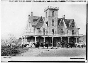
.jpg)  Images, from left to right: Contra Costa County courthouse, Mount Diablo's North Peak
|
|||||
|
|||||

Location in the state of California
|
|||||
| Country | United States | ||||
| State | California | ||||
| Region | San Francisco Bay Area | ||||
| Incorporated | February 18, 1850 | ||||
| Named for | "Opposite coast" (Spanish: Contra costa) of the San Francisco Bay | ||||
| County seat | Martinez | ||||
| Largest city | Concord (population and land area) Richmond (total area) |
||||
| Government | |||||
| • Type | Council–CAO | ||||
| • Body | Board of Supervisors | ||||
| Area | |||||
| • Total | 804 sq mi (2,080 km2) | ||||
| • Land | 715.94 sq mi (1,854.3 km2) | ||||
| • Water | 81 sq mi (210 km2) | ||||
| Highest elevation | 3,852 ft (1,174 m) | ||||
| Population
(2020)
|
|||||
| • Total | 1,165,927 | ||||
| • Estimate
(2023)
|
1,155,025 |
||||
| • Density | 1,450.2/sq mi (559.9/km2) | ||||
| GDP | |||||
| • Total | $94.802 billion (2022) | ||||
| Time zone | UTC−8 (Pacific Time Zone) | ||||
| • Summer (DST) | UTC−7 (Pacific Daylight Time) | ||||
| Area code | 510, 341, 925 | ||||
| FIPS code | 06-013 | ||||
| GNIS feature ID | 1675903 | ||||
| Congressional districts | 8th, 9th, 10th | ||||


Contra Costa County is a county in the state of California, located in the East Bay part of the San Francisco Bay Area. Its name means "Opposite Coast" in Spanish, because it's across the bay from San Francisco. In 2020, over 1.1 million people lived here. The main city and county seat is Martinez. This area is mostly made up of suburbs.
Contents
History of Contra Costa County
Ancient Times
Long, long ago, in the Miocene period, this area was a marshy grassland. Many ancient mammals lived here, and we know about them from fossils found in the southern part of the county. In other parts, you can find old seashells stuck in rocks and layers of ash from ancient volcanoes. The famous Mount Diablo mountain was formed by strong forces deep within the Earth.
Native American Life
Before European settlers arrived, the Bay Miwok, Yokut, and Ohlone people lived in what is now Contra Costa County. One group, the Volvon, lived near Mount Diablo until they were moved to Spanish missions in the early 1800s.
Another group, the Saklan tribe, lived around Moraga and Lafayette. Spanish missionaries and soldiers first came to this area in 1772. At first, interactions were mostly peaceful. However, as Spanish cattle grazed on Saklan lands, tensions grew. The Saklans tried to resist the Spanish efforts to change their way of life. Sadly, by the early 1800s, many Saklan people were affected by diseases, and their traditional lands became empty.
Spanish and Mexican Rule
The Spanish started missions and military bases (called presidios) in California. Even though there were no missions directly in Contra Costa County, Spanish influence was strong. The King of Spain gave large pieces of land, called land grants, to his favorite settlers.
In 1821, Mexico became independent from Spain. This led to changes in land ownership. The missions' lands were given out, and new land grants were made under Mexican law. Between 1836 and 1846, 15 large land grants were given in Contra Costa County. Some of these ranches were huge, like Rancho Monte del Diablo, which was given to Salvio Pacheco. He later founded the city of Concord. Another important landowner was Don Víctor Castro.


These land grants were measured roughly, often using natural features like streams. The smallest grant was about seven square miles. People who received land had to build a house within a year. Many families raised cattle on these large ranches.
California Becomes a State
The way land was owned in California changed when Americans started to arrive. John Marsh, who owned Rancho Los Meganos in Contra Costa County, wrote letters to people in the eastern United States. He described California's good climate and farming potential, encouraging Americans to move there. His letters were printed in newspapers and led to the first wagon trains coming to California. His ranch became the end point of the California Trail.
In 1846, American settlers started the Bear Flag Revolt and declared California a republic. After the Mexican-American War (1846–1848), California came under U.S. control. By 1850, California's population grew quickly because of the Gold Rush. This allowed California to become a state in 1850. By this time, many Native American populations had faced great challenges, and their numbers had significantly decreased.
The County is Formed
Contra Costa County was one of California's first 27 counties, created in 1850. It was almost called Mt. Diablo County. Its Spanish name, Contra Costa, means "opposite coast" because it's across the bay from San Francisco. In 1853, some southern parts of the county were used to form Alameda County.

Many city and town names in the county, like Martinez, Pacheco, and Moraga, come from the names of the original land grant families. Some old ranch houses are now museums or cultural centers, like the Borges Ranch.

World War II and Beyond
During World War II, the city of Richmond had large shipyards that built ships for the war. Pilots were trained at what is now Concord/Buchanan Field Airport. A big Naval Weapons Depot at Port Chicago is still active today. In 1944, a terrible explosion happened at Port Chicago.
After the war, many people wanted to live in the suburbs. Large areas of farmland were turned into new neighborhoods with houses and roads. This growth was partly because people wanted bigger homes with yards, which were hard to find in older cities.
Many big companies also moved their offices to the suburbs. This led to the building of large shopping centers and new roads, schools, libraries, and other services. The Bay Area Rapid Transit (BART) system and improved highways also helped cities like Walnut Creek and Concord grow into important "edge cities."
More recently, housing prices in the county have changed a lot. Some areas saw big drops in value, while others stayed strong. The economy has since recovered, and home values have gone back up.
Geography
Contra Costa County covers about 804 square miles. Most of this is land (716 square miles), and the rest is water (88 square miles).
The county's landscape includes flat areas near the bay, hills like the Oakland Hills, several valleys, and the tall Mount Diablo. Mount Diablo is a 3,849-foot (1,173-meter) peak. It's so important that it's used as a starting point for surveying land across much of California and Nevada.
Several fault lines, which are cracks in the Earth's crust, run through the county. These include the Hayward Fault, Calaveras Fault, and Concord Fault. They can cause earthquakes.
Areas of the County
Contra Costa County is divided into three main areas:
- West County: This area includes cities like El Cerrito, Richmond, and Hercules.
- Central County: This is split into three smaller parts:
* Lamorinda: Named after Lafayette, Moraga, and Orinda. * North Central County: Includes Walnut Creek, Pleasant Hill, Concord, Clayton, and Martinez. * San Ramon Valley: Includes Danville and San Ramon.
- East County: This area is on the edge of the Central Valley. It includes cities like Pittsburg, Antioch, Oakley, and Brentwood.
Neighboring Counties
- Solano County - to the north
- Sacramento County - to the northeast
- San Joaquin County - to the east
- Alameda County - to the south
Protected Natural Areas
The county has several special protected areas:
- Antioch Dunes National Wildlife Refuge
- Eugene O'Neill National Historic Site
- John Muir National Historic Site
- Port Chicago Naval Magazine National Memorial
- Rosie the Riveter/World War II Home Front National Historical Park
Mount Diablo

Mount Diablo is the most famous natural landmark in the county, standing 3,849 feet (1,173 meters) tall. It's the center of Mount Diablo State Park, which was created in 1921.
In the 1960s, as towns grew, people worried about protecting the mountain's open spaces. In 1971, a group called Save Mount Diablo was formed. They worked to buy land and add it to the park. Today, Mount Diablo State Park and other nearby preserves protect over 89,000 acres (360 square kilometers) of land.
The name Mount Diablo comes from a Spanish phrase, Monte del Diablo, which meant "thicket of the devil." Early English settlers misunderstood "monte" to mean "mountain" and applied the name to the peak.
Population and People
| Historical population | |||
|---|---|---|---|
| Census | Pop. | %± | |
| 1860 | 5,328 | — | |
| 1870 | 8,461 | 58.8% | |
| 1880 | 12,525 | 48.0% | |
| 1890 | 13,515 | 7.9% | |
| 1900 | 18,046 | 33.5% | |
| 1910 | 31,674 | 75.5% | |
| 1920 | 53,889 | 70.1% | |
| 1930 | 78,608 | 45.9% | |
| 1940 | 100,450 | 27.8% | |
| 1950 | 298,984 | 197.6% | |
| 1960 | 409,030 | 36.8% | |
| 1970 | 558,389 | 36.5% | |
| 1980 | 656,380 | 17.5% | |
| 1990 | 803,732 | 22.4% | |
| 2000 | 948,816 | 18.1% | |
| 2010 | 1,049,025 | 10.6% | |
| 2020 | 1,165,927 | 11.1% | |
| 2023 (est.) | 1,155,025 | 10.1% | |
| U.S. Decennial Census 1790–1960 1900–1990 1990–2000 2010 2020 |
|||
Contra Costa County has grown a lot over the years. In 2020, the population was 1,165,927 people. The county is very diverse, with people from many different backgrounds living here.
| Race / Ethnicity (NH = Non-Hispanic) | Pop 2000 | Pop 2010 | Pop 2020 | % 2000 | % 2010 | % 2020 |
|---|---|---|---|---|---|---|
| White alone (NH) | 549,409 | 500,923 | 455,421 | 57.90% | 47.75% | 39.06% |
| Black or African American alone (NH) | 86,851 | 93,604 | 97,994 | 9.15% | 8.92% | 8.40% |
| Native American or Alaska Native alone (NH) | 3,648 | 2,984 | 2,553 | 0.38% | 0.28% | 0.22% |
| Asian alone (NH) | 102,681 | 148,881 | 214,520 | 10.82% | 14.19% | 18.40% |
| Pacific Islander alone (NH) | 3,157 | 4,382 | 5,720 | 0.33% | 0.42% | 0.49% |
| Other Race alone (NH) | 2,636 | 3,122 | 8,366 | 0.28% | 0.30% | 0.72% |
| Mixed Race or Multi-Racial (NH) | 32,658 | 39,569 | 66,453 | 3.44% | 3.77% | 5.70% |
| Hispanic or Latino (any race) | 167,776 | 255,560 | 314,900 | 17.68% | 24.36% | 27.01% |
| Total | 948,816 | 1,049,025 | 1,165,927 | 100.00% | 100.00% | 100.00% |
| Population, race, and income | |||||
|---|---|---|---|---|---|
| Total population | 1,037,817 | ||||
| White | 656,311 | 63.2% | |||
| Black or African American | 94,782 | 9.1% | |||
| American Indian or Alaska Native | 4,375 | 0.4% | |||
| Asian | 147,948 | 14.3% | |||
| Native Hawaiian or other Pacific Islander | 4,727 | 0.5% | |||
| Some other race | 79,498 | 7.7% | |||
| Two or more races | 50,176 | 4.8% | |||
| Hispanic or Latino (of any race) | 248,089 | 23.9% | |||
| Per capita income | $38,141 | ||||
| Median household income | $79,135 | ||||
| Median family income | $93,437 | ||||

Cities and Towns by Population
| Places by population and race | ||||||||
|---|---|---|---|---|---|---|---|---|
| Place | Type | Population | White | Other |
Asian | Black or African American |
Native American |
Hispanic or Latino (of any race) |
| Acalanes Ridge | CDP | 1,431 | 71.6% | 14.0% | 11.8% | 0.0% | 2.6% | 4.8% |
| Alamo | CDP | 15,531 | 88.6% | 3.4% | 7.1% | 0.6% | 0.2% | 3.6% |
| Alhambra Valley | CDP | 910 | 98.6% | 0.0% | 1.4% | 0.0% | 0.0% | 0.0% |
| Antioch | City | 101,118 | 51.7% | 19.2% | 9.8% | 17.5% | 1.8% | 32.1% |
| Bay Point | CDP | 21,987 | 51.0% | 28.5% | 7.6% | 12.1% | 0.8% | 54.1% |
| Bayview | CDP | 2,168 | 55.5% | 9.7% | 18.2% | 15.3% | 1.3% | 29.6% |
| Bethel Island | CDP | 1,882 | 92.2% | 5.6% | 2.2% | 0.0% | 0.0% | 11.8% |
| Blackhawk | CDP | 9,186 | 72.2% | 4.9% | 19.0% | 4.0% | 0.0% | 5.8% |
| Brentwood | City | 48,582 | 73.7% | 13.1% | 6.7% | 5.5% | 1.0% | 28.6% |
| Byron | CDP | 1,287 | 84.8% | 10.4% | 0.4% | 4.4% | 0.0% | 13.8% |
| Camino Tassajara | CDP | 1,813 | 51.9% | 2.5% | 45.6% | 0.0% | 0.0% | 8.3% |
| Castle Hill | CDP | 1,369 | 89.5% | 6.6% | 3.9% | 0.0% | 0.0% | 8.2% |
| Clayton | City | 10,856 | 85.3% | 4.6% | 7.6% | 2.2% | 0.3% | 8.2% |
| Clyde | CDP | 529 | 78.8% | 9.8% | 11.3% | 0.0% | 0.0% | 37.4% |
| Concord | City | 121,989 | 69.2% | 15.0% | 11.8% | 3.1% | 1.0% | 27.9% |
| Contra Costa Centre | CDP | 5,773 | 69.2% | 8.2% | 20.6% | 2.0% | 0.0% | 10.3% |
| Crockett | CDP | 2,921 | 85.6% | 7.6% | 4.9% | 1.0% | 0.9% | 11.7% |
| Danville | Town | 41,994 | 81.7% | 5.7% | 11.6% | 0.8% | 0.1% | 5.9% |
| Diablo | CDP | 1,083 | 70.0% | 16.6% | 11.0% | 0.0% | 2.4% | 0.0% |
| Discovery Bay | CDP | 12,506 | 86.2% | 5.1% | 2.0% | 5.7% | 1.0% | 10.1% |
| East Richmond Heights | CDP | 3,157 | 66.0% | 4.6% | 9.8% | 18.9% | 0.7% | 7.9% |
| El Cerrito | City | 23,482 | 58.3% | 9.3% | 24.9% | 7.2% | 0.3% | 12.0% |
| El Sobrante | CDP | 13,823 | 62.6% | 11.0% | 14.6% | 11.4% | 0.5% | 23.4% |
| Hercules | City | 23,556 | 28.3% | 9.0% | 43.8% | 16.7% | 2.1% | 12.2% |
| Kensington | CDP | 5,117 | 78.6% | 7.7% | 12.3% | 1.0% | 0.4% | 4.3% |
| Knightsen | CDP | 1,484 | 78.3% | 19.6% | 0.6% | 1.1% | 0.3% | 30.6% |
| Lafayette | City | 23,863 | 86.7% | 4.6% | 8.1% | 0.6% | 0.0% | 6.3% |
| Martinez | City | 35,808 | 79.7% | 7.4% | 7.6% | 4.6% | 0.6% | 13.6% |
| Montalvin Manor | CDP | 2,614 | 68.4% | 11.0% | 11.1% | 3.6% | 5.9% | 49.5% |
| Moraga | Town | 16,033 | 78.8% | 3.5% | 14.8% | 2.1% | 0.7% | 7.3% |
| Mountain View | CDP | 2,032 | 89.7% | 4.7% | 1.5% | 2.3% | 1.8% | 18.7% |
| Norris Canyon | CDP | 941 | 65.9% | 1.2% | 32.9% | 0.0% | 0.0% | 0.0% |
| North Gate | CDP | 387 | 92.5% | 0.0% | 7.5% | 0.0% | 0.0% | 0.0% |
| North Richmond | CDP | 3,214 | 31.5% | 17.8% | 16.5% | 34.2% | 0.0% | 43.9% |
| Oakley | City | 34,410 | 65.3% | 20.0% | 5.8% | 7.8% | 1.2% | 39.7% |
| Orinda | City | 17,599 | 82.0% | 6.0% | 10.1% | 1.7% | 0.3% | 3.8% |
| Pacheco | CDP | 4,022 | 76.2% | 7.4% | 11.9% | 2.2% | 2.3% | 13.9% |
| Pinole | City | 18,470 | 49.8% | 16.8% | 23.0% | 10.1% | 0.3% | 21.7% |
| Pittsburg | City | 62,528 | 40.6% | 24.6% | 15.1% | 17.8% | 1.9% | 41.7% |
| Pleasant Hill | City | 33,045 | 75.4% | 9.0% | 13.5% | 2.0% | 0.2% | 14.0% |
| Port Costa | CDP | 274 | 90.5% | 4.7% | 4.7% | 0.0% | 0.0% | 0.0% |
| Reliez Valley | CDP | 3,141 | 85.6% | 4.2% | 9.7% | 0.5% | 0.0% | 11.2% |
| Richmond | City | 103,161 | 43.8% | 14.4% | 14.7% | 26.5% | 0.6% | 37.9% |
| Rodeo | CDP | 8,786 | 50.1% | 12.3% | 22.8% | 14.2% | 0.5% | 21.4% |
| Rollingwood | CDP | 2,790 | 53.3% | 17.0% | 25.2% | 3.0% | 1.5% | 57.8% |
| San Miguel | CDP | 3,382 | 92.9% | 1.7% | 4.3% | 0.9% | 0.1% | 2.4% |
| San Pablo | City | 29,224 | 53.7% | 14.4% | 15.9% | 14.7% | 1.3% | 55.8% |
| San Ramon | City | 69,241 | 53.4% | 7.8% | 35.9% | 2.3% | 0.5% | 9.9% |
| Saranap | CDP | 4,486 | 85.2% | 3.8% | 5.8% | 5.1% | 0.0% | 6.4% |
| Shell Ridge | CDP | 1,123 | 80.1% | 10.2% | 9.7% | 0.0% | 0.0% | 19.0% |
| Tara Hills | CDP | 4,565 | 59.6% | 13.2% | 10.5% | 14.9% | 1.8% | 37.3% |
| Vine Hill | CDP | 3,620 | 69.7% | 11.9% | 8.6% | 7.3% | 2.4% | 31.7% |
| Walnut Creek | City | 64,168 | 80.7% | 4.7% | 12.0% | 2.3% | 0.3% | 10.2% |
| Places by population and income | ||||||||
|---|---|---|---|---|---|---|---|---|
| Place | Type | Population | Per capita income | Median household income | Median family income | |||
| Acalanes Ridge | CDP | 1,431 | $61,205 | $138,672 | $146,708 | |||
| Alamo | CDP | 15,531 | $73,964 | $149,601 | $161,953 | |||
| Alhambra Valley | CDP | 910 | $67,774 | $124,547 | $170,583 | |||
| Antioch | City | 101,118 | $25,264 | $66,479 | $73,491 | |||
| Bay Point | CDP | 21,987 | $18,844 | $45,389 | $48,020 | |||
| Bayview | CDP | 2,168 | $28,092 | $78,385 | $77,260 | |||
| Bethel Island | CDP | 1,882 | $27,443 | $30,409 | $57,292 | |||
| Blackhawk | CDP | 9,186 | $83,440 | $167,778 | $181,955 | |||
| Brentwood | City | 48,582 | $32,030 | $87,642 | $96,433 | |||
| Byron | CDP | 1,287 | $29,723 | $71,483 | $70,800 | |||
| Camino Tassajara | CDP | 1,813 | $54,858 | $164,773 | $197,159 | |||
| Castle Hill | CDP | 1,369 | $60,700 | $119,688 | $137,350 | |||
| Clayton | City | 10,856 | $51,854 | $131,991 | $142,671 | |||
| Clyde | CDP | 529 | $36,408 | $99,375 | $115,795 | |||
| Concord | City | 121,989 | $31,338 | $65,769 | $74,205 | |||
| Contra Costa Centre | CDP | 5,773 | $48,300 | $78,176 | $90,495 | |||
| Crockett | CDP | 2,921 | $44,115 | $76,023 | $89,844 | |||
| Danville | Town | 41,994 | $61,002 | $133,360 | $152,368 | |||
| Diablo | CDP | 1,083 | $161,436 | $154,191 | $250,001 | |||
| Discovery Bay | CDP | 12,506 | $46,867 | $102,527 | $104,522 | |||
| East Richmond Heights | CDP | 3,157 | $39,283 | $92,750 | $99,024 | |||
| El Cerrito | City | 23,482 | $43,529 | $83,933 | $98,727 | |||
| El Sobrante | CDP | 13,823 | $29,706 | $58,706 | $72,177 | |||
| Hercules | City | 23,556 | $38,687 | $94,493 | $99,548 | |||
| Kensington | CDP | 5,117 | $63,253 | $124,010 | $148,063 | |||
| Knightsen | CDP | 1,484 | $29,772 | $63,359 | $77,596 | |||
| Lafayette | City | 23,863 | $66,492 | $134,871 | $159,834 | |||
| Martinez | City | 35,808 | $38,311 | $79,705 | $94,479 | |||
| Montalvin Manor | CDP | 2,614 | $23,930 | $46,924 | $63,287 | |||
| Moraga | Town | 16,033 | $54,830 | $121,875 | $151,467 | |||
| Mountain View | CDP | 2,032 | $25,798 | $46,660 | $50,423 | |||
| Norris Canyon | CDP | 941 | $72,940 | $250,001 | $250,001 | |||
| North Gate | CDP | 387 | $57,244 | $84,781 | $97,500 | |||
| North Richmond | CDP | 3,214 | $19,697 | $40,714 | $44,681 | |||
| Oakley | City | 34,410 | $27,742 | $78,102 | $82,037 | |||
| Orinda | City | 17,599 | $76,830 | $157,500 | $183,279 | |||
| Pacheco | CDP | 4,022 | $28,155 | $58,036 | $64,814 | |||
| Pinole | City | 18,470 | $32,649 | $80,042 | $92,035 | |||
| Pittsburg | City | 62,528 | $23,344 | $57,965 | $64,788 | |||
| Pleasant Hill | City | 33,045 | $42,497 | $78,765 | $108,403 | |||
| Port Costa | CDP | 274 | $36,439 | $91,429 | $91,714 | |||
| Reliez Valley | CDP | 3,141 | $85,6% | 4.2% | 9.7% | 0.5% | 0.0% | 11.2% |
| Richmond | City | 103,161 | $25,358 | $54,554 | $62,477 | |||
| Rodeo | CDP | 8,786 | $27,048 | $65,906 | $72,675 | |||
| Rollingwood | CDP | 2,790 | $15,724 | $49,522 | $58,125 | |||
| San Miguel | CDP | 3,382 | $71,225 | $129,375 | $142,422 | |||
| San Pablo | City | 29,224 | $17,044 | $45,305 | $49,955 | |||
| San Ramon | City | 69,241 | $50,962 | $124,014 | $139,709 | |||
| Saranap | CDP | 4,486 | $54,996 | $77,708 | $103,977 | |||
| Shell Ridge | CDP | 1,123 | $69,676 | $182,500 | $205,962 | |||
| Tara Hills | CDP | 4,565 | $26,773 | $58,542 | $64,607 | |||
| Vine Hill | CDP | 3,620 | $24,205 | $53,561 | $55,592 | |||
| Walnut Creek | City | 64,168 | $52,727 | $84,722 | $114,726 | |||
Economy
Farming and Water
In the past, the large ranches were divided and sold for farming. Canals brought water from the eastern part of the county to the center, helping farms grow crops. Walnuts were a popular crop, and in the Moraga area, pears were common. Today, some farms in the eastern county still grow fruits like cherries.
The Contra Costa Canal is an old irrigation canal that still provides water to industries near Martinez. You can find public trails along these canals today.
Transportation and Industry
Early on, railroads helped connect farms to cities. This led to the growth of towns and industries.
Because it's located along the San Francisco, San Pablo, and Suisun bays, the northern part of the county has many large industries. These include oil refineries (like Chevron in Richmond and others in Martinez and Rodeo) and chemical plants.
Housing and Growth
West County Homes
The West County area, near the bays, grew a lot after the 1906 San Francisco earthquake. Homes here are becoming more expensive. Many people are moving here, making it a diverse area with different races and income levels. New homes are being built in Richmond and Hercules.
Central County Homes


The central part of the county has a valley with major highways. Towns like Lafayette, Moraga, and Orinda are known as "Lamorinda." Cities along Interstate 680 include Martinez, Concord, Pleasant Hill, Walnut Creek, Danville, and San Ramon. This area is popular with families because of its good schools. During a time when home prices were very high, many older, smaller homes were torn down to build bigger ones. This area now has a mix of old and new homes, plus many shopping centers.
East County Homes
New, more affordable homes are being built in the "East County" towns like Pittsburg, Antioch, Oakley, and Brentwood. These are often called "bedroom communities" because many people live there and commute to work in other cities. Some towns like Brentwood and Discovery Bay are quite wealthy, with good schools and golf courses. Discovery Bay is a waterfront community with many homes having private docks.
Highways in East County have been improved to make commuting easier.
County Budget
Like many places, Contra Costa County has faced money challenges. This is partly because of rising costs for retirement benefits for workers and changes in property taxes. The county government works to manage its money and provide services to its residents.
Businesses and Development
Many businesses have moved to the county, especially along Interstate 680. This area has a lot of office space.
There are plans to redevelop parts of Martinez, the county seat. Also, a large area of the former Concord Naval Weapons Station is being planned for new development. This will add new homes and open spaces to the county.
Education
The Contra Costa County Library is the main library system for the county.
Media
Contra Costa County gets news and media from the wider San Francisco Bay Area.
The East Bay Times is a daily newspaper that covers the county. It has offices in Walnut Creek. There are also weekly local papers, like the Concord Transcript.
Transportation
Before 1903, most people traveled to central Contra Costa County by boat or train to Martinez.
In 1903, the first tunnel through the Oakland hills was built. This made it easier to transport goods. In 1937, the Caldecott Tunnel for cars was finished, making the county much more accessible. This led to more development after World War II. The tunnel has been expanded over the years, with a fourth tunnel completed in 2013.
Main Roads
 Interstate 80
 Interstate 580
 Interstate 680
 State Route 4
 State Route 24
 State Route 123 (San Pablo Avenue)
 State Route 160
 State Route 242
Public Transportation
- Amtrak trains, like the San Joaquins and Capitol Corridor lines, stop in Richmond, Martinez, and Antioch-Pittsburg.
- BART is a fast train system that connects the county to other parts of the Bay Area. The eBART extension serves East Contra Costa County.
- Local bus services include AC Transit (West County), County Connection (Central County), and Tri-Delta Transit (East County).
- WestCAT provides bus service in northern West County and to San Francisco.
- Other bus services connect the county to Marin and Solano counties.
Airports
The county has two airports for smaller planes:
- Buchanan Field Airport in Concord
- Byron Airport near Byron
Railroads
Major railroads like Union Pacific and BNSF Railway have lines that run through Contra Costa County, connecting it to other parts of the country. These railroads helped industries grow in the late 1800s and early 1900s. Many old railroad paths are now used as walking, jogging, and biking trails.
Fun Places to Visit
- Black Diamond Mines Regional Preserve
- Blackhawk Museum (has a museum about ancient animals)
- Eugene O'Neill National Historic Site
- John Muir National Historic Site
- Lindsay Wildlife Museum
- Borges Ranch (a working demonstration ranch)
- Richmond Museum of History
- Rosie the Riveter/World War II Home Front National Historical Park
- Vasco Caves Regional Preserve
Parks and Outdoor Fun
Contra Costa County has many parks and open spaces for outdoor activities:
- Briones Regional Park
- Diablo Foothills
- Mount Diablo State Park
- Las Trampas Regional Wilderness
- Shell Ridge Open Space
- Lime Ridge Open Space
- San Pablo Recreation Area (around San Pablo Dam Reservoir)
- Point Isabel Regional Shoreline in Richmond is a very large dog park.
Trails for Exploring
You can find many trails for walking, hiking, and biking:
- Iron Horse Regional Trail
- California State Riding and Hiking Trail
- Contra Costa Canal Regional Trail
- Delta de Anza Regional Trail
- Briones-Mount Diablo Regional Trail
- Lafayette-Moraga Regional Trail
- Marsh Creek Regional Trail
- American Discovery Trail
Utilities
Important services like water and sanitation are provided by:
- Central Contra Costa Sanitary District
- Contra Costa Water District
- East Bay Municipal Utility District
Communities
.jpg)
Cities
Towns
Census-Designated Places (CDPs)
These are areas that are like towns but are not officially incorporated as cities.
- Acalanes Ridge
- Alamo
- Alhambra Valley
- Bay Point
- Bayview
- Bethel Island
- Blackhawk
- Byron
- Camino Tassajara
- Castle Hill
- Clyde
- Contra Costa Centre
- Crockett
- Diablo
- Discovery Bay
- East Richmond Heights
- El Sobrante
- Kensington
- Knightsen
- Montalvin Manor
- Mountain View
- Norris Canyon
- North Gate
- North Richmond
- Pacheco
- Port Costa
- Reliez Valley
- Rodeo
- Rollingwood
- Saranap
- San Miguel
- Shell Ridge
- Tara Hills
- Vine Hill
Other Communities
Former Communities
Some communities that used to exist are:
Ghost Towns
These are towns that no longer exist:
Population Ranking of Communities (2020)
† county seat
| Rank | City/Town/etc. | Municipal type | Population (2020 Census) |
|---|---|---|---|
| 1 | Concord | City | 125,410 |
| 2 | Richmond | City | 116,448 |
| 3 | Antioch | City | 115,291 |
| 4 | San Ramon | City | 84,605 |
| 5 | Pittsburg | City | 76,416 |
| 6 | Walnut Creek | City | 70,127 |
| 7 | Brentwood | City | 64,292 |
| 8 | Danville | Town | 43,582 |
| 9 | Oakley | City | 43,357 |
| 10 | † Martinez | City | 37,287 |
| 11 | Pleasant Hill | City | 34,613 |
| 12 | San Pablo | City | 32,127 |
| 13 | Hercules | City | 26,016 |
| 14 | El Cerrito | City | 25,962 |
| 15 | Lafayette | City | 25,391 |
| 16 | Bay Point | CDP | 23,896 |
| 17 | Orinda | City | 19,514 |
| 18 | Pinole | City | 19,022 |
| 19 | Moraga | Town | 16,870 |
| 20 | El Sobrante | CDP | 15,524 |
| 21 | Discovery Bay | CDP | 15,358 |
| 22 | Alamo | CDP | 15,314 |
| 23 | Clayton | City | 11,070 |
| 24 | Rodeo | CDP | 9,653 |
| 25 | Blackhawk | CDP | 9,637 |
| 26 | Contra Costa Centre | CDP | 6,808 |
| 27 | Saranap | CDP | 5,830 |
| 28 | Kensington | CDP | 5,428 |
| 29 | Tara Hills | CDP | 5,364 |
| 30 | Camino Tassajara | CDP | 4,951 |
| 31 | Vine Hill | CDP | 4,323 |
| 32 | Pacheco | CDP | 4,183 |
| 33 | North Richmond | CDP | 4,175 |
| 34 | San Miguel | CDP | 3,591 |
| 35 | East Richmond Heights | CDP | 3,460 |
| 36 | Reliez Valley | CDP | 3,354 |
| 37 | Crockett | CDP | 3,242 |
| 38 | Montalvin Manor | CDP | 3,099 |
| 39 | Rollingwood | CDP | 3,015 |
| 40 | Mountain View | CDP | 2,622 |
| 41 | Bethel Island | CDP | 2,131 |
| 42 | Bayview | CDP | 1,782 |
| 43 | Knightsen | CDP | 1,596 |
| 44 | Castle Hill | CDP | 1,271 |
| 45 | Diablo | CDP | 1,255 |
| 46 | Byron | CDP | 1,140 |
| 47 | Acalanes Ridge | CDP | 1,285 |
| 48 | Shell Ridge | CDP | 1,014 |
| 49 | Norris Canyon | CDP | 1,313 |
| 50 | Alhambra Valley | CDP | 805 |
| 51 | North Gate | CDP | 667 |
| 52 | Clyde | CDP | 729 |
| 53 | Port Costa | CDP | 190 |
|
See also
 In Spanish: Condado de Contra Costa para niños
