Iron Horse Regional Trail facts for kids

The Iron Horse Regional Trail is a special path for walking, biking, and even horse riding in the East Bay Area of California. It's called a "rail trail" because it follows an old railroad track!
This trail runs through the middle of Alameda and Contra Costa counties. It mostly uses a path that the Southern Pacific Railroad first set up way back in 1891. The railroad stopped using it in 1977. After that, the two counties bought the path. They wanted to use it for transportation, and the Iron Horse Trail officially opened in 1986.
The trail goes through many cities like Pleasanton, Dublin, San Ramon, Danville, Alamo, Walnut Creek, Pleasant Hill, and Concord. When it's fully finished, the trail will stretch over 40 miles (about 64 kilometers)! It will connect Livermore in Alameda County all the way to Suisun Bay in Contra Costa County. That's a huge distance connecting nine communities! The trail also connects directly to two BART train stations: Dublin/Pleasanton and Pleasant Hill.
The East Bay Regional Park District takes care of the trail. It's a paved path that's great for wheelchairs. Some parts even have unpaved or soft trails next to the main path.
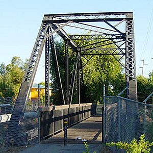
The Iron Horse Regional Trail has several bridges that go over busy roads. These bridges help people cross safely and keep traffic flowing smoothly below. Two important bridges cross over Ygnacio Valley Road in Walnut Creek and Treat Boulevard in Contra Costa Centre. More bridges are being planned for the future.
Even though some people were unsure about the trail at first, it's now a very popular place. It's used for both getting around and having fun outdoors. About one million trips are made on the trail every single year!
Building the Trail in Pleasanton
When the trail was first being planned, the city of Pleasanton decided not to keep the old railroad path clear within its city limits. This meant that even though the East Bay Regional Park District (EBRPD) owned the path, some buildings were built on top of it. A big example is the Hacienda Business Park.
Work on the trail in Pleasanton finally started in March 2006. This first part was about 1 mile (1.6 kilometers) long on the south side of the city. It opened in March 2008.
However, this left a gap in the trail. This missing section was about 1.6 miles (2.6 kilometers) long. It stretched from the Dublin side of the Dublin/Pleasanton BART station to Santa Rita Road.
To figure out how to finish the trail in Pleasanton, the EBRPD, the City of Pleasanton, and landscape architects held public meetings starting in June 2010. They wanted to hear ideas from the community.
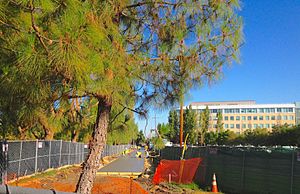
In February 2011, the Pleasanton City Council approved the EBRPD's plan for the trail, which was based on these meetings. About $4 million in grants was set aside to finish this part of the trail. Construction began in May 2013, and this important section opened on July 25, 2014.
Building this part of the trail was tricky! The path had to go through a business campus, two city parks, a neighborhood, an apartment complex, and cross three busy roads at ground level. It then connected to the earlier southern part of the trail where two major streets meet.
In April 2013, another new section of the trail opened. This part runs along Stanley Boulevard near Shadow Cliffs Lake. This still leaves a small gap of about 0.6 miles (1 kilometer) between the end of the Pleasanton trail and this new section. Plans are in place to complete this last gap in the future.
- Learn more about Hiking Trails in Contra Costa County - Walnut Creek Wiki
Images for kids
 | Janet Taylor Pickett |
 | Synthia Saint James |
 | Howardena Pindell |
 | Faith Ringgold |


