
Mount Diablo facts for kids
Quick facts for kids Mount Diablo |
|
|---|---|
| Cerro Alto de los Bolbones | |

West face of Mount Diablo and Hwy 24
|
|
| Highest point | |
| Elevation | 3,849 ft (1,173 m) NAVD 88 |
| Prominence | 3,109 ft (948 m) |
| Listing | California county high points 45th |
| Naming | |
| Native name | Error {{native name}}: an IETF language tag as parameter {{{1}}} is required (help) |
| Geography | |

Mount Diablo
Location in California

Mount Diablo
Location in the United States
|
|
| Location | Contra Costa County, California, U.S. |
| Parent range | Diablo Range |
| Topo map | USGS Clayton |
| Geology | |
| Age of rock | Cretaceous, Jurassic |
| Mountain type | Sedimentary |
| Climbing | |
| Easiest route | Paved road |
| Designated: | 1982 |
| Reference #: | 905 |

Mount Diablo is a famous mountain in Contra Costa County, California. It's part of the Diablo Range in the eastern San Francisco Bay Area. This mountain stands tall at about 3,849 feet (1,173 meters) and can be seen from many places around the Bay Area.
Mount Diablo often looks like a double pyramid. Its closest and largest partner peak is North Peak, which is almost as high at 3,557 feet (1,084 meters). North Peak is about 1 mile (1.6 kilometers) northeast of the main summit. The mountain is protected within the Mount Diablo State Park, which is managed by California State Parks.
Contents
Exploring Mount Diablo
You can reach the top of Mount Diablo by walking, biking, or driving. There are two main roads to the summit: North Gate Road and South Gate Road.
Mount Diablo State Park
The peak of Mount Diablo is inside Mount Diablo State Park. This park covers about 20,000 acres (8,100 hectares). It was the first public protected area around the mountain. Today, there are over 90,000 acres (36,000 hectares) of protected land on and around Mount Diablo. This includes 38 different preserves, like city open spaces and regional parks.
Amazing Views from the Top

On a clear day, the views from Mount Diablo's summit are incredible! You can see the Sierra Nevada mountains far away. The best time to see them is after a winter storm when they are covered in snow. You might even spot Lassen Peak, which is 181 miles (291 kilometers) away!
Many bridges are visible from the top, including the Bay Bridge and the Golden Gate Bridge. Even though other mountains in California are taller, Mount Diablo stands out because it rises so dramatically from the flat land around it. This made it a very important landmark for explorers and mapmakers during the California Gold Rush.
Mount Diablo's Story and Names
Mount Diablo is a very special place for many Native American tribes in California. For some, it's believed to be the place where the world was created. One story says that the creator, Coyote, and his helper, Eagle-man, made people and the world from two islands: Mount Diablo and Reed's Peak.
Earliest Names

Long ago, about 25 different tribal groups lived around the mountain. They spoke different languages like Ohlone, Bay Miwok, and Northern Valley Yokuts. The Chochenyo-speaking Ohlone people called the mountain Tuyshtak, which means "at the dawn of time." The Nisenan people called it Sukkú Jaman, or "dog mountain," because it was a place where dogs were traded.
Spanish explorers in 1811 sometimes called it Cerro Alto de los Bolbones, meaning "High Hill of the Volvon," after the local Volvon tribe.
How it Got its Current Name
The name "Mount Diablo" comes from a story about Spanish soldiers in 1805. Several Native Americans from the Chupcan tribe escaped from the soldiers in a thicket (a dense group of bushes) about 7 miles (11 kilometers) north of the mountain. Some say mysterious lights helped them escape at night. An old report from 1850 even mentions a strange dancing spirit that helped the Chupcan people.
The Spanish called the area Monte del Diablo, meaning "devil's thicket." Later, American settlers thought "Monte" referred to the mountain itself, and so it became "Mount Diablo" in 1850.
In 1862, the northeast peak of Mount Diablo was named "Mount King" after a famous clergyman, Thomas Starr King. Today, we know it as North Peak.
Attempts to Change the Name
In 2005, a person named Arthur Mijares asked the government to change the mountain's name. He felt the name "Diablo" (which means "devil" in Spanish) was offensive to his Christian beliefs. He suggested names like Mount Kawukum, Mount Yahweh, or Mount Reagan. Other people suggested Mount Miwok or Mount Ohlone, honoring the local Native American tribes.
The U.S. Board on Geographic Names decided not to change the name. They said there wasn't a strong enough reason to change such a historic name.
Early Uses of the Mountain
In 1851, the south peak of Mount Diablo became a very important point for land surveying. It was used as a starting point for mapping large areas of California, Nevada, and Oregon.
In 1874, toll roads were built up the mountain, allowing people to drive to the top. A hotel called the Mountain House was also built near the summit for visitors. In 1928, a powerful navigation beacon, called the "Eye of Diablo," was placed at the summit. It was so bright it could be seen for a hundred miles!
Protecting the Area

California created a small state park around the peak in 1931. Over the years, the park grew bigger. A botanist named Mary Bowerman helped a lot with this. She studied the plants on Mount Diablo and her work helped create the park's first map and led to its expansion.
In 1971, Mary Bowerman and Art Bonwell started a group called "Save Mount Diablo." This group worked to protect the mountain from being developed by builders. Thanks to their efforts and others, Mount Diablo State Park has grown to almost 20,000 acres (8,100 hectares). Including other parks and preserves, the protected lands around the mountain now total more than 90,000 acres (36,000 hectares).
Nature on Mount Diablo
Mountain Rocks and How it Formed
Mount Diablo is made of three main types of rocks. The oldest are from the Jurassic period, about 145 to 200 million years ago. These include rocks that formed deep in the ocean. Other rocks are from the Jurassic and Cretaceous periods, and some are even younger.
Even though the rocks are very old, Mount Diablo itself is quite young! The mountain started forming about 2 million years ago. It was pushed up by forces deep underground. The mountain is still growing today because it's squeezed between active faults.
You can find "wind caves" on Mount Diablo. These were made by water slowly dissolving the sandstone rocks. There were also mines for sand and coal north of the mountain in the 1800s. Today, you can visit these old mines at the Black Diamond Mines Regional Preserve.
Plants of Mount Diablo

The park has many different plants, including oak trees, grasslands, and thick chaparral bushes. Some plants are endemic, which means they only grow on Mount Diablo and nowhere else in the world! Examples include the Mount Diablo manzanita and the Mount Diablo fairy-lantern.
Be careful of western poison oak when hiking. It can cause an itchy rash, even when it doesn't have leaves in winter. At higher elevations, you'll see foothill pines. In 2005, the rare Mount Diablo buckwheat, which people thought was extinct, was rediscovered on the mountain!
Wildlife of Mount Diablo

All plants, minerals, and animals in the park are protected. It's against the rules to take anything or bother the wildlife.
You might see animals like coyotes, bobcats, black-tailed deer, and fox squirrels. Many other animals, including mountain lions, live here too. The park is an important home for the threatened Alameda whipsnake and California red-legged frog.
In September and October, you might see male tarantula spiders looking for mates. These spiders are usually harmless, and their bite is like a bee sting. However, you should always be careful around any wildlife.
In winter, from November to February, bald eagles and golden eagles visit the mountain. Mount Diablo is known for having a large number of golden eagles.
A potential danger is the Northern Pacific rattlesnake. They like to warm themselves in sunny spots, so watch where you step. If you see a mountain lion, know how to react safely.
Visiting Mount Diablo

You can enter the park from Northgate Road in Walnut Creek or Diablo Road in Danville. If the entrance stations are closed, you can pay fees at the ranger station where the two roads meet.
At the summit, there's a visitor center with an observation deck and exhibits about nature. The Mary Bowerman Trail is an easy path around the mountain with signs that explain things. There are also 520 miles (837 kilometers) of trails for hiking, horseback riding, and some for mountain biking.
You can go camping at the park, and there are many picnic spots. Remember, alcohol is not allowed, and fires are only permitted in special fire pits during the wet season. The park might close on windy days in summer to prevent fires.
There are also entrances for hikers at Mitchell Canyon and Donner Canyon. These spots give you access to more trails and seasonal waterfalls.
Weather on the Mountain

Mount Diablo has different weather depending on how high you are. At Mount Diablo Junction (about 2,170 feet or 661 meters up), July is the warmest month, with highs around 85°F (29.5°C). January is the coolest, with highs around 55°F (13.1°C). It can get very hot, reaching over 100°F (37.8°C) a few days a year. It also gets cold enough for temperatures to drop below freezing about 15 days a year.
The mountain gets about 24 inches (61 centimeters) of rain each year. Snowfall is rare at the junction, averaging about 1.2 inches (3 centimeters) per year. However, more snow falls higher up on the mountain. For example, in December 2009, the mountain received a rare 18 inches (46 centimeters) of snow in one day!
| Climate data for Mt. Diablo (near summit), elevation: 3,337 ft (1,017 m) | |||||||||||||
|---|---|---|---|---|---|---|---|---|---|---|---|---|---|
| Month | Jan | Feb | Mar | Apr | May | Jun | Jul | Aug | Sep | Oct | Nov | Dec | Year |
| Mean daily maximum °F (°C) | 51.2 (10.7) |
50.6 (10.3) |
54.9 (12.7) |
57.6 (14.2) |
66.0 (18.9) |
74.2 (23.4) |
80.9 (27.2) |
80.8 (27.1) |
78.1 (25.6) |
67.2 (19.6) |
56.3 (13.5) |
50.7 (10.4) |
64.0 (17.8) |
| Mean daily minimum °F (°C) | 37.1 (2.8) |
37.2 (2.9) |
38.4 (3.6) |
40.0 (4.4) |
45.9 (7.7) |
52.0 (11.1) |
63.5 (17.5) |
59.1 (15.1) |
56.3 (13.5) |
49.3 (9.6) |
41.4 (5.2) |
36.9 (2.7) |
46.4 (8.0) |
| Average precipitation inches (mm) | 5.49 (139) |
5.80 (147) |
3.88 (99) |
1.57 (40) |
0.97 (25) |
0.22 (5.6) |
0.07 (1.8) |
0.07 (1.8) |
0.30 (7.6) |
1.67 (42) |
3.72 (94) |
4.96 (126) |
28.72 (729) |
| Climate data for Mt. Diablo Junction, elevation: 2,170 ft (661 m) | |||||||||||||
|---|---|---|---|---|---|---|---|---|---|---|---|---|---|
| Month | Jan | Feb | Mar | Apr | May | Jun | Jul | Aug | Sep | Oct | Nov | Dec | Year |
| Mean daily maximum °F (°C) | 55.5 (13.1) |
56.6 (13.7) |
59.8 (15.4) |
64.4 (18.0) |
70.5 (21.4) |
77.6 (25.3) |
84.7 (29.3) |
84.7 (29.3) |
81.7 (27.6) |
73.5 (23.1) |
61.8 (16.6) |
55.2 (12.9) |
68.9 (20.5) |
| Mean daily minimum °F (°C) | 40.0 (4.4) |
40.3 (4.6) |
41.8 (5.4) |
43.7 (6.5) |
48.9 (9.4) |
54.3 (12.4) |
60.3 (15.7) |
59.7 (15.4) |
57.8 (14.3) |
51.6 (10.9) |
44.5 (6.9) |
39.8 (4.3) |
48.6 (9.2) |
| Average precipitation inches (mm) | 4.77 (121) |
4.62 (117) |
3.52 (89) |
1.63 (41) |
1.06 (27) |
0.19 (4.8) |
0.01 (0.25) |
0.04 (1.0) |
0.28 (7.1) |
1.42 (36) |
3.11 (79) |
4.39 (112) |
25.04 (636) |
| Average snowfall inches (cm) | 0.5 (1.3) |
0.2 (0.51) |
0.3 (0.76) |
0.4 (1.0) |
0 (0) |
0 (0) |
0 (0) |
0 (0) |
0 (0) |
0 (0) |
0 (0) |
0.1 (0.25) |
1.5 (3.8) |
Mount Diablo in Art and Stories
_-_Google_Art_Project.jpg)
Mount Diablo has been a source of inspiration for many artists and writers over the years. Early artists often painted the mountain to show its beauty and encourage tourism.
Many famous painters have captured Mount Diablo's landscapes, from early artists like William Keith to modern painters. Photographers like Ansel Adams have also taken stunning pictures of the mountain.
The mountain has even inspired music, including pieces by the California Symphony. The local pop-punk band The Story So Far has a song called "Mt. Diablo." The name "Devils" in the Blue Devils Drum and Bugle Corps also comes from Mount Diablo.
The creator of the popular Diablo game franchise, David Brevik, got the idea for the game's name from Mount Diablo when he lived nearby.
Fun Events at Mount Diablo

Every fall, usually in September and October, male tarantulas come out of their homes to find mates. You can even go on guided hikes to see this "March of the Tarantulas"!
Since 1964, survivors of Pearl Harbor and their families have honored Pearl Harbor Day by relighting the historic beacon at the summit of Mount Diablo. This ceremony remembers the attack on December 7, 1941.
Save Mount Diablo organizes many events on the mountain throughout the year. These include "Spring on Diablo" and "Autumn on Diablo" events, as well as the "Mount Diablo Challenge." This is an annual bicycle race where over 1,100 cyclists ride to the summit every October.
The park is also popular in winter when snow falls on the mountain. It's a rare and beautiful sight for people in the Bay Area.
Mount Diablo Challenge Bicycle Race
|
Mount Diablo
|
|
|---|---|

A cyclist riding up Mount Diablo
|
|
| Gain in altitude | 3,249 ft (990 m) |
| Length of climb | 10.8 mi (17.4 km) |
| Maximum elevation | 3,849 ft (1,173 m) |
| Average gradient | 5.7 % |
| Maximum gradient | 13 % |
The Mount Diablo Challenge is a bicycle race held every year on the first Sunday in October. It helps raise money for "Save Mount Diablo" to protect the land. The race starts at The Athenian School and climbs 3,249 feet (990 meters) over 10.8 miles (17.4 kilometers).
Hundreds of riders, from casual cyclists to professionals, take part. A special "One-Hour" T-shirt is given to those who finish the climb in less than an hour. The fastest time ever recorded for the race is 43 minutes, 33 seconds, set by Nate English in 2008. The fastest woman's time is 48 minutes, 13 seconds, set by Flavia Oliveira in 2012.
Images for kids
-

Fossilized sea shells in the sandstone at the summit of Mt. Diablo (about 3,800' MSL)
-
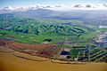
Aerial view of the Los Medanos foothills and Mount Diablo from over Suisun Bay at Concord, California
-

Mount Diablo with the San Francisco Bay and Richmond–San Rafael Bridge in the foreground
-

Mount Diablo as seen from Franks Tract in the Sacramento–San Joaquin River Delta

.jpg)


See also
 In Spanish: Monte Diablo para niños
