Richmond–San Rafael Bridge facts for kids
Quick facts for kids Richmond–San Rafael Bridge |
|
|---|---|

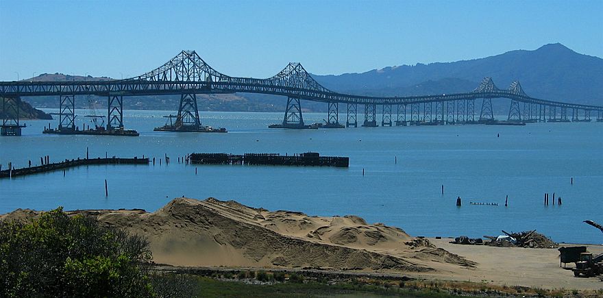
The Richmond–San Rafael Bridge, as seen from Mount Tamalpais, 2012
|
|
| Coordinates | 37°56′05″N 122°26′02″W / 37.9347°N 122.4338°W |
| Carries |
|
| Crosses | San Francisco Bay |
| Locale | San Rafael and Richmond, California |
| Official name | John F. McCarthy Memorial Bridge |
| Other name(s) | Richmond Bridge San Rafael Bridge |
| Named for | John F. McCarthy |
| Owner | State of California |
| Maintained by | California Department of Transportation and the Bay Area Toll Authority |
| ID number | 28 0100 |
| Characteristics | |
| Design | Double-Decked Dual Cantilever bridge with Pratt Truss Approach |
| Total length | 29,040 ft (5.500 mi; 8.85 km) |
| Longest span | 326 m (1,070 ft) cantilever structure |
| Number of spans | 77 in total, consisting of: 19 girder spans (west) |
| Piers in water | 70 |
| Clearance below | 185 feet (56 m) (main channel) 135 feet (41 m) (secondary channel) |
| History | |
| Designer | Norman Raab |
| Constructed by | Gerwick—Kiewit Joint Venture (substructure) Kiewit—Soda—Judson Pacific-Murphy Joint Venture (superstructure) |
| Construction begin | March 1953 |
| Construction cost | US$62,000,000 (equivalent to $667,400,000 in 2022) |
| Opened | September 1, 1956 |
| Statistics | |
| Daily traffic | 66,800 (2011) 67,800 (2012) |
| Toll |
|
The Richmond–San Rafael Bridge is a major bridge in California. It crosses the San Francisco Bay, connecting Richmond on the east side to San Rafael on the west. This bridge is part of Interstate 580.
The bridge opened in 1956. It replaced a ferry service that used to carry people and cars across the bay. In 1981, the bridge was officially renamed the John F. McCarthy Memorial Bridge. This was to honor John F. McCarthy, a state senator who strongly supported building the bridge.
Contents
History of the Richmond–San Rafael Bridge
Early Ideas for a Bridge
People started talking about building a bridge here way back in the 1920s. This was even before the famous Golden Gate Bridge was finished. In 1927, a man named Roy O. Long wanted to build a private toll bridge. His idea was for a steel suspension bridge. It would have been about 2.7 miles (4.4 kilometers) long.
Another idea came from Charles Van Damme in 1927. He owned the ferry company that crossed the bay. His proposed bridge would have been longer, about 3.6 miles (5.8 kilometers). It would have followed a path very similar to the bridge we see today.
Eventually, Long and Van Damme decided to work together. They combined their plans for a bridge. This new plan got approval in 1929. However, the project didn't move forward for many years.
A third person, T.A. Tomasini, also proposed several bridges in the late 1920s. One of his ideas was for a very long bridge and tunnel system. It would have connected San Francisco to the East Bay and Marin County. These ambitious plans faced many challenges and were never built.
Building the Bridge: 1953–1957
After World War II, interest in building the bridge grew again. In 1949, studies showed that a bridge was possible. The state of California approved the project in 1951.
Construction began in March 1953. The project was divided into two main parts: building the underwater supports (substructure) and then building the bridge structure itself (superstructure). Large companies worked together to build it.
The upper deck of the bridge opened on September 1, 1956. At that time, it had one lane of traffic in each direction. It was the second-longest bridge in the world when it opened. The lower deck opened about a year later, on August 20, 1957. After that, the bridge had three lanes of traffic in each direction.
What the Richmond–San Rafael Bridge Looks Like
The Richmond–San Rafael Bridge is about 5.5 miles (8.9 kilometers) long, including its approach roads. It was one of the longest bridges in the world when it was built.
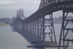
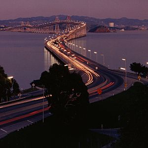
The bridge crosses two main shipping channels. It has two large "cantilever" sections that are raised high above the water. These sections allow big ships to pass underneath. Between these two high sections, the bridge dips down. This gives it a wavy, "roller coaster" look. Also, the bridge doesn't go in a perfectly straight line because the shipping channels are not parallel. Some people have even called its shape a "bent coat hanger."
When the bridge was finished, some people were not happy with how it looked. A famous designer, Frank Lloyd Wright, reportedly called it "the most awful thing I've ever seen." However, the engineers who designed it also worked on the Bay Bridge. They used what they learned to make the Richmond–San Rafael Bridge strong and practical.
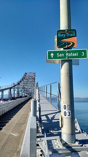
Today, the bridge has two decks. The upper deck carries traffic heading west towards San Rafael. It has two lanes for cars and a special path for bikes and walkers. This path is separated from the cars by a movable barrier. The lower deck carries traffic heading east towards Richmond. It has two lanes for cars. There is also a third lane on the lower deck that opens during busy evening hours. When not in use, this third lane acts as a shoulder for emergencies.
The bridge stands on 79 strong concrete supports called piers. These piers are built on steel piles driven into the ground or bay floor. The bridge was designed with special pipes to carry compressed air and water. This helps with maintenance.
Public Transportation Across the Bridge
You can cross the Richmond–San Rafael Bridge using public transportation. Golden Gate Transit bus route 580 travels across the bridge. It connects the San Rafael Transit Center to the El Cerrito del Norte BART station.
Tolls on the Bridge
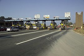
Drivers only pay a toll when they are traveling westbound towards San Rafael. The toll plaza is on the Richmond side of the bridge. Since March 2020, all tolls are collected electronically. This means you cannot pay with cash. You can pay using a FasTrak electronic device or through a license plate tolling program.
The standard toll rate for passenger cars is $8.00. If you are carpooling with three or more people, driving a clean-air vehicle, or riding a motorcycle, you might get a discount. During weekday rush hours (5:00 AM to 10:00 AM and 3:00 PM to 7:00 PM), these vehicles pay $4.00 if they use FasTrak in the special carpool lane.
If you don't have FasTrak or a license plate account, you need to pay online within 48 hours after crossing. If you pay within 21 days of getting an invoice, you won't get an extra penalty.
How Tolls Have Changed
When the bridge first opened in 1956, the toll for a car was $0.75. Over the years, tolls have increased to help pay for bridge maintenance and improvements.
In 1988, the basic toll for seven state-owned bridges, including this one, became $1.00. A $1.00 surcharge was added in 1998 to help pay for earthquake safety upgrades. This raised the toll to $2.00. More increases happened in 2004 and 2007 to fund other transportation projects and Bay Bridge repairs.
By July 2010, the toll for cars on the Richmond–San Rafael Bridge was $5.00. In June 2018, voters approved a plan to raise tolls even more. The toll increased to $6.00 in 2019 and to $7.00 in 2022. As of January 1, 2025, the toll is $8.00.
In September 2019, the Bay Area Toll Authority decided to remove toll takers. They made all seven state-owned bridges cashless. This change was completed by early 2021. The goal was to improve traffic flow. Plans are in place to remove the unused toll booths. This will create an "open-road tolling" system where drivers don't have to slow down.
Bridge Improvements
Earthquake Safety Upgrades
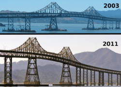
Starting in 2001, the bridge went through a big project to make it safer during earthquakes. This "seismic retrofit" was designed to help the bridge withstand very strong earthquakes. For example, it could handle a 7.4 magnitude quake from the Hayward Fault.
Workers strengthened the bridge's piers by adding concrete and bracing. They also added special joints and bearings to the main sections of the bridge. This helps the structure move safely during an earthquake.
The bridge was also getting old and needed repairs. Concrete pieces were sometimes falling from the upper deck onto the lower deck. This maintenance work was done at the same time as the earthquake upgrades.
A large part of the project involved replacing much of the concrete roadway on the Marin side. To keep traffic moving, most of the work happened at night. Large concrete sections were built somewhere else and then brought to the bridge by barges. A huge crane lifted these new sections into place. This project was completed on September 22, 2005. It was a big success, even though two workers sadly lost their lives during the construction. The final cost of the retrofit was $778 million.
Adding More Lanes
The bridge is wide enough for three lanes of traffic in each direction. When it first opened in 1957, all three lanes were used for cars. However, the third lane on the lower deck is now mostly used as a shoulder for emergencies.
In 1977, during a severe drought, a temporary water pipeline was placed in the third lane of the bridge. This pipe carried millions of gallons of water every day to Marin County residents. Once the drought ended in 1978, the pipeline was removed, and the lane became a shoulder again.
After the 1989 Loma Prieta earthquake, the third lane was temporarily opened for regular traffic. This helped handle the extra cars when the Bay Bridge was closed for repairs. Once the Bay Bridge reopened, the third lane was closed again.
In 2015, a plan was approved to add a protected path for bikes and walkers on the upper deck. This path opened on November 16, 2019. As part of the same project, a third eastbound lane was added to the lower deck in 2018. This lane is now available for cars during busy evening commutes.
Bridge Closures
Like many bridges in the San Francisco Bay Area, the Richmond–San Rafael Bridge sometimes closes because of strong winds. It has been closed due to wind at least three times in its history.
On February 7, 2019, the bridge was closed for several hours. This happened because concrete pieces fell from the upper deck onto the lower deck.
On July 21, 2023, the eastbound direction of the bridge was closed for over 19 hours. This was due to a person in distress on the bridge. The closure was to ensure the person's safety and allow rescuers to communicate with them. The bridge reopened after the person was safely rescued.
 | Shirley Ann Jackson |
 | Garett Morgan |
 | J. Ernest Wilkins Jr. |
 | Elijah McCoy |


