Mount Tamalpais facts for kids
Quick facts for kids Mount Tamalpais |
|
|---|---|
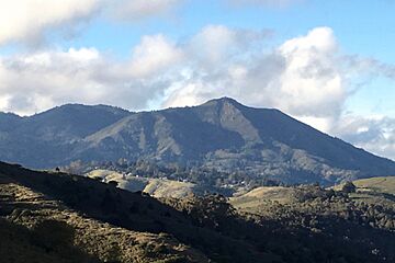
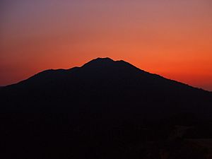
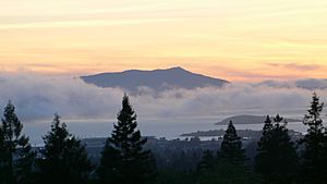
Mount Tamalpais, viewed from the southeast
|
|
| Highest point | |
| Elevation | 2,579 ft (786 m) NAVD 88 |
| Prominence | 2,456 ft (749 m) |
| Listing | California county high points 55th |
| Naming | |
| Native name | Error {{native name}}: an IETF language tag as parameter {{{1}}} is required (help) |
| Geography | |
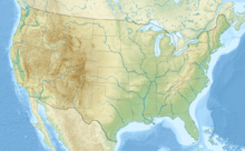
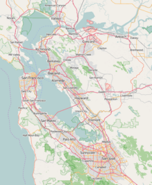
| Location | Marin County, California, U.S. |
| Parent range | California Coast Ranges |
| Topo map | USGS San Rafael |
| Geology | |
| Mountain type | Sedimentary |
| Climbing | |
| First ascent | 1830s by Jacob P. Leese (first recorded ascent) |
| Easiest route | Railroad Grade fire trail |
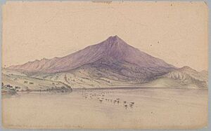
Mount Tamalpais (pronounced TAM-əl-PY-iss), often called Mount Tam, is a famous mountain in Marin County, California, United States. It's a symbol of the area and a big part of its natural beauty. Much of Mount Tamalpais is protected land, including Mount Tamalpais State Park, the Marin Municipal Water District watershed, and parts of National Park Service land like Muir Woods. This means many people can enjoy its trails and views.
Contents
What's in a Name?
The name Tamalpais was first written down in 1845. It comes from the Coast Miwok people, who were the original inhabitants of this land. Their name for the mountain was Támal Pájiṣ, which means "west hill."
There are also some interesting stories about where the name came from, but these are just folk tales. One story says it means "Tamal country" in Spanish, referring to the Miwok people. Another popular story talks about the "Legend of the Sleeping Maiden." This legend says the mountain looks like a young Miwok girl lying down. However, this "Sleeping Lady" story isn't a real Miwok myth. It was actually created by a playwright named Dan Totheroh in the Victorian era for a play.
Mountain Geography
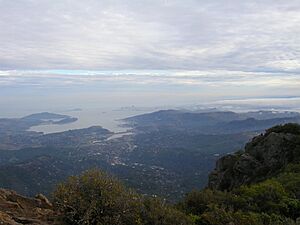
Mount Tamalpais is the tallest peak in the Marin Hills, which are part of California's Northern California Coast Ranges. The highest point, called the West Peak, is about 2,579 feet (786 meters) tall. It used to be even taller, over 2,600 feet, before a radar dome was built there. The East Peak is slightly lower at 2,571 feet (784 meters). You can easily see Mount Tamalpais from many parts of San Francisco and the East Bay.
Most of the mountain is protected land, like Mount Tamalpais State Park and Muir Woods National Monument. It also connects to the Golden Gate National Recreation Area. This creates a huge area of almost 40 miles (64 kilometers) of open space for everyone to enjoy. Some parts of the mountain's lower slopes are home to towns like Mill Valley and Stinson Beach.
Nature's Wonders
How the Mountain Formed
Mount Tamalpais, like other mountains in the California Coast Ranges, was formed by the movement of Earth's tectonic plates. The North American Plate and the Pacific Plate are constantly sliding past each other along the San Andreas Fault. This movement causes the land to push up, buckle, and fold, creating mountains like Mount Tamalpais.
You can find a special type of rock called serpentine on the mountain, especially near the top. Some unique plants only grow in the special serpentine soils found here.
Water on the Mountain
Mount Tamalpais is so tall that it captures moisture from passing storms and fog. This helps create several streams that flow all year round, like Redwood Creek, which runs through Muir Woods National Monument. The southeastern slopes also drain into Arroyo Corte Madera del Presidio, which then flows into Richardson Bay.
Mountain Weather
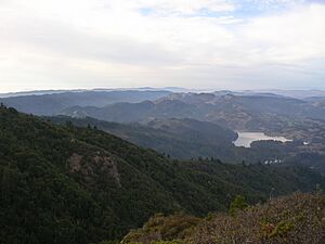
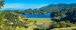
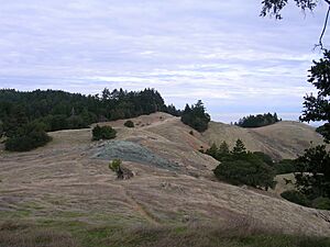
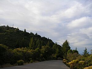
Because of its height and closeness to the ocean and bay, Mount Tamalpais has many different microclimates. You can find cool, foggy valleys with redwood forests, hot and dry slopes with manzanita bushes, and cool, windy spots at the very top. The north slopes, near Alpine Lake, are often shady and covered in Douglas-fir trees.
The amount of rain on Mount Tamalpais changes a lot. The western side, closer to the Pacific Ocean, gets more rain and is covered in tall redwoods and Douglas firs. The eastern foothills are drier because they are sheltered from the ocean breezes and fog. These areas have more oak trees, pine trees, and chaparral shrubs.
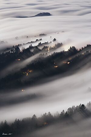
Most of the rain falls during the winter. Sometimes, during cold winter storms, the mountain even gets snow! This happened in February 2001, March 2006, February 2011, February 2019, and February 2023. In summer, there's almost no rain, but fog often rolls in, especially near the ocean, keeping some areas cool and moist.
Temperatures at the top of Mount Tamalpais are usually cooler than at sea level. However, on some summer days, the very top can actually be warmer than the middle, foggy parts of the mountain.
Amazing Plant Life
Mount Tamalpais has a huge variety of plants because of its many different climates. You can find different kinds of hardwood and coniferous forests, coastal scrub, chaparral, grassland, and wetland plants.
- Redwood Forests: These are found in very moist areas at lower elevations, like Muir Woods.
- Mixed Evergreen Forests: These have trees like tanoak, madrone, coast live oak, and Douglas-fir. You can see them in moist areas at middle to high elevations.
- Scrublands: These areas have bushes and shrubs. Chaparral grows in dry, rocky soils.
- Grasslands: Originally, these had native tall grasses, but now many are covered by grasses brought from Europe.
- Wetlands: Along streams, you'll find alder and willow trees.
The special serpentine soils on the mountain are home to unique plants that don't grow anywhere else. For example, the Mount Tamalpais thistle and the Mount Tamalpais jewelflower are rare plants found only in these serpentine areas.
Wonderful Wildlife
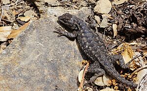
Mount Tamalpais is one of the last safe places for wildlife in the Bay Area. As cities grew, many animals in southern Marin County moved to Mount Tamalpais, Muir Woods, and the Bolinas Ridge. A wide variety of birds, amphibians, arthropods (like insects), and mammals live here. This includes some rare and endangered species. Mount Tamalpais and the nearby Golden Gate Recreation Area together form a large protected parkland near a major U.S. city.
A Look Back in Time
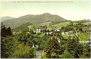
The Coast Miwok people once believed that a powerful witch lived at the top of Mount Tamalpais, so they avoided going to the very peak.
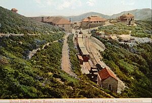
From 1896 to 1930, a special train called the Mount Tamalpais and Muir Woods Railway ran up the mountain. It was known as "The Crookedest Railroad in the World" because of its winding path from Mill Valley to the East Peak. Later, in the 1920s, a road was built for cars.
Early radio towers were built on the mountain in the early 1900s, but strong winds, sometimes like hurricanes, would destroy them. In November 1944, a US Navy plane crashed into the mountain after its engines had trouble. All eight people on board died. For many years, the U.S. Weather Bureau had a weather station on the mountain.
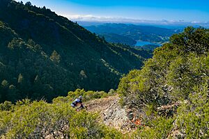
Mount Tamalpais is also famous as the birthplace of mountain biking in the 1970s. Early mountain bikers like Gary Fisher and Joe Breeze rode their bikes on its trails. British philosopher Alan Watts lived in a cabin on Mount Tamalpais later in his life and passed away there in 1973. Today, a fire lookout station on the East Peak is staffed by volunteers during the summer to watch for fires.
Fun Things to Do
Mount Tamalpais is a popular spot for many outdoor activities for people living in the San Francisco Bay Area. You can go hiking, picnicking, mountain biking, road cycling, horseback riding, and even hang-gliding! There are over 100 miles (160 kilometers) of trails and fire roads. The mountain has many starting points for trails, a great network of paths, and hikes for all skill levels.
The Marin Municipal Water District manages several lakes on the north side of Mount Tamalpais, including Alpine Lake, Kent Lake, Bon Tempe Lake, Phoenix Lake, and Lake Lagunitas.
The western slopes of the mountain lead down to the Pacific Ocean at Stinson Beach. The yearly Dipsea Race, a famous cross-country running race, goes from Mill Valley to Stinson Beach, crossing the mountain. While you can't backpack camp, there are walk-in campgrounds at Pantoll and Bootjack. The Bootjack Campground, first set up in the 1920s, reopened in June 2014 after being closed for many years.
Parking at trailheads in Mount Tamalpais State Park usually costs a small fee. The beautiful Ridgecrest Blvd. runs along the mountain's ridge, offering amazing views of the summit, the Pacific Ocean, San Francisco, and Point Reyes. It's often seen in car commercials and is a popular spot for hang-gliding. Mount Tam also has the Edgewood Botanic Garden and the Cushing Memorial Amphitheatre, where Broadway-style musicals are performed outdoors every year. From April to October, you can even attend monthly astronomy events at Rock Spring and Mountain Theater.
Hiking and Mountain Biking Adventures
With its large areas of natural land, Mount Tamalpais has many trails for hikers and bikers. These trails offer a great escape from city life. Some trails on the mountaintop or ridges give you incredible views of the San Francisco Bay and the Pacific Ocean. Other trails, usually in lower valleys, lead through dense forests of Douglas-fir and redwood trees, open grasslands, and shrublands. Roads to the trailheads are usually open, but they might close during fire season if the risk is high.
The many roads, both paved and unpaved, are popular with mountain bikers, especially on weekends. Mount Tamalpais played a key role in the early days of mountain biking. However, there have been discussions about how mountain bikes affect the environment and the safety of other trail users. Because of this, bikes are not allowed on most narrow, single-track trails, but they are still welcome on the wider fire roads. These fire roads are used by runners, hikers, bikers, and horseback riders.
The Dipsea Race, the oldest cross-country trail running race in the U.S., takes place here. Part of the race trail crosses the mountain from Mill Valley to Stinson Beach.
Outdoor Theater
The stone Cushing Memorial Amphitheatre on the southern side of Mount Tamalpais hosts outdoor Broadway musicals several times each summer. It's a unique way to enjoy a show in nature!
See also
 | William Lucy |
 | Charles Hayes |
 | Cleveland Robinson |


