
San Rafael, California facts for kids
Quick facts for kids
San Rafael
|
|||
|---|---|---|---|
|
Aerial view
Downtown San Rafael
Dominican University of California
|
|||
|
|||
| Nickname(s):
The City With a Mission
|
|||

Location in California
|
|||

San Rafael
Location in San Francisco Bay Area

San Rafael
Location in California

San Rafael
Location in the United States
|
|||
| Country | United States | ||
| State | California | ||
| County | Marin | ||
| Incorporated | February 18, 1874 | ||
| Named for | Archangel Raphael | ||
| Government | |||
| • Type | Council-manager with directly elected mayor | ||
| Area | |||
| • City | 22.54 sq mi (58.4 km2) | ||
| • Land | 16.59 sq mi (43.0 km2) | ||
| • Water | 5.96 sq mi (15.4 km2) 26.42% | ||
| Elevation | 43 ft (13 m) | ||
| Population
(2020)
|
|||
| • City | 61,271 | ||
| • Density | 3,693.92/sq mi (1,426.23/km2) | ||
| • Urban | 246,548 (US: 165th) | ||
| • Urban density | 2,897.2/sq mi (1,118.6/km2) | ||
| • Demonym | San Rafaelino | ||
| Time zone | UTC−8 (PST) | ||
| • Summer (DST) | UTC−7 (PDT) | ||
| ZIP code |
94901
|
||
| Area codes | 415/628 | ||
| FIPS code | 06-68364 | ||
| GNIS feature IDs | 1659589, 2411804 | ||
.jpg)
.jpg)
_(cropped).jpg)
_(cropped).jpg)
.jpg)


San Rafael is a city in California, United States. It is the main city of Marin County. The city is part of the San Francisco Bay Area, located in the "North Bay" region. In 2020, about 61,271 people lived there.
San Rafael was started by the Spanish in 1817. They built Mission San Rafael Arcángel as a small church and hospital. It became a full mission in 1822. The city is named after Saint Raphael, an angel of healing. San Rafael officially became a city in 1874.
Contents
History of San Rafael
Before the Spanish arrived, the area of San Rafael was home to several Coast Miwok villages. These included Awani-wi near downtown, Ewu near Terra Linda, and Shotomko-cha in Marinwood.
Spanish Beginnings
.jpg)
Mission San Rafael Arcángel was the 20th Spanish mission built in what was then called Alta California. Three priests started it on December 14, 1817. This was four years before Mexico became independent from Spain. The mission and the city are named after the Archangel Raphael, who is known as the Angel of Healing.
The mission was first meant to be a hospital for Central Valley American Indians who got sick at the cold San Francisco Mission Dolores. Father Luis Gil, who could speak several Native American languages, was put in charge. Because of its good weather, San Rafael was later made a full mission in 1822.
Mexican Rule and American Arrival
.png)
The mission quickly grew, with 300 people joining in its first year and 1,140 by 1828.
In 1834, the Mexican government took over the California missions. Mission San Rafael was left empty in 1844 and eventually fell apart.
Later, in 1879, the San Francisco and North Pacific Railroad reached San Rafael. This connected the city to the national train system by 1888. During World War II, the United States Navy used a special area near San Rafael in San Pablo Bay.
Geography and Climate

San Rafael covers about 22.5 square miles (58.3 square kilometers). About 16.6 square miles (43 square kilometers) is land, and 6.0 square miles (15.5 square kilometers) is water. The city of San Francisco is about 16 miles (26 kilometers) to the south.
The coastline of San Rafael has been changed over time to make room for buildings. The ground underneath is often soft bay mud. San Rafael has many different natural areas, from forests in the hills to marshlands and areas where rivers meet the bay. Its marshes are home to the endangered species salt marsh harvest mouse. There are also areas along rivers like San Rafael Creek and Miller Creek.
San Rafael's Weather

San Rafael has a warm-summer Mediterranean climate. This means it has mild winters where it rarely freezes. Summers are warm but not too hot. August is usually the warmest month, with highs around 80°F (27°C). December is the coldest, with lows around 41°F (5°C).
The highest temperature ever recorded was 110°F (43°C) in June 1961. It gets above 90°F (32°C) about 18 days a year. Freezing temperatures (32°F or 0°C) happen about 4 mornings a year.
San Rafael gets about 32 inches (817 mm) of rain each year. It rains on about 64 days. Most of the rain falls from November to early April. It is very rare to have rain in June, July, August, and September.
Population and People
| Historical population | |||
|---|---|---|---|
| Census | Pop. | %± | |
| 1870 | 841 | — | |
| 1880 | 2,276 | 170.6% | |
| 1890 | 3,290 | 44.6% | |
| 1900 | 3,879 | 17.9% | |
| 1910 | 5,934 | 53.0% | |
| 1920 | 5,512 | −7.1% | |
| 1930 | 8,022 | 45.5% | |
| 1940 | 8,573 | 6.9% | |
| 1950 | 13,848 | 61.5% | |
| 1960 | 20,460 | 47.7% | |
| 1970 | 38,977 | 90.5% | |
| 1980 | 44,700 | 14.7% | |
| 1990 | 48,404 | 8.3% | |
| 2000 | 56,063 | 15.8% | |
| 2010 | 57,713 | 2.9% | |
| 2020 | 61,271 | 6.2% | |
| U.S. Decennial Census 1850–1870 1880-1890 1900 1910 1920 1930 1940 1950 1960 1970 1980 1990 2000 2010 |
|||
San Rafael first appeared as a city in the 1870 U.S. Census.
San Rafael in 2010
_(cropped).jpg)
In 2010, the city of San Rafael had a population of 57,713 people. This number only counts the official city limits. Many people who live in nearby areas also use San Rafael postal addresses.
Most people in San Rafael lived in homes (96.3%). About 19.3% of the population was under 18 years old. The average age was 40.2 years. For every 100 females, there were about 99.7 males.
San Rafael in 2000

_at_Mission_San_Rafael_Arc%C3%A1ngel_-_panoramio_(cropped).jpg)
In 2000, San Rafael had 56,063 people. The population density was about 3,379 people per square mile.
About 59% of the people were White, 6% were Asian, and 30% were Hispanic or Latino.
The average income for a household in the city was about $60,994. For families, it was about $74,398.
Economy and Jobs
.JPG)
Many companies have their main offices in San Rafael. These include BioMarin, Autodesk, In Defense of Animals, Westamerica Bank, and GIS Data Resources. In 2022, Autodesk announced it would move its main office to San Francisco.
Top Employers in San Rafael

Here are some of the biggest employers in San Rafael, based on a 2023 report:
| # | Employer | Number of Employees |
|---|---|---|
| 1 | Kaiser Permanente | 2,339 |
| 2 | BioMarin | 950 |
| 3 | San Rafael City Schools | 700 |
| 4 | City of San Rafael | 420 |
| 5 | Dominican University of California | 394 |
| 6 | Ghilotti Bros., Inc. | 298 |
| 7 | Community Action Marin | 200 |
| 8 | Equator Coffees, LLC | 95 |
Entertainment Industry in San Rafael

San Rafael became a hub for the entertainment industry, especially for high-tech parts of the business. This happened after filmmaker George Lucas came to San Rafael in 1970.
Lucasfilm was started by George Lucas in 1971. It is famous for the Star Wars and Indiana Jones movies. Some of Lucasfilm's work moved to San Francisco in 2005. Parts of the movie American Graffiti were filmed in downtown San Rafael. Also, parts of THX 1138 and Gattaca were filmed at the Marin County Civic Center in San Rafael.
Industrial Light & Magic (ILM) was founded by Lucas in 1975. ILM creates amazing special effects for movies. The new-age music show Hearts of Space has been based in San Rafael since 2004.
Because LucasFilm was there, many video game companies also came to San Rafael:
- Broderbund: Started in 1980, known for games like Choplifter, Lode Runner, Where in the World is Carmen Sandiego?, and Myst.
- LucasArts: Started by George Lucas in 1984. Famous for Star Wars and Indiana Jones games, and unique titles like The Secret of Monkey Island.
- Stormfront Studios: Started in 1988. Known for The Lord of the Rings: The Two Towers and many EA Sports games.
- Visual Concepts: Started in 1988. Known for creating many EA Sports and 2K sports games.
- Totally Games: Started in 1994. Known for Star Wars flight simulation games.
- THX: A company that sets high standards for sound and picture quality. It started from Lucasfilm.
- Factor 5: Moved to San Rafael in 1996. Known for Star Wars and Indiana Jones games.
- Telltale Games: Started in 2004 by former LucasArts employees. Known for games like The Walking Dead.
- Mind Control Software: Started in 1994. Known for its award-winning game, Oasis.
Parks and Recreation
.jpg)

San Rafael has many parks for everyone to enjoy. Some of the community parks include Albert Park, Boyd Park, Gerstle Park, Pickleweed Park, and the Terra Linda Recreational Center.
Larger parks include China Camp State Park and McNear's Beach Park.
There are also many smaller neighborhood parks like Bret Harte Park, Sun Valley Park, Oleander Park, Victor Jones Park, Peacock Gap Park, and Gerstle Park. Gerstle Park is also a historic neighborhood close to downtown.
Education in San Rafael
.jpg)
San Rafael is home to one university, Dominican University of California.
The Ali Akbar College of Music was founded here by Indian musician Ali Akbar Khan. It teaches Indian classical music. San Rafael also has one of the two campuses for Guide Dogs for the Blind, a school that trains guide dogs.
Most public schools in San Rafael are run by the San Rafael City Schools district. The Miller Creek Elementary School District runs some elementary and middle schools north of the city. All public high schools are part of San Rafael City Schools. The district has two main high schools: San Rafael High School and Terra Linda High School. There is also an alternative high school called Madrone.
Some notable private schools include Marin Academy, Saint Raphael School, and Brandeis Marin. The Marin School was a private school that closed in 2023.
Transportation


The main highway through San Rafael is U.S. Route 101. This highway connects the city to the northern North Coast (California) and San Francisco to the south. Interstate 580 crosses the Richmond–San Rafael Bridge to the East Bay.
The San Rafael Transit Center is a major hub for buses. It is served by Golden Gate Transit, Marin Transit, Sonoma County Transit, and Greyhound.
A commuter train called Sonoma–Marin Area Rail Transit (SMART) also serves San Rafael. It has two stations: one at the San Rafael Transit Center and another at the Marin Civic Center. The train line to Santa Rosa opened in 2017. This brought passenger trains back to San Rafael for the first time since 1958. The line was extended to Larkspur in 2019 to connect with ferries.
Notable People from San Rafael
Many interesting people have lived in or are from San Rafael:
- Isabel Allende, a famous author
- Stacey Bailey, a former American football player
- Philip K. Dick, a well-known novelist
- George Duke, a talented musician and composer
- William English, who helped create the computer mouse
- Brad Gilbert, a professional tennis player and coach
- Jared Goff, a quarterback for the Detroit Lions
- James Hetfield, the lead singer of the band Metallica
- Michael Johnson, an Olympic gold medalist in sprinting
- Christian Mortensen, who was once the oldest living man in the world
- Carlos Santana, a legendary musician
- Michael Savage, a radio host and author
Sister Cities
San Rafael has "sister city" relationships with other cities around the world. This helps build friendships and understanding between different cultures.
 San Rafael del Norte, Nicaragua
 Lonate Pozzolo, Italy
 Falkirk, Scotland
 Chiang Mai, Thailand
Images for kids
-
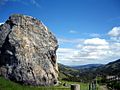
Big Rock Ridge
See also
 In Spanish: San Rafael (Estados Unidos) para niños
