Santa Rosa, California facts for kids
Quick facts for kids
Santa Rosa
|
||
|---|---|---|
|
|
||
|
||
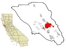
Location of Santa Rosa in Sonoma County, California and of Sonoma County in California
|
||
| Country | United States | |
| State | California | |
| County | Sonoma | |
| Incorporated | March 26, 1868 | |
| Government | ||
| • Type | Council-Manager | |
| Area | ||
| • City | 42.70 sq mi (110.58 km2) | |
| • Land | 42.52 sq mi (110.13 km2) | |
| • Water | 0.17 sq mi (0.45 km2) 0.49% | |
| Elevation | 164 ft (50 m) | |
| Population
(2020)
|
||
| • City | 178,127 | |
| • Rank | 1st in Sonoma County 25th in California 144th in the United States |
|
| • Density | 4,171.6/sq mi (1,610.84/km2) | |
| • Urban | 297,329 (US: 136th) | |
| • Urban density | 3,745.1/sq mi (1,446.0/km2) | |
| • Metro | 488,863 (US: 116th) | |
| Time zone | UTC−8 (Pacific) | |
| • Summer (DST) | UTC−7 (PDT) | |
| ZIP Codes |
95401–95407, 95409
|
|
| Area code | 707 | |
| FIPS code | 06-70098 | |
| GNIS feature IDs | 249105, 1659601 | |
Santa Rosa is a city in California, located in the Bay Area. Its name means "Saint Rose" in Spanish. It is the biggest city in Sonoma County and is known as part of California's Wine Country. In 2020, about 178,127 people lived there. Santa Rosa is the fifth largest city in the Bay Area and the 25th largest in California.
Contents
History of Santa Rosa
Early History of the Santa Rosa Plain
Before Europeans arrived, the Santa Rosa Plain was home to the Bitakomtara, a strong tribe of Pomo people. They carefully controlled who could enter their land. The tribe held special ceremonies near Santa Rosa Creek.
When Spanish explorers and colonists came, the Pomo people faced many challenges. Their population was greatly reduced by violence, land being taken, and diseases like smallpox. Even today, descendants of the Pomo people live in the region.
Santa Rosa in the 1800s

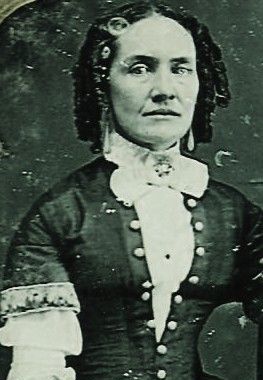
Santa Rosa was founded in 1833 by Mexican colonists. They named it after Saint Rose of Lima. The first lasting European settlement was the home of the Carrillo family. María López de Carrillo built an adobe house on her land grant, Rancho Cabeza de Santa Rosa, in the 1830s.
Before this, in the 1820s, Spanish and Mexican settlers raised livestock in the area. They would slaughter animals where Santa Rosa Creek and Matanzas Creek meet. This place became known as La Matanza, meaning "the slaughter."
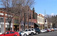
By the 1850s, after California became part of the United States, a Wells Fargo post and general store opened. In the mid-1850s, locals like Julio Carrillo, Maria Carrillo's son, planned the city's street layout with a public square in the middle. This plan is still largely seen in downtown Santa Rosa today.
In 1867, Santa Rosa officially became an incorporated city. The state confirmed this in 1868. It was the third city in Sonoma County to be incorporated.
Santa Rosa grew steadily, becoming the eighth-largest city in California by 1870. It was also the county seat. While other cities grew faster later, Santa Rosa continued to develop.
Santa Rosa in the 1900s
By 1900, the Pomo population had significantly decreased. In 1905, Santa Rosa had just over 10,000 people.
The 1906 San Francisco earthquake destroyed most of downtown Santa Rosa. However, the city's population did not suffer much. After this, Santa Rosa's growth was slow for a while.
Santa Rosa grew more after World War II. This was partly because of the Naval Auxiliary Landing Field Santa Rosa. The city also became a popular stop for travelers going to the Russian River.
Between 1950 and 1970, the population increased by two-thirds. This was about 1,000 new residents each year. Some of this growth came from adding nearby areas to the city.
In 1958, Santa Rosa was chosen as a regional headquarters for civil defense. This meant it was important for planning how to respond to emergencies. This role continued until 1979.
By 1991, Santa Rosa had about 113,000 people. The city planned for a population of 175,000 by 2010. They expanded the city's boundaries for future growth.
In November 2017, Santa Rosa officially added the community of Roseland.
The 2017 Firestorm
On October 8, 2017, a large wildfire called the Tubbs Fire started. It destroyed about five percent of Santa Rosa's homes. This fire was part of a major firestorm in California. Many homes in the Coffey Park, Larkfield-Wikiup, and Fountain Grove areas were lost.
Despite the fires, over 1,000 animals at the Safari West Wildlife Preserve were saved. The owner, Peter Lang, fought the flames for more than 10 hours using garden hoses.
Geography of Santa Rosa
Santa Rosa covers about 41.50 square miles (110.58 square kilometers). Most of this area is land, with a small amount of water.
The city is in the North Bay region. It is about 55 miles (88 km) north of San Francisco. Santa Rosa is located on the Santa Rosa Plain.
The city's eastern parts reach into the Valley of the Moon. Its western edge is near the Laguna de Santa Rosa.
Santa Rosa Creek flows through the city. This creek starts on Hood Mountain and flows into the Laguna de Santa Rosa. Other creeks like Brush Creek and Matanzas Creek also flow through the city. Lakes in Santa Rosa include Fountaingrove Lake and Lake Ralphine.
East of the city, you can see mountains like Bennett Peak, Mount Hood, and Sonoma and Taylor mountains.
Climate in Santa Rosa
Santa Rosa has a warm-summer Mediterranean climate. This means it has cool, wet winters and warm, dry summers. In summer, fog often rolls in from the Pacific Ocean in the evenings and mornings. It usually clears up by late morning, making way for sunny weather.
The city gets about 32.20 inches (818 mm) of rain each year. Snowfall is very rare in the city itself, but light snow can sometimes fall in the nearby mountains.
Santa Rosa has about 29 days a year where the temperature reaches 90°F (32°C) or higher. It also has about 30 mornings where the temperature drops to freezing (32°F or 0°C). The highest temperature ever recorded was 115°F (46°C) on September 6, 2022. The lowest was 9°F (-13°C) on December 25, 1924.
Earthquakes in Santa Rosa
Santa Rosa is located on the Healdsburg-Rodgers Creek fault. Experts believe there is a chance of a strong earthquake on this fault by 2037.
A map from 2005 showed that the 1906 San Francisco earthquake caused the most shaking between Santa Rosa and Sebastopol. This caused more damage in Santa Rosa, for its size, than any other city affected.
On October 1, 1969, two earthquakes shook Santa Rosa. They caused damage to about 100 buildings. These were the strongest quakes since 1906.
Nature and Wildlife in Santa Rosa
Much of Santa Rosa's natural areas are on its edges. However, Santa Rosa Creek and its smaller streams flow through the city. You can see Great blue herons, great egrets, and black-crowned herons nesting in trees.
Deer are often seen in neighborhoods near the eastern hills. Wild turkeys are also common. Sometimes, mountain lions are seen within the city limits. Raccoons and opossums are common throughout the city. Foxes and rabbits can be seen in more rural areas.
The city is also next to Trione-Annadel State Park. This park connects to Spring Lake County Park and Howarth Park, creating a large area for enjoying nature.
Santa Rosa Neighborhoods
Santa Rosa is often thought of as having four main areas: Northeast, Southeast, Southwest, and Northwest. U.S. Route 101 divides the city into east and west. State Route 12 divides it into north and south.
Some of Santa Rosa's neighborhoods include:
- Bennett Valley
- Coffey Park
- Fountain Grove
- Juilliard Park
- Lomita Heights
- McDonald Mansion Historic District
- Montecito Heights
- Montgomery Village
- Oakmont Village
- Olive Park
- Railroad Square District
- Rincon Valley
- Roseland
- Skyhawk
- Spring Lake
- Annadel Heights
- South Park
- St. Rose Historic District
- West End Arts and Theater District
People of Santa Rosa
| Historical population | |||
|---|---|---|---|
| Census | Pop. | %± | |
| 1860 | 1,623 | — | |
| 1870 | 2,898 | 78.6% | |
| 1880 | 3,616 | 24.8% | |
| 1890 | 5,220 | 44.4% | |
| 1900 | 6,673 | 27.8% | |
| 1910 | 7,817 | 17.1% | |
| 1920 | 8,758 | 12.0% | |
| 1930 | 10,636 | 21.4% | |
| 1940 | 12,605 | 18.5% | |
| 1950 | 17,902 | 42.0% | |
| 1960 | 31,027 | 73.3% | |
| 1970 | 50,006 | 61.2% | |
| 1980 | 82,658 | 65.3% | |
| 1990 | 113,313 | 37.1% | |
| 2000 | 147,595 | 30.3% | |
| 2010 | 167,815 | 13.7% | |
| 2020 | 178,127 | 6.1% | |
| 2023 (est.) | 175,861 | 4.8% | |
| source: | |||
In 2010, Santa Rosa had 167,815 people. About 98% of the people lived in homes.
About 23.4% of the population was under 18 years old. The average age was 36.7 years. For every 100 females, there were about 95 males.
Santa Rosa's Hispanic population, mostly of Mexican background, lives throughout the city. However, many are in the western part of Santa Rosa. The Apple Valley Lane/Papago Court neighborhood has the highest percentage of Hispanic residents, at 87%.
Southeast Asian communities, including Vietnamese, Laotian, and Cambodian people, are mostly in the western neighborhoods like Bellevue Ranch and Roseland. The northeast neighborhoods of Skyhawk and Fountaingrove have the largest Chinese communities.
Economy of Santa Rosa
Forbes Magazine once ranked Santa Rosa as one of the best places for business. However, its ranking dropped due to higher costs for businesses and slower job growth. This was mainly because housing became more expensive.
Top Employers in Santa Rosa
Here are some of the biggest employers in Santa Rosa:
| # | Employer | Employees |
|---|---|---|
| 1 | County of Sonoma | 4,284 |
| 2 | Kaiser Permanente | 3,371 |
| 3 | Santa Rosa Junior College | 2,975 |
| 4 | St. Joseph Health System | 2,409 |
| 5 | Keysight/Agilent Technologies | 1,700 |
| 6 | Santa Rosa School District | 1,691 |
| 7 | City of Santa Rosa | 1,279 |
| 8 | Sutter Medical Center of Santa Rosa | 1,196 |
| 9 | Safeway | 796 |
| 10 | Medtronic/Arterial Vascular Eng | 682 |
Santa Rosa is also home to smaller, well-known businesses like Moonlight Brewing Company and Russian River Brewing Company.
Shopping in Santa Rosa
Santa Rosa has many places to shop. There are 12 neighborhood shopping centers and 17 commercial areas. It also has three large shopping malls:
- Santa Rosa Plaza: Has over 100 stores.
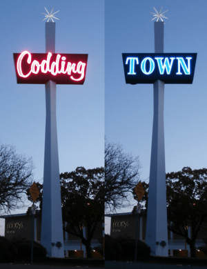
- Coddingtown Mall: Has over 40 stores.
- Montgomery Village: An outdoor mall with more than 70 shops, a supermarket, and banks.
Arts and Culture in Santa Rosa
Libraries in Santa Rosa
The Sonoma County Library has several branches in Santa Rosa. The Central Library is downtown. There are also branches in Roseland, at Coddingtown Mall, and in Rincon Valley. The Central Library has a special section for local history.
The Sonoma County Public Law Library is at the Sonoma County Courthouse.
At Santa Rosa Junior College, the Frank P. Doyle Library has four floors. It includes the library, media services, and a college art gallery.
Tourism in Santa Rosa
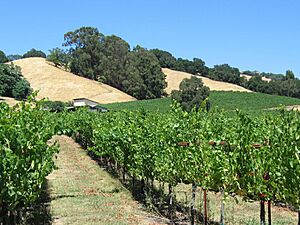
Santa Rosa is a great starting point for exploring California's famous Wine Country. Many wineries and vineyards are nearby. You can also visit the Russian River resort area, the Sonoma Coast, Jack London State Historic Park, and the tall redwood trees at Armstrong Redwoods State Reserve.
The Santa Rosa Convention & Visitors Bureau helps people plan their visits. Their visitors center is in the old railroad depot in Historic Railroad Square.
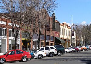
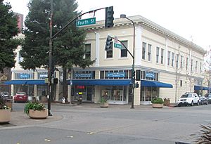
Downtown Santa Rosa is a lively area with shops, restaurants, nightclubs, and theaters. It also has City Hall and many offices.
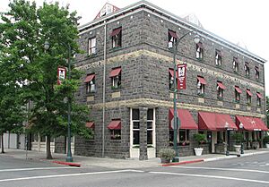
Railroad Square District is a historic part of downtown. It has many old commercial buildings. Some, like the old Northwestern Pacific Railroad depot and the Hotel La Rose, survived the 1906 earthquake. The hotel was built in 1907 and is a registered historic hotel.
Fun Places to Visit in Santa Rosa
- Carrillo Adobe: Built in 1837, this was one of the first homes in the area that became Santa Rosa.
- Luther Burbank Home and Gardens: Visit the home and gardens of famous botanist Luther Burbank.
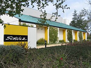
- Charles M. Schulz Museum and Research Center: Learn about the creator of Peanuts, Charles M. Schulz.
- Redwood Empire Ice Arena (Snoopy's Home Ice): Go ice skating at this rink.
- Safari West: See over 1,000 animals from about 98 different species at this wildlife preserve.
- Sonoma County Museum: Explore local history and art.
- Doyle Community Park: Enjoy outdoor activities.
- Spring Lake Regional Park: A great place for outdoor fun.
- Trione-Annadel State Park: Hike and explore nature.
- Railroad Square: A historic area with shops and restaurants.
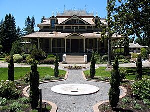
- Historic Neighborhoods: See many old, beautiful houses, including Victorian homes. The McDonald Mansion is one example.
- Luther Burbank Rose Parade and Festival: An annual event celebrating roses.
- California Indian Museum and Cultural Center: Learn about California's Native American cultures.
- Pacific Coast Air Museum: See old airplanes at the airport.
Performing and Visual Arts in Santa Rosa

Santa Rosa has a lively arts scene:
- Luther Burbank Center for the Arts: A place for concerts and shows.
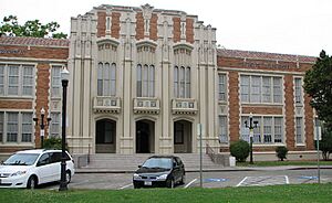
- Sonoma County Philharmonic: An orchestra that performs at Santa Rosa High School.
- Summer Repertory Theatre: A theater group that puts on plays.
- Santa Rosa Symphony: A regional orchestra founded in 1928. They perform at the Green Music Center.
- 6th Street Playhouse: A theater that puts on various performances.
For visual arts, you can visit the Sonoma County Museum and many independent art galleries.
Education in Santa Rosa
School Districts in Santa Rosa
Several school districts serve Santa Rosa. The main one is the Santa Rosa City Schools system. This includes both elementary and high schools.
Most of the city is in the Santa Rosa High School District. Some smaller parts are in the West Sonoma County Union High School District.
Elementary school districts that feed into the Santa Rosa high school district include:
- Santa Rosa
- Bellevue Union
- Bennett Valley Union
- Kenwood
- Mark West Union
- Piner-Olivet Union
- Rincon Valley Union
- Roseland Public Schools
- Wright Union School District
Private Schools in Santa Rosa
- Cardinal Newman High School (grades 9–12)
- Redwood Adventist Academy (grades K-12)
- Rincon Valley Christian School (grades K-12)
- Sonoma Academy (grades 9–12)
- St. Eugene's cathedral school
- St. Luke's Elementary School
- St. Rose Elementary School
- Sonoma Country Day School (grades K-8)
- Summerfield Waldorf School & Farm (grades K-12)
- Stuart School (grades K-8)
Colleges in Santa Rosa
- Empire College
- Santa Rosa Junior College
- University of San Francisco (USF) – Santa Rosa campus
Media in Santa Rosa
Print Media
The Press Democrat is the largest daily newspaper in the North Bay. It has been published in Santa Rosa since 1857. Other local business papers include the North Bay Business Journal. The North Bay Bohemian is a free weekly paper. The Sonoma County Gazette is a free monthly paper.
Television Media
The television studios for KQSL are located in Santa Rosa.
City Services in Santa Rosa
Law Enforcement
The Santa Rosa Police Department has about 259 employees, including 172 police officers. Their budget is over $40 million.
Fire Department
The Santa Rosa Fire Department provides fire protection and emergency medical services. They also work with Medic Ambulance Service for ambulance calls.
The Santa Rosa Fire Department started as a volunteer group in 1861. It became a paid department in 1894. After the big 1906 earthquake, the department grew. Many firefighters are part of the Urban Search and Rescue California Task Force 4. This team helps with large disasters both in the United States and other countries.
Transportation in Santa Rosa
Road Travel
Santa Rosa is located along the U.S. Route 101 freeway. It's about an hour's drive north of San Francisco. Sonoma County Transit provides bus service within the city.
Train Travel
Sonoma–Marin Area Rail Transit (SMART) brought passenger trains back to Santa Rosa in 2017. It has two stations in the city: Guerneville Road and Railroad Square. Trains travel south to Larkspur.
The Amtrak Thruway 7 bus connects Santa Rosa to other cities. You can catch it at 2012 Range Avenue.
Air Travel
Charles M. Schulz–Sonoma County Airport is just north of Santa Rosa. It has flights from American, Alaska, and Avelo. You can fly directly to cities like Los Angeles, San Diego, and Seattle. A SMART train station is near the airport, with a shuttle bus to the terminal. Sonoma County Airport Express buses also connect Santa Rosa to Oakland International Airport and San Francisco International Airport.
Biking and Walking Paths
The Prince Memorial Greenway is a path for bikes and walking along Santa Rosa Creek. It goes through downtown and connects to the Joe Rodota Trail. This paved path goes all the way to Sebastopol. Santa Rosa is also part of the planned Great Redwood Trail. This trail will eventually run from San Francisco Bay to Humboldt Bay.
Santa Rosa in Movies
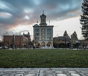
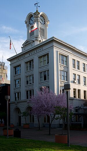
Director Alfred Hitchcock filmed his movie Shadow of a Doubt in Santa Rosa in 1943. The movie shows what Santa Rosa looked like in the 1940s. Many downtown buildings from the film are gone now because of rebuilding after the earthquakes in 1969. However, the old Northwestern Pacific Railroad depot and the Empire Building (with its gold-topped clock tower) are still there.
The Coen brothers' film The Man Who Wasn't There (2001) is also set in Santa Rosa around 1949.
Santa Rosa Film Locations
Santa Rosa has been a filming location for many movies, including:
- The Happy Land (1943)
- Shadow of a Doubt (1943)
- The Sullivans (1944)
- All My Sons (1948)
- Storm Center (1956)
- Pollyanna (1960)
- It's a Mad, Mad, Mad, Mad World (1963)
- The Candidate (1972)
- Slither (1972)
- Steelyard Blues (1973)
- Smile (1975)
- Little Miss Marker (1980)
- Shoot the Moon (1982)
- Cujo (1983)
- Smooth Talk (1985)
- Peggy Sue Got Married (1986)
- Wildfire (1988)
- Wired (1989)
- Die Hard 2 (1990)
- Stop! Or My Mom Will Shoot! (1992)
- Phenomenon (1996)
- Scream (1996)
- Inventing the Abbotts (1997)
- Mumford (1999)
- Bandits (2001)
- The Man Who Wasn't There (2001)
- Cheaper by the Dozen (2003)
- Paranormal Activity 3 (2011)
Sister Cities of Santa Rosa
Santa Rosa has sister cities around the world:
 Cherkasy, Ukraine
 Jeju City, South Korea
 Los Mochis, Sinaloa, Mexico
See also
 In Spanish: Santa Rosa (California) para niños
 | Laphonza Butler |
 | Daisy Bates |
 | Elizabeth Piper Ensley |


