U.S. Route 101 in California facts for kids
Quick facts for kids
U.S. Route 101 |
||||
|---|---|---|---|---|
| Lua error in Module:Infobox_road/map at line 15: attempt to index field 'wikibase' (a nil value). | ||||
| Route information | ||||
| Defined by S&HC § 401 | ||||
| Maintained by Caltrans | ||||
| Length | 808.111 mi (1,300.529 km)
Parts of US 101 have been given to or are otherwise taken care of by local or other governments, and are not a part of the length.
|
|||
| Existed | 1926–present | |||
| Major junctions | ||||
| South end | ||||
|
||||
| North end | ||||
| Highway system | ||||
| United States Numbered Highways List • Bannered • Divided • Replaced State highways in California(list • pre-1964)
|
||||
U.S. Route 101 (US 101) is a very important highway in California. It's one of the oldest and longest roads in the state. This highway was first created in 1926. It is also the longest highway of any type in California.
This road is part of the California Freeway and Expressway System. This means it's designed for fast travel with no traffic lights.
What is US 101?
US 101 is a major road that stretches along the Pacific Coast. It starts in Olympia, Washington, and goes south. It passes through Oregon before entering California. The highway then continues all the way to Los Angeles.
One of the most famous parts of US 101 is the Golden Gate Bridge in San Francisco. This amazing bridge is a key section of the highway.
People in different parts of California call the highway by different names. In Southern California, where it's mostly a fast freeway, people often say "The 101." But in Northern California, people usually just call it "101."
Images for kids
-
US 101 northbound approaching the Gaviota Tunnel through the Santa Ynez Mountains.
-
US 101 follows the Russian River past Frog Woman Rock in southern Mendocino County.
-
Parking next to US 101 along the sandy bar between Freshwater Lagoon and the Pacific Ocean.
-
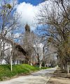
An early narrow concrete road near Mission San Miguel Arcángel. This was US 101 until 1938.
See also
 In Spanish: U.S. Route 101 (California) para niños
 | Calvin Brent |
 | Walter T. Bailey |
 | Martha Cassell Thompson |
 | Alberta Jeannette Cassell |


