History of California's state highway system facts for kids
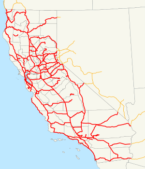
California's state highway system helps people travel all over the state. It began way back in 1896. Before that, local towns and counties took care of roads. Building a huge system of highways for the whole state started in 1912. This happened after people voted to spend $18 million on over 3,000 miles (4,900 km) of roads. The last big additions to the system were made in 1959. Since then, only small changes have happened.
Contents
How California's Highways Began (1895-1919)
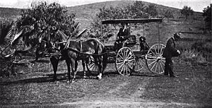
The very first state road was approved on March 26, 1895. A new law created a special "Lake Tahoe Wagon Road Commissioner." This person was in charge of keeping up the Lake Tahoe Wagon Road. This road is now part of US 50. It goes from Smith Flat, near Placerville, to the Nevada border. The road was 58 miles (93 km) long. It used to be a toll road, meaning you had to pay to use it. But El Dorado County bought it in 1886. Then, they gave the road to the state in 1896. There wasn't much money for big improvements. But a stone bridge was built over the South Fork American River in 1901.
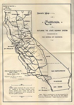
Also in 1895, the state created the Bureau of Highways. This group of three people helped counties build "good roads." The bureau traveled to every county in 1895 and 1896. They made a map of state roads they thought California should build. They gave this map to the governor in November 1896. The state then changed the Bureau of Highways to the Department of Highways in 1897. Soon after, a second state highway was created. This road went from Sacramento to Folsom. It also became part of US 50. This was the last road managed by a separate group. After this, the Department of Highways took over all new state roads.
More state highways were added over the next ten years. In 1907, the Department of Engineering was created. This new department was in charge of all state highways. This included the Lake Tahoe Wagon Road. In 1909, the "State Highways Act" was passed. It allowed the state to borrow $18 million. This money was for a "continuous and connected state highway system." The goal was to link all county seats. To do this, the California Highway Commission was formed in 1911. They were in charge of building and maintaining this new system. Like the 1896 plan, the commission traveled the state. They decided on the best routes, which ended up being about 3,100 miles (5,000 km) long. Building started in mid-1912. The first project was in San Mateo County. Important parts built by the commission included the Ridge Route and the Yolo Causeway.
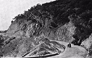
The first money wasn't enough to finish all the roads. So, the "State Highways Act of 1915" was approved. This gave the Department of Engineering an extra $12 million. This was to finish the first system. It also provided $3 million for about 680 more miles (1,100 km) of roads. At this time, each route got a number from 1 to 34. These numbers were not put on signs. But they were used until the highways were renumbered in 1964. In 1917, the California Highway Commission officially took over about 750 miles (1,200 km) of roads. These roads had been adopted by law. More routes were added in 1917 and 1919. They were given numbers from 35 to 45. A third bond issue was approved in 1919. This gave $20 million more for existing roads. It also gave $20 million for new roads, adding about 1,800 miles (2,900 km). Routes 46 to 64 were added. All three bond issues together planned for 5,560 miles (8,948 km) of roads. By mid-1920, over 40% of these roads were built or being built.
Growing the Highway Network (1920-1958)
In 1921, the Department of Engineering became part of the new Department of Public Works. The California Highway Commission became its own separate department in 1923. To pay for the roads, a 2-cent tax on each gallon of gasoline was approved in 1923. The state legislature kept adding more highways. These included the Mother Lode Highway (now part of SR 49) in 1921. The Arrowhead Trail (now I-15 north of Barstow) was added in 1925.
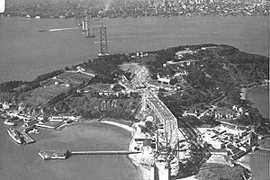
In 1928, two car clubs started marking U.S. Highways. They put up signs along the most important state highways. The California Toll Bridge Authority was created in 1929. This group bought and ran all toll bridges on state highways. This included the famous San Francisco–Oakland Bay Bridge.
After 1927 and 1929, when no new highways were added, things changed. In 1931, the legislature approved 23 new routes. These were numbered from 72 to 80. Two years later, 213 more highway sections were added. This almost doubled the total length of state highways to about 14,000 miles (23,000 km). The last route number jumped from 80 to 202. Many of these new routes were given official state sign numbers in 1934. The car clubs also put up these signs.
In 1947, the Division of Highways took over putting up signs. Before that, the car clubs had done it. The Auto Club of Southern California kept putting signs on city streets until 1956.
The Big Highway Renumbering of 1964
In 1963 and 1964, the California Division of Highways made a huge change. They renumbered many state highways. Most of the "sign routes" (the ones people saw signs for) kept their numbers. The biggest change was for the "legislative routes." These were the official numbers used in laws. They were changed to match the sign routes. Many roads that didn't have signs before got new numbers.
Another change was removing or shortening many U.S. Routes. This was done because of the new Interstate Highways, which started in 1959. Also, some State Routes were renumbered if their numbers were the same as new Interstate numbers. Some U.S. Routes that were officially removed still had signs. This lasted until the new Interstates were finished. The law for this renumbering was passed on September 20, 1963. The new signs were put up by July 1, 1964.
Highways Today (1964-Present)
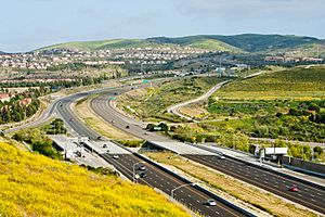
Since the 1960s, there's been a big question in California. Should the state keep building more freeways? Or should it focus on improving public transportation like trains and buses? Many "freeway revolts" happened in the 1960s and 1970s. People protested against new freeways. This stopped or delayed several projects. For example, a freeway in San Francisco was never built. It would have connected the Golden Gate Bridge and the San Francisco–Oakland Bay Bridge.
New laws in 1969 and 1970 added important environmental rules. These rules affected how highways could be built. Then, in 1972, the Department of Public Works joined with the Department of Aeronautics. They became the California Department of Transportation (Caltrans). Now, Caltrans does more than just manage state highways. It also works with public transportation systems. So, Caltrans is in charge of almost all of California's transportation.
Toll roads and special "high-occupancy toll lanes" (HOT lanes) started opening in the 1990s. On these roads, you pay a fee to drive. The 1990s also saw the start of FasTrak. This is California's electronic toll collection system. It lets you pay tolls without stopping. The 91 Express Lanes opened in 1995. They are on State Route 91. This project was a partnership between Caltrans and a private company. Local agencies also built three toll roads in Orange County in the 1990s. Another private toll highway, the South Bay Expressway, opened in San Diego County in 2007. Many other HOT lanes are being built or planned on state highways today.
|
 | Janet Taylor Pickett |
 | Synthia Saint James |
 | Howardena Pindell |
 | Faith Ringgold |


