Santa Rosa Creek facts for kids
Quick facts for kids Santa Rosa Creek |
|
|---|---|
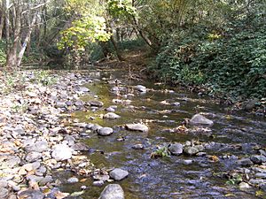
Middle reach of Santa Rosa Creek
|
|
|
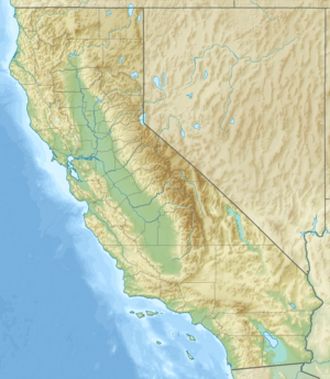
Location of the mouth of Santa Rosa Creek in California
|
|
| Country | United States |
| State | California |
| Region | Sonoma County |
| City | Santa Rosa |
| Physical characteristics | |
| Main source | Hood Mountain 5 km (3 mi) west of St. Helena, California 1,940 ft (590 m) 38°31′10″N 122°32′56″W / 38.51944°N 122.54889°W |
| River mouth | Laguna de Santa Rosa 49 ft (15 m) 38°27′5″N 122°50′3″W / 38.45139°N 122.83417°W |
| Length | 22 mi (35 km) |
| Basin features | |
| Tributaries |
|
Santa Rosa Creek is a cool stream in Sonoma County, California. It's about 22 miles (35 km) long! This creek starts high up on Hood Mountain. It then flows into a wetland called the Laguna de Santa Rosa. The creek also includes a special part called the Santa Rosa Flood Control Channel. This article will tell you all about this important waterway.
Contents
About Santa Rosa Creek
Santa Rosa Creek begins as a wild stream in the Mayacamas Mountains. But as it flows through downtown Santa Rosa, parts of it go underground in culverts (like big pipes). The areas along the creek have a rich history. Long ago, the Southern Pomo people lived near the middle and lower parts of the creek.
Bringing Fish Back to the Creek
In the late 1990s, a big project started to restore the creek in downtown Santa Rosa. This project helped steelhead and coho salmon fish. It made it easier for them to swim upstream to their spawning areas. Spawning is when fish lay their eggs.
Creek Branches and Water Quality
Many smaller streams flow into Santa Rosa Creek. These are called tributaries. Some main ones are Brush Creek, Piner Creek, and Matanzas Creek. The area around the creek gets about 24 to 38 inches (60 to 70 centimeters) of rain each year. Sometimes, tests show that the water in the downtown area has too much coliform bacteria. This means the water isn't always clean enough for swimming.
History of Santa Rosa Creek
Long ago, archaeological findings show that Pomo tribes lived along the lower parts of Santa Rosa Creek. Another tribe, the Yuki, lived near the creek's start on Hood Mountain.
Flat Rocks and Early Settlements
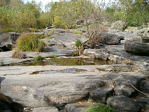
Near where Brush Creek joins Santa Rosa Creek, there's a cool rock formation called "Flat Rocks." A Pomo village was once right next to it. This spot was great for fishing, bathing, and getting drinking water. In 1828, a priest named Padre Juan Amorós visited this area. He baptized a Pomo maiden on a special day and named her "Rosa." He called the place "Santa Rosa." This became the start of the city of Santa Rosa.
Changes to the Creek Over Time
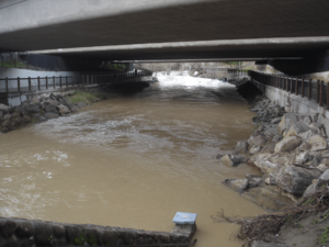
Later, Spanish settlers also lived along the creek. As the city of Santa Rosa grew, people decided in the 1960s to make parts of the creek into a channel. This meant putting concrete walls along the creek. This change made it very hard for fish like salmon to swim upstream to lay their eggs.
Restoring the Creek for Fish and People
By the 1990s, people realized this was a problem. They started planning to restore the creek. The goal was to remove much of the concrete and plant new vegetation. This would create a better path for steelhead and coho salmon to reach their spawning grounds.
Today, much of this restoration is done, especially west of Santa Rosa Avenue. The Prince Memorial Greenway now runs along the creek. It has paved paths for bikes and walkers, places to access the creek, and lots of new plants. However, a part of the creek still flows under city hall in a covered culvert. There are plans to open this section up in the future.
The Land Around Santa Rosa Creek
The land around Santa Rosa Creek changes as the creek flows from the mountains to the valley.
Mountain Headwaters
The creek starts high up on Hood Mountain. The terrain here is steep, but there's not much erosion. This is because not many people have visited this area, and the plants have stayed healthy. The soils here are mostly loam and clay-loam.
Valley Floor and Development
As the creek flows down to the valley, the land becomes flatter. Here, you'll find soils that are good for Valley Oak trees. Further down, the soils are used for pasture (where animals graze) and some vineyards.
In the valley, Santa Rosa Creek flows under State Route 12. The soils here are mostly silt loams and clay loams. This area used to have pastures and orchards. Now, many homes are built here.
Lower Creek and Flooding
Below downtown, where Matanzas Creek joins, the soils are sandy loam. This area is often prone to flooding. Historically, it was used for pastures, orchards, and vineyards. Because the land is very flat here, there isn't much erosion.
Wildlife and Plants of Santa Rosa Creek
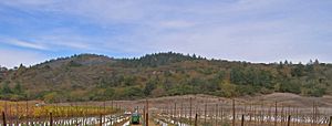
The plants and animals living around Santa Rosa Creek change depending on where you are along the creek.
Mountain Ecosystem
The upper parts of the creek on Hood Mountain are covered in thick oak woodlands. The trees here include coast live oak, Douglas fir, California buckeye, and bigleaf maple.
Under these trees, you'll find plants like toyon, blackberry, and western poison-oak. In some cooler, steeper areas, there are many California bay laurel trees.
Many animals live here, too! You might see California mule deer, gray squirrel, raccoons, skunks, and Western pond turtles. Sometimes, people spot river otters, opossums, tiger salamanders, bobcats, and even mountain lions. There are also many birds, like scrub jays, Steller's jays, acorn woodpeckers, and juncos.
Valley Ecosystem
As Santa Rosa Creek reaches the valley floor, you'll see red willow trees. There are also coast live oak, bigleaf maple, and California laurel trees. Some Douglas fir and huckleberry oak trees are also present.
This middle part of the creek feels more like a suburban area than the wild mountains. It still has a lot of plants along its banks, stretching from Melita Road to Farmers Lane. The "Flat Rocks" area, where Brush Creek joins, is special because of its large boulders. After Farmers Lane, the creek becomes more like a channel, and some of its natural feel is lost until it leaves the west side of Santa Rosa.
 | Delilah Pierce |
 | Gordon Parks |
 | Augusta Savage |
 | Charles Ethan Porter |


