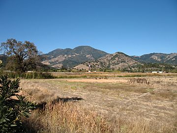
Mayacamas Mountains facts for kids
Quick facts for kids Mayacamas Mountains |
|
|---|---|

|
|
| Highest point | |
| Peak | (Cobb Mountain) |
| Elevation | 4,724 ft (1,440 m) |
| Dimensions | |
| Length | 52 mi (84 km) northwest-southeast |
| Naming | |
| Etymology | Wappo language |
| Geography | |
| Country | United States |
| State | California |
| Range coordinates | 38°40′9.663″N 122°37′59.948″W / 38.66935083°N 122.63331889°W |
| Parent range | California Coast Ranges |
The Mayacamas Mountains are a mountain range in northwestern California, United States. They are part of the larger California Coast Ranges system. These mountains are known for their beautiful natural areas and important energy resources.
Contents
Exploring the Mayacamas Mountains
The Mayacamas Mountains are found in northern California. They stretch for about 52 miles (84 km) from the northwest to the southeast. You can find them south of the Mendocino Range. They are also west of Clear Lake and east of Ukiah. The mountains spread across several counties, including Mendocino, Lake, Napa, and Sonoma.
Highest Points and Peaks
The tallest point in the Mayacamas Mountains is Cobb Mountain. It stands at 4,724 feet (1,440 meters) high. This peak is located in the middle part of the range.
Other important peaks include Mount Saint Helena and Hood Mountain. These mountains are high enough to get some snow during the winter months. Imagine seeing snow-capped peaks in California!
Rivers and Streams
Many streams and small rivers begin in the Mayacamas Mountains. These include Mark West Creek, Sonoma Creek, Calabazas Creek, Arroyo Seco Creek, Putah Creek, and Santa Rosa Creek. These waterways are important for the local environment.
Natural Habitats and Wildlife
Millions of years ago, these mountains were covered in dense forests. Today, the Mayacamas Mountains are home to different types of forests and woodlands. You can find California mixed evergreen forests here. There are also areas of California interior chaparral and woodlands. These habitats provide homes for many plants and animals.
How the Mountains Got Their Name
The name "Mayacamas" comes from the Native American tribes who lived here long ago. Specifically, it comes from a Wappo village called Maiya'kma. This village was located near what is now Calistoga.
Early maps and land records from the 1800s used similar names. Over time, the spelling changed a bit. The official name "Mayacamas" was decided by the Geographic Board in 1941. This helped clear up confusion from other spellings like Malacomas or Miyakma.
Geothermal Power: Energy from the Earth
The Mayacamas Mountains are home to something very special: The Geysers. This is the largest and most developed geothermal field in the world!
What is Geothermal Energy?
Geothermal energy uses heat from deep inside the Earth. At The Geysers, there are more than 22 power plants. They are spread out over about 30 square miles (78 square kilometers). These plants use steam that comes from underground. This steam spins large machines called turbines, which then create electricity.
Powering Communities
The Geysers provides electricity to the nearby counties of Lake, Sonoma, and Mendocino. It's an amazing example of how we can use natural resources to power our homes and schools.
 | Delilah Pierce |
 | Gordon Parks |
 | Augusta Savage |
 | Charles Ethan Porter |


