Sonoma Creek facts for kids
Quick facts for kids Sonoma Creek |
|
|---|---|
|
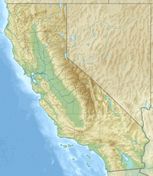
Location of the mouth of Sonoma Creek in California
|
|
| Native name | Spanish: Estero de Sonoma |
| Country | United States |
| State | California |
| Region | Sonoma and Napa counties |
| Cities | Kenwood, Glen Ellen, El Verano, Sonoma |
| Physical characteristics | |
| Main source | Bald Mountain 4 mi (6 km) southwest of St. Helena, California 2,480 ft (760 m) 38°27′23″N 122°30′25″W / 38.45639°N 122.50694°W |
| River mouth | San Pablo Bay 11 mi (18 km) west of Vallejo, California 0 ft (0 m) 38°9′2″N 122°24′13″W / 38.15056°N 122.40361°W |
| Basin features | |
| Basin size | 170 sq mi (440 km2) |
| Tributaries |
|
Sonoma Creek is a stream in northern California. It is about 33.4 miles (53.8 kilometers) long. This creek is one of the two main waterways in southern Sonoma County, California. Its journey starts in the rugged hills of Sugarloaf Ridge State Park. It then flows into San Pablo Bay, which is the northern part of San Francisco Bay.
The area that Sonoma Creek drains is called its watershed. This watershed is about 170 square miles (440 square kilometers). It is mostly the same area as the wine region of Sonoma Valley. The State of California calls the Sonoma Creek watershed a "Critical Coastal Water Resource." This means it is a very important natural area.
This creek flows south, collecting water from the western slopes of the Mayacamas Mountains. It also gets water from the southern slopes of Trione-Annadel State Park and the eastern slopes of the Sonoma Mountains. In winter, smaller streams that feed into it, called tributaries, flow strongly. As these tributaries reach the valley floor, Sonoma Creek becomes a year-round stream. It flows through beautiful vineyards near Kenwood.
Sonoma Creek then turns west at Kenwood and cuts through a gorge. It flows parallel to Warm Springs Road. After that, it turns south towards historic Glen Ellen. It passes close to Jack London State Historic Park and the Wolf House. The creek continues south, running next to Arnold Drive. In the city of Sonoma, it is an urban creek. South of Sonoma, it flows through farmlands. Finally, Sonoma Creek empties into the large Napa Sonoma Marsh at the northern tip of San Pablo Bay. Some of its main smaller streams are Yulupa Creek, Graham Creek, Calabazas Creek, Bear Creek, Schell Creek, and Fowler Creek.
Contents
Where Sonoma Creek Begins
The creek starts high up on the western side of the southern Mayacamas Mountains. The tallest peaks here are Hood Mountain (2,750 feet or 833 meters high) and Bald Mountain (2,729 feet or 826 meters high). From these peaks, you can see the Pacific Ocean and the Sierra Nevada mountains.
The headwaters of Sonoma Creek flow through a gorge and meadows in Sugarloaf Ridge State Park. This park has 25 miles (40 kilometers) of trails for you to explore. It is also home to the Robert Ferguson Observatory. There is a 25-foot (eight-meter) tall waterfall in the park. This waterfall is active mainly during the winter rains. It can sometimes last until late May if there has been a lot of rain.
The waterfall spills into a 100-foot (30-meter) deep gorge. This area has a moist forest with many types of trees. These include California bay laurel, coast redwood, Douglas fir, big leaf maple, and tanbark oak. The ground is covered with lots of ferns and mossy boulders. A notable landform created by Sonoma Creek in this upper area is Adobe Canyon. Sometimes, people call this part of the creek Adobe Creek. Other small streams near the headwaters are Mount Hood Creek and Graywood Creek.
Amazing Animals and Plants
Sonoma Creek and the areas around it are home to many different water and land animals and plants.
Fish in the Creek
Some of the most important fish in the creek are Chinook salmon, Delta smelt, and steelhead. These fish are called anadromous. This means they are born in fresh water, live in the ocean, and then return to fresh water to lay their eggs. Scientists have studied these fish a lot in Sonoma Creek and its smaller streams. They have found that there are fewer places for these fish to lay eggs now. This is mainly because of sedimentation (dirt and sand building up) and because plants along the creek have been removed since the 1800s.
Other Wildlife
You can also find different kinds of salamanders, snakes, and frogs here. The California red-legged frog, which is a threatened species, lives in the northern part of the creek near Trione-Annadel State Park.
Several endangered species live in or near the marshy area where the creek flows into the bay. These include the California clapper rail, California black rail, California brown pelican, California freshwater shrimp, salt marsh harvest mouse, and Suisun shrew. The Sacramento splittail, steelhead, and black rail are considered threatened species.
Beavers Return to Sonoma Creek
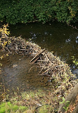
California golden beavers used to be very common along Sonoma Creek. But they were hunted for their fur in the late 1700s and early 1800s. By the mid-1800s, they were mostly gone. However, beavers returned to Sonoma Creek in the 1990s, likely from the Delta.
In 1996, a beaver family started eating the bark of grapevines in a vineyard next to the creek. They were removed, which caused a lot of discussion in the community. People decided it was important to make space for beavers to live there again. Richard Dale, who works for the Sonoma Ecology Center, says that even though beavers cut down trees and build dams, they actually help the creek a lot. They create deep pools of water, which slows down floods and makes better homes for fish.
New beavers have moved back into Sonoma Creek. You can find them in both Sonoma and Glen Ellen. Beavers are a "keystone species." This means they are very important to their ecosystem. Because of the beavers, other animals like river otters have also returned. River otters have been seen in the beaver pond near the Boyes Boulevard bridge in Boyes Hot Springs.
Upland Animals and Plants
The higher areas around the creek have different types of oak forests, chaparral (dense shrubs), and savannah woodland (grasslands with scattered trees). Here, you can find many animals like black-tailed deer, coyotes, skunks, raccoons, opossums, wild turkeys, turkey vultures, and red-tailed hawks. Sometimes, you might even see bobcats and mountain lions.
Some of the tall trees in these higher areas include coast live oak, Garry oak, Pacific madrone, California buckeye, and Douglas fir. On the floor of the Sonoma Valley, you will mostly see valley oak trees.
History of Sonoma Creek
Before about 1850, Sonoma Creek was in its natural state. The creek banks were stable, and not too much dirt or sand was washing into the water. This meant the water was clear enough for aquatic animals to thrive. Flooding in the lower parts of the creek was also less common. This was because all parts of the creek could hold more extra water during heavy rains.
Near Kenwood, there used to be a large marsh. This marsh acted like a natural dam, stopping the creek from flowing west towards Glen Ellen.
In the late 1800s, people started farming more intensely in Sonoma Valley. The Kenwood Marsh was drained to create land for grazing animals, vineyards, and other agricultural uses. When this marsh was removed, the creek lost its biggest natural buffer that helped control floods upstream. Because of this, floods have become more frequent and severe since the 1960s.
In 1978, the Sonoma League of Historic Preservation recognized Sonoma Creek as a historic resource. They called it "one of the most picturesque sites and valuable natural resources in Sonoma County."
Water Quality in the Creek
The State of California Regional Water Quality Control Board looks at the water quality of Sonoma Creek. They focus on things like turbidity (how cloudy the water is), pathogens (germs), and nitrates (chemicals from fertilizers).
Turbidity is a problem because of erosion from the creek banks. This erosion is made worse by ongoing land development in Sonoma Valley. When too much dirt and sand get into the creek, it harms aquatic animals. It also changes the streambed gravels, making it harder for fish to lay eggs. Also, when pools of water fill with sediment, the water gets warmer in the summer. This makes it harder for fish to survive.
Pathogens, or germs, seem to come from broken septic tanks or drain fields in some rural areas. Nitrates enter the creek from too much fertilizer used on farms. They can also come from septic waste that gets into the creek. Dirt and nitrates can also wash into the creek from urban stormwater runoff in the city of Sonoma.
Wine Production and the Creek
Sonoma Creek is the only main waterway that drains the Sonoma Valley Wine Country. This makes it a very important source for refilling the underground water supply, called an aquifer. Sonoma Creek helps refill the aquifer more than the nearby Napa River and Petaluma Rivers. This is because the valley floor has soft, alluvial soils and the creek flows gently.
The valley itself is part of the Franciscan Complex. This area has crumpled and uplifted land that was formed by ancient geological events. Growing grapes and making wine needs a lot of groundwater. There is some debate about how much water wineries should use from the creek and other waterways.
Sonoma Creek Meets San Pablo Bay
The large marsh area where Sonoma Creek meets San Pablo Bay has shrunk a lot over time. This is because people built levees (walls to hold back water) and developed the land for agriculture and other uses. This Napa Sonoma Marsh was mostly formed by sedimentary deposits over the last two million years.
Historically, this marsh was a very diverse wetlands ecosystem. It had many important plants like pickleweed, eelgrass, and giant bulrush. It also had many fish, mammals, amphibians, and birds. The marsh is a key stop along the Pacific Flyway. This is a major route for migratory birds to rest and feed.
By 2006, much of this ecosystem had been damaged by filling in land, building levees, and dredging. Experts estimate that about 75 percent of the marsh's original natural life has been lost. However, it is still a very important habitat. People are actively working to restore the wetlands to make them healthy again.
Images for kids
 | Mary Eliza Mahoney |
 | Susie King Taylor |
 | Ida Gray |
 | Eliza Ann Grier |


