Landform facts for kids
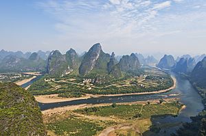
A landform is a natural part of the Earth's surface. Think of it as a specific shape or feature you see on the ground. Each landform has its own size, shape, and location. It's also defined by what it's made of, like rock or soil.
Landforms are created naturally. This means they are not made by people. So, things like canals, ports, or harbors are not considered landforms.
Many landform terms can describe features on other planets too. For example, mountains, hills, and valleys are found on planets like Mars. Even polar ice caps exist on other worlds.
Contents
What Makes a Landform?
Landforms are described by their physical features. These include how high they are (their elevation). We also look at how steep they are (their slope).
Other features include their direction on a map (orientation). We also consider if layers of rock are visible (stratification). How much rock is sticking out (rock exposure) is also important. Finally, the type of soil helps define a landform.
Types of Landforms
There are many different kinds of landforms. They are often grouped by how they were formed or where they are found.
Landforms with Slopes
These landforms are often defined by how steep or flat they are.
- Cliff: A very steep face of rock.
- Gully: A small valley or channel made by flowing water.
- Hill: A natural rise of land, smaller than a mountain.
- Mountain: A very large natural elevation of the Earth's surface.
- Plain: A large area of flat land.
- Plateau: A flat area of land that is high above other land.
- Ravine: A deep, narrow valley.
- Valley: A low area between hills or mountains, often with a river.
Coastal and Ocean Landforms
These landforms are found near or in the ocean.
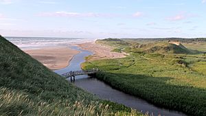
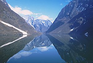
- Bay & Gulf: A body of water partly enclosed by land.
- Beach: A sandy or pebbly shore by the sea or a lake.
- Cape: A piece of land that sticks out into the sea.
- Cave: A natural underground space.
- Cliff: A steep rock face, often found on coasts.
- Coast: The land next to the sea.
- Coral reef: An underwater structure made of coral.
- Delta: A landform at the mouth of a river, where it splits into many channels.
- Dune system: Hills of sand formed by wind.
- Estuary: Where a river meets the sea, and fresh and salt water mix.
- Fjord: A long, narrow, deep inlet of the sea between high cliffs.
- Island: A piece of land completely surrounded by water.
- Lagoon: A shallow body of water separated from the sea by a barrier.
- Ocean: A very large body of salt water.
- Peninsula: A piece of land almost surrounded by water but connected to the mainland.
- Sea: A large body of salt water, smaller than an ocean.
River Landforms (Fluvial)
These landforms are shaped by flowing water, like rivers and streams.
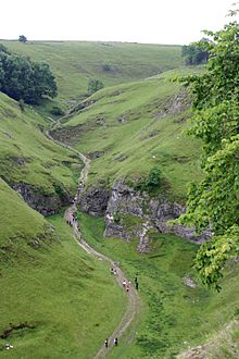
- Basin: An area of land drained by a river and its tributaries.
- Beach: A shore by a river or lake.
- Cave: Can be formed by underground rivers.
- Gully: A small valley formed by water erosion.
- Island: Can be found in rivers.
- Lake: A large body of still water surrounded by land.
- Levee: A natural or artificial bank alongside a river.
- Marsh: A wetland area often found near rivers.
- Meander: A bend in a river.
- Oasis: A fertile spot in a desert where water is found.
- Pond: A small body of still water.
- River: A large natural stream of water flowing to the sea, a lake, or another river.
- Spring: A place where water flows out of the ground.
- Stream: A small, narrow river.
- Swamp: A wetland area with trees.
- Valley: Often formed by rivers cutting through land.
- Waterfall: Where a river or stream falls over a steep drop.
Mountain and Glacial Landforms
These landforms are found in mountainous areas or were shaped by glaciers (large sheets of ice).
- Fjord: A long, narrow inlet of the sea, often carved by glaciers.
- Glacier: A large, slow-moving mass of ice.
- Inselberg: An isolated hill or mountain rising from a plain.
- Moraine: A mass of rocks and sediment carried and deposited by a glacier.
- Mountain: A large natural elevation.
- Mountain range: A line of mountains connected together.
- Summit: The highest point of a hill or mountain.
- Valley: Can be U-shaped if carved by a glacier.
Volcanic Landforms
These landforms are created by volcanic activity.
- Caldera: A large, bowl-shaped hollow formed after a volcano erupts and collapses.
- Geyser: A hot spring that shoots water and steam into the air.
- Lava dome: A mound formed by slow-moving lava.
- Mesa: A flat-topped hill with steep sides, often formed from volcanic rock.
- Mid-ocean ridge: An underwater mountain range formed by volcanic activity.
- Oceanic trench: A deep, narrow depression in the ocean floor.
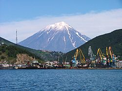
- Volcano: A mountain or hill with a crater where lava, rock fragments, hot vapor, and gas are erupted.
Erosion Landforms
These landforms are shaped by the natural processes of erosion and weathering. Erosion is when wind, water, or ice wear away land. Weathering is when rocks break down.
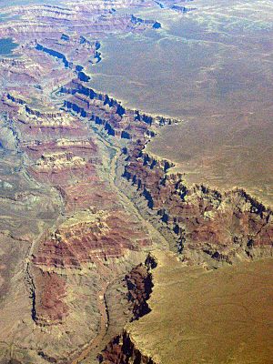
- Canyon: A deep gorge, typically one with a river flowing through it.
- Cave: Can be formed by erosion from water or wind.
See also
 In Spanish: Accidente geográfico para niños
 | John T. Biggers |
 | Thomas Blackshear |
 | Mark Bradford |
 | Beverly Buchanan |


