Upper Missouri River Breaks National Monument facts for kids
Quick facts for kids Upper Missouri River Breaks National Monument |
|
|---|---|

The breaks of the
Upper Missouri River National Monument |
|
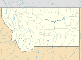
| Location | Chouteau, Fergus, Blaine, and Phillips counties, Montana, U.S. |
| Nearest city | Great Falls |
| Area | 377,000 acres (1,530 km2) |
| Established | January 17, 2001 |
| Visitors | 63,512 (in 2002) |
| Governing body | U.S. Bureau of Land Management |
| Website | Upper Missouri River Breaks National Monument |
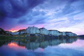
The Upper Missouri River Breaks National Monument is a special protected area in the western United States. It helps to keep safe a unique part of north central Montana known as the Missouri Breaks. The Bureau of Land Management (BLM) looks after this monument.
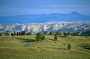
"The Breaks" is a local name for this kind of land. It has badland areas with rocky cliffs, steep hills, and wide grassy plains. It looks like the land "breaks away" towards the river.
This monument was created on January 17, 2001, by President Bill Clinton. It covers about 377,000 acres (or 589 square miles) of public land. Most of this land was already managed by the U.S. government. The nearby Missouri River was named a Wild and Scenic River in 1976. It forms the western edge of the monument. To the east is the Charles M. Russell National Wildlife Refuge. The beautiful "Breaks" area was often painted by the famous artist Charles M. Russell.
A Look Back: History of the Monument
French trappers first came to this area in the late 1700s. They found many Native American tribes living here. Some of these tribes included the Blackfoot, Northern Cheyenne, Sioux, Assiniboine, Gros Ventre (Atsina), Crow, Plains Cree, and Plains Ojibwa. The Crow people called this place Xuáhcheesh Annáppiio, which means "Where the Crow warrior Skunk was killed."
The Lewis and Clark Expedition traveled through the Breaks in 1805. They were the first white explorers to write about and draw this region. They also saw and wrote about bighorn sheep here. This was the first time this animal was recorded in North America by white explorers. Much of the Breaks area still looks the same as it did when Lewis and Clark first saw it. Important peace meetings were held at the meeting point of the Judith and Missouri Rivers in 1846 and 1855.
In 1877, the Nez Perce tribe crossed the Missouri River into the Breaks. They were trying to reach Canada to escape the U.S. Army. A small fight called the Cow Island Skirmish happened in the Breaks. This was one of the last events before the Nez Perce surrendered to the U.S. Army at the Battle of Bear Paw, which is just north of the monument.
Protecting Nature: How the Monument is Managed
A full plan for managing the monument is still being created. This is because some parts of the land are privately owned, and there are agreements with local people. Conservationists (people who want to protect nature) hope that some areas of the monument will become designated Wilderness. This would give them even stronger protection.
However, local ranchers and farmers also use the land. They have long-standing agreements with the government to graze over 10,000 cattle each year within the monument. They are worried that the monument's status might affect their way of life and the local towns' economies.
The Department of the Interior has a proposed plan. It says that the monument's natural resources will be better protected. But, activities like grazing livestock, hunting, and fishing will generally continue as they do now. Private land (about 81,911 acres) and state land (about 38,722 acres) inside the monument's borders will also not be affected.
In 2013, a U.S. court ruled that the BLM's management plan did not follow laws about historic sites. The National Trust for Historic Preservation said that this site was one of ten historic places saved that year.
Wildlife and Plants of the Breaks
The Breaks is home to at least sixty different kinds of mammals. It also has hundreds of bird species. Along the banks of the Missouri River, you can find Willows and other shrubs. In other areas, sagebrush and short grass prairie plants are common.
 | James Van Der Zee |
 | Alma Thomas |
 | Ellis Wilson |
 | Margaret Taylor-Burroughs |


