Little Colorado River facts for kids
Quick facts for kids Little Colorado River |
|
|---|---|
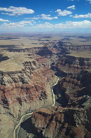
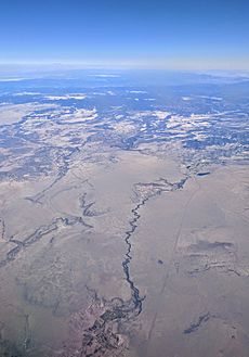
The Little Colorado River carves a deep canyon just above its confluence with the Colorado
|
|
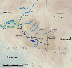
Map showing the Little Colorado River basin. The Little Colorado River flows northwest through eastern Arizona to join the Colorado north of Flagstaff.
|
|
| Other name(s) | Tółchíʼíkooh Colorado Chiquito |
| Country | United States |
| States | Arizona, New Mexico |
| Region | Apache County, Navajo County, Coconino County |
| Physical characteristics | |
| Main source | West Fork Little Colorado River Mount Baldy, White Mountains 10,000 ft (3,000 m) |
| 2nd source | East Fork Little Colorado River |
| River mouth | Colorado River Grand Canyon, Coconino County 2,700 ft (820 m) 36°11′28″N 111°48′14″W / 36.19111°N 111.80389°W |
| Length | 338 mi (544 km) |
| Basin features | |
| River system | Colorado River |
| Basin size | 26,500 sq mi (69,000 km2) |
| Tributaries |
|
The Little Colorado River (also called Paayu by the Hopi people) is a river in Arizona, United States. It's a major branch of the famous Colorado River. This river helps drain a large area of eastern Arizona and western New Mexico, including the Painted Desert.
Even though it's almost 340 miles (550 km) long, the Little Colorado River doesn't always flow with water along its entire length. Only the parts near where it starts and where it joins the Colorado River have water all year. In between, it's often a wide, sandy riverbed that only fills up after heavy snow melts or big flash floods.
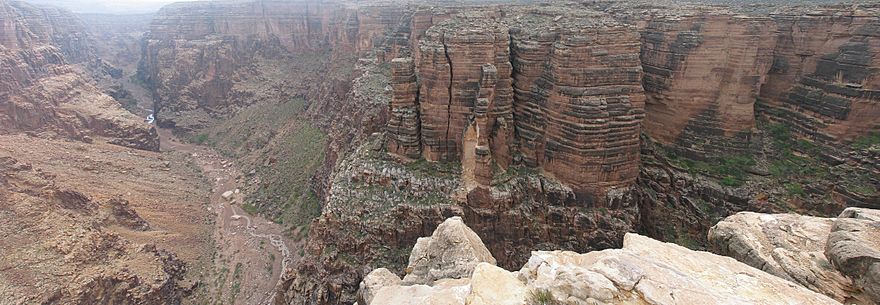
The last 57.2 miles (92.1 km) of the river flows through the Little Colorado River Gorge. This gorge is a huge part of the Grand Canyon, reaching over 3,000 feet (910 m) deep where it meets the Colorado River inside Grand Canyon National Park.
Contents
Where Does the Little Colorado River Flow?
The Little Colorado River starts in the White Mountains in eastern Arizona. It actually begins as two smaller streams, called forks. The West Fork starts high up on Mount Baldy, at an elevation of nearly 10,000 feet (3,000 m). The East Fork begins nearby.
These two forks meet in a canyon close to the town of Greer. From there, they form the main Little Colorado River. The river flows into River Reservoir and then leaves the canyon near Eagar. It then turns north, winding through the Richville Valley, before flowing into Lyman Lake. This lake was created by a dam built in 1912 to help with irrigation.
After Lyman Lake, the river continues north past St. Johns. Soon, the river changes from flowing all the time to being a dry riverbed that only carries water during wet seasons. It travels northwest through Hunt Valley, where it is joined by the Zuni River, and then by Silver Creek and the Puerco River. The Puerco River is its biggest branch. These rivers join near Holbrook as the Little Colorado flows into the Painted Desert.
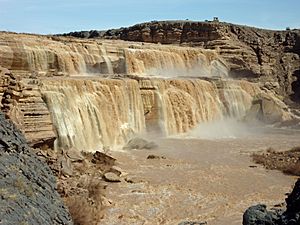
The Little Colorado River passes Joseph City and goes under the BNSF Railway tracks. It then winds north into Coconino County. The river enters the Navajo Nation and soon drops over the amazing 185-foot (56 m) Grand Falls of the Little Colorado. After Grand Falls, the river flows through a short but rugged canyon for about 15 miles (24 km).
Once it leaves the canyon, the Little Colorado River flows past the eastern edge of Wupatki National Monument and the town of Cameron. Here, U.S. Highway 89 crosses over it.
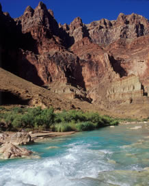
From Cameron, the Little Colorado River carves a very deep and narrow gorge into the Colorado Plateau. This canyon can reach a depth of about 3,200 feet (980 m). The canyon is so deep that groundwater is pushed to the surface, creating many springs that make the river flow all year again. Finally, it joins the Colorado River deep inside the Grand Canyon, far from any towns. This meeting point marks the end of the Marble Canyon part of the Grand Canyon.
How Much Water Flows?
The Little Colorado River is one of the two main rivers that join the Colorado River in Arizona. The other is the Gila River. The amount of water in the Little Colorado River usually peaks twice a year. First, in early spring (February–April), from melting snow and rain in the mountains. Second, in the summer (July–September), from monsoon storms.
The amount of water flowing each year can change a lot. Sometimes, there's almost no flow if there isn't much snow or summer rain. But in other years, like 1949 or 1983, there can be huge amounts of water from melting snow. Big monsoon rains also caused a lot of water in 1955 and 2006.
The middle part of the river, between St. Johns and Cameron, is mostly dry. It only carries water during the wet seasons. Near Cameron, before the river enters the Grand Canyon, the average flow from 1948 until now has been 367.2 cubic feet per second (10.40 m3/s). The highest average flow was 1,127 cubic feet per second (31.9 m3/s) in 1973, and the lowest was 14.1 cubic feet per second (0.40 m3/s) in 2000.
The river's peak flows can be much higher than its average flow. This is because of quick runoff from sudden, heavy rainstorms in the desert. The highest recorded peak flow was 120,000 cubic feet per second (3,400 m3/s) on September 20, 1923.
History of the River and People
People have lived near the Little Colorado River for a very long time, going back almost 8,000 years. Early nomadic hunter-gatherers lived in the upper parts of the river basin, where there was more water and different types of plants and animals. Later, the Navajo, Apache, and Hopi tribes settled in the area. Many of these groups used small-scale irrigation to grow crops in riverside villages. They often built their homes in sheltered canyons and cliffs for protection.
The first Europeans to see the Little Colorado River were likely early Spanish explorers. They were exploring the Grand Canyon area and called the river Colorado Chiquito, which means "Little Colorado."
One of the first organized trips to map the area was led by Amiel Weeks Whipple in 1853–54. This was part of the Great Railroad Expeditions, which aimed to find a route for a railroad across the country. Whipple's team mapped the area roughly along the 35th parallel.
The Powell Geographic Expedition of 1869 was one of the first American groups to see the Little Colorado River. On August 10, 1869, John Wesley Powell and some of his crew explored part of the Little Colorado River canyon. They found it hard to pass through. In their journals, they called it "Flax River" because of the flax plants growing along its banks, and also "Colorado Chiquito."
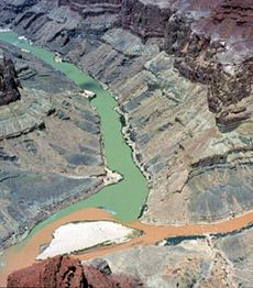
One explorer described the river as "filthy and muddy." This was because they saw it during a rare flash flood. Normally, the Little Colorado River can be a bright blue color. This blue color comes from dissolved minerals like travertine and limestone in the water, similar to Havasu Creek.
In the 1870s, Mormon settlers moved south from Salt Lake City and settled in the lower Little Colorado River valley. They founded Joseph City near where the Puerco River joins, and four other towns nearby. Joseph City is the only one that still exists today.
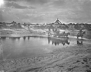
Crossing the Little Colorado River was often difficult for the settlers' wagons because the river flows through soft sand and sometimes even quicksand. It was easier to cross at the Grand Falls and Black Falls, where the river flows over hard rock.
The Mormons tried many times to build dams on the river for irrigation, but most of them failed because the Little Colorado's water flow changes so much. Finally, they built one at Joseph City that lasted for 29 years. Despite the challenges, the Mormons successfully established their communities. Later, Hispanic people moved into the area, founding St. Johns and Concho. American ranchers also came, creating Eagar and Springerville.
Changes to the River
Because it's quite isolated, most of the Little Colorado River remains untouched by human development. However, near where it starts, the river is dammed twice. First, at River Reservoir, and then at Lyman Lake. The water here is stored for irrigation to help grow crops. Other dams built by Mormon settlers long ago no longer exist.
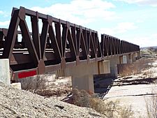
There are not many levees (walls to prevent flooding) along the river, except for a 2,300-foot (700 m) floodwall near Holbrook. Also, there are only a few bridges for a river of its length.
In 1979, there was a large radioactive spill from a uranium mine. About 100 million US gallons (380,000,000 L; 83,000,000 imp gal) of water containing uranium waste leaked into the North Fork of the Puerco River. This contaminated land and about 50 miles (80 km) of the Puerco River, with the pollution reaching the Little Colorado River as far as the Navajo Nation. Even today, small traces of this spill can still be found.
See also
 In Spanish: Río Pequeño Colorado para niños
 | Stephanie Wilson |
 | Charles Bolden |
 | Ronald McNair |
 | Frederick D. Gregory |


